

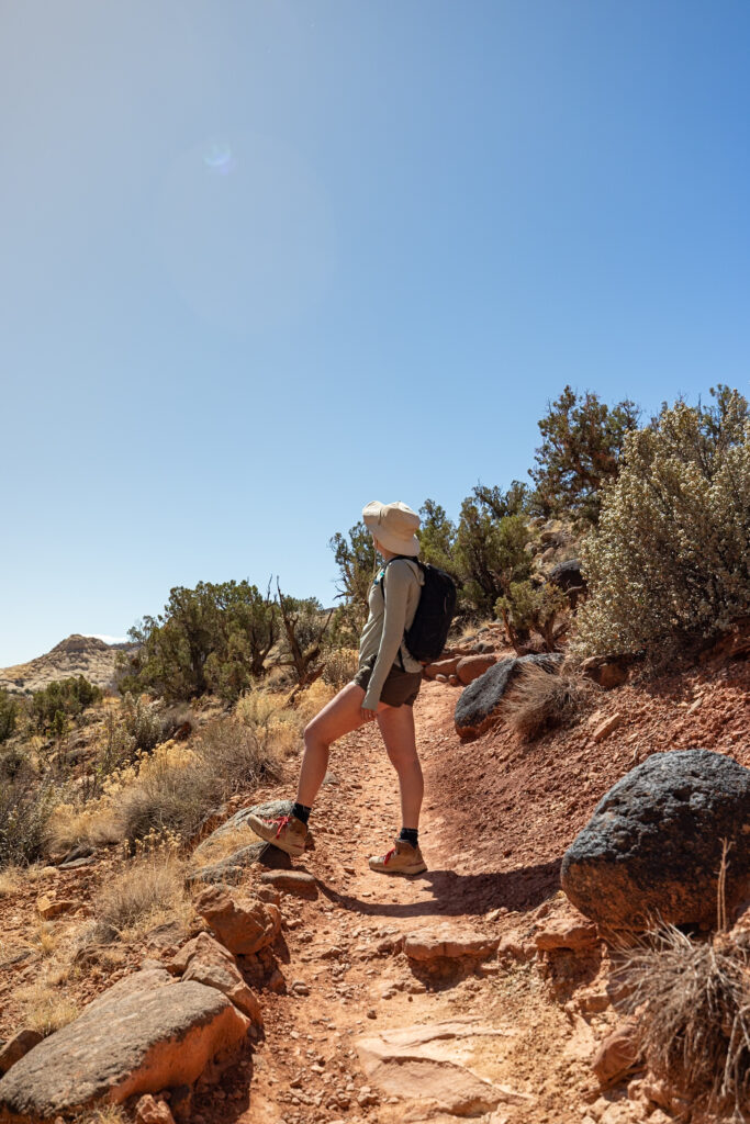
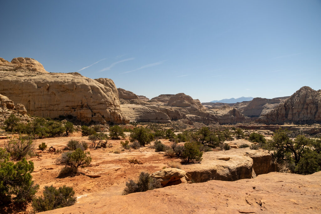
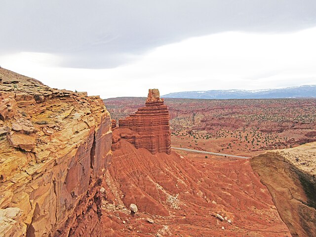
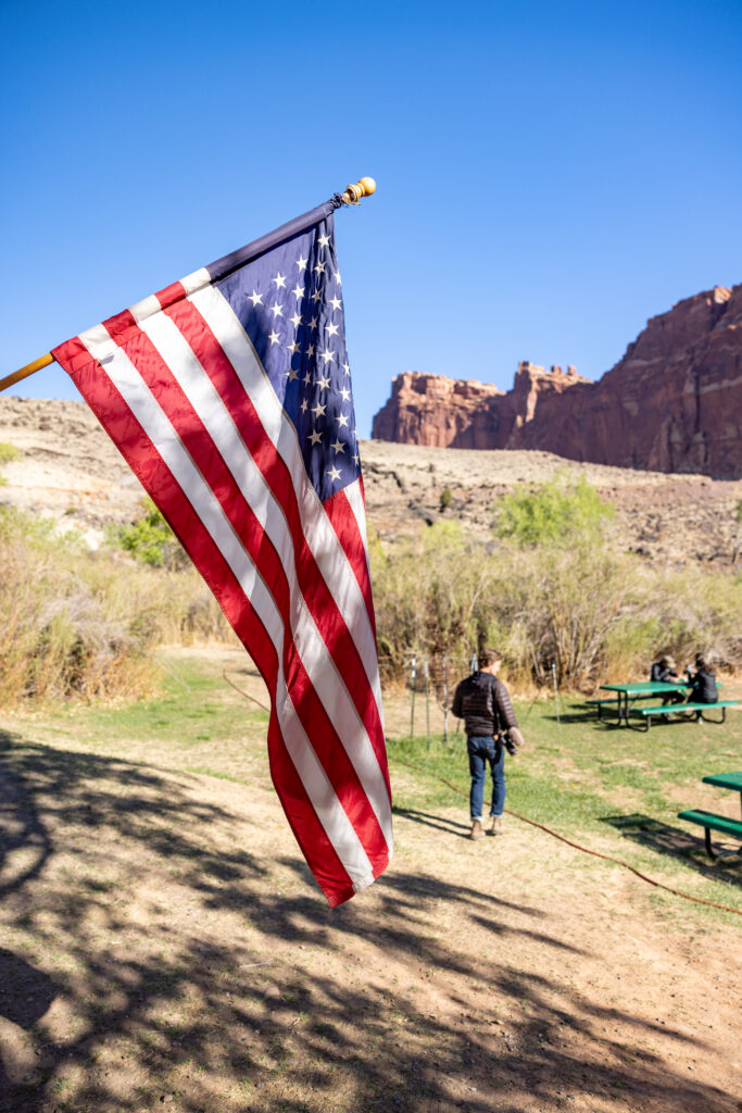
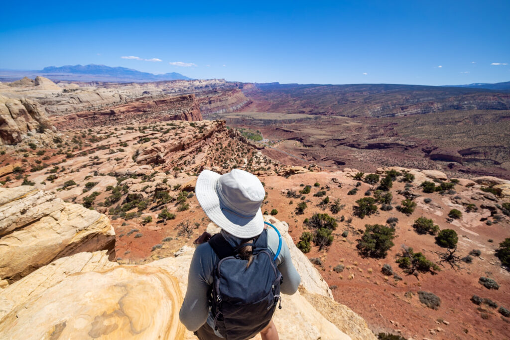
With 50+ trails spread across 240,000+ acres, trying to figure out which hikes to do in Utah’s Capitol Reef National Park is a daunting task. Luckily, we’ve done the legwork (literally) to narrow it down for you. In this article, we’ve rounded up 11 extraordinary hikes in Capitol Reef, including the most popular trails along with our personal favorites!
Note: We use affiliate links which provide us a little kickback each time you use one of our links and make a purchase, without any additional cost to you. We do not recommend products that we don’t already love or have heard great things about, so you can trust we’re only suggesting great products to you.
❌ Don’t Bust the Crust! When exploring national parks like Capitol Reef, Arches, and Canyonlands, stay on marked trails. These arid landscapes are home to Biological Soil Crust (Living Crust), a delicate ecosystem that takes decades to form and can be destroyed with just a single step off-trail.
🥾 Our Favorite Hikes at a Glance
👪 Most Popular: Hickman Bridge is the #1-rated trail in Capitol Reef on AllTrails!
😴 Most Challenging: Navajo Knobs Trail, taking a whopping 5 hours to complete.
📸 Best Photo Opportunity: Cassidy Arch Trail, specifically an hour before sunrise.
🌄 Best Sunset Views: Sunset Point Overlook, with a very short walk to the overlook!
🐶 Ollie’s Favorite: Fremont River Trail, the first half is dog-friendly!
Please respect the outdoors and Leave No Trace! Before embarking on your outdoor adventure, review the seven principles of Leave No Trace, which include planning ahead and preparing, traveling and camping on durable surfaces, disposing of waste properly (pack out what you pack in), leaving what you find, minimizing campfire impacts, respecting wildlife, and being considerate of others. Abiding by these principles helps keep these places beautiful so others can enjoy them for years to come!
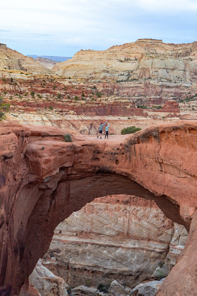
1. Hickman Bridge
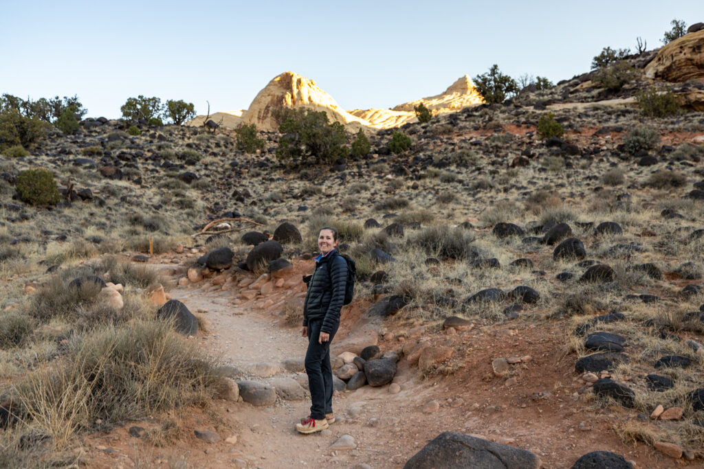
Hickman Bridge Trail is hands-down the most popular hike in Capitol Reef National Park. Because of this, the trailhead parking lot fills up incredibly fast, often as early as 9:30 AM. Knowing this, we arrived just before sunrise, easily got a spot, and were the second group on the trail!
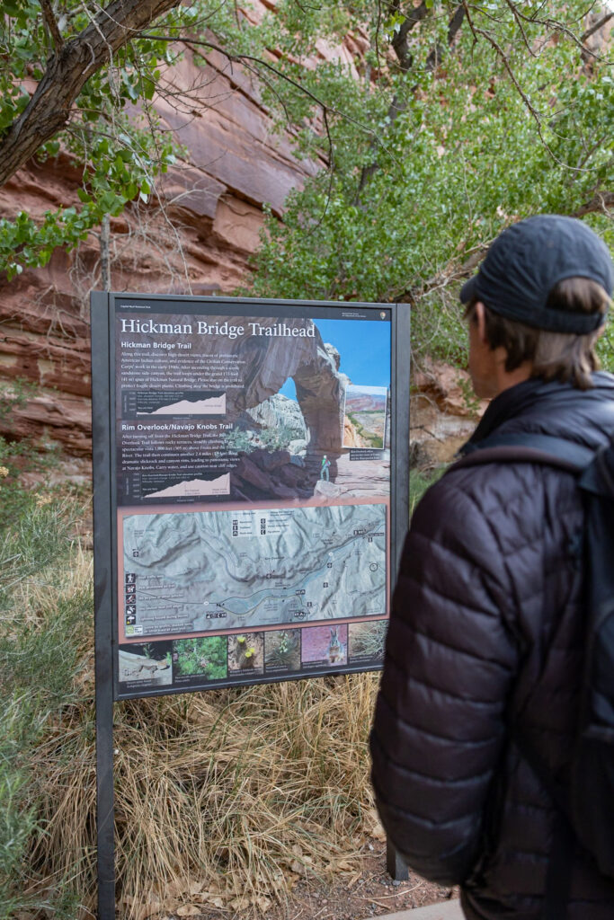
This 1-hour moderate hike begins along the scenic Fremont River before gently climbing a series of steps, where it then levels out until you reach Hickman Bridge itself. There’s a well-marked loop around the bridge, so staying on the trail is quite easy. A trail brochure (available for $0.50 at the trailhead) highlights 17 unique features along the way, which we think is worth the few coins!
As you approach the bridge from the east, keep an eye out for old markings with names and dates going back to the late 1800s. We particularly loved getting sunrise photos of the incredible views from the shaded western side of the bridge. As always, remember to practice Leave No Trace principles, stay on the trail, and refrain from adding to any markings.
Estimated Time: 1 hour
Length: 1.7 miles / 2.7 km
Elevation Gain: 416 ft / 127 m
Difficulty: Moderate
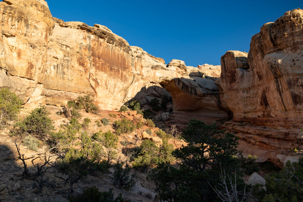
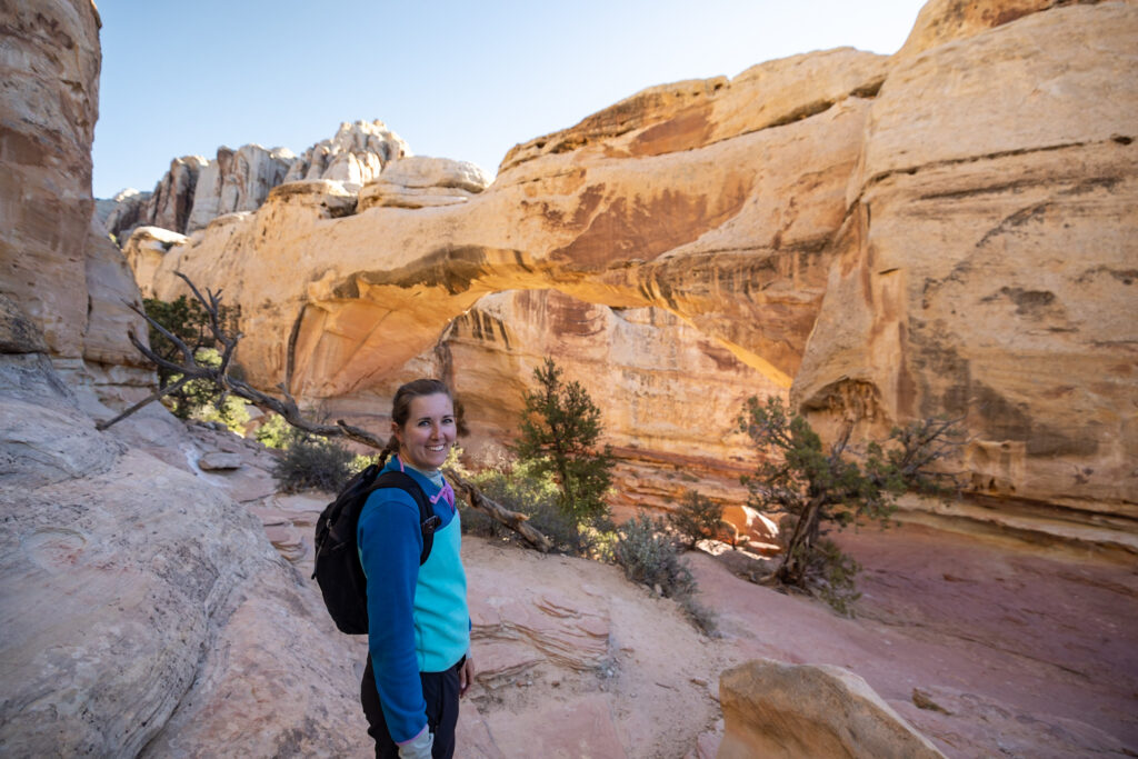
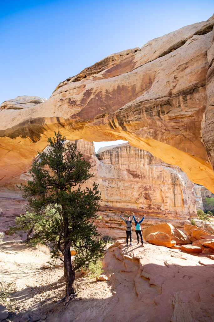
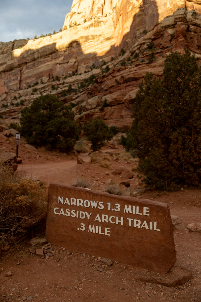
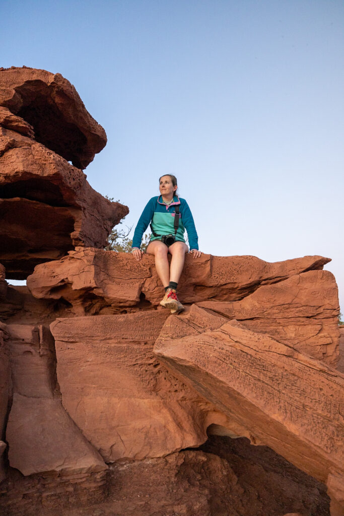
2. Cassidy Arch Trail
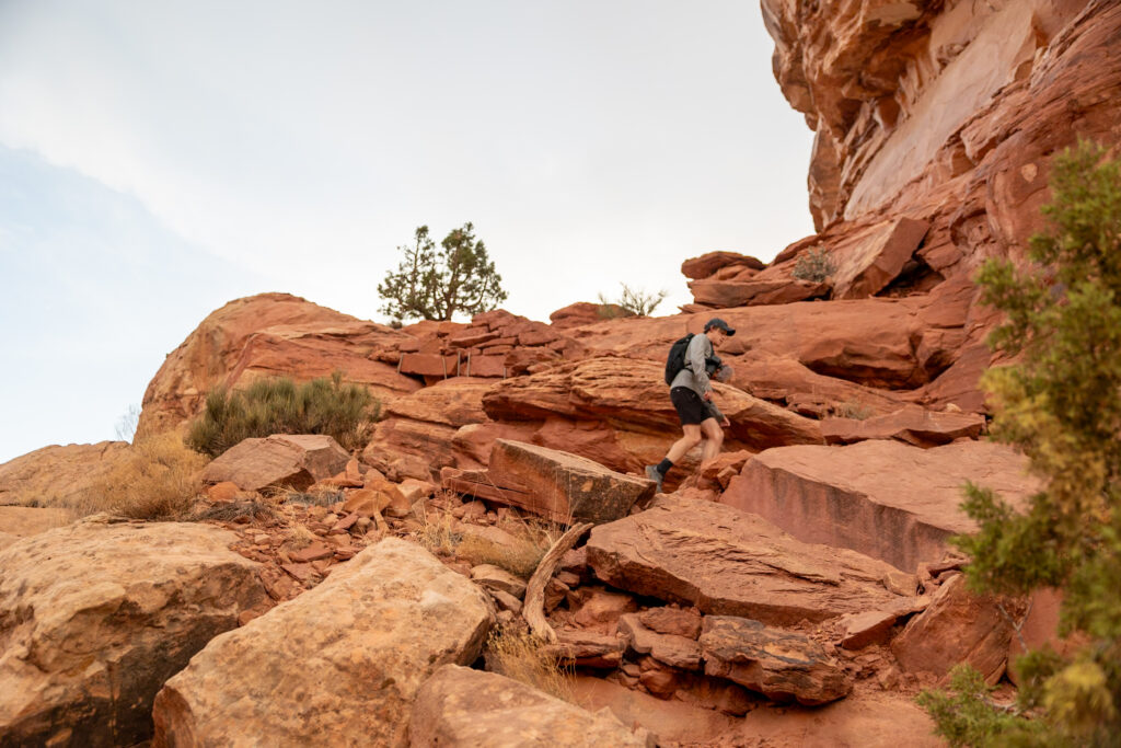
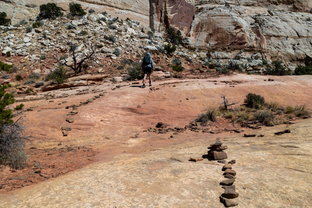
Cassidy Arch Trail is the second most popular trail in Capitol Reef, offering a rewarding, moderately challenging 2-hour hike up to, you guessed it, Cassidy Arch! The hike involves a decent initial climb, which we affectionately called “Nature’s Stairmaster,” before winding its way across varied terrain. Unlike some trails, signage is quite minimal here. Instead, cairns (stacked rocks) are what guide you along the path, so keep an eye out for them!
For the fewest people, we recommend hiking this trail either before sunrise or about two hours before sunset. If you choose sunset, aim to arrive at the arch roughly one hour before the sun sets behind the cliffs and carry headlamps for your descent. For sunrise photos, be sure to reach the arch before the sun fully rises to avoid harsh direct glare as you view the arch itself.
The Cassidy Arch itself is somewhat hidden below the skyline, so when you do discover it, it’s even more exciting. As you approach the arch, the terrain gets quite steep again, so be careful when exploring around the base of the arch. Overall, this hike, although a bit strenuous, delivers some truly incredible views and will leave you with a huge sense of accomplishment!
Estimated Time: 2 hours
Length: 3.1 miles / 5 km
Elevation Gain: 685 ft / 209 m
Difficulty: Moderate
With offline maps, wrong-turn alerts, and extra planning features, make the most of every outside adventure with AllTrails Plus. Get 7 days of AllTrails Plus for free!
3. Grand Wash Trail
The Grand Wash Trail offers an easy, approximately 2-hour easy hike through a dramatic canyon in Capitol Reef National Park. While not a true slot canyon, sections of the walls become incredibly constricted, making for an impressive sense of scale.
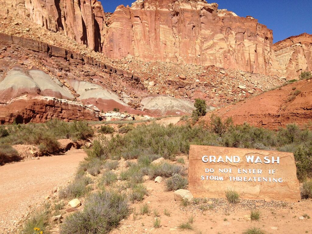
As this is a “wash,” always check weather conditions before entering, as flash floods can be a serious risk. Although we didn’t get a chance to experience this hike ourselves, it’s on our list for next time as it’s made its way into the Top 3 Hikes in Capitol Reef on AllTrails.
Estimated Time: 2 hours
Length: 4.7 miles / 7.6 km
Elevation Gain: 341 ft / 104 m
Difficulty: Easy
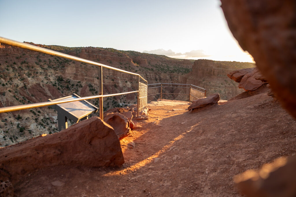
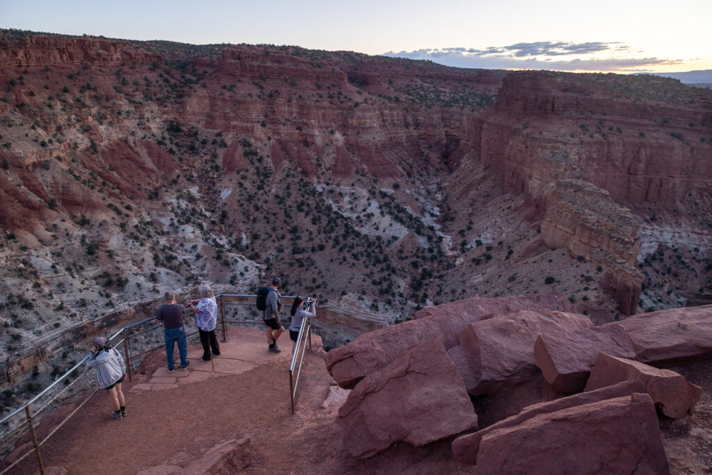
4. Sunset Point Overlook Trail
At just 15 minutes, Sunset Point Trail quickly became our favorite short hike in all of Capitol Reef. As its name suggests, the sunset views from this trail are incredible. This is when we hiked it, and we were mesmerized by how vibrant the colors were that reflected off the surrounding stone.
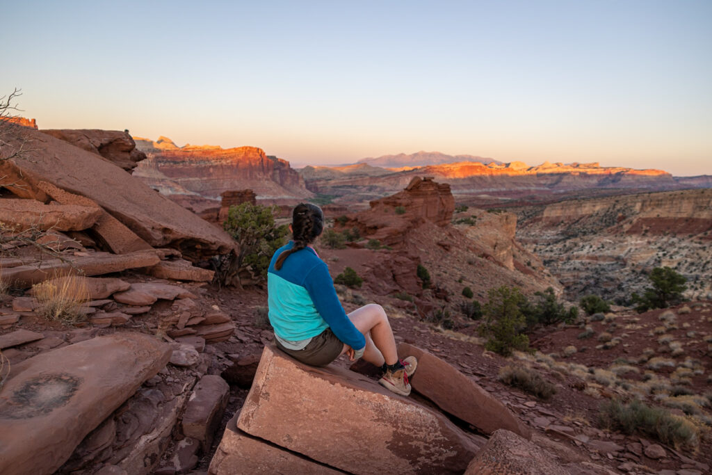
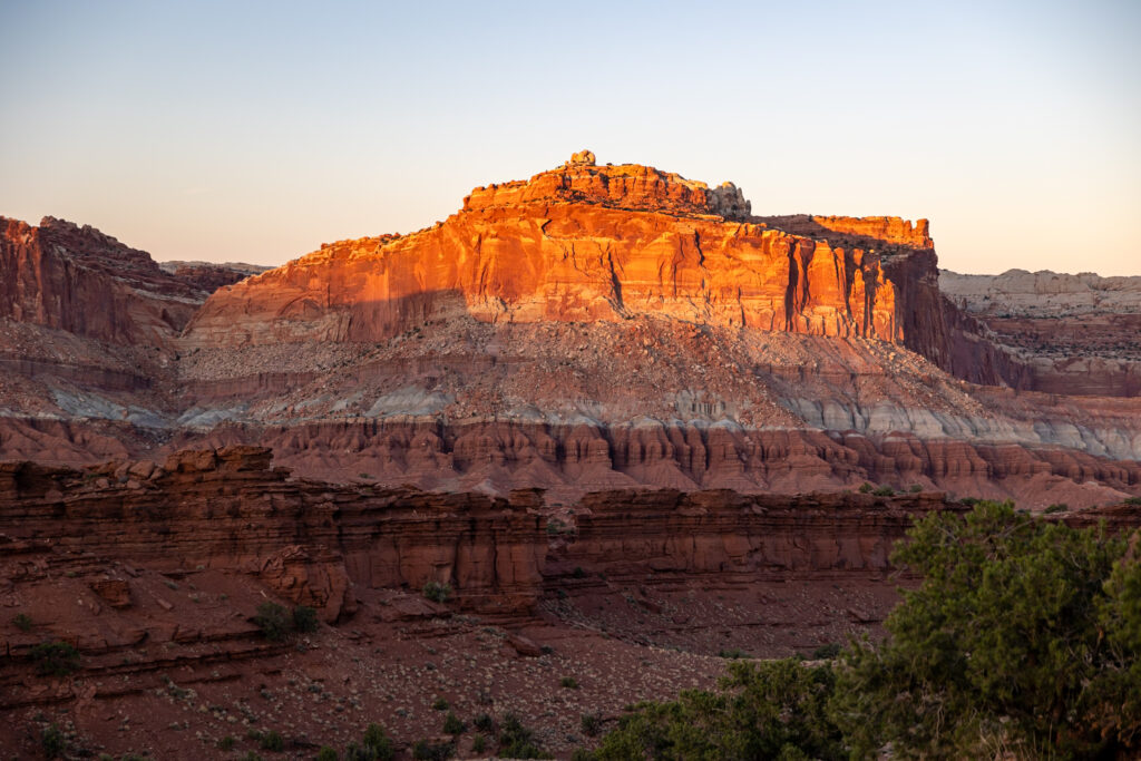
Located at the end of the Goosenecks dirt road, this easy-to-follow trail is the perfect way to cap off a long day in the park. We highly recommend arriving about 1 hour before sunset so you have enough time to enjoy the light shining directly on the cliff faces before the sun dips behind them, softening the hues.
Estimated Time: 15 minutes
Length: 0.7 miles / 1.1 km
Elevation Gain: 46 ft / 14 m
Difficulty: Easy
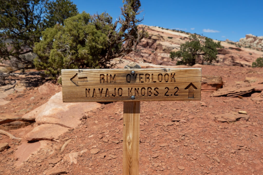
5. Navajo Knobs Trail
Navajo Knobs Trail is a difficult trail—long, steep, and hot. Stretching just over 9 miles (15 km) and gaining 2,139 feet (652 meters) in elevation, you’re in for a 5-hour workout. That being said, the views are the best in the entire park, so we do recommend the trail. However, expect it to be the only hike (or activity) you do that day.

During the hike up, you’ll need to watch for rock cairns, man-made stone piles, to stay on the trail. We found ourselves wandering off trail frequently and would check AllTrails before realizing, “Oh, we missed that cairn! Let’s make our way back to the trail!” Most of the trail is on exposed rock, so that part was pretty easy, just a consistent incline that we felt in our legs.
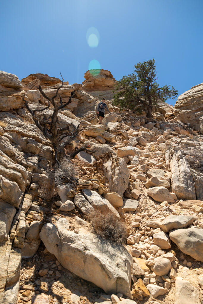
At the very end of the trail is a slightly technical rock scramble to the top with room for just 2-4 people. For the average hiker, we recommend sticking to the viewpoint from the lower part of the trail—it was 90% as good as the views from the top of the scramble!
☀️ Practice Sun Safety: This trail is very sun-exposed, with very few shaded areas, so be prepared with 1 liter of water per hour, ample sunscreen, a sunhat, glasses, and bonus points for sun shirts to protect your arms.
Estimated Time: ~5 hours
Length: 9.1 miles / 14.6 km
Elevation Gain: 2,139 ft / 652 m
Difficulty: Hard
With offline maps, wrong-turn alerts, and extra planning features, make the most of every outside adventure with AllTrails Plus. Get 7 days of AllTrails Plus for free!
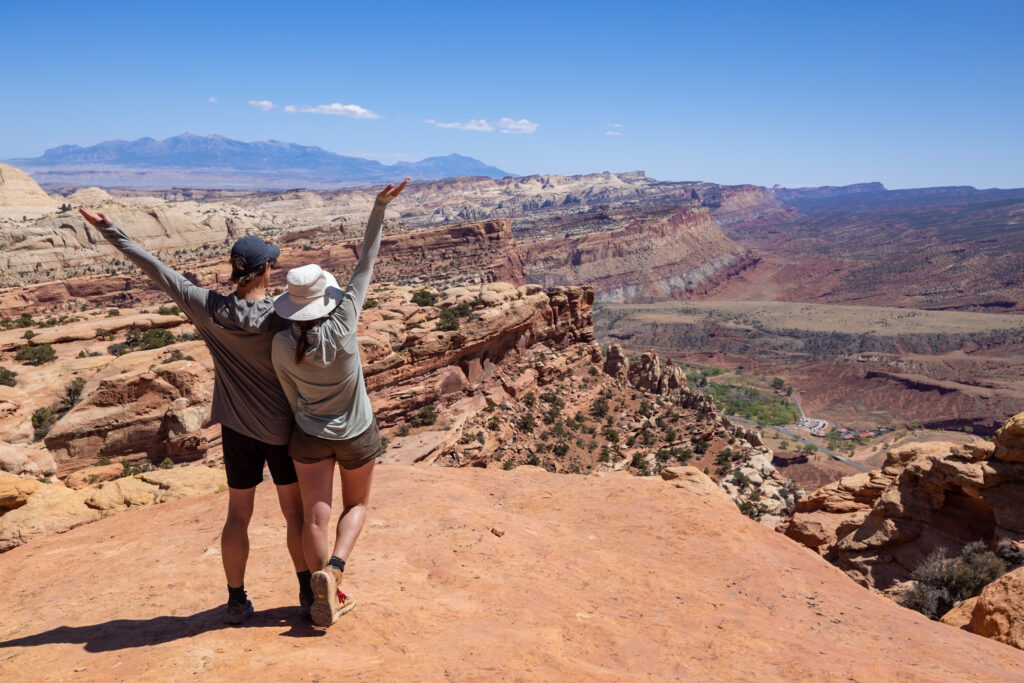
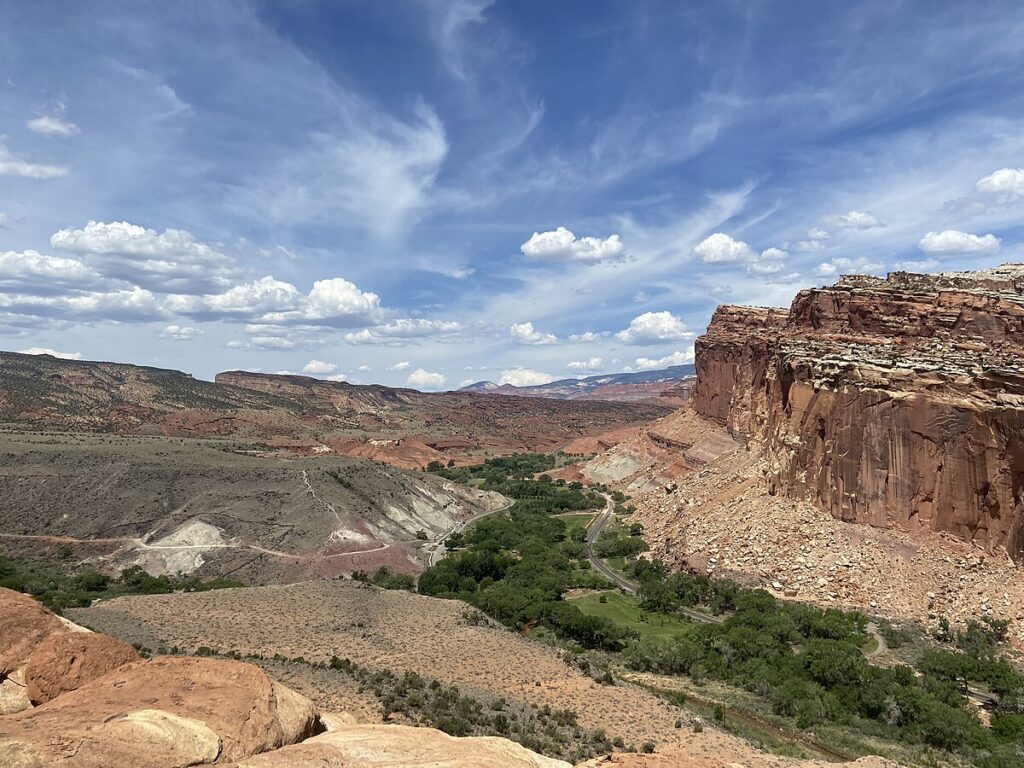
6. Rim Overlook Trail
Rim Overlook Trail is a great, 2.5-hour alternative to the Navajo Knobs Trail. This trail takes you half the length of the Navajo Knobs Trail, to Rim Overlook, before turning back. It’s especially good for those who still want to gain some elevation to look out over the valley, without committing to a 5-hour trek.
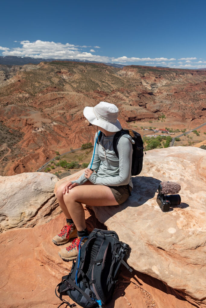
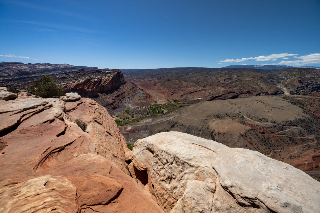
From the overlook, you will be able to see the road through the park, the Visitors Center, and even the orchards from above. There’s a nice place to sit, so bring some snacks to appreciate the view once you arrive!
☀️ Practice Sun Safety: This trail is very sun-exposed, with very few shaded areas, so be prepared with 1 liter of water per hour, ample sunscreen, a sunhat, glasses, and bonus points for sun shirts to protect your arms.
Estimated Time: 2.5 hours
Length: 4.3 miles / 6.9 km
Elevation Gain: 1,066 ft / 325 m
Difficulty: Moderate
7. Chimney Rock Trail
Chimney Rock Loop Trail is a moderate, 2-hour loop trail, best done in the morning. Although we didn’t get a chance to hike this trail ourselves, we’ve included it as it’s made its way into the top 5 hikes in Capitol Reef National Park! We’ve read it recommended to take the first fork in the road left and hike it clockwise so that the wide-open vistas are in front of you, instead of behind you, the whole way.
Estimated Time: 2 hours
Length: 3.6 miles / 5.8 km
Elevation Gain: 790 ft / 241 m
Difficulty: Moderate
8. Capitol Gorge Trail
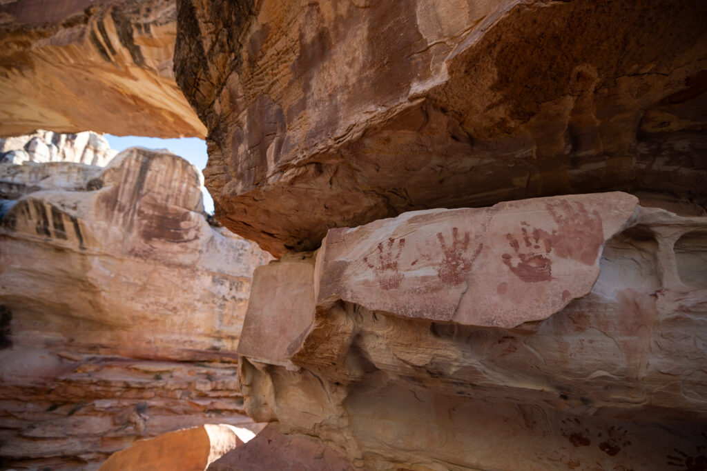
Capitol Gorge Trail is an easy, 1-hour hike through Capitol Gorge, a canyon that once served as a pioneer road. Although graffiti is no longer allowed, this trail is famous for the Pioneer Register, where pioneers from the 19th and 20th centuries etched their names and the date onto the canyon walls. You’ll also find several prehistoric Native American petroglyphs and remnants of a telephone line.
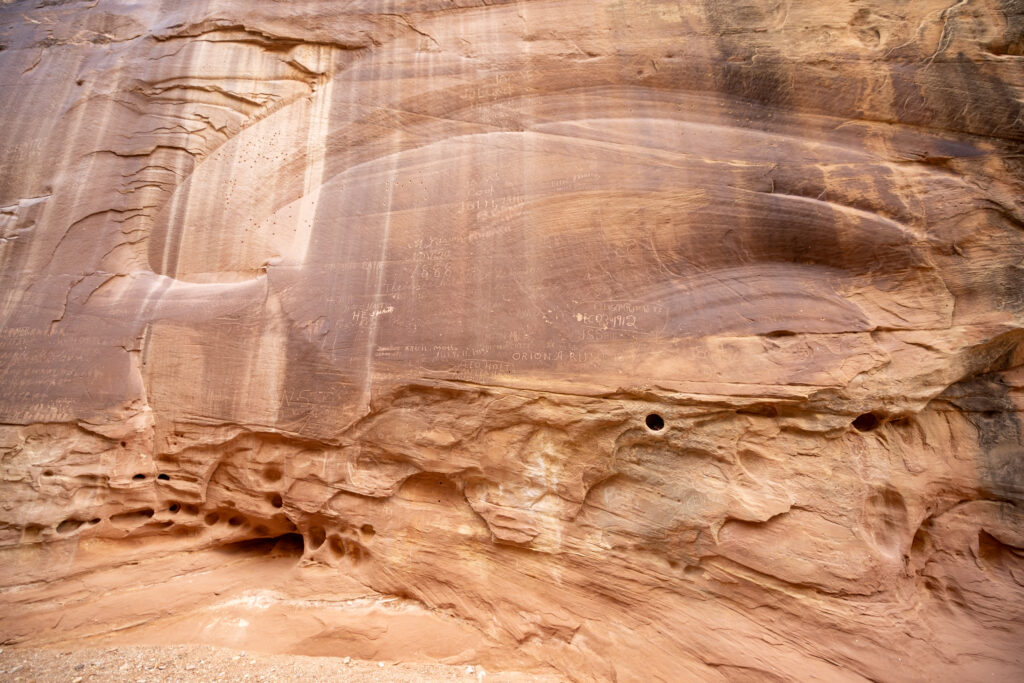
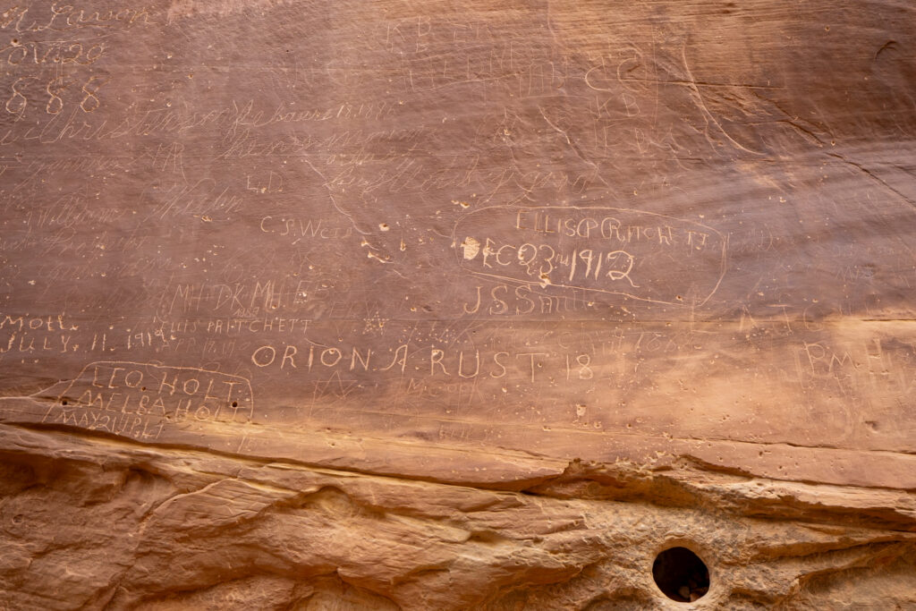
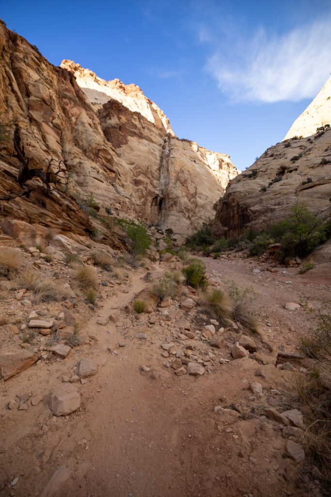
As you walk, it’s easy to imagine early travelers here, perhaps guided by the remnants of old street light poles still visible. The hike culminates at several water-filled potholes, the Tanks, before turning back, but the real highlight to us was seeing the petroglyphs and Pioneer Register.
Estimated Time: 1 hour
Length: 2.2 miles / 3.5 km
Elevation Gain: 167 ft / 51 m
Difficulty: Easy
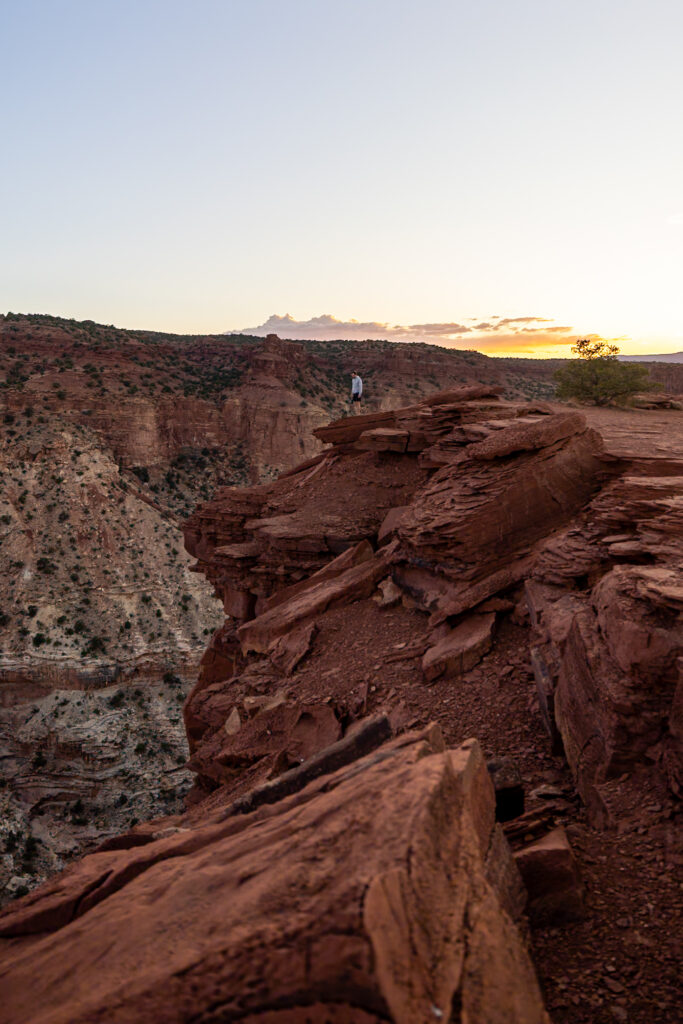
9. Goosenecks Overlook
Goosenecks Overlook is another super-easy 15-minute overlook trail located at the end of the Gooseneck dirt road. The overlook is super short and sweet, best enjoyed during sunrise or sunset. There is a small overlook area that you can access through a cut in the rock. Otherwise, you can take a seat on one of the rocks while the sun goes down.
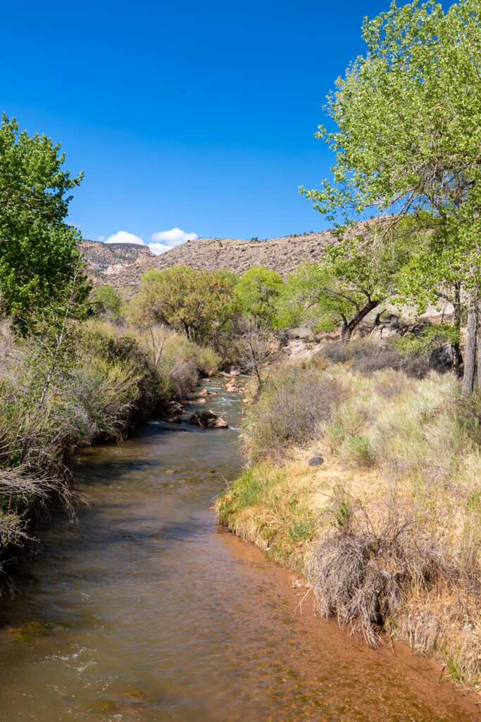
This area has almost 360-degree views, making it a great spot to look down at Sulphur Creek, a tributary of the Colorado River, and the “Goosenecks,” the name given to this canyon’s tight curves. The view down really reminded us of our time hiking the Narrows in Zion National Park.
Estimated Time: 15 minutes
Length: 0.2 miles / 0.3 km
Elevation Gain: 16 ft / 5 m
Difficulty: Easy
10. Cohab Canyon Trail
Cohab Canyon Trail is another moderate, 2-hour trail with a steep beginning before leveling out to a mostly flat, sandy trail with incredible canyon views. It stretches from the Hickman Bridge Trailhead to the Fruita Trailhead, so you can start from either. If you hike from Fruita, you get over the steep stretch more quickly and get to enjoy nice views sooner.

If you’ve got a sweet tooth, stop by Gifford Homestead, located by the Fruita trailhead, for fresh, homemade pies. We absolutely devoured our pies from here! They have a few picnic tables outside of the pie shop where you can sit and enjoy the canyon views while you dig in.
Estimated Time: 2 hours
Length: 3.3 miles / 5.3 km
Elevation Gain: 797 feet / 243 m
Difficulty: Moderate
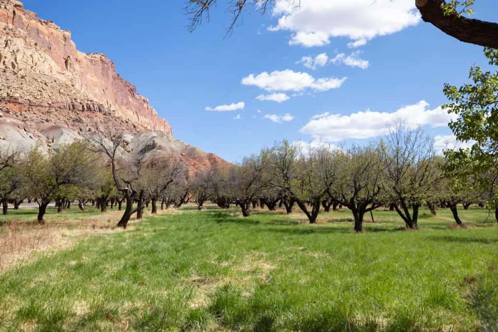
11. Fremont River Trail
Wrapping up this list is the Fremont River Trail, a peaceful riverside trail where you’ll be rewarded with views of Capitol Reef’s horse stables and orchards, run by the NPS. In the orchards, they still use the same cultivation methods that were used when they were first planted, which is really neat!
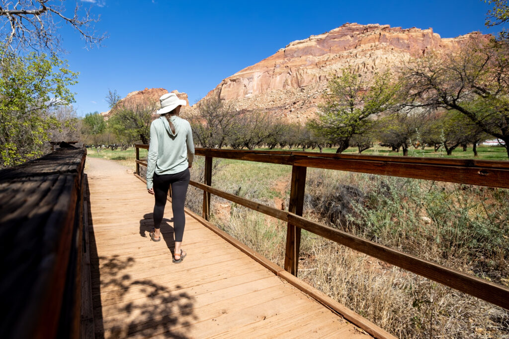
The first half of this hike is dog-friendly, which Ollie was very excited about! Although we turned around after the first half, you can continue into the second half of the hike if you aren’t traveling with your pup. This takes you up to two viewpoints that overlook the Fruita historic district and orchards. Overall, we really enjoyed the simplicity of this hike, feeling like we had been transported back to a slower time.
🍑 Grove Difficulties: The park is facing challenges keeping the groves alive. In early May this year they had already run out of water due to less snow melt. Also, due to a recent early hot-then-cold spell, all the apricot trees had lost their fruit.
Estimated Time: 1 hour
Length: 2.1 miles / 3.4 km
Elevation Gain: 400 ft / 122 m
Difficulty: Moderate
With offline maps, wrong-turn alerts, and extra planning features, make the most of every outside adventure with AllTrails Plus. Get 7 days of AllTrails Plus for free!
🗺️ Map of Best Capitol Reef Hikes
Here we’ve compiled a map of all the hikes in Capitol Reef National Park that we’ve mentioned in this article. This is to give you a general idea of where they’re located in the park, but we still recommend following a hiking guide like AllTrails for getting to the specific trailhead and navigating the trails.
How to use this map: We have saved the locations from this guide on this map. You can save this map to your Google Maps by pressing the star icon. In your Google Maps, click the menu icon and then Saved Maps, where this map will appear.
🎒 Capitol Reef Hiking Essentials
One of the biggest essentials while hiking in Capitol Reef National Park is ample hydration and sun protection. Our favorite ways to hit both of these are by carrying water bladders, instead of tons of heavy water bottles, and wearing a mix of sunscreen, sun shirts, and wide-brimmed hats. In this section, we outline everything else that came in handy for us.
Sun Protection
- Sunscreen – No matter the time of year you visit, sunscreen is essential to protect your skin from the sun.
- Sunglasses – Protect your eyes with your favorite pair of sunglasses.
- Wide-brimmed hat – As part of sun safety, we love pairing sunscreen with wide-brimmed hats.
- Sun Shirts – Light, sunshirts are great for protecting against the sun! Here is Elliot’s favorite long-sleeve sun shirt and Jen’s favorite long-sleeve sun shirt.
- Refillable Water Bottle – Staying hydrated is a key part of sun safety. We love this water bottle featuring all of the US National Parks with stickers to check off your visits.
- Water Bladders – A water bladder is super helpful to pack in more water without adding extra weight.
Hiking Essentials
- Hiking pants – We recommend hiking pants to protect against the sun and trails with higher grasses. Elliot’s favorite hiking pants and Jen’s favorite hiking pants.
- Layers – As the weather can vary in Capitol Reef, come prepared with layers of fleece jackets, long sleeves, and even coats if you’re coming in the middle of winter.
- Rainjacket – You never know what weather awaits you when travelling in a national park. If you’re looking for a new rain jacket fit for hiking, this is Elliot’s favorite rain jacket and Jen’s favorite rain jacket.
- Hiking Boots – Solid footwear with good traction is a must when hiking. Here are Elliot’s favorite trail runners and Jen’s favorite hiking boots.
- Lightweight backpack – Elliot carries this backpack with the included rain cover, while Jen carries this backpack.
- Hat and Gloves – Especially if you’re visiting in the shoulder seasons (spring and fall) or winter, packing a hat and gloves for extra warmth is a must.
- Snacks – We always make sure to pack protein-rich, lightweight snacks with us while hiking.
Safety Essentials
- Trail Maps – We love using AllTrails+ to download maps ahead of time.
- GPS – We carry the Garmin InReach Mini 2 with us on all trails for safety.
- First Aid Kit – This first aid kit is one of those items we hope to never have to use but always carry, just in case.
- Headlamp – A headlamp is especially useful when going on sunrise, sunset, or night hikes in Capitol Reef.
📅 When to Hike in Capitol Reef National Park
Choosing when to hike in Capitol Reef National Park comes down to your preference for heat, crowd levels, and special programming. Each season here offers a unique combination of these factors—here’s a breakdown:
- Summer: Summer brings the largest crowds and highest temperatures, especially in canyons, with potential for afternoon flash floods. Despite this, long daylight hours allow you to explore for longer, and you can experience special events like Stargazing Nights and the Fruit Harvest Festival.
- Spring & Fall: These shoulder seasons are ideal for comfortable hiking, offering milder temperatures and fewer crowds, and lots of fun programming. Highlights include the annual Wildflower Bloom in spring and the Apple Days Celebration and Night Sky Festival in the fall.
- Winter: Winter transforms Capitol Reef into a quiet, snowy wonderland, with opportunities for snowshoe tours and Holiday Light Displays. However, expect cold temperatures, icy trails, and potential facility/road closures. Probably not the best if you’re looking for a one-time visit, but worth the trip if you live nearby!

📰 Related Articles
- The Best Spot to Watch the Sunset in Capitol Reef National Park
- How to Spend 24 Hours in Capitol Reef National Park
- Temple of the Sun and Moon Guide: Cathedral Valley, Utah
🎥 Watch on YouTube
🔎 Ready to Explore Capitol Reef National Park?
Pin this guide with the best hikes in Capitol Reef National Park to help plan your trip!


Leave a Reply
You must be logged in to post a comment.