

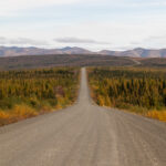
Hiking Guadalupe Mountains National Park is hands-down the best way to experience its rugged peaks, fossil-studded canyons, and wide-open Texas views. Jen, Ollie, and I were completely blown away by the sheer variety and beauty of this national park’s 80-mile+ trail system. We spent three days in the park and hiked over 20 miles! To help you decide which trails you’d like to hit, we’ve rounded up 7 of the best hikes in Guadalupe Mountains National Park to help you hit the ground running—or should we say hiking!
Note: We use affiliate links which provide us a little kickback each time you use one of our links and make a purchase, without any additional cost to you. We do not recommend products that we don’t already love or have heard great things about, so you can trust we’re only suggesting great products to you.
🥾 Important Preparations Before You Hike
💨 Wind Safety: Always check in with rangers for trail conditions and wind forecasts—some hikes may be unsafe on especially windy days.
🧥 Layer up: Mornings and exposed sections can be chilly, but the sun heats things up fast. We wore long sleeves, fleece, and puffy jackets, and rotated layers the entire way.
💧 Bring plenty of water: Rangers recommend at least one gallon per person. We’d add some electrolytes to the mix, too.
🥪 Fuel up: Eat a solid breakfast and bring lunch or high-energy snacks to keep you going. You’ll earn every bite!
🎒 Bring the 10 Essentials: Some of these trails are very remote. Ensure you have all your bases covered, we brought our Garmin inReach in case of emergency.
Please respect the outdoors and Leave No Trace! Before embarking on your outdoor adventure, review the seven principles of Leave No Trace, which include planning ahead and preparing, traveling and camping on durable surfaces, disposing of waste properly (pack out what you pack in), leaving what you find, minimizing campfire impacts, respecting wildlife, and being considerate of others. Abiding by these principles helps keep these places beautiful so others can enjoy them for years to come!
1. Guadalupe Peak Trail
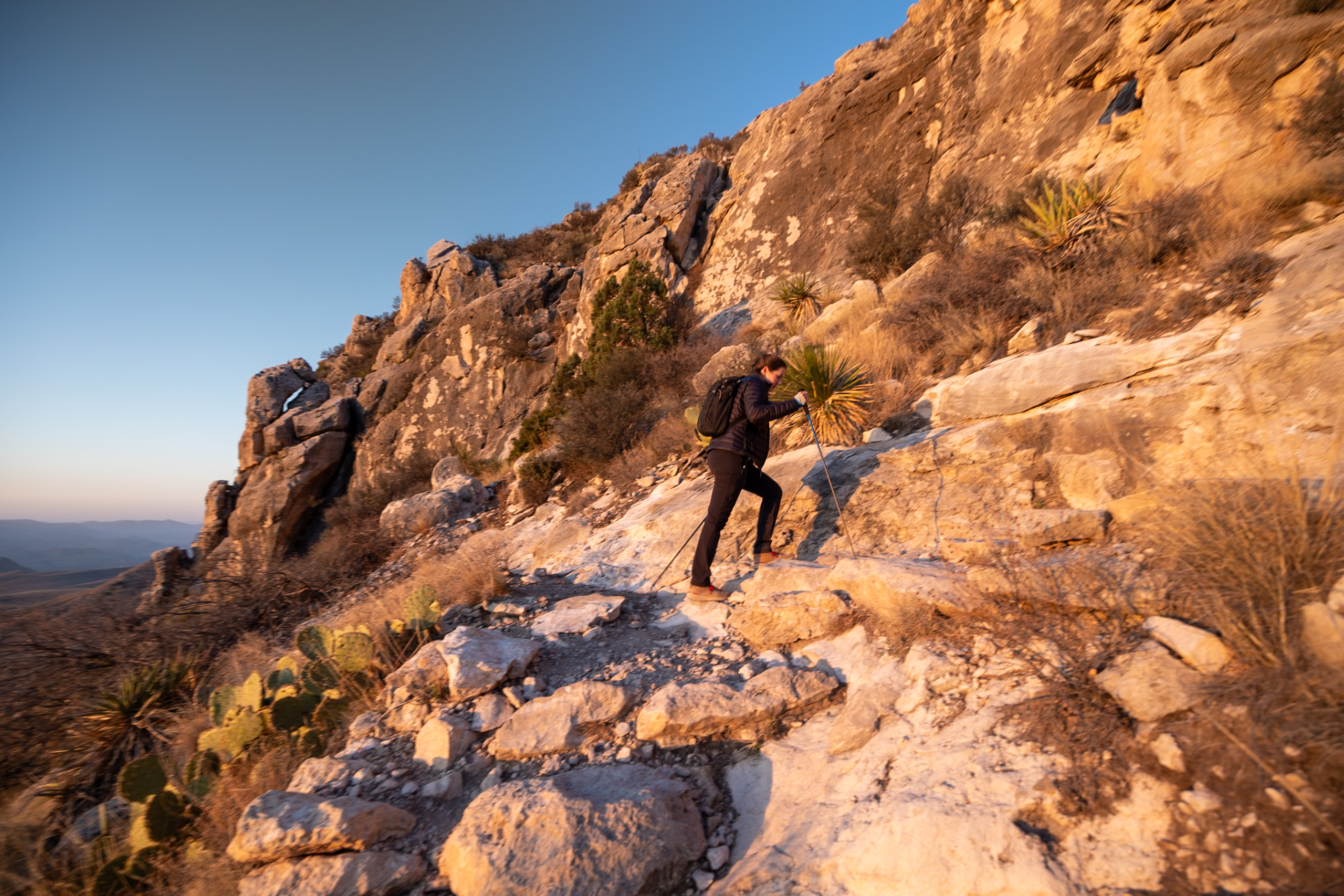
The Guadalupe Peak Trail is the most popular in the park, taking you to the highest point in Texas at 8,751 feet. With 3,000 feet of elevation gain over roughly 8.4 miles, this trail is no joke—but if you’re up for the challenge, the sweeping views and ancient geology make it incredibly rewarding.
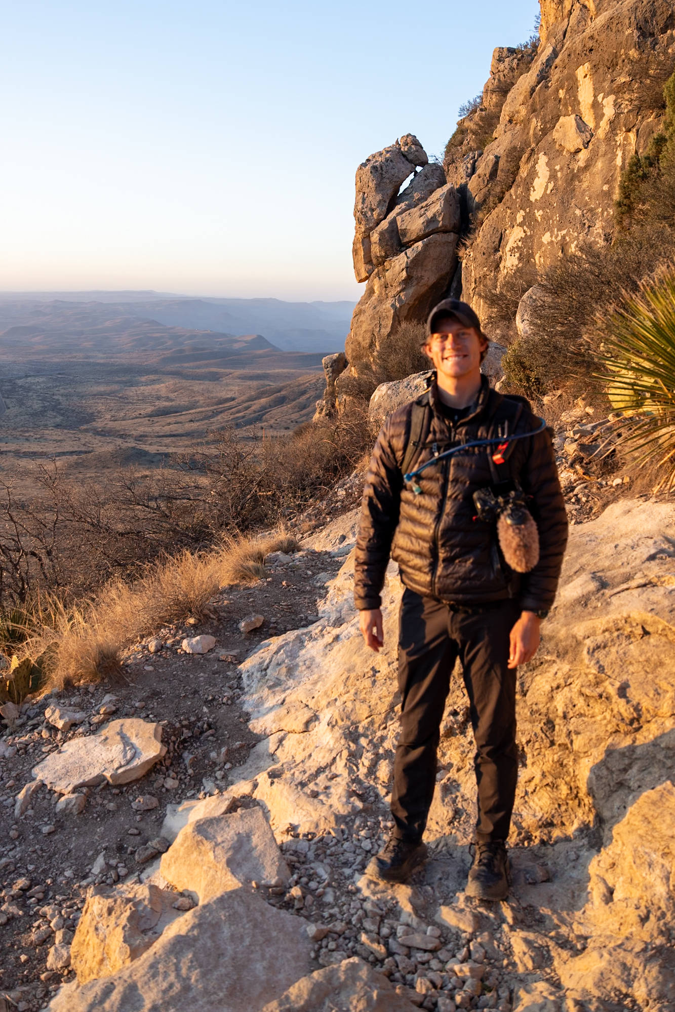
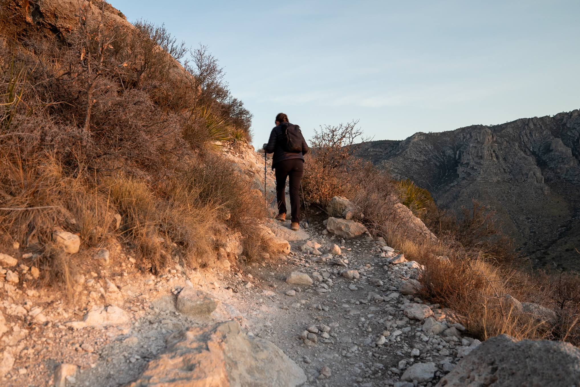
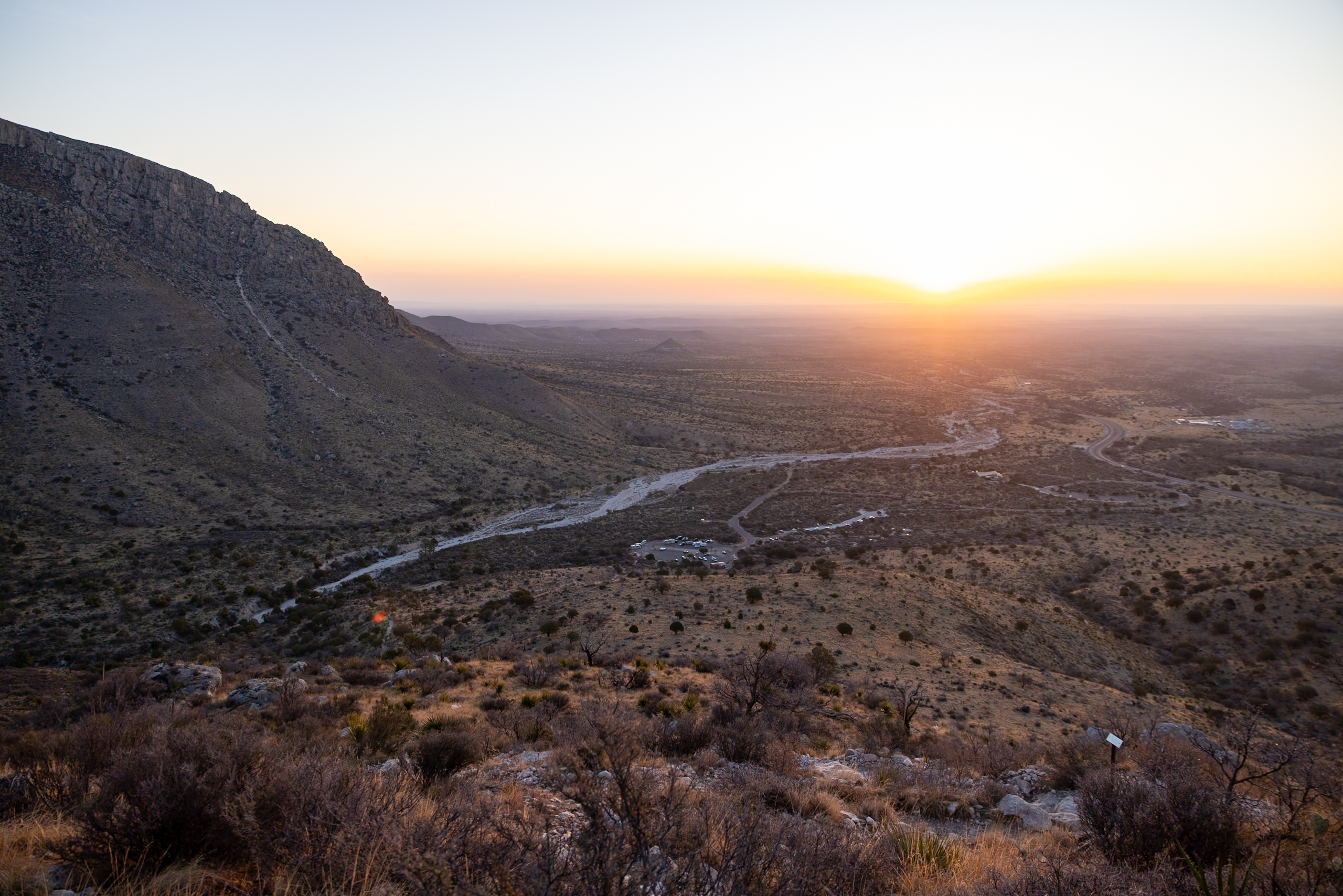
We tackled this hike on our first morning in the park, setting off about an hour before sunrise. The first 2 miles were the most grueling, especially in the cold morning air. The final mile is fully exposed and can be tough if the winds kick up—this is the 2nd windiest place in the U.S.! During our hike, gusts topped 30 mph and made us grateful for the layers we packed.
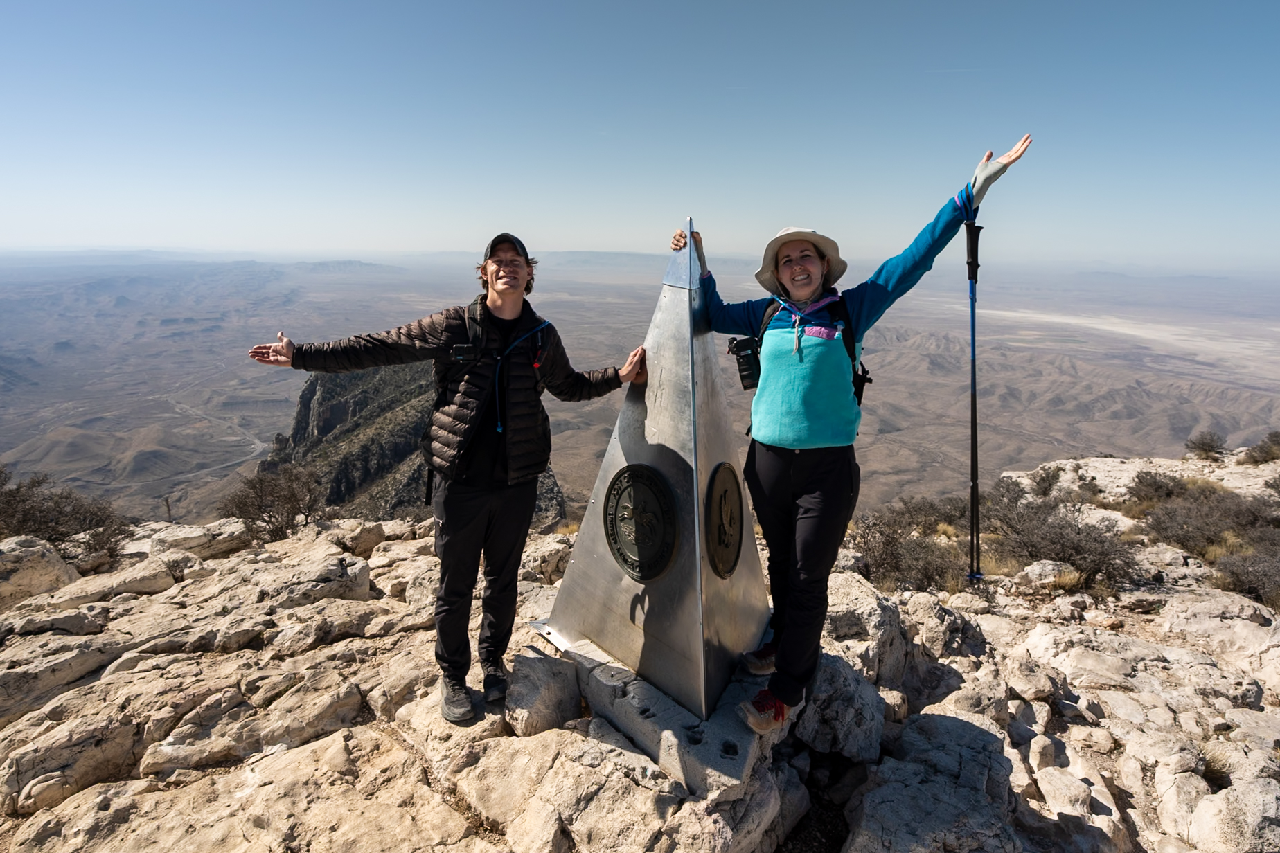
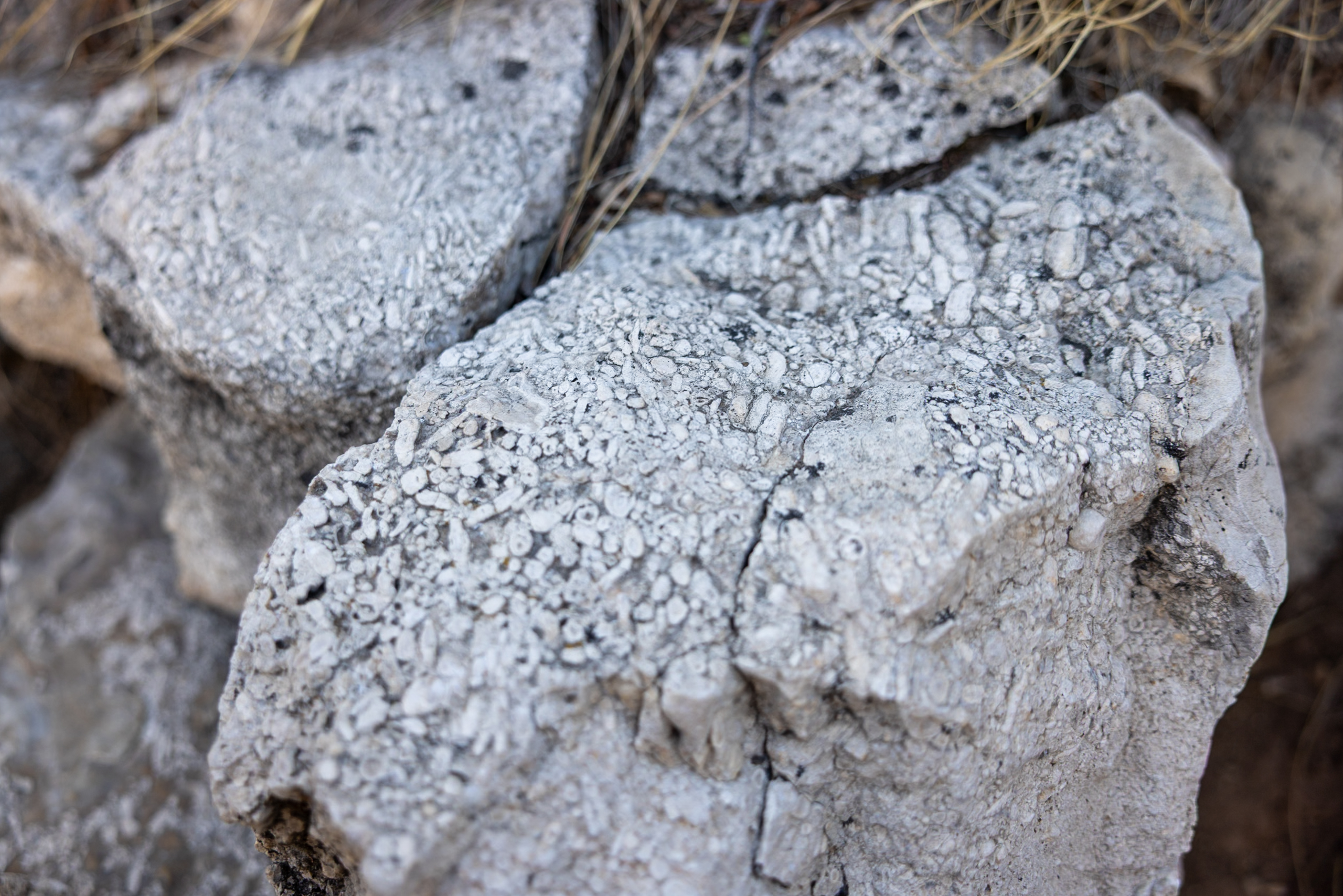
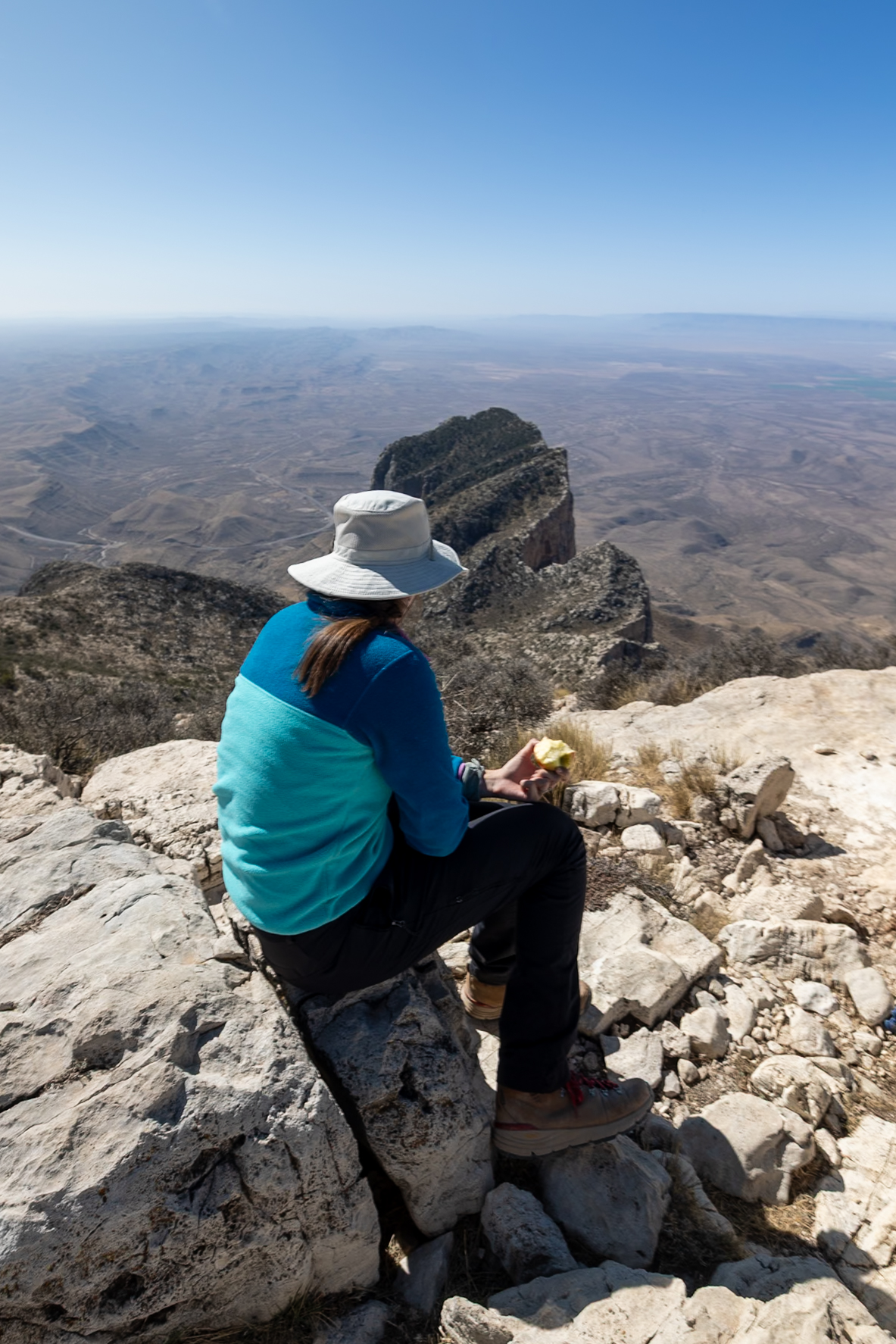
The top half of the trail offers panoramic views that just keep getting better with every step. This entire area was once submerged during the Permian Era as part of the massive Capitan Reef, so you can sometimes spot fossils in the rocks under your feet, from ancient algae to coral and shells. It felt like hiking through a prehistoric seabed in the sky.
Distance: 8 miles (12.9 km)
Difficulty: Hard
Estimated Time: 5-6 hours
Type: Out-and-back
2. Devil’s Hall Trail
Devil’s Hall Trail is one of the most unique hikes in Guadalupe Mountains National Park, offering a mix of peaceful walking and fun scrambling through a rugged limestone canyon. It starts on a well-maintained trail for the first couple of miles, winding gently through piney woodlands and alongside dry washes. But once you reach the rocky riverbed, things get a lot more interesting.
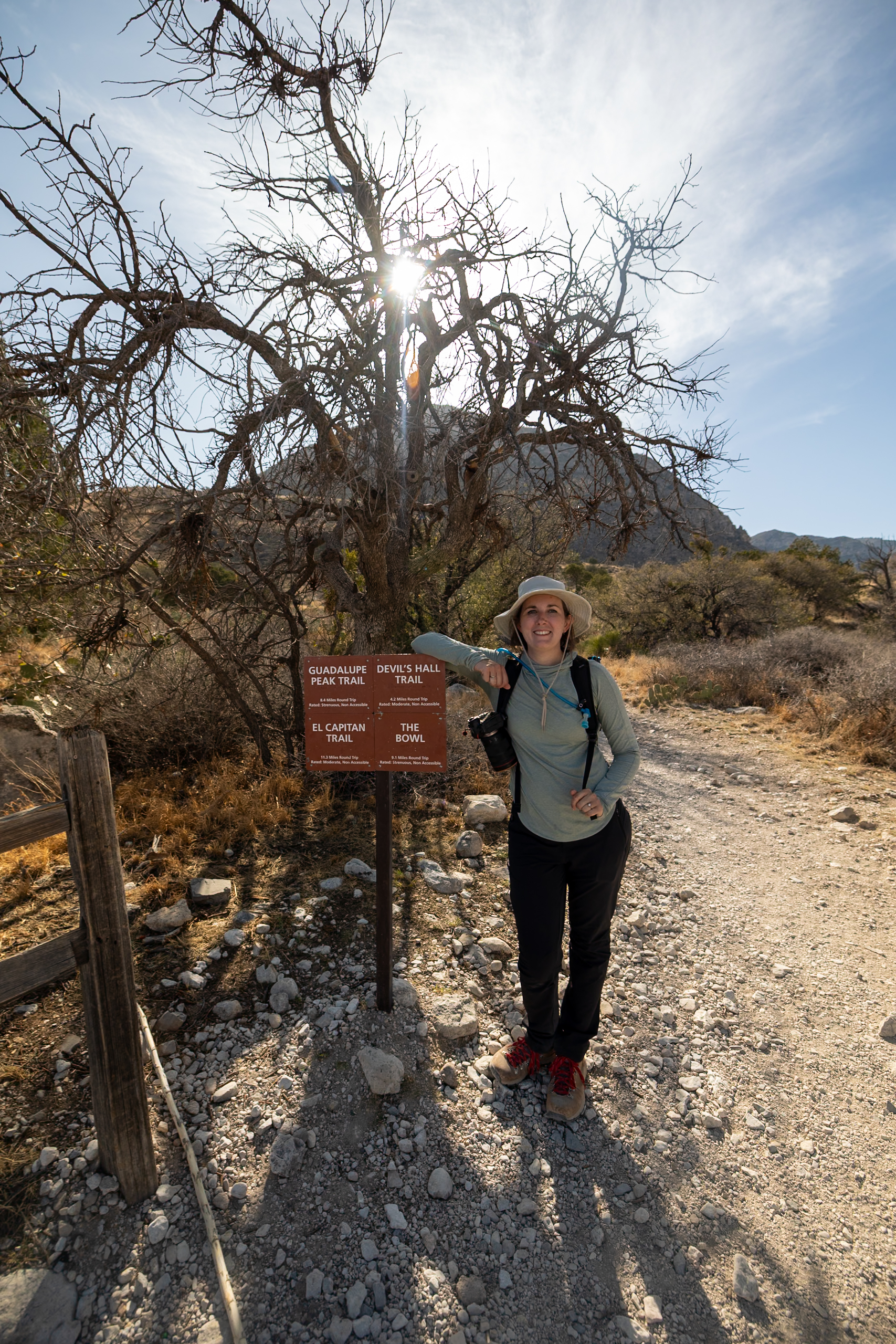
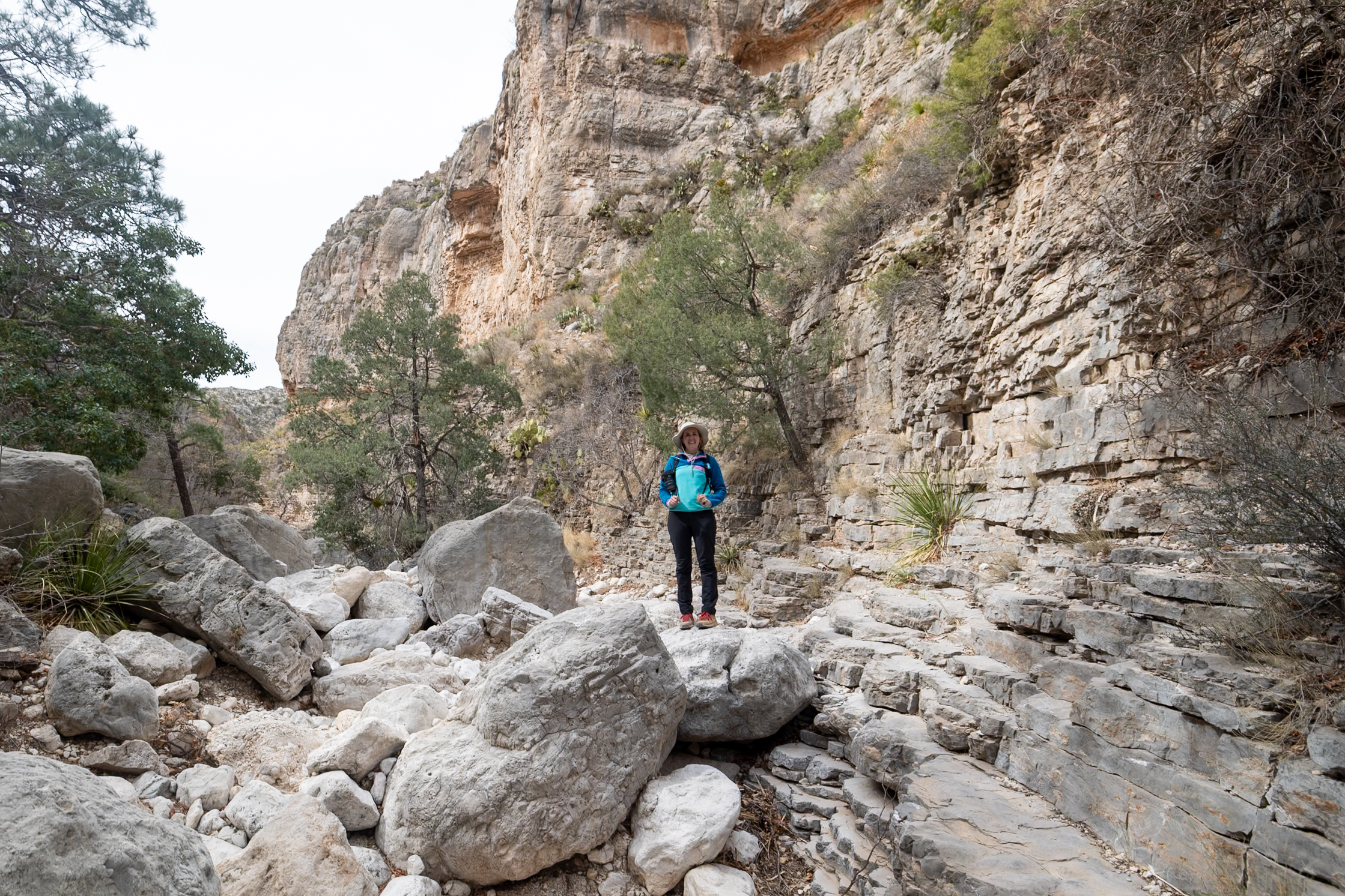
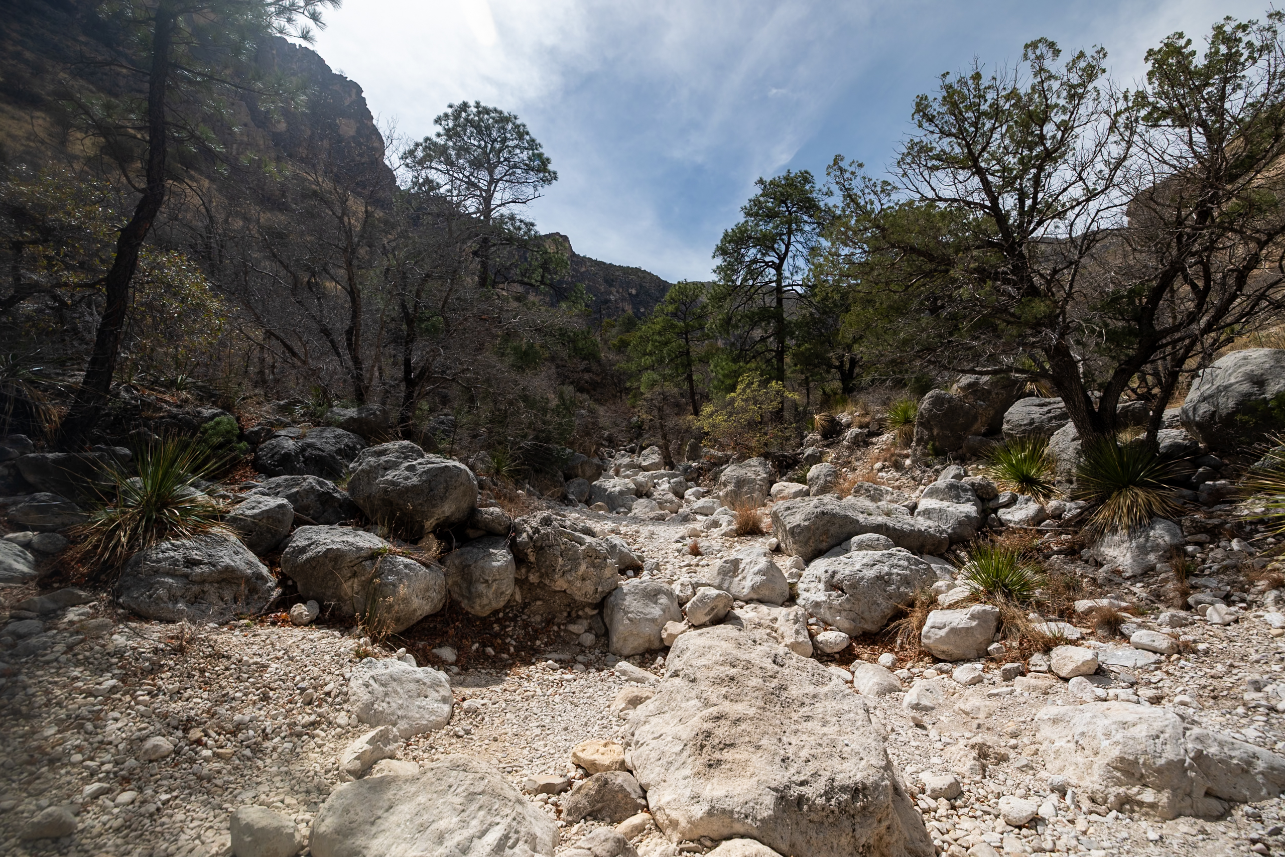
From there, it’s a choose-your-own-adventure kind of route, with the canyon acting as your trail. You’ll be clambering over boulders, navigating uneven rock, and slowly making your way toward the trail’s namesake feature: Devil’s Hall—a narrow, steep-walled corridor. Right before reaching it, you’ll climb a natural staircase of rock slabs, pass a small seasonal pool, and enter the striking, slot-like passage that marks the end of the trail before turning back.
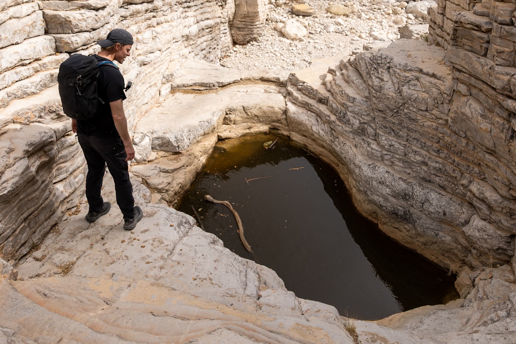
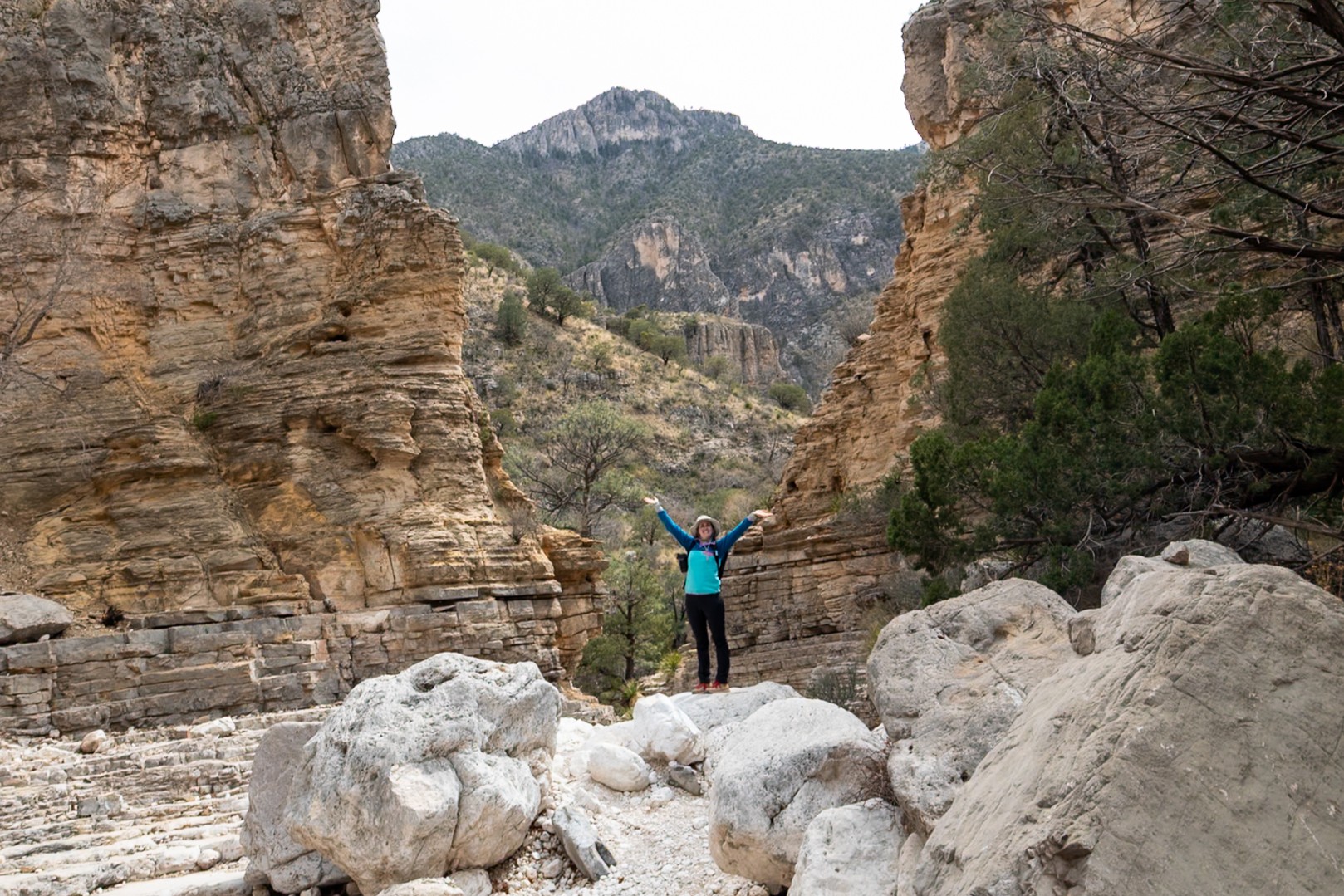
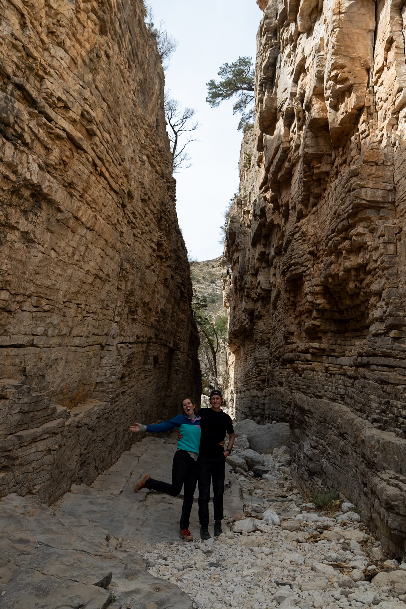
We visited in spring, and while the weather was perfect, we could see how this trail would be treacherous after rain. If you’re planning to do this hike during the summer storm season or winter snowmelt, check with rangers beforehand. On the way back, the rock formations beautifully framed the surrounding canyon walls and made the return just as memorable as the hike in!
Distance: 3.79 miles (6.1 km)
Difficulty: Moderate
Estimated Time: 2-3 hours
Type: Out-and-back
3. The Pinery Trail
The Pinery Trail is a short, paved walk that’s perfect for a quick stretch—and it’s also the only dog-friendly trail in Guadalupe Mountains National Park. We walked this historic trail daily with our pup, Ollie, since dogs are otherwise restricted to campgrounds and parking areas.
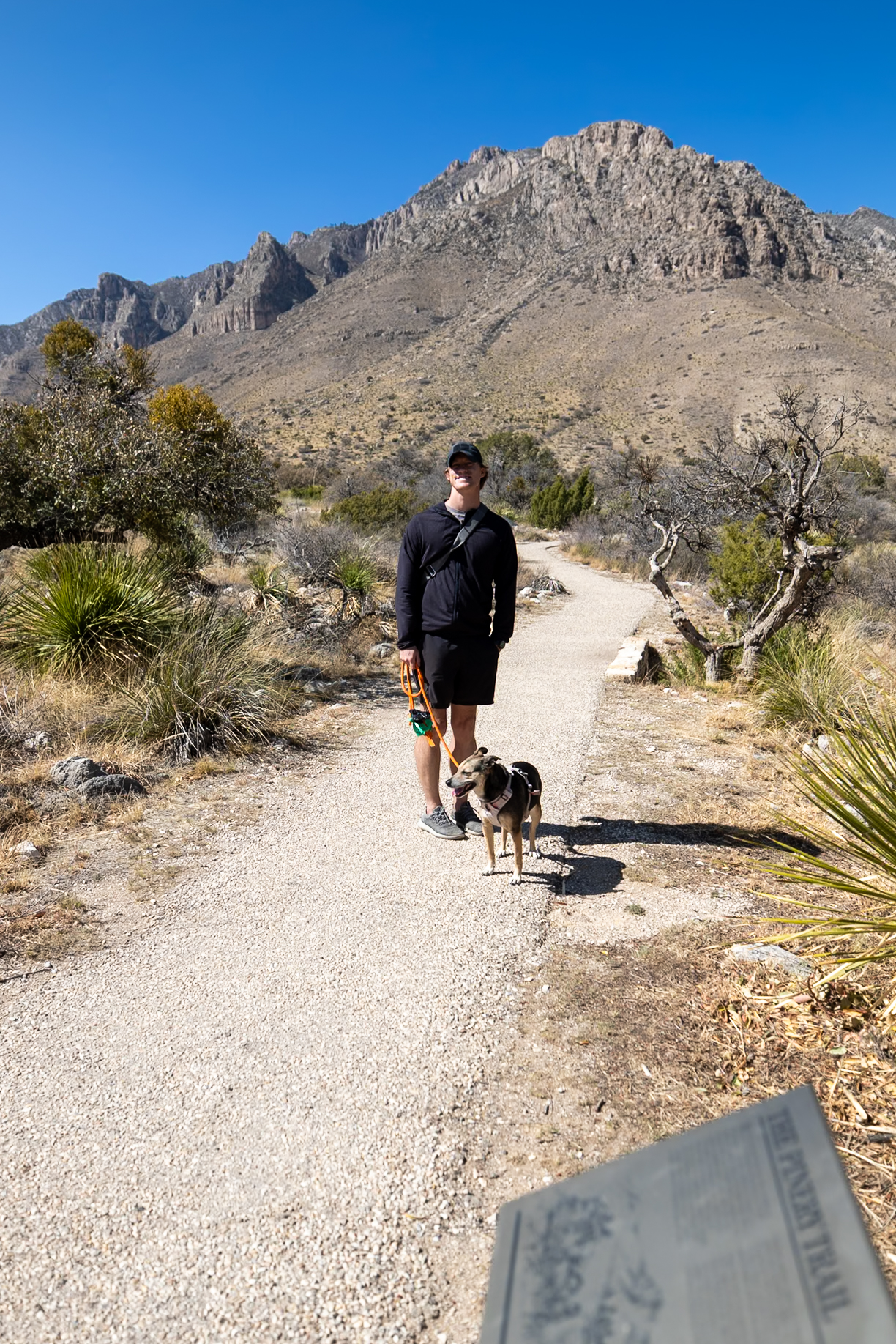
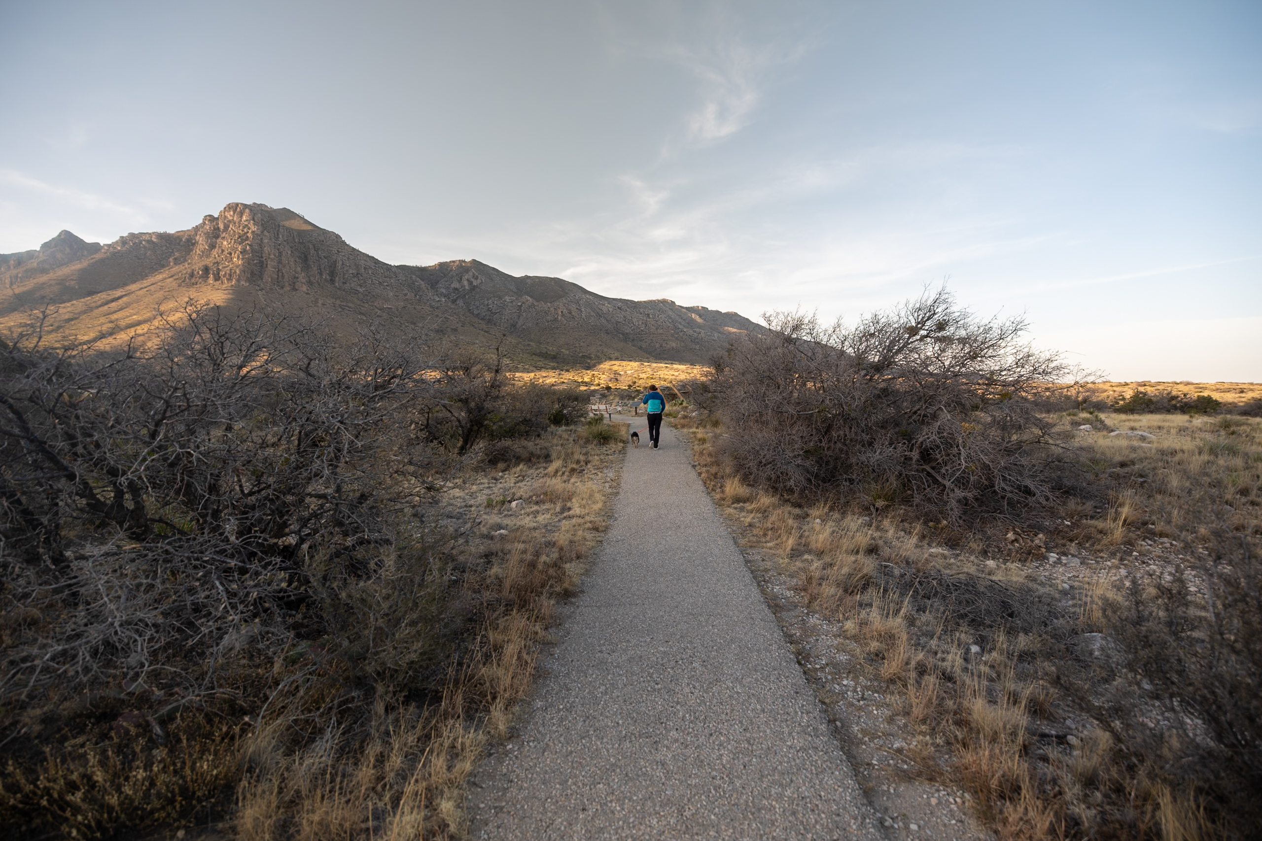
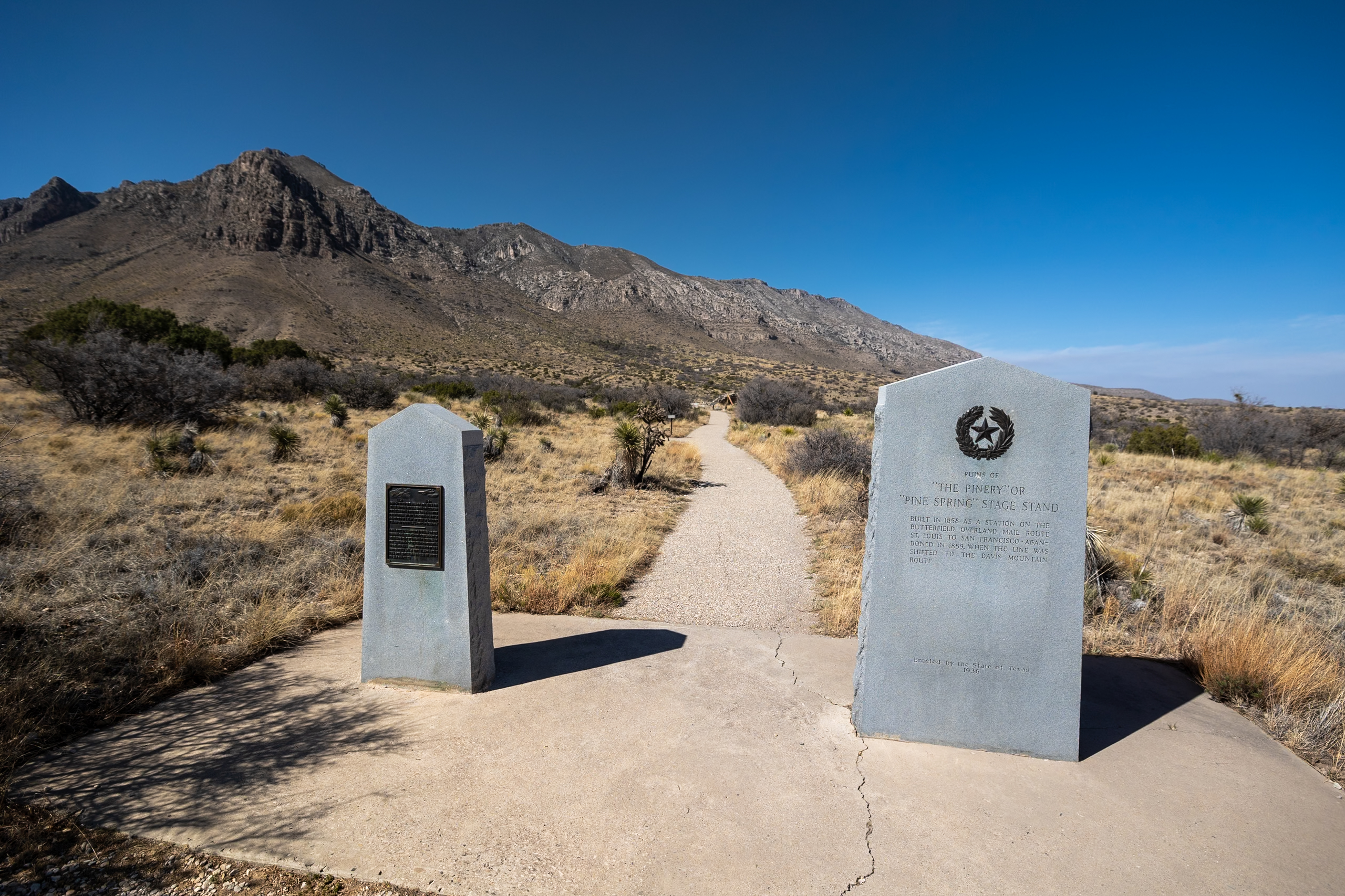
The trail leads to the ruins of The Pinery, a stone station dating back to 1858 that once served as a stop on the 2,700-mile Butterfield Overland Mail Route. This route connected the East and West (St. Louis to San Francisco) over 25 days, predating the Pony Express and the Transcontinental Railroad. It was super cool to be able to walk a trail with so much history! This trail was very easy, and since you’ll probably go to the visitors center, you might as well enjoy it!
Distance: 1 mile (1.6 km)
Difficulty: Easy
Estimated Time: 30 minutes
Type: Out-and-back
4. Salt Basin Dunes Trail
Tucked away on the western edge of the park, the Salt Basin Dunes Trail offers a completely new landscape. We hiked this on our second day and were struck by how surreal it felt—the soft, white dunes stretch out dramatically against the backdrop of the mountains. The trail itself is short and easy, leading you into an expanse that was once covered by ocean waters millions of years ago. This area is one of the lesser-known Gypsum Sand Dunes, overshadowed by the magnificent White Sand Dunes National Park, just a few miles north.
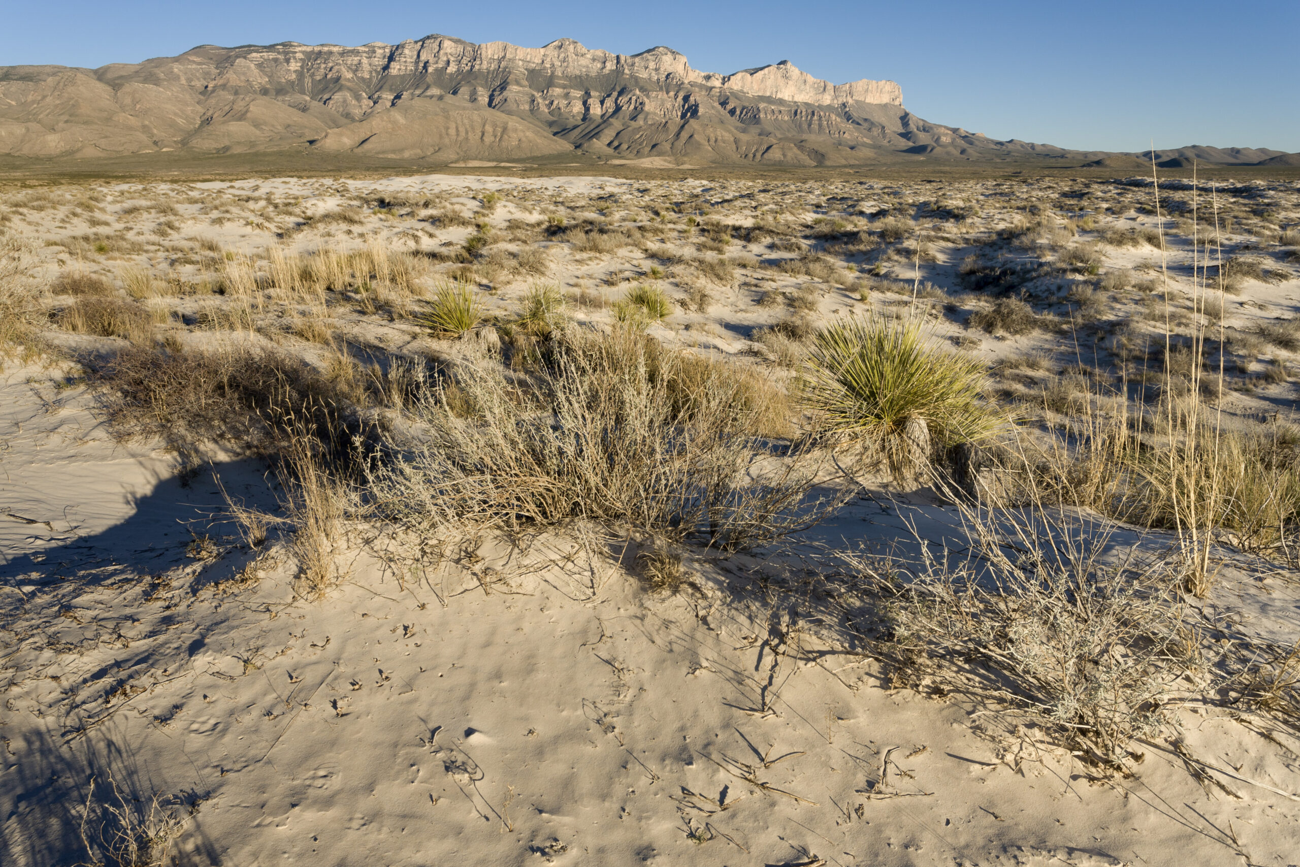
This is the only established trail in this part of the park, and the sense of solitude is one of its biggest draws. As you walk across the windswept dunes, it’s easy to imagine the sea that once filled this basin and left behind these shimmering remnants. It’s especially beautiful in the early morning or late afternoon, when the low sun casts dramatic shadows across the sand.
💡 This trail is not recommended in the rain, as the Gypsum Dunes become very sticky when wet.
Distance: 3.3 miles (5.3 km)
Difficulty: Easy
Estimated Time: 1 hour
Type: Out-and-back
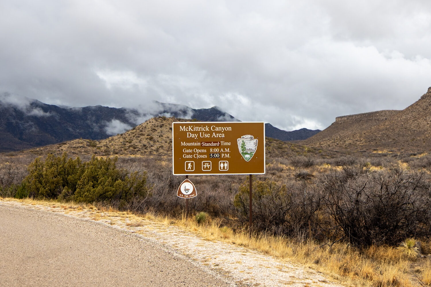
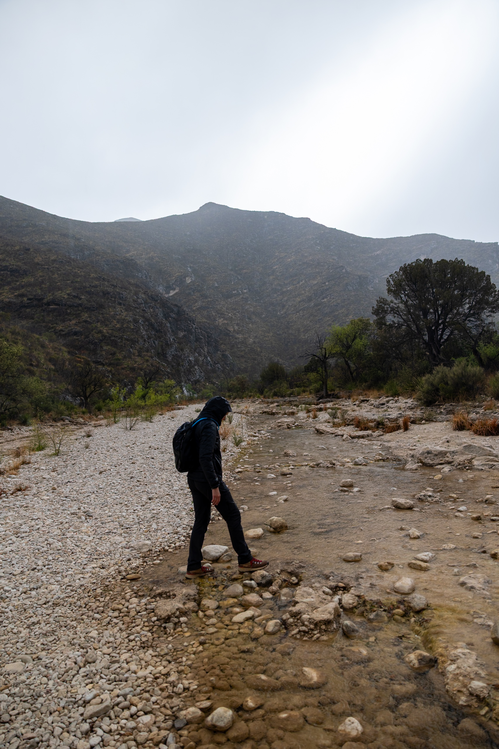
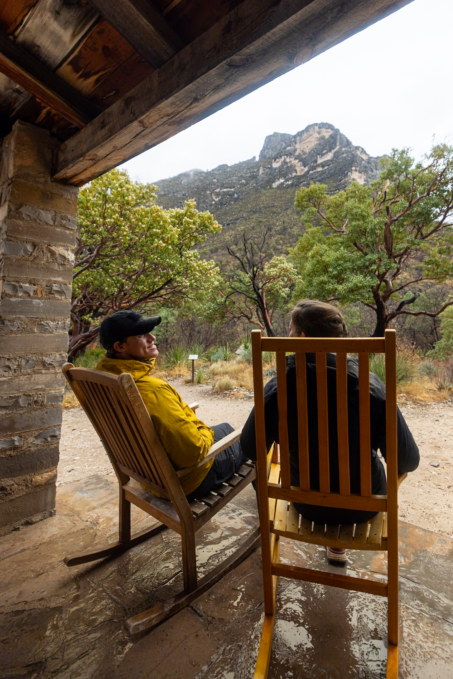
5. McKittrick Canyon Trail to Hunter Line Shack
The McKittrick Canyon Trail to Hunter Line Shack is a great way to experience a different side of Guadalupe Mountains National Park. We tackled this hike on our second day in the park, starting right when the McKittrick Canyon gate opened at 8 AM.
💡 Timing is Crucial: This area of the park closes at 5 PM and the gate locks. Thus, time your return carefully, keeping in mind it takes about 15 minutes to drive from the trailhead to the gate.
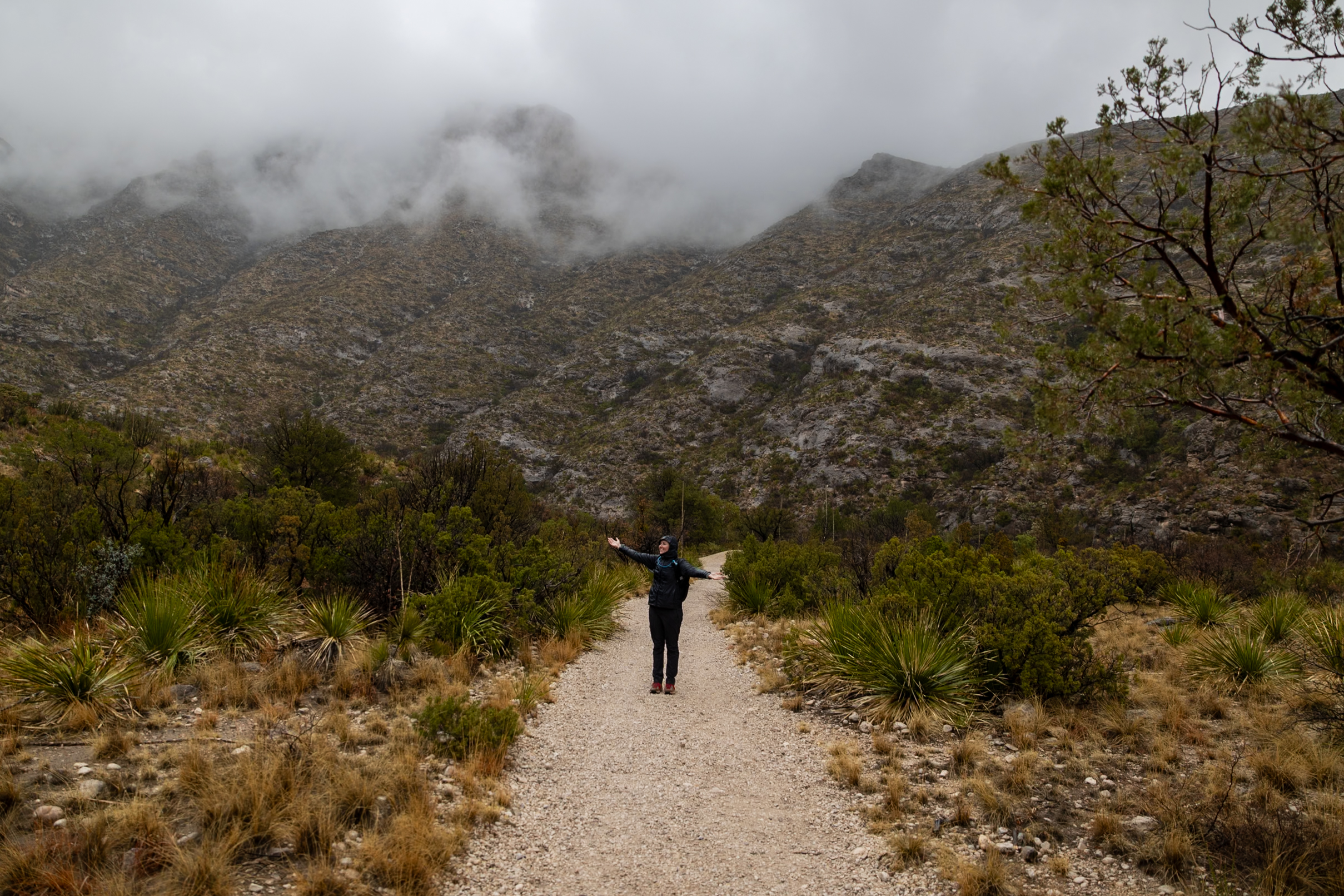
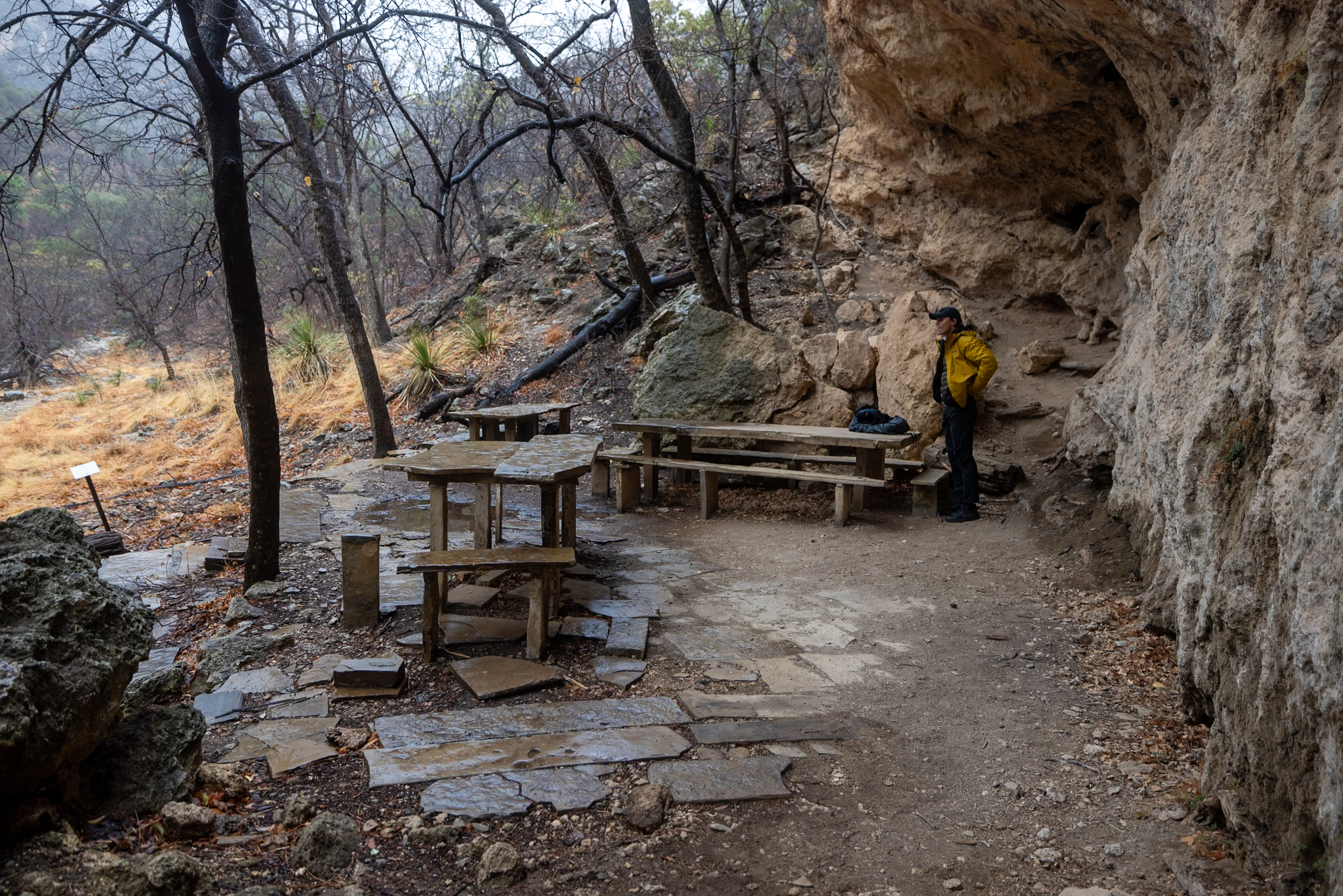
This relatively gentle trail winds through a striking limestone canyon filled with desert flora, hardwood trees, and the remnants of historic life in the area. We were lucky to hike it during a light rain, which brought out an incredible blend of floral and earthy fragrances in the air. Along the way, you’ll pass several notable landmarks, including:
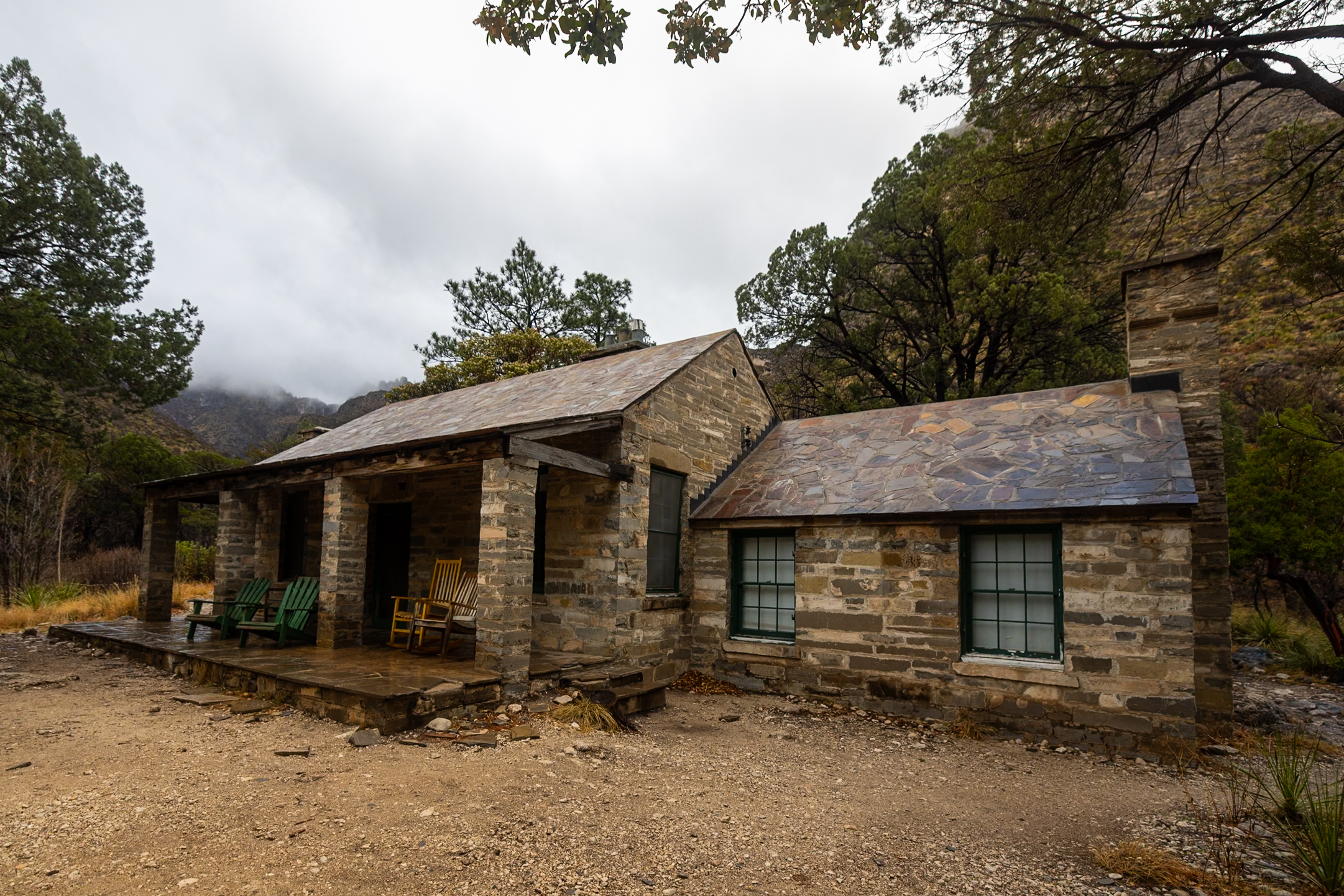
- Pratt Cabin, a charming stone structure from the 1930s, with a peaceful front porch view.
- The Grotto, a rocky overhang and rest area composed of limestone stalagmites & stalactites, complete with picnic tables.
- Hunter Line Shack, a stone and wood cabin further down the trail if you’re up for a longer day.
The main challenge on this hike is the multiple riverbed crossings—typically dry, but filled with loose and uneven rocks that can make footing tricky. It is not the boulder scramble of Devil’s Hall, but still be cautious and sure-footed.
Distance: 7 miles (11.3 km)
Difficulty: Moderate
Estimated Time: 2.5 hours
Type: Out-and-back
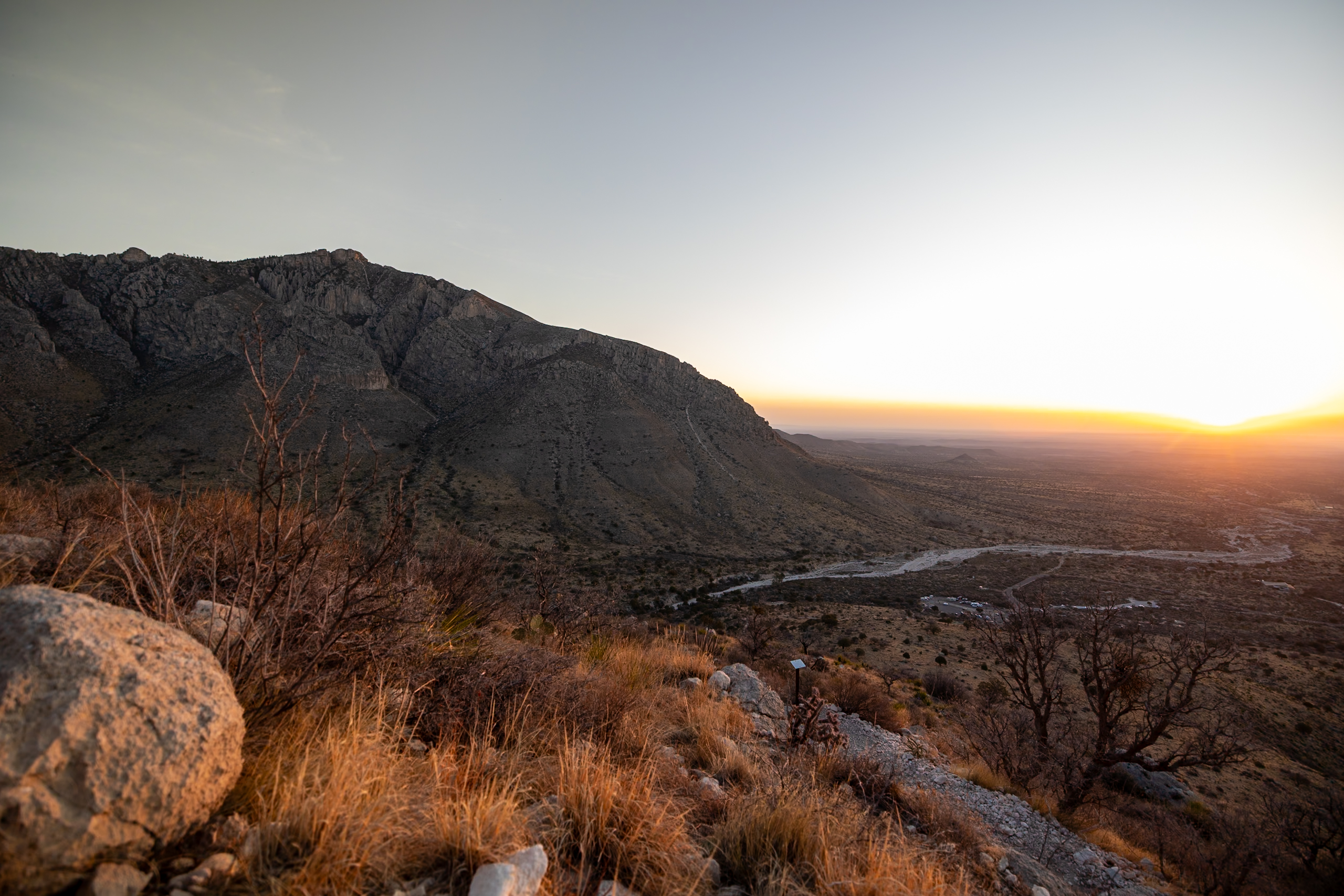
6. Hunter Peak via Bear Canyon Trail
At 8,368 feet, Hunter Peak is the sixth-highest mountain in Texas, only 381 feet lower than Guadalupe Peak. While not quite as tall, this trail is often quieter and offers sweeping views of the Guadalupe Mountains with far fewer crowds. The route via Bear Canyon Trail is steep in its elevation gain, but incredibly rewarding.
What makes this trail stand out is the diversity of terrain—you’ll climb through shaded canyons filled with pines and emerge onto exposed high country where the views open up in every direction. At the summit, you’re greeted with panoramic scenes of McKittrick Canyon, the Salt Basin Dunes, and the Chihuahuan Desert stretching endlessly beyond.
💡 While we didn’t hike this trail, many who do like it more than the Peak.
Distance: 8.4 miles (13.5 km)
Difficulty: Hard
Estimated Time: 5.5 hours
Type: Loop
7. El Capitan Trail
The El Capitan Trail takes you to the eighth-highest peak in Texas, at 8,085 feet. Towering over the desert floor, it’s the mountain most travelers spot first as they drive in from the west, and it creates a dramatic backdrop for countless photos. While you can see El Capitan from various scenic drives, hiking it offers a unique opportunity to experience it up close.
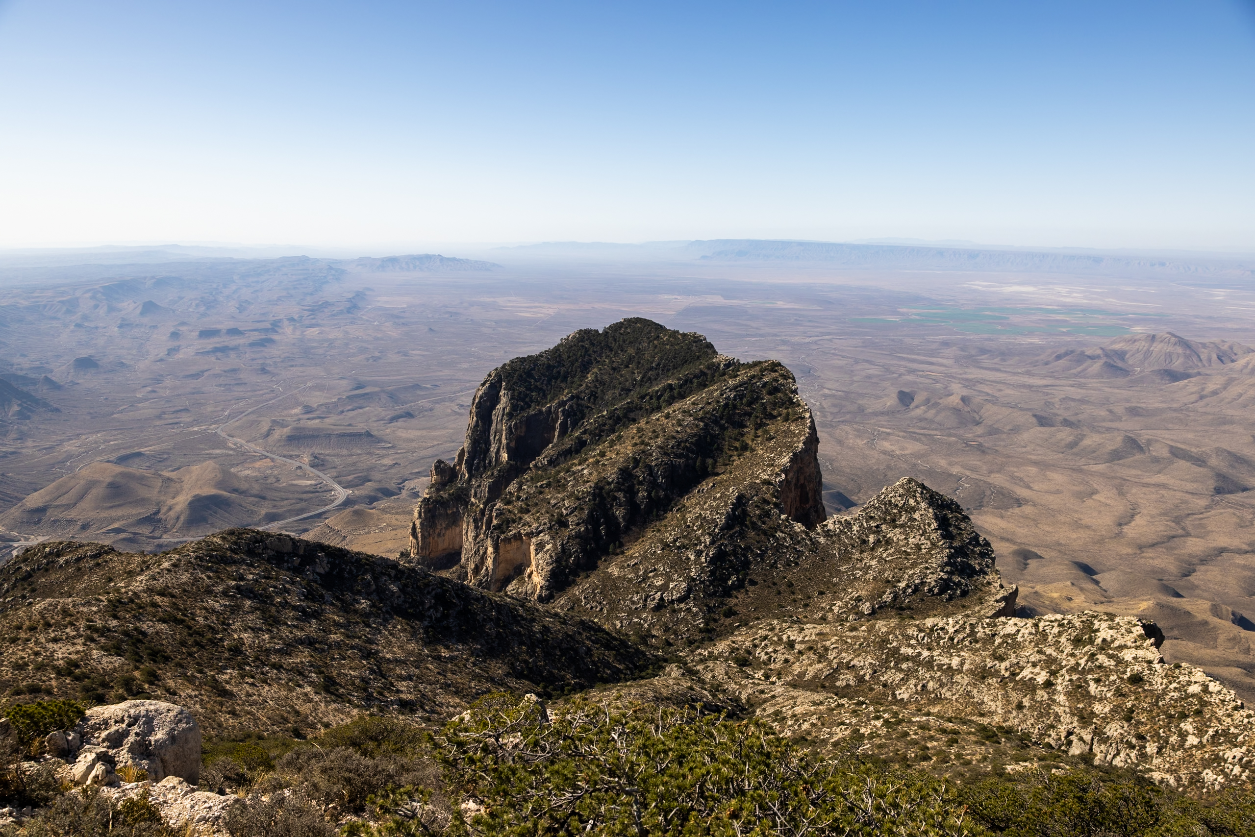
This 11-mile round-trip trail begins at the Guadalupe Peak Trailhead and skirts around the southern flank of the mountain, gradually descending into the desert before climbing again. It’s a moderately strenuous hike, with exposed sections and little shade, so it’s best attempted in cooler months and on calm weather days.
Rangers warned us that El Capitan often experiences stronger winds than other areas of the park due to its southernmost position—something worth considering when planning your day. While you can’t summit the peak itself (it’s a very technical climb), the trail still offers sweeping desert views and a memorable close-up encounter with one of Texas’s most striking landforms.
Distance: 9 miles (14.6 km)
Difficulty: Moderate
Estimated Time: 4.5 hours
Type: Out-and-back
🗺️ Map of Our 7 Favorite Hikes in Guadalupe Mountains
Here we’ve pinned our top 7 hikes in the Guadalupe Mountains. We were able to mark the trailheads for some of them, but we always recommend using AllTrails to navigate the trails themselves. This map is designed to give you a sense of the areas each trail covers within the park.
How to use this map: We have saved the locations from this guide on this map. You can save this map to your Google Maps by pressing the star icon. In your Google Maps, click the menu icon and then Saved Maps, where this map will appear.
📅 Best Time of Year to Hike in the Guadalupe Mountains
The best times to hike in Guadalupe Mountains National Park are fall and spring, when temperatures are mild and conditions are ideal for exploring. Fall offers cooler weather and beautiful foliage in McKittrick Canyon, while spring brings blooming desert plants—but also stronger winds. Summer can be dangerously hot, and winter may bring snow and ice to higher elevations, complicating hikes during this time.
🎒 Guadalupe Mountains Hiking Essentials
From sun protection to comfortable hiking shoes, here’s a quick list of our top hiking essentials for hiking in Guadalupe Mountains National Park.
Sun Protection
- Sunscreen – No matter the time of year you visit, sunscreen is essential to protect your skin from the Texas sun.
- Wide-brimmed hat – As part of sun safety, we love pairing sunscreen with wide-brimmed hats.
- Sun Shirts – Light, sunshirts are great for protecting against bugs and the sun! Here is Elliot’s favorite long-sleeve sun shirt and Jen’s favorite long-sleeve sun shirt.
- Refillable Water Bottle – Staying hydrated is a key part of sun safety. We love this water bottle featuring all of the US National Parks with stickers to check off your visits.
Hiking Essentials
- Hiking shorts or pants – We recommend hiking pants to protect against the sun as well. Elliot’s favorite hiking pants and Jen’s favorite hiking pants.
- Rainjacket – You never know what weather awaits you in Texas. If you’re looking for a new rain jacket fit for hiking, this is Elliot’s favorite rain jacket and Jen’s favorite rain jacket.
- Hiking Boots – Solid footwear is a must in any national park, here are Elliot’s favorite trail runners and Jen’s favorite hiking boots.
- Lightweight backpack – Elliot carries this backpack with the included rain cover, while Jen carries this backpack.
- Snacks – We always make sure to pack protein-rich, lightweight snacks with us while hiking.
Safety Essentials
- Trail Maps – We love using AllTrails+ to download maps ahead of time.
- GPS – We carry the Garmin InReach Mini 2 with us on all trails for safety.
- First Aid Kit – This first aid kit is one of those items we hope to never have to use but always carry, just in case.
- Headlamp – A headlamp is especially useful when going on sunrise, sunset, or night hikes!
With offline maps, wrong-turn alerts, and extra planning features, make the most of every outside adventure with AllTrails Plus. Get 7 days of AllTrails Plus for free!
📰 Related Articles
- 3 Days in Guadalupe Mountains: Itinerary & Ultimate Guide
- 3 Parks in 3 Days: A Quick Southwest National Parks Road Trip
📺 Watch on YouTube
🔎 Ready to Explore Guadalupe Mountains?
Pin this guide to hiking Guadalupe Mountains National Park to help plan your trip!


Leave a Reply
You must be logged in to post a comment.