

We recently drove the Dempster Highway in September of 2025 and had the time of our lives traveling through Canada’s stunning Yukon and Northern Territory up to the Arctic Ocean. In this article, we’ve broken down everything you need to know to go on a Dempster Highway Road Trip—our favorite stops, a sample itinerary, when to drive the Dempster Highway, what gear to pack, and more! This complete Dempster Highway guide will give you the information you need to confidently prepare for your trip north.
Note: We use affiliate links which provide us a little kickback each time you use one of our links and make a purchase, without any additional cost to you. We do not recommend products that we don’t already love or have heard great things about, so you can trust we’re only suggesting great products to you.
ℹ️ About the Dempster Highway
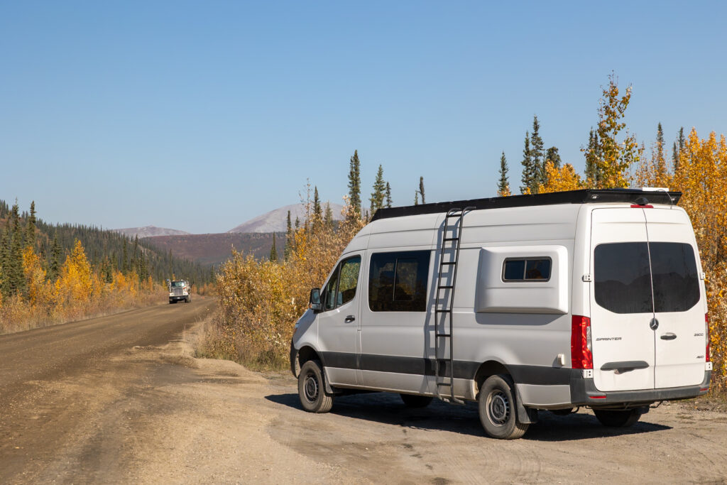
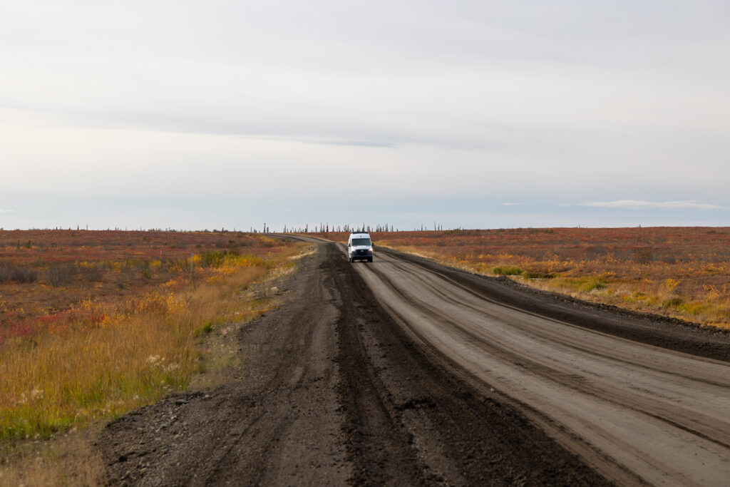
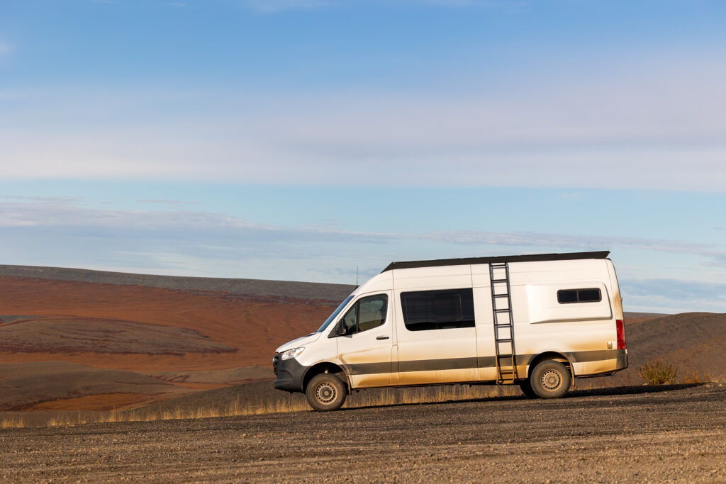
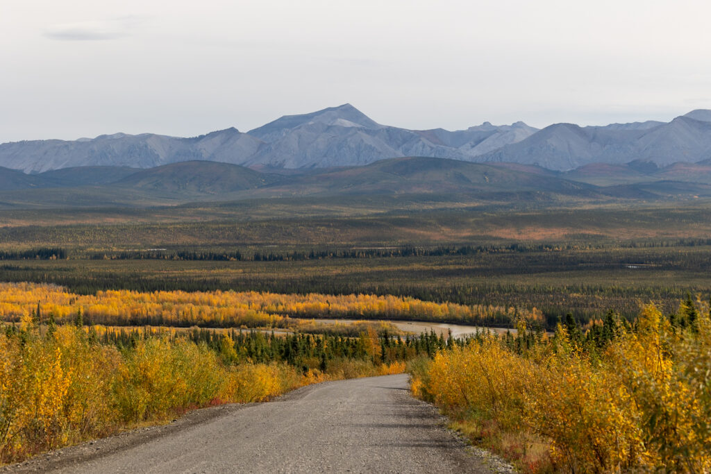
The Dempster Highway is also known as Yukon Highway 5 or Northwest Territories Highway 8, depending on where you are along the way. This rugged route opened back in 1979 and made history as the first all-weather road to cross the Arctic Circle. It runs about 884 kilometers (549 miles) from just outside Dawson City in the Yukon all the way up to Tuktoyaktuk in the Northwest Territories.
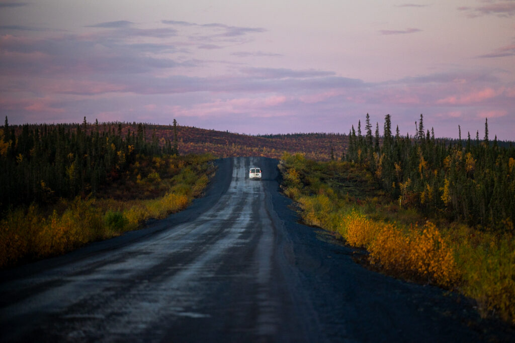
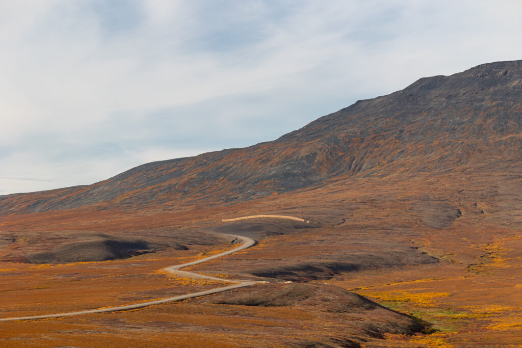
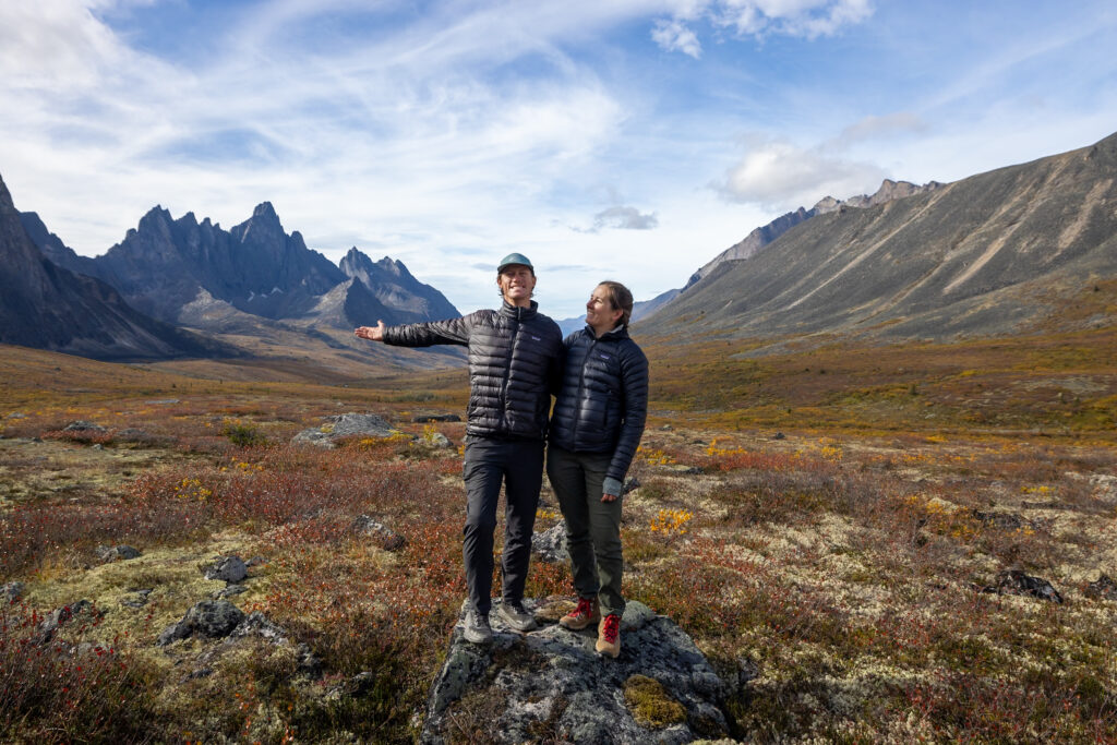
What makes the Dempster so special is the wild, untouched landscapes you pass through. It’s a trip that really shows you the raw beauty of Canada’s north. We drove the whole thing in the late summer/early fall of 2025, and had a wonderful time! From the amazing wildlife sightings to quiet northern communities, we saw and learned a lot.
And although total driving time is just over 14 hours, we recommend taking your time and making a road trip out of it. In this guide, we’re sharing everything you need to know to confidently road trip the Dempster yourself—what to expect, how to prepare, and the spots you definitely don’t want to miss.
🚗 How to Get to the Dempster Highway
The Dempster Highway officially begins just outside Dawson City, Yukon. To get to the start of the Dempster Highway, you’ll either come up Yukon Highway 2 from Whitehorse or come up the Top of the World Highway from Alaska. Either way, you’ll need to get yourself to the Yukon to start this grand road trip.

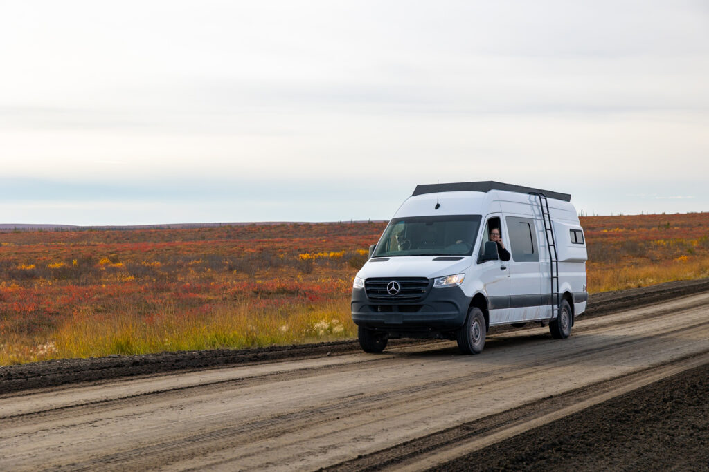
Most US travelers enter Canada through major border crossings like the Peace Arch near Vancouver or the Coutts crossing near Montana, then make their way north on the Alaska Highway or the Stewart-Cassiar Highway up to the Yukon. Flying into Whitehorse and renting a campervan from a company that approves rentals on the Dempster Highway (we linked one) is a popular alternative. Make sure you have insurance to cover any flat tires or windshield damage, just in case.

Love finding cheap flights?
Going (formerly Scott’s Cheap Flights) is one of our favorite tools for discovering insane airfare deals.
We’ve been members since 2015 and it has saved us thousands! The membership practically pays for itself if you use it once a year.
✅ Things to know before the Dempster Highway
1. Bring a spare tire (or two)
As the Dempster is a completely gravel road, flat tires are no rarity. Bring at least one spare (two if you have the space), along with a jack and the tools (and knowledge) you need to change it. Depending on where you get your flat, help can be hundreds of miles away. During our trip up the Dempster Highway, we saw two rigs with flat tires. We got lucky and didn’t get any flats, but we were prepared with an extra tire and all the tools to change it if needed.
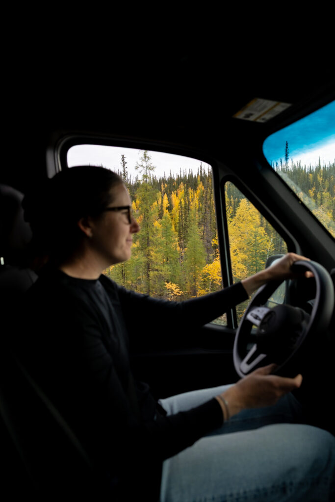
2. Rest every few hours from driving
If traveling with a partner, split the driving into shifts of about 2 to 3 hours each. This is what we did, and it helped keep us both alert while on long stretches of road. If you’re driving the Dempster Highway solo, we recommend stopping every few hours to rest and stretch. The drive is long, so it’s best to be in good shape. There are pull-offs on the side of the road if you need to rest.
3. Drive slowly
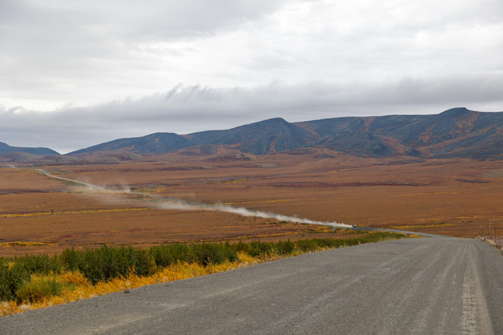
Even though the speed limit on the Dempster Highway is 90 km (55 mph), we recommend staying under that as it is a gravel road. This will help you avoid any flat tires or even cracked windshields from flying debris from other vehicles. Depending upon the section of highway, we were driving around 30 km through areas with a lot of potholes and then closer to 90 km on the best-maintained sections of highway.
🛞 What to Bring for the Dempster Highway
Besides your typical clothing, food, and personal items, we’ve listed what to pack for a Dempster Highway Roadtrip that you might not initially think of. This road is completely unpaved, remote, and has very little cell service, so some of the most important items include a spare tire, plenty of food, and a satellite phone.
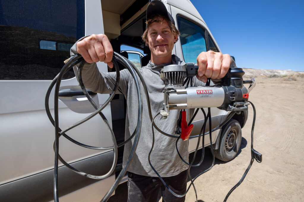
- Tire Repair Kit: A tire repair kit is essential on a road as remote and bumpy as the Dempster Highway. This kit allows you to repair your tire as an interim step before fully replacing it.
- Spare tire: Along with your repair kit, bring along a spare tire (and know how to change it).
- Tire Deflator & Compressor: An off-road tire deflator and tire compressor made our ride much smoother on Dempster’s gravel. We deflated our tires at the beginning and end of the Dempster Highway.
- Off-grid van prep: If traveling by RV, having a good power source and sufficient water are necessary on this drive, as it’s so remote. Depending upon when you travel the Dempster Highway, some water sources might be turned off for the year. We filled our water tanks in Dawson City before starting the Dempster Highway.
- Starlink: Starlink comes in super handy if you need a reliable internet connection from your van. For more information about how to pick the best Starlink model, check out our related article, The Best Starlink for Van Life!
- Garmin inReach: Since investing in a Garmin inReach, we’ve carried it with us on all of our hikes to make sure we can always send messages, navigate with its GPS, and have an SOS button just in case.
- Food: Make sure to have enough food to last your expected trip duration before setting out. The only grocery store we found on the entire route was in Inuvik, and it was very expensive! There are some convenience stores and restaurants along the way that you could stop in but the selection would be more limited.
- Canadian Dollars: Make sure to take out Canadian Dollars at some point before or at the beginning of your trip. There were a few places during the trip where we preferred to pay in cash.
- Bug repellent: The bugs are known to be intense in Canada and Alaska during the summer, so we recommend bringing along some heavy-duty bug spray as well as a Thermacell bug shield.
- Binoculars & Cameras: Bring a pair of binoculars if you have them, as well as your best camera, to capture any wildlife you pass while driving! The drive is stunning, so you’ll want to pull off the road to take in wildlife or the scenery.
🚫 What NOT to bring! If crossing the US-Canada border, make sure to avoid bringing any prohibited items such as pepper spray, meat and dairy products, or fresh produce to comply with regulations.
📝 Dempster Highway Road Trip Itinerary
We recommend taking around 5-7 days to drive up the Dempster Highway, stopping to explore as you go. Below, we’ve outlined a sample itinerary that will get you to Tuktoyaktuk in 5 days. Although you can technically drive up in as little as two days if you’re in a rush, or as long as two weeks, one week is the sweet spot in our opinion.
🔼 Click for more info! Click on a specific day to hop down to a section with more information like driving times, things to do, and where to camp!
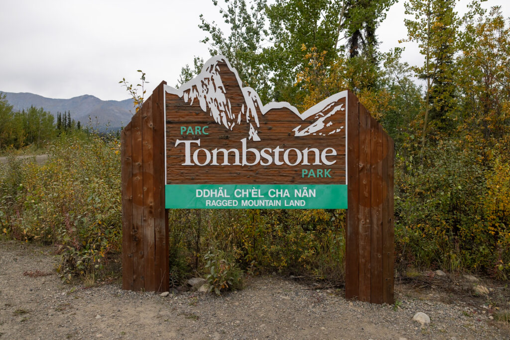
Day 1: Drive to & Explore Tombstone Territorial Park
Day 2: Drive to Eagle Plains to Camp
Day 3: Drive to Inuvik
Day 4: Explore Inuvik
Day 5: Drive to Tuktoyaktuk
Day 6+: Drive back down
Day 1: Drive to & Explore Tombstone Territorial Park (1 hour)
From the start of the Dempster Highway just outside of Dawson City, it’s about a 70-kilometer (43.5-mile) drive to Tombstone Territorial Park. This drive usually takes around 1 hour, depending on road conditions.
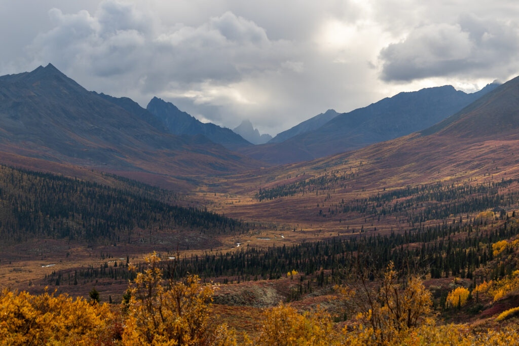
Tombstone Territorial Park is known for its dramatic, rugged mountain peaks, earning it the nickname “Patagonia of the North.” Other than campground fees, this park is completely free to visit!
Tombstone quickly became one of our favorite stops on the entire road trip. It’s up to you whether you want to spend just a day or two exploring, or extend your visit to a multi-day adventure. For the sake of this itinerary, we’ve recommended a full day in the park, but you can tailor this to your liking!
📌 Pin this post
Pin this guide to the Dempster Highway to make your upcoming trip a breeze to plan!

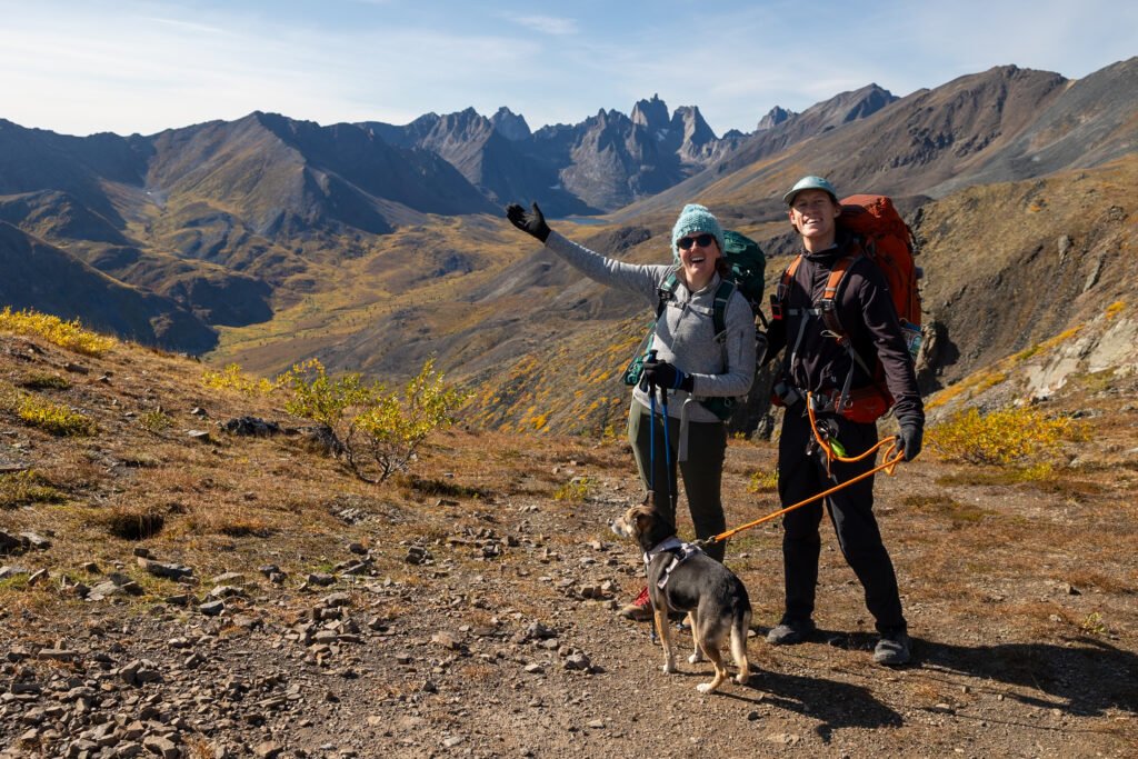
Some of the top trails here range from easy to challenging: the North Klondike River Trail is a gentle 2.4-mile (3.9 km) walk perfect for soaking in the scenery; Goldensides Mountain offers a slightly more difficult 3.7-mile (6 km) hike; and for the more adventurous, the Grizzly Lake Trail is a strenuous 14-mile (22.9 km) trek and the most popular trail on AllTrails. This is the hike we set out on, turning it into a multi-day backpacking trip!
With offline maps, wrong-turn alerts, and extra planning features, make the most of every outside adventure with AllTrails Plus. Get 7 days of AllTrails Plus for free!
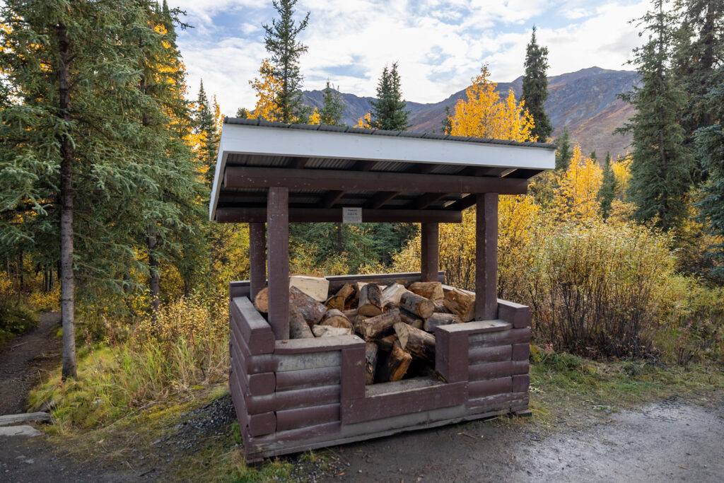
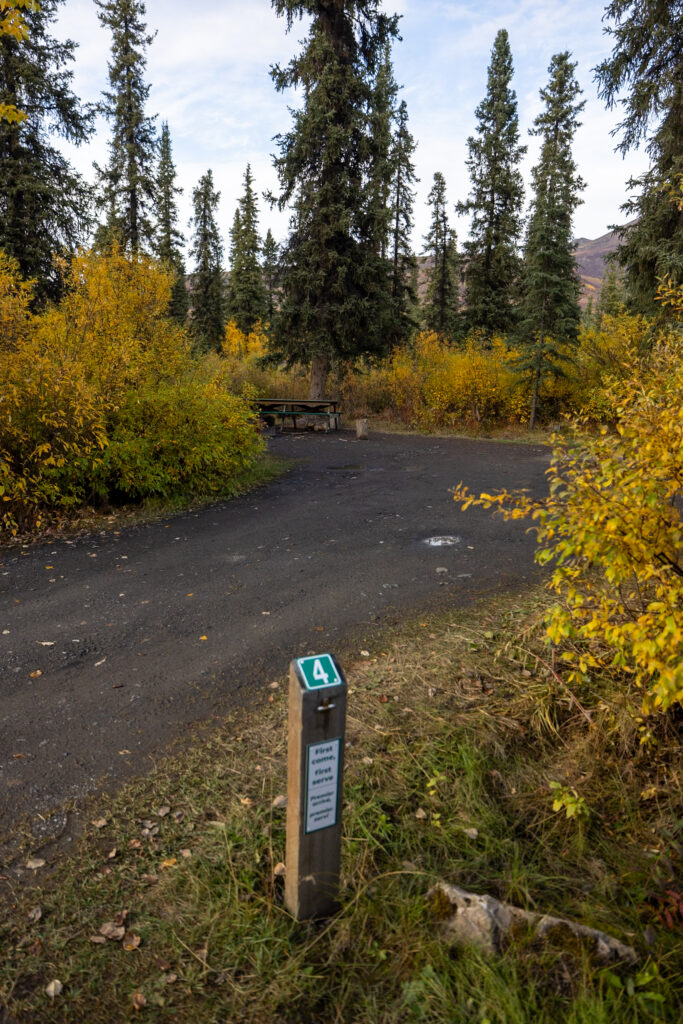
For those camping, Tombstone Mountain Campground has 51 sites just a half-kilometer from the park’s Interpretive Center. This is one of the most convenient bases in the park, from what we saw. You can reserve a spot in advance on this website starting at just $18/night for a tent spot. If this campground is full, or you prefer a free boondocking spot, we recommend checking a site like iOverlander.
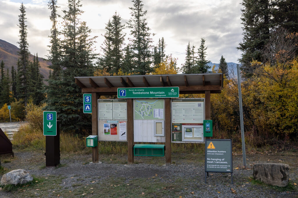
🗓️ Special Events! Check for any special talks, walks, or workshops going on in Tombstone on their Facebook page or at the Interpretive Center.
Day 2: Drive towards Eagle Plains (4.5 hours)
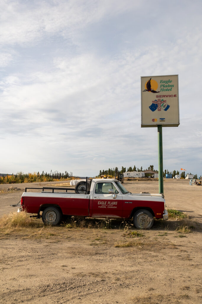
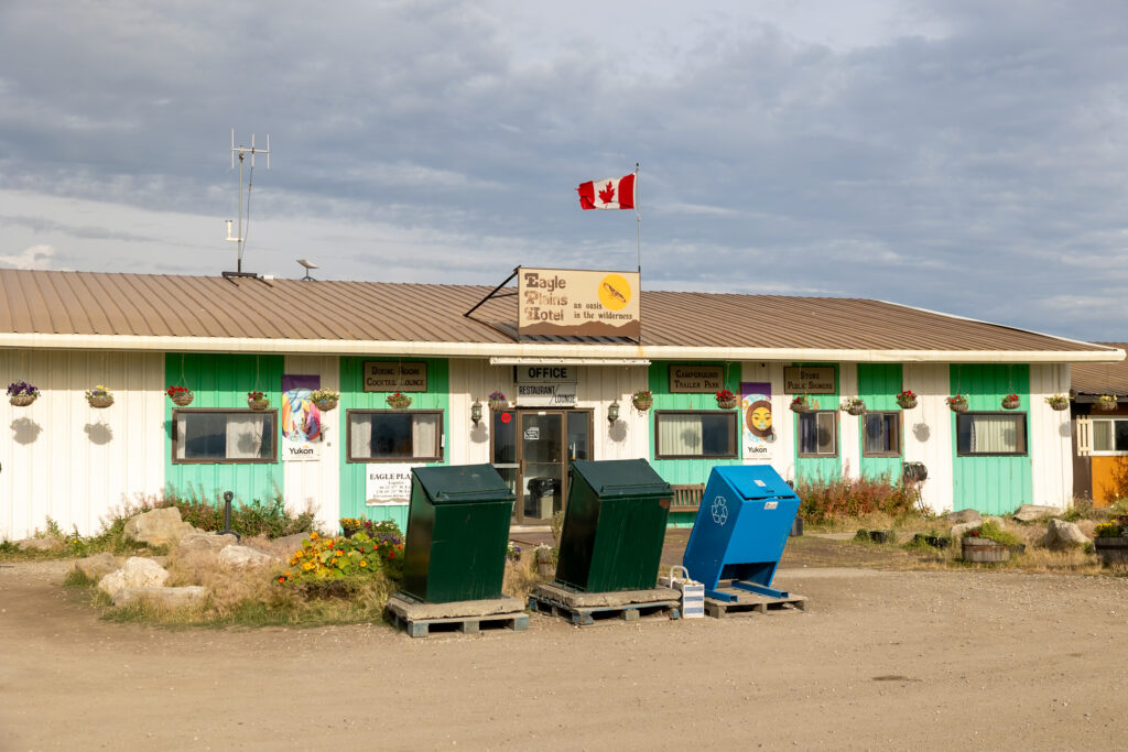
After you’ve explored Tombstone Territorial Park to your heart’s content, it’s time to continue north on the Dempster. We recommend making some headway like we did, driving about 4.5 hours north, and staying the night at this wild camping spot just before the small town of Eagle Plains. You can pick another spot if this one isn’t available, or even stay at the hotel or RV Park and Campground in town if you want to.
⛽ Fill up today! We recommend filling up your tank today. You can fuel up in Eagle Plains or in the town of Fort McPherson, where you’ll find less expensive gas.
Day 3: Drive to Inuvik (6-8 hours)
Next up is an all-day drive to Inuvik with two ferry crossings! Total driving time is around 6 hours, but with two ferries, it can easily take up to 8 hours to get to Inuvik. We recommend starting out first thing from the boondocking spot in Eagle Plains to get to Inuvik before dark.
Remember to rest from the road every few hours, and feel free to stop for the night at a boondocking spot if you’d like to break up this drive into two days.
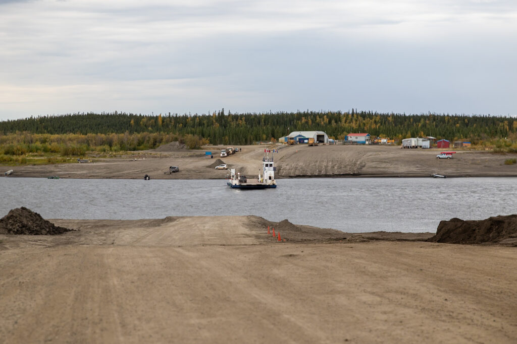
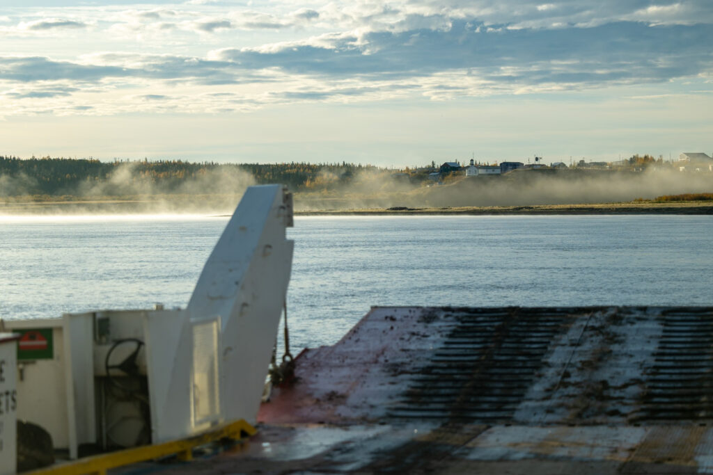
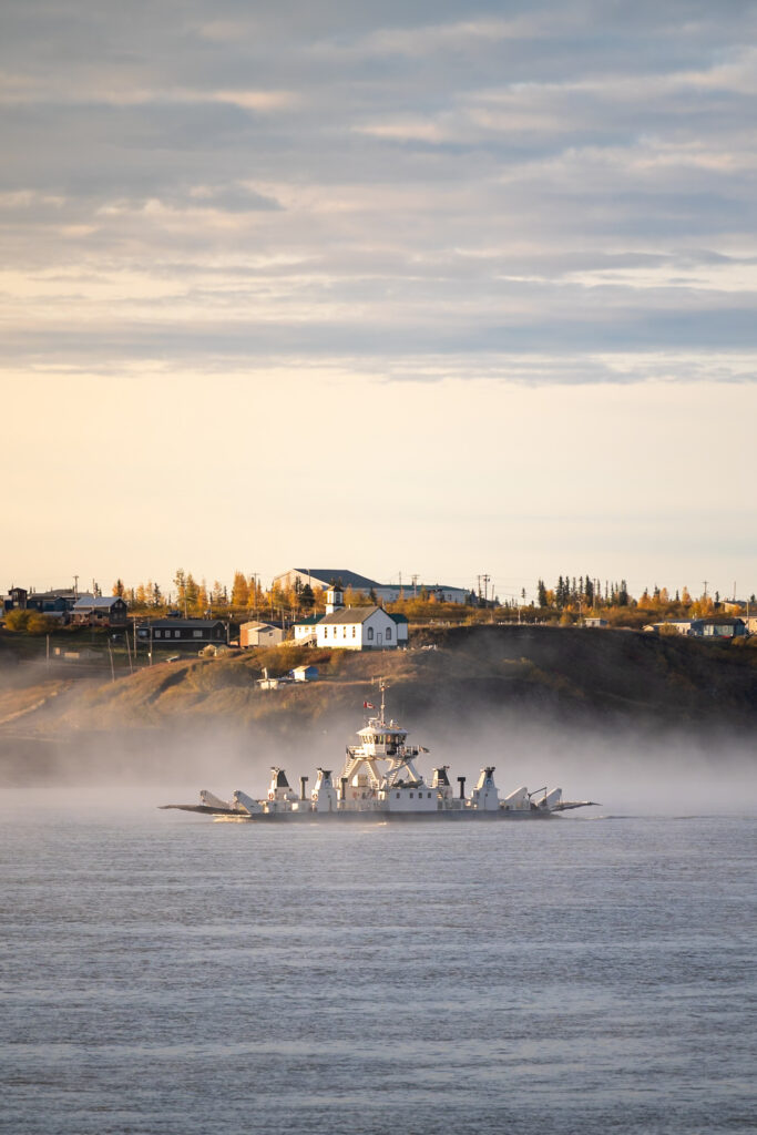
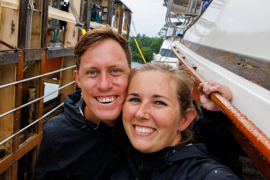
Pulling your vehicle up onto a boat and crossing a river was a really cool experience, and a really beautiful part of the trip. The people working the ferries were super friendly, and we enjoyed chatting with them as they transported us across the Peel River and the Mackenzie River. Both of these transport ferries are free and operate from 9 am to midnight daily.
Once you’re in Inuvik, we recommend either boondocking at a spot like this one (this is where we stayed) or camping at an established campground like Happy Valley Campground. By the time we visited, Happy Valley Campground was closed. They did have a convenient dump station that we used, but we ended up staying at the Inuvik Visitor Center parking lot with about 10 other vehicles driving the Dempster Highway – many of which were driving the Pan-American Highway.

Day 4: Explore Inuvik (No Driving)
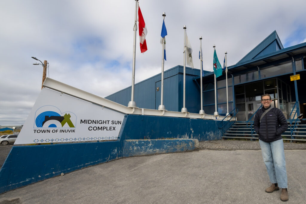
Inuvik is the largest town you’ll encounter on the Dempster Highway. As a cultural hub and territory of the Inuvialuit and Gwich’in First Nations peoples, it offers a unique glimpse into northern life. The town is very walkable, and one of our favorite surprises was the local pool. You can swim here for free, no membership needed. Painted like a tropical oasis, this was perfect for relaxing after so many days on the road.
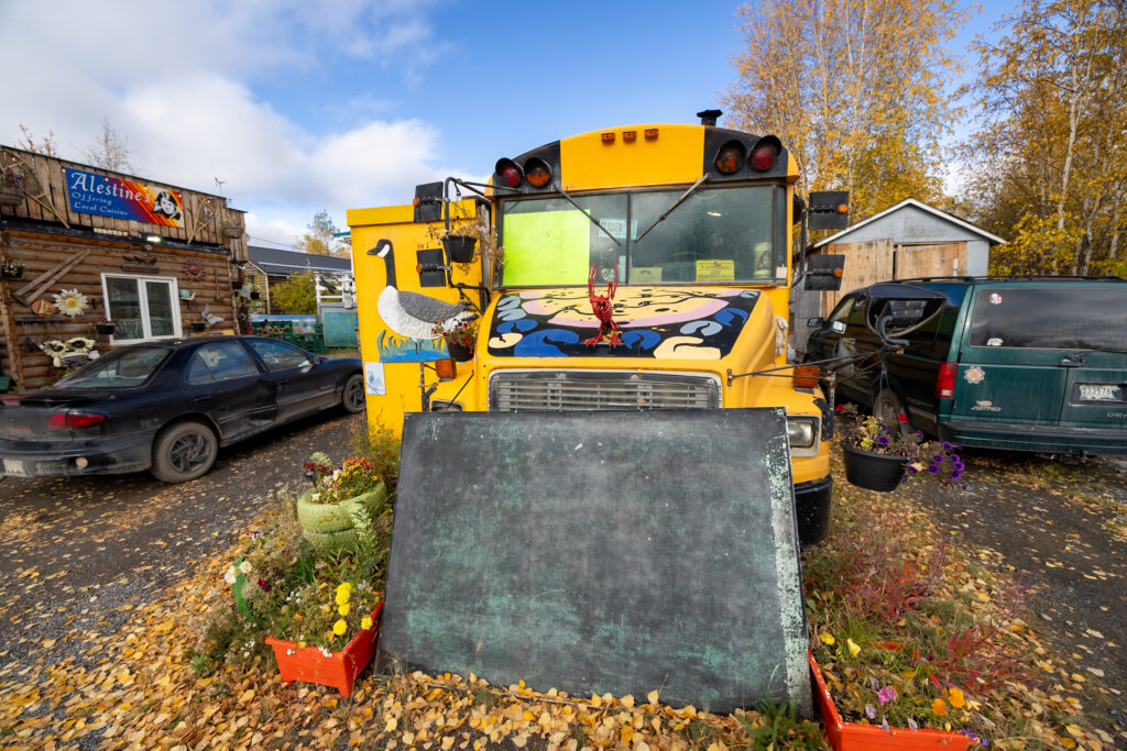
For food lovers, Alestine’s is a must-visit. This quirky spot serves delicious fish and chips out of a converted school bus. Keep in mind that they close after Labor Day, so plan accordingly if this is on your list.
Below, we’ve listed even more places you can visit in town:
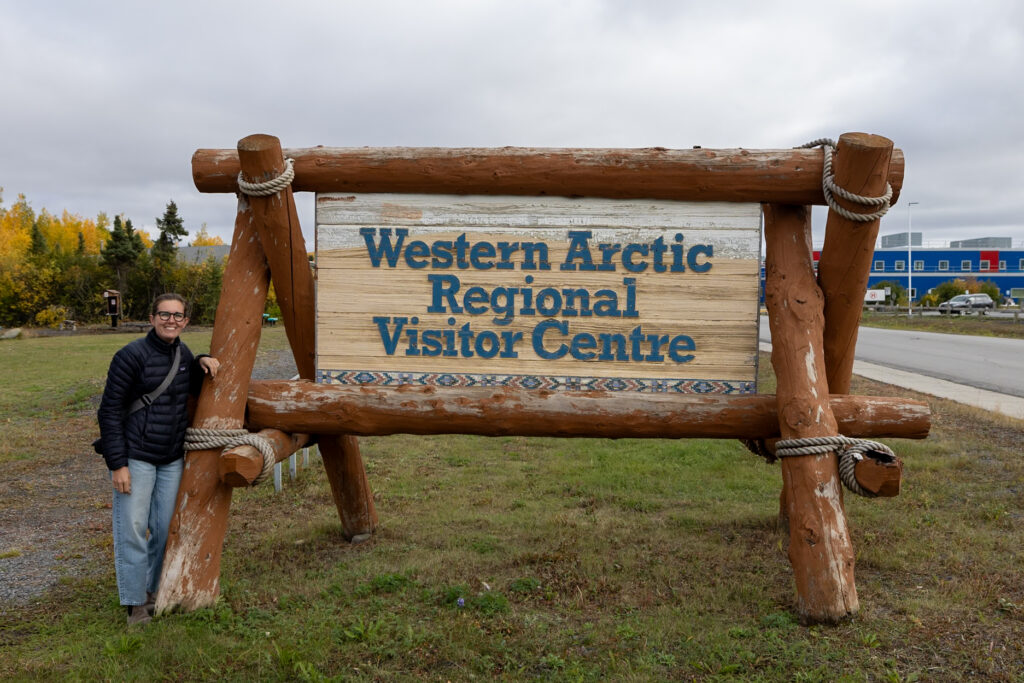
- Western Arctic Regional Visitors Centre: This center also comes highly recommended, though it was closed when we visited. We heard there is a food tour available if you inquire here.
- Inuvik Welcome Centre: This is the other tourist information center in town, just a short walk away from the other.
- Local parks: Stroll through the local parks around the center once you’re done visiting.
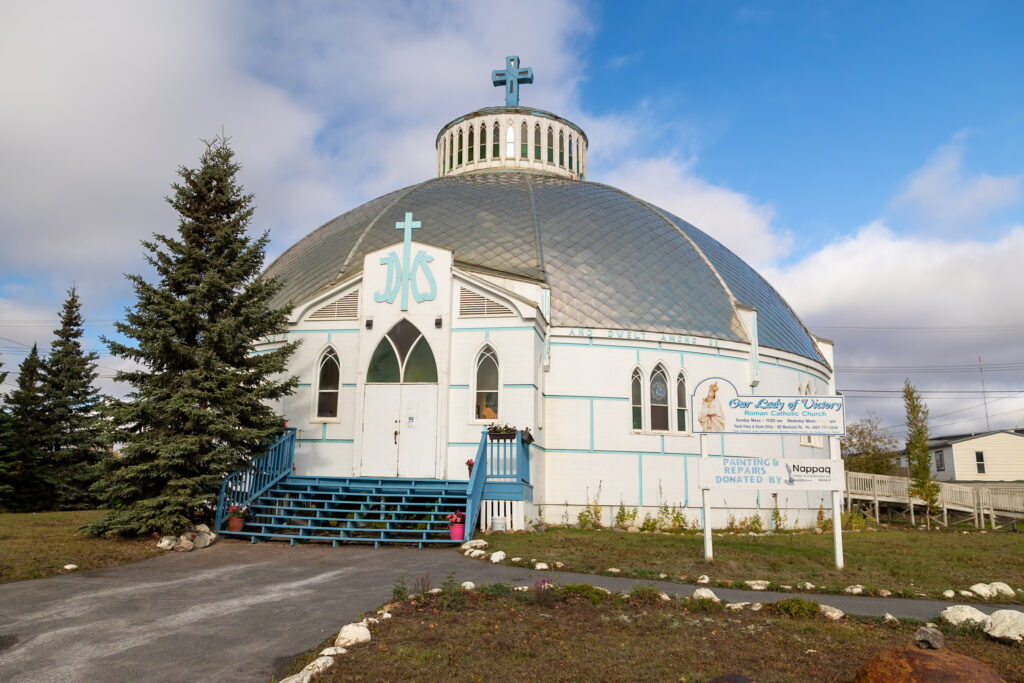
- Our Lady of Victory Church: Famously designed to resemble an igloo, this unique church is definitely worth a visit.
Finally, if you need to restock supplies, Inuvik is home to some of the only full grocery stores along the entire Dempster Highway, including NorthMart and Stanton Distributing. Be warned, it’s expensive. It’s not an easy or cheap task to transport fresh food up to the Arctic Circle.
If we’d arrived earlier in the season or had more time, we’d definitely dive into the local events and spend more time in Inuvik. If you have time on your side, we recommend taking your time here!
⬆️ Tundra North Tours! Tundra North Tours is a local tour company based in Inuvik. They offer tours of Inuvik itself, as well as boat or flight tours to Tuktoyaktuk.
Day 5: Drive to Tuktoyaktuk (2.5 hours)
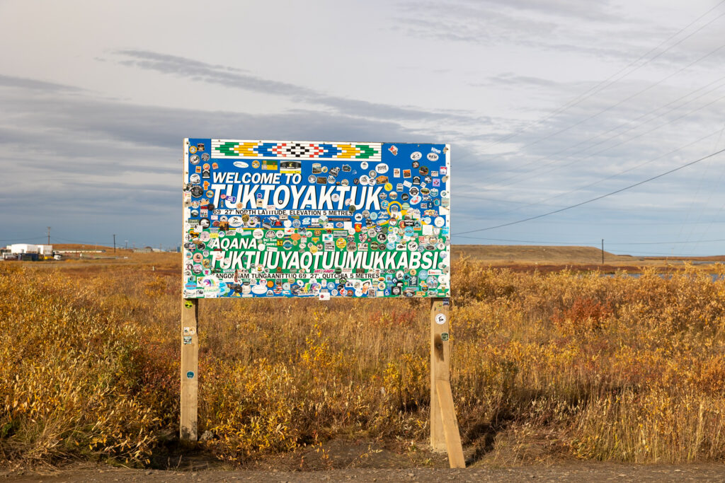
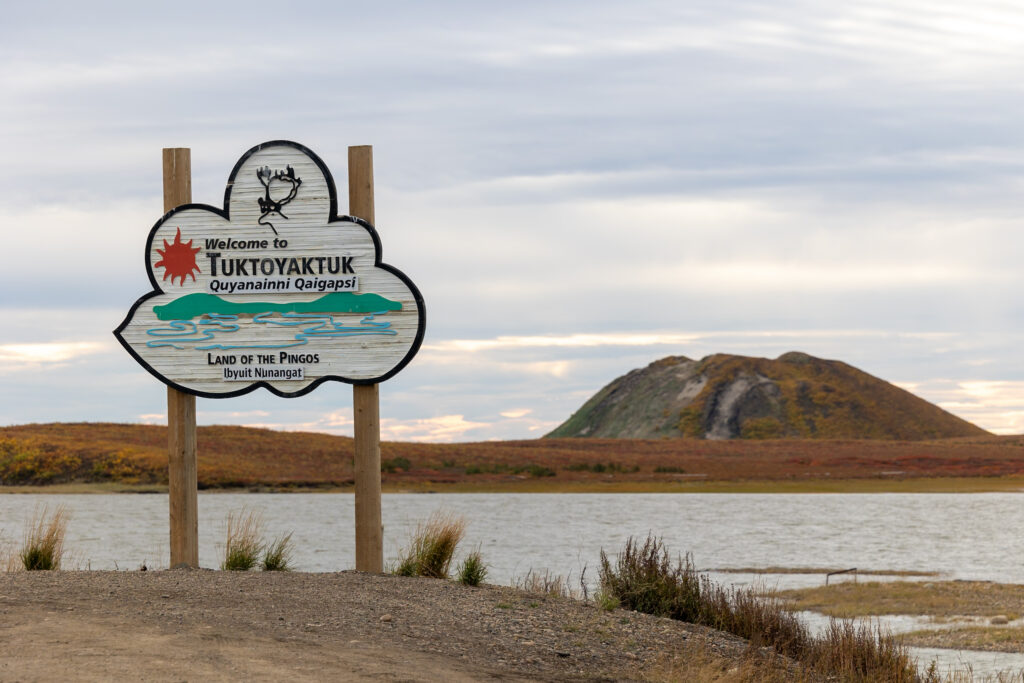
After Inuvik, the final destination on the Dempster Highway is the small, remote town of Tuktoyaktuk, often called “Tuk” by locals. You have a couple of ways to visit: either make the 2.5-hour drive up and back to Inuvik in one day, or spend a night in Tuk to soak in the quiet Arctic vibe.
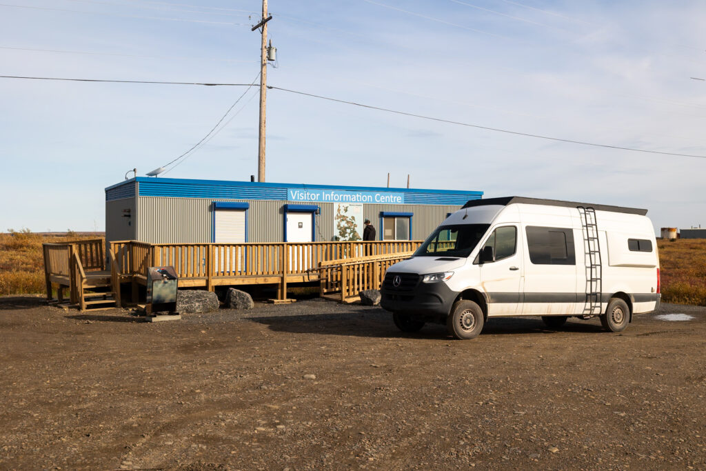
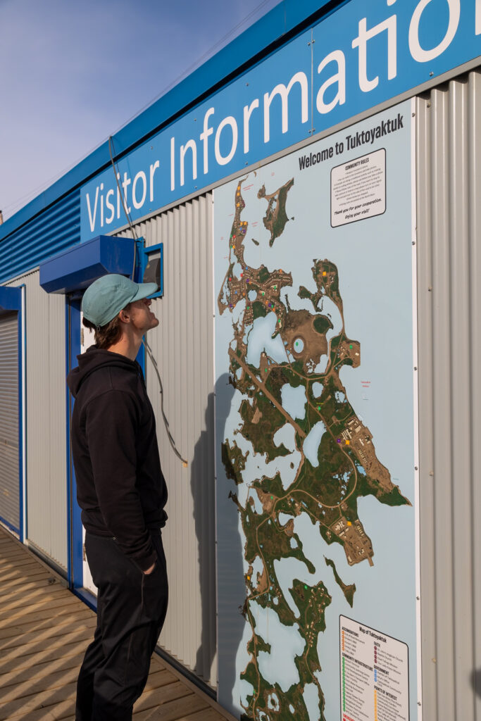
We found Tuk itself to be a fascinating place just to experience with kids riding around on bikes and the peaceful northern tundra atmosphere. There’s not much going on, so we suggest limiting your visit to a day trip or a single overnight stay. The Visitors Information Centre was closed when we visited, but it’s also worth checking out if you’re looking for local tips.
⛽ Gas in Tuk! You can get diesel and gasoline in Tuk, but it was among the most expensive fuel we saw along the entire highway. We highly recommend filling up in Inuvik!
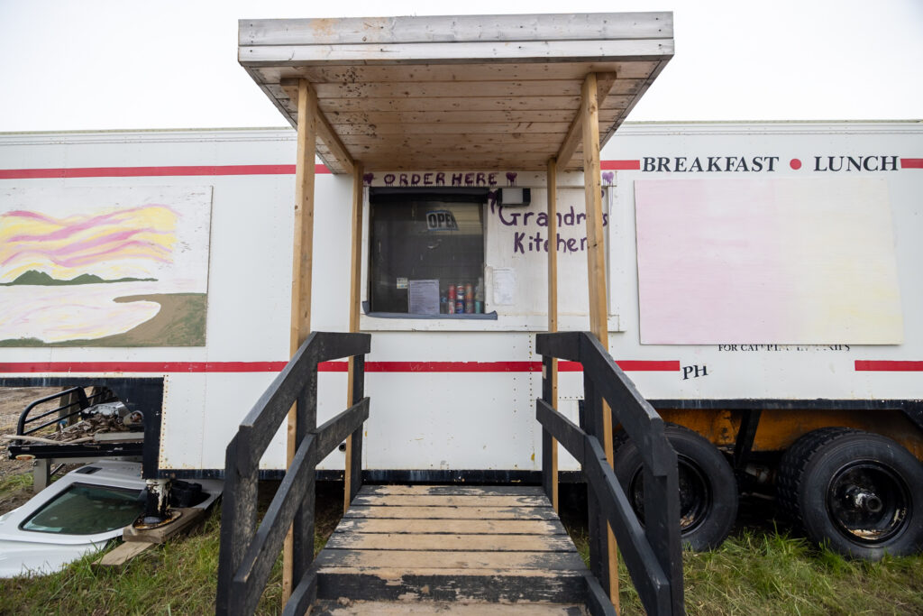
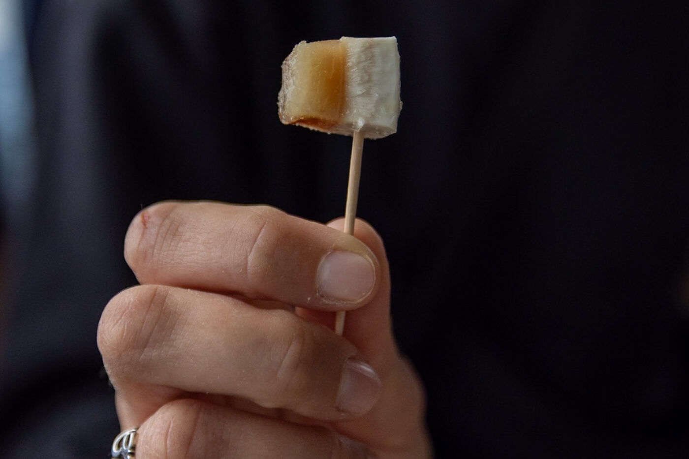
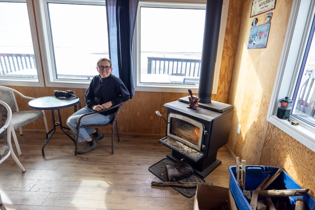
In town, don’t miss a meal at Grandma’s Kitchen. This cozy spot is split into two parts: a food-truck-style ordering window and a larger dining room with large windows overlooking the water. You can order classic fried fish or try the local delicacy, muktuk (beluga whale).
We went for a small plate of muktuk with fries, a salty, chewy, and distinctly seafood-flavored taste that’s definitely worth trying at least once.

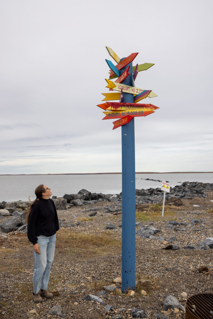
One of the highlights nearby is the Pingo Canadian Landmark, a national park composed of ice-cored hills that rise out of the tundra. We went to see these at the Pingo Canadian Landmark Viewpoint, but you can also rent paddleboards or kayaks in town to explore the waters around the park.
At first glance, the pingos might seem unremarkable compared to the towering peaks you see in Tombstone, but when you consider you’re in the flat Arctic tundra, these hills are truly special and hold deep meaning for the local First Nations peoples.
Last but not least, don’t forget to visit the Arctic Ocean itself and take a photo by the Arctic Ocean sign! If you want to stay the night, there’s also a campground and RV park right on the shore. We decided to head back to Inuvik.
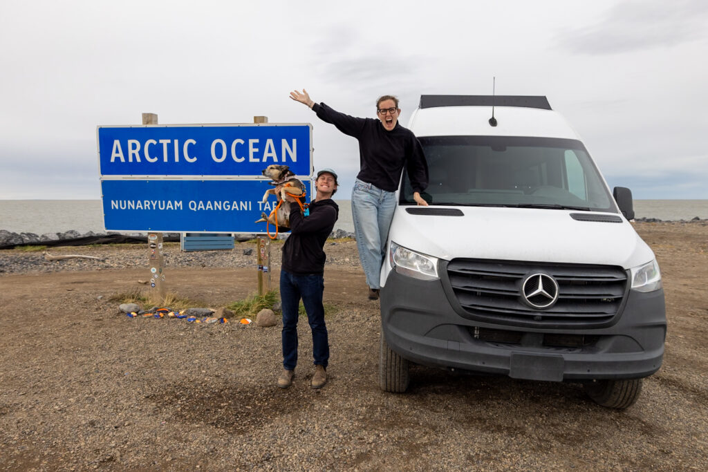
If you’re feeling brave, attempt a polar plunge in the icy waters of the Arctic Ocean! We warmed up the van, parked near the shore, grabbed our towels, and took the plunge right after our photos with the Arctic Ocean sign. This was a truly bucket-list moment!
Days 6+: Drive back down
After reaching Tuktoyaktuk, the only way out is the way you came. Retrace the Dempster Highway all the way back south, taking it at your own pace. We drove back in just two long 7–8 hour days because we needed to get our dog Ollie to a vet, but if your schedule allows, we’d definitely recommend taking the return trip a bit more slowly.
The way back down is the perfect chance to try out some new campgrounds you may have skipped on the way up. Or, if somewhere you visited really caught your attention, feel free to go back and explore it a bit more!
To find different camping spots on the Dempster, we highly recommend using iOverlander. This handy app lets you search for campgrounds, services, and traveler tips in real time. It will come in handy if you decide you want a shorter driving day, are looking for a unique spot, or if a specific campground we listed here has filled up.
⛽ Fill up before driving down! Fill up in Inuvik before starting the drive back down. Remember that your only stations are in Fort McPherson and Eagle Plains until the end of the highway.
Pit Stops on the Dempster Highway
Below we’ve listed a few quick pit stops you can take while on the highway. All of them are also pinned in the below Dempster Highway Road Trip Map!
- Tombstone Range Viewpoint: As a final goodbye to the park, we recommend stopping at this viewpoint just past the campground for its spectacular views.
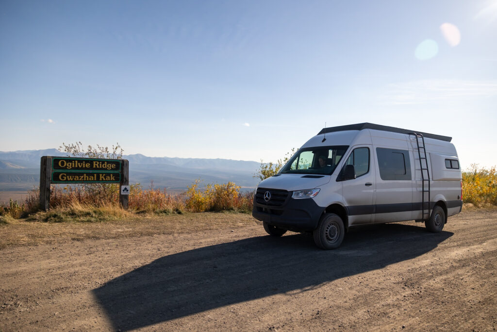
- Ogilvie Ridge Viewpoint: Just over halfway between Tombstone and Eagle Plains, you’ll pass this viewpoint. This is a great spot to rest halfway through this long drive.
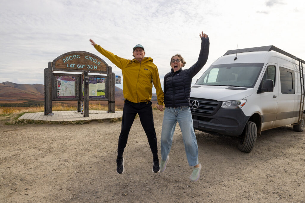
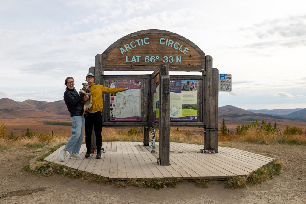
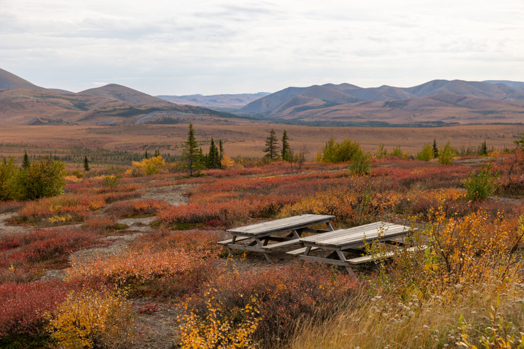
- Arctic Circle Sign: Just after Eagle Plains, you’ll pass the Arctic Circle Sign. There is a great photo opp here as well as a small picnic area with amazing views!
🗺️ Dempster Highway Map
How to use this map: We have saved the locations from this guide on this map. You can save this map to your Google Maps by pressing the star icon. In your Google Maps, click the menu icon and then Saved Maps, where this map will appear.
⛽ Dempster Highway Gas Stations
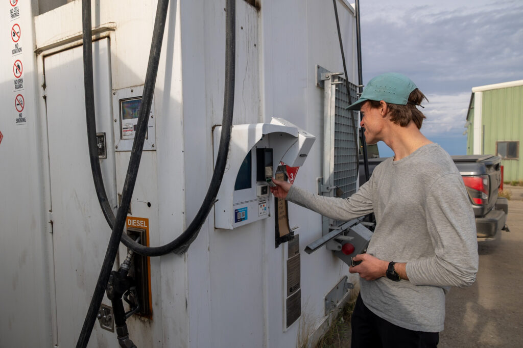
Gas stations aren’t going to be every few miles on the Dempster Highway. Plan your fill-ups to make sure you have enough to bring you to the next gas station, and then some.
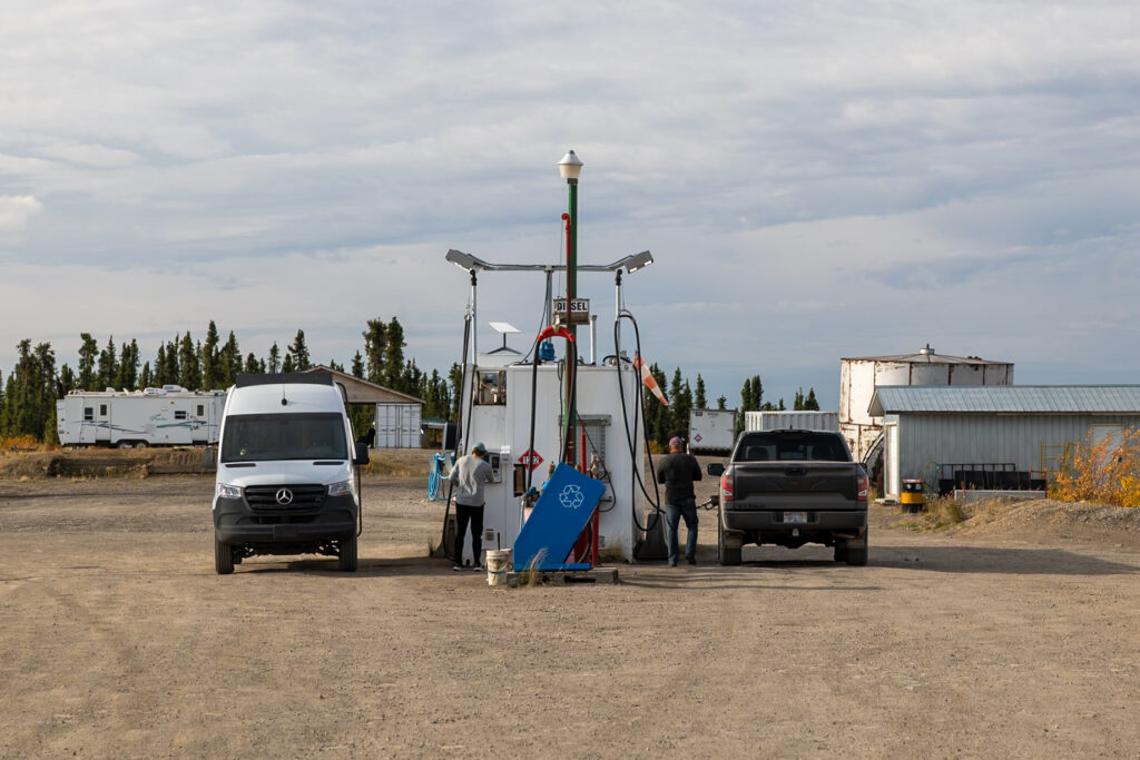
We recommend filling up right before setting off. You’ll find some of the cheapest gas right at the corner where the highway begins. This gas was actually cheaper than what we found in Dawson City itself. It’s a great place to fill up at the start of the road.
Eagle Plains is the next stop for gas, which means you’ll have to go for 368 km (228 miles) without filling up. Prices in Eagle Plains tend to be quite high, so if you want to save a bit, the next town up, Fort McPherson, usually has cheaper gas, especially if you’re willing to drive a couple of minutes into the downtown to fill up.
When you reach Inuvik towards the end of the highway, swing by the Visitor Center first. They often have coupon codes or discounts for gas, which can help you save a little money. If you’re worried about running out of gas, you can always invest in fuel containers as backup. We did not bring extra fuel containers as backup and instead just lived by the rule of thumb to always keep our fuel tank half full.
📍 We’ve pinned all the gas stations you can find on the Dempster Highway in our Dempster Highway Map!
☀️ Best Time of Year to Drive the Dempster Highway
The Dempster Highway opens from around June 10th to October 14th and December 15th to April 30th, closing in between these dates because of the rivers freezing and thawing. We recommend traveling in mid-summer (July, August) or late summer (late-August, early-September).
The time just before and after Labor Day is a great time to visit, with great weather and beautiful fall colors for exploring places like Tombstone Territorial Park. Keep in mind, though, that after Labor Day many businesses start closing for the season, like the famous fish and chips spot, Alestine’s in Inuvik.
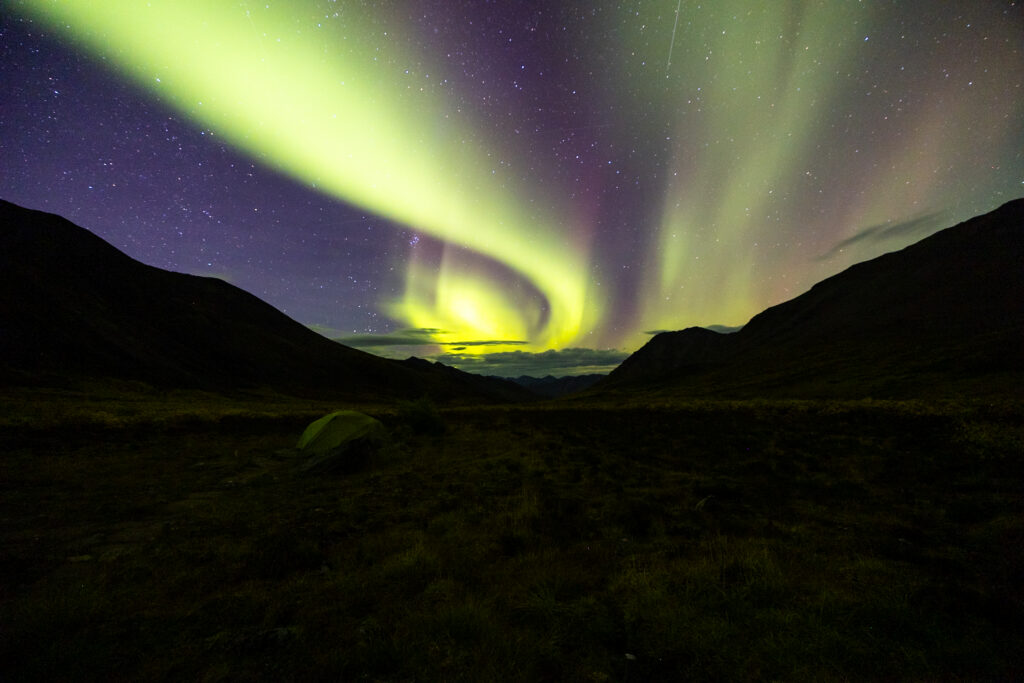
Later on in the fall, you have a better chance to catch the Northern Lights, but be ready for colder temperatures. Snow can start arriving as early as mid-September. We finished our Dempster Highway roadtrip in early September, and just a week later, around September 15th the highway was covered in the first snow of the season.
⭐ Looking to catch the Northern Lights? Download an app like the My Aurora Forecast & Alerts app to check the forecast and increase your chances of catching them!
❓ FAQ About the Dempster Highway
How long is the Dempster Highway?
The entire Dempster Highway is approximately 884 kilometers (549 miles) of gravel road, running from just outside Dawson City in the Yukon Territory all the way up to Tuktoyaktuk in the Northwest Territories.
How long does it take to drive the Dempster Highway?
Without stopping, Google Maps says that it takes roughly 14 hours to drive from the beginning to the end. That being said, ferry schedules, countless potholes, and varying road conditions almost always add a lot to the total driving time.
Although you can drive each way in as little as two days, we recommend taking your time and not burning yourself out. In our case, we took 5 days to drive up the Dempster Highway, capping daily driving times to 3 to 4 hours on average, and just 2 days to drive back down as we were rushing to get our dog to a vet.
How can I check road conditions on the Dempster Highway?
Road conditions on the Dempster Highway can change quickly, especially given how remote the route is. Before you set off, stop by the Dempster Highway Visitor Centre in Dawson City to chat with the volunteer there and get the latest road updates. You can also keep an eye on current conditions online through the Yukon 511 and Northwest Territories Highway Conditions websites. As far as weather conditions go, we used this site to check the weather as we went.
Can I camp on the Dempster Highway?
Yes, you can absolutely camp along the Dempster Highway, and that’s exactly how we spent most of our nights on the road. There are plenty of free pullouts and wild camping spots all along the highway where travelers safely park for the night, plus a few paid campgrounds in towns and territorial parks along the route. We’ve pinned every place we stayed on our Dempster Highway map so you can easily see our favorite overnight spots.
📰 Related Articles
- How to Go Backpacking in Tombstone Territorial Park
- Anchorage to Denali National Park: The Perfect Alaskan Road Trip
- Alaska Highway Roadtrip: Where to Camp, What to See, & More!
📌 Pin this post
Pin this guide to the Dempster Highway to make your upcoming trip a breeze to plan!


Leave a Reply
You must be logged in to post a comment.