

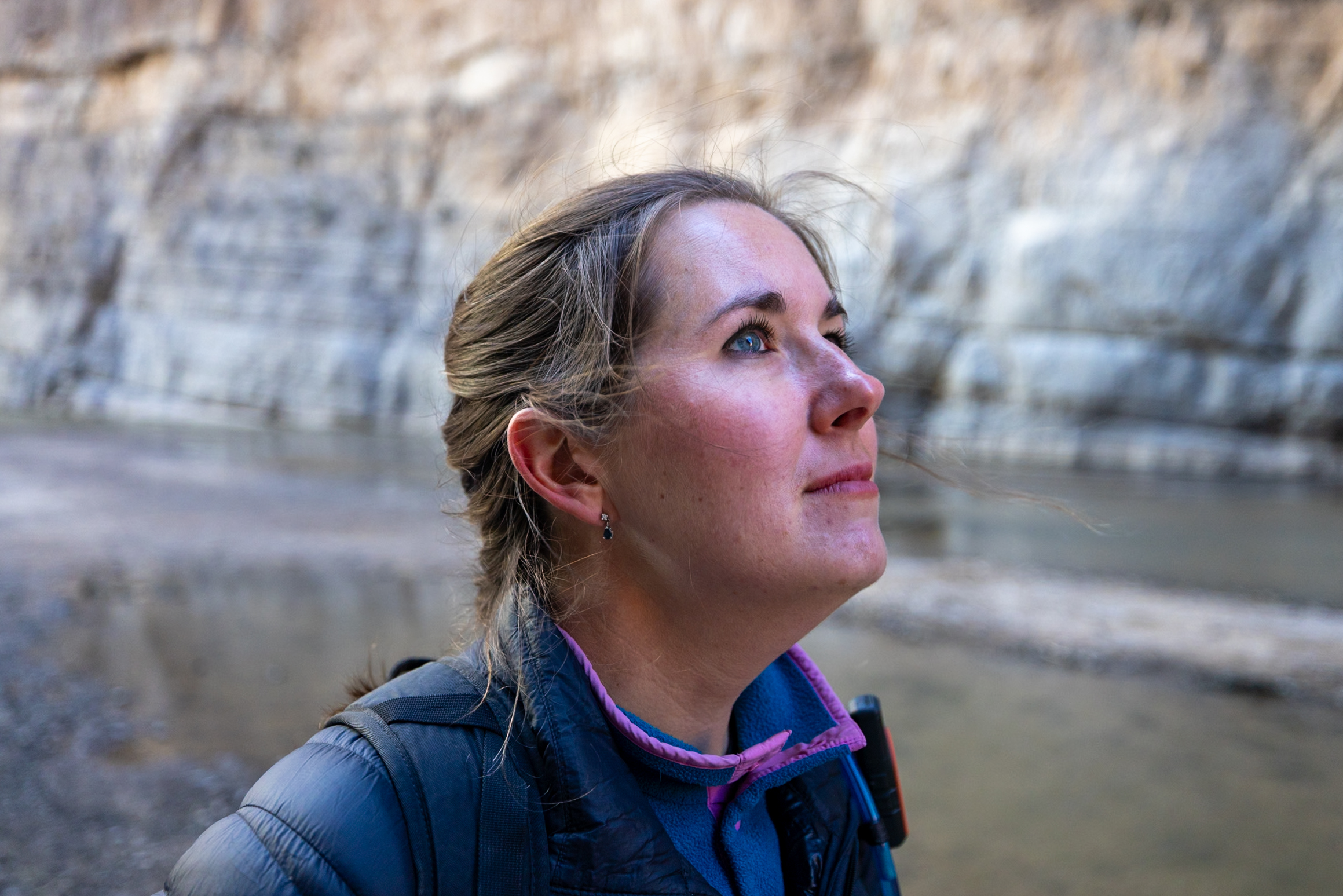
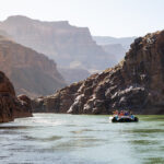
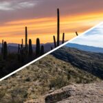
Spanning over 800,000 acres, Big Bend National Park in Texas is a hiker’s paradise filled with rugged mountains, deep canyons, and expansive desert. The park has over 200 miles of hiking trails, but with so many trails to choose from, deciding where to start can be tricky. To make planning your trip easier, we’ve rounded up our 9 favorite hikes in Big Bend, complete with trail length, difficulty, highlights, and more!
Note: We use affiliate links which provide us a little kickback each time you use one of our links and make a purchase, without any additional cost to you. We do not recommend products that we don’t already love or have heard great things about, so you can trust we’re only suggesting great products to you.
🐶 No Dogs Allowed: You’ll need to leave your pup at home when hiking in Big Bend, as no dogs are allowed on trails within the park—we left Ollie in our temperature-controlled van parked at the campground.
🥾 Our Favorite Hikes in Big Bend at a Glance
🌄 Best Sunrise Views: Santa Elena Canyon off of Ross Maxwell Scenic Drive
⛰️ Highest Altitude: Emory Peak Trail from Chisos Basin
⭐ Most Popular: Lost Mine Trail from Chisos Basin Road
🍬 Short and Sweet: Hot Springs Trail near Rio Grande Village
💚 Our Overall Favorite: South Rim Trail from Chisos Basin
Please respect the outdoors and Leave No Trace! Before embarking on your outdoor adventure, review the seven principles of Leave No Trace, which include planning ahead and preparing, traveling and camping on durable surfaces, disposing of waste properly (pack out what you pack in), leaving what you find, minimizing campfire impacts, respecting wildlife, and being considerate of others. Abiding by these principles helps keep these places beautiful so others can enjoy them for years to come!
1. Lost Mine Trail
Lost Mine Trail is one of the most popular hikes in Big Bend National Park, and for good reason—it offers breathtaking views of the Chisos Mountains from start to finish. The 4.8-mile round-trip hike is rated moderate, with a steady uphill climb leading to a stunning overlook. Because of its popularity, parking at the trailhead often fills up early, especially during peak seasons like spring break.
We attempted this hike in March 2025 and arrived at 7:20 a.m., about 40 minutes before sunrise, only to find the parking lot already full! The main lot has just 24 spaces, with a few extra spots further down the mountain for compact cars. To avoid missing out, consider pairing this hike with others in the Chisos Basin, allowing flexibility to return later if needed, as we did.
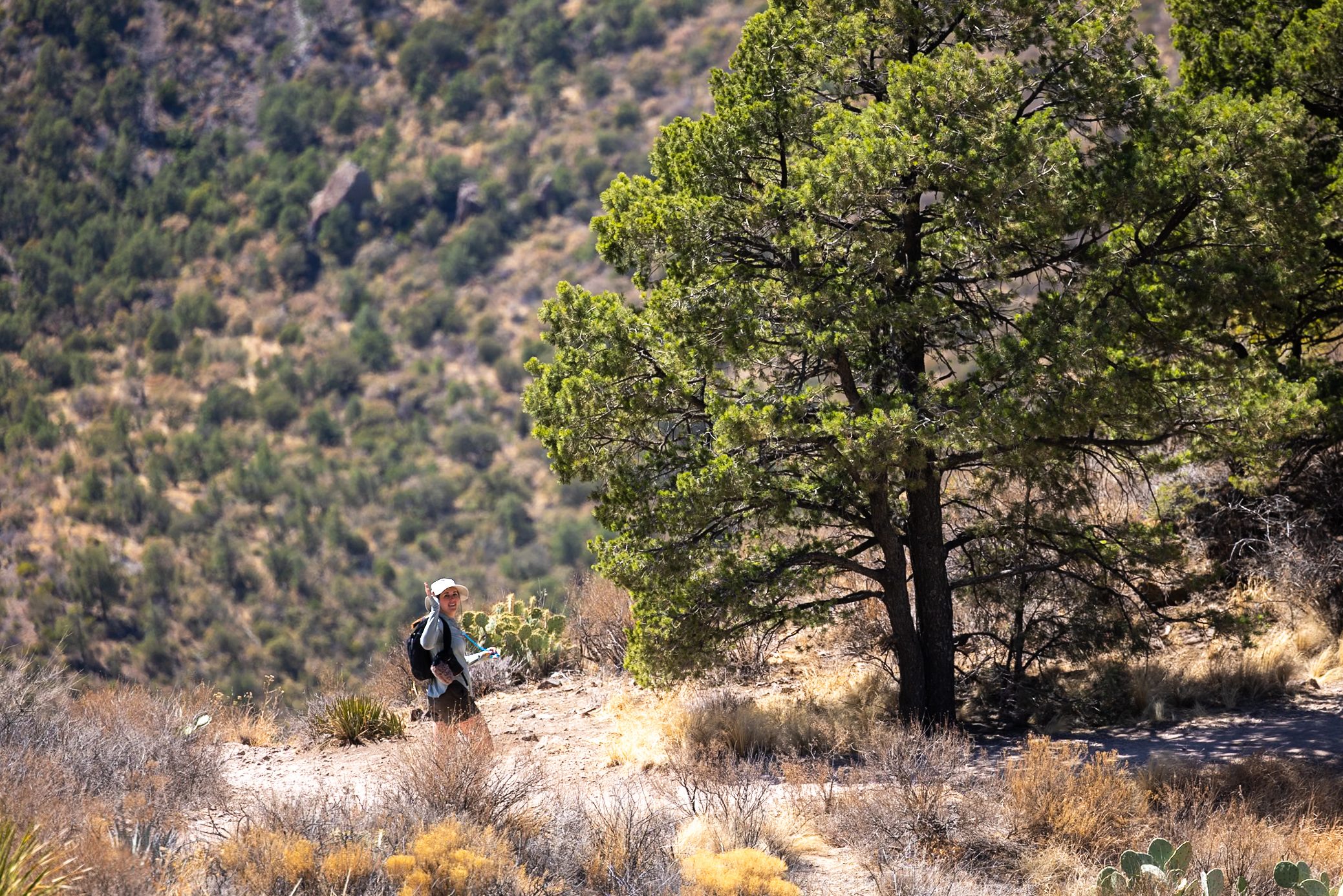
The first half of the trail is a steady incline with plenty of scenic rest spots, while the return trip is all downhill. The last stretch crosses an exposed rock section with steep drop-offs, but if heights aren’t your thing, you can easily enjoy the stunning views from the top without going the last little bit.
Since much of the trail is exposed to the sun, bringing enough water is essential. While some opt to hike in the dark before sunrise, we think this one is best enjoyed in daylight to fully take in its beauty.
Distance: 4.78 mi (7.7 km)
Difficulty: Moderate
Estimated Time: 2.5 hours
Type: Out and back
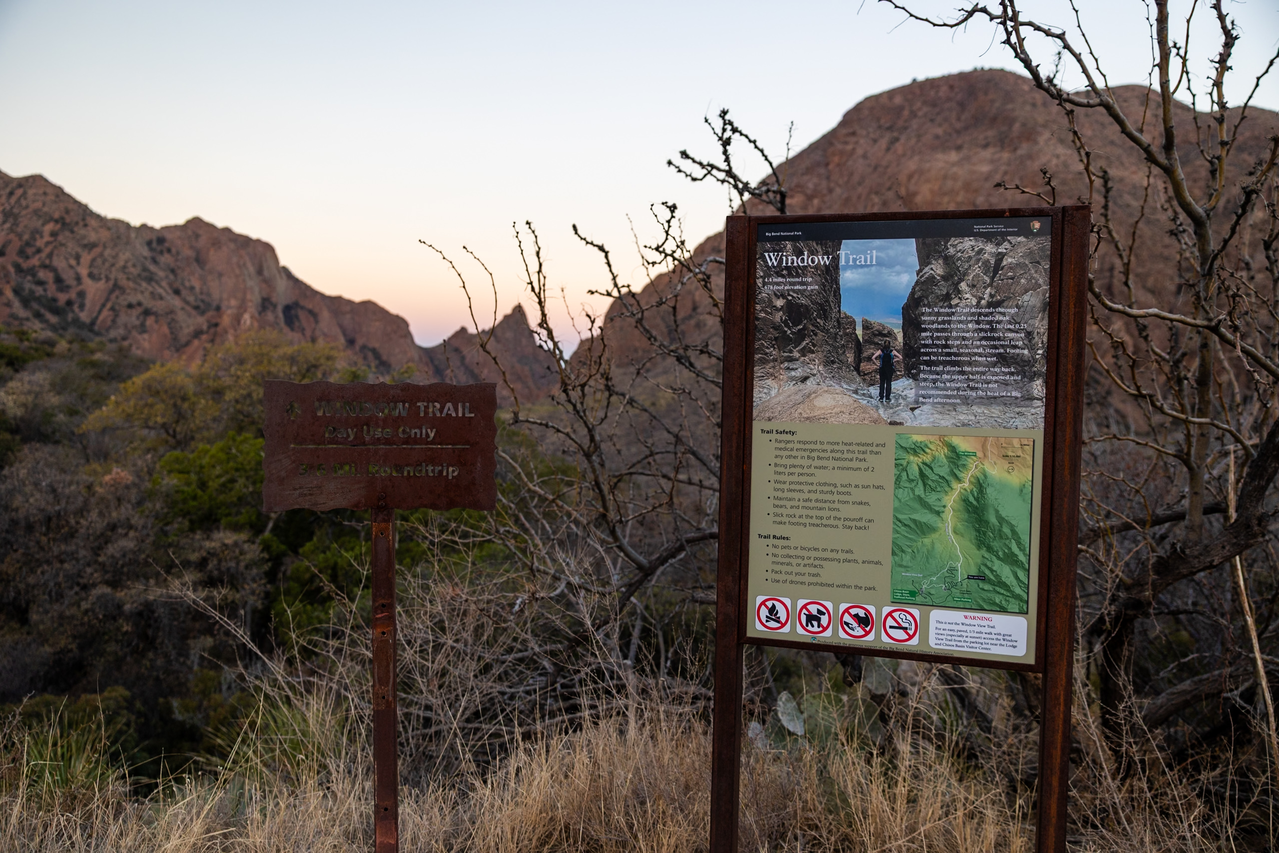
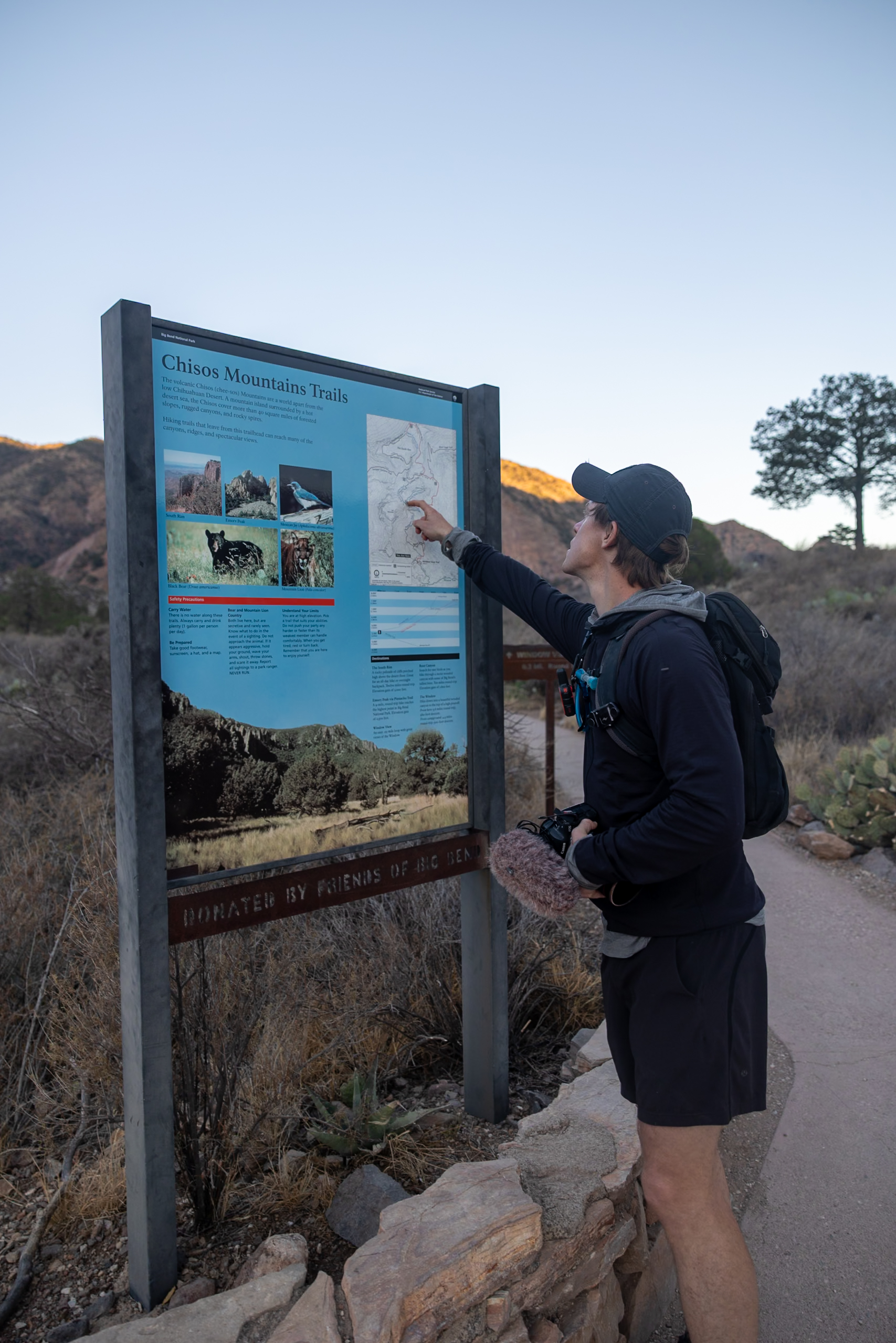
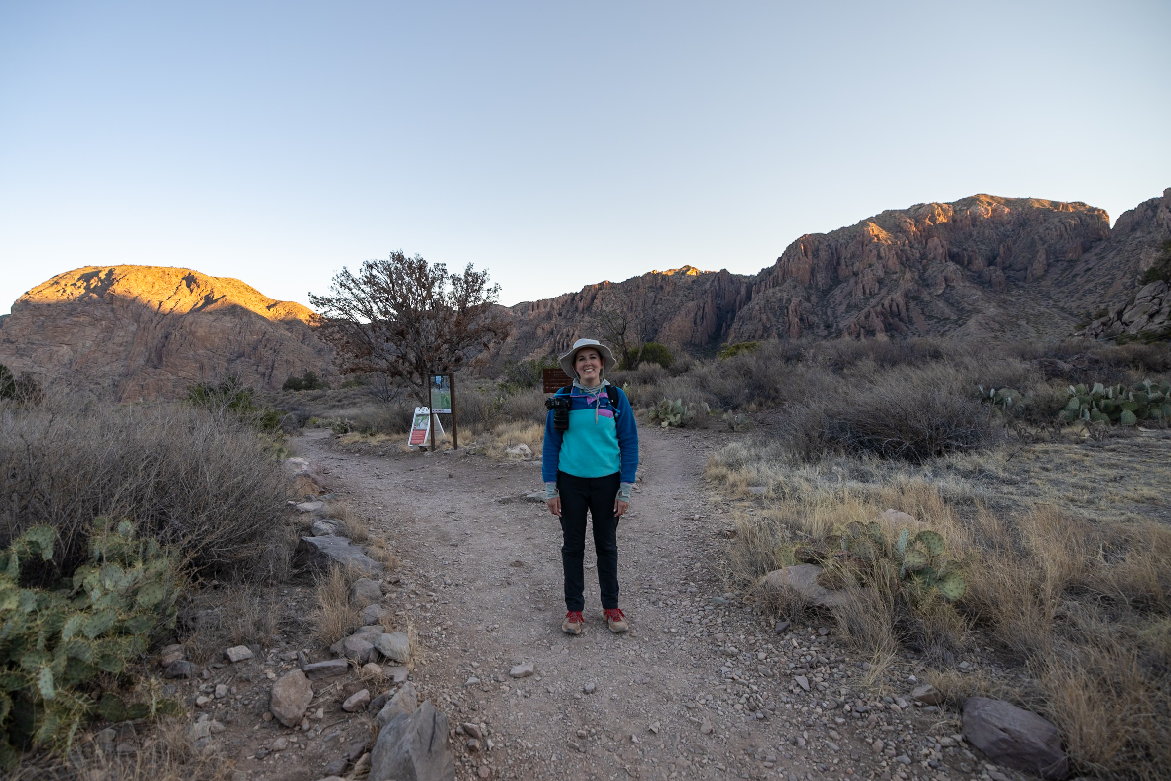
2. The Window Trail
The Window Trail is one of the top must-do hikes in Big Bend, leading to a breathtaking natural rock “window” that perfectly frames the desert landscape beyond. This moderate hike takes about 2.5 hours round trip and begins at the Chisos Basin Campground, though you can also start from the amphitheater parking lot via a short connecting trail. The route is mostly downhill on the way in and uphill on the return, making the journey back a bit more challenging.
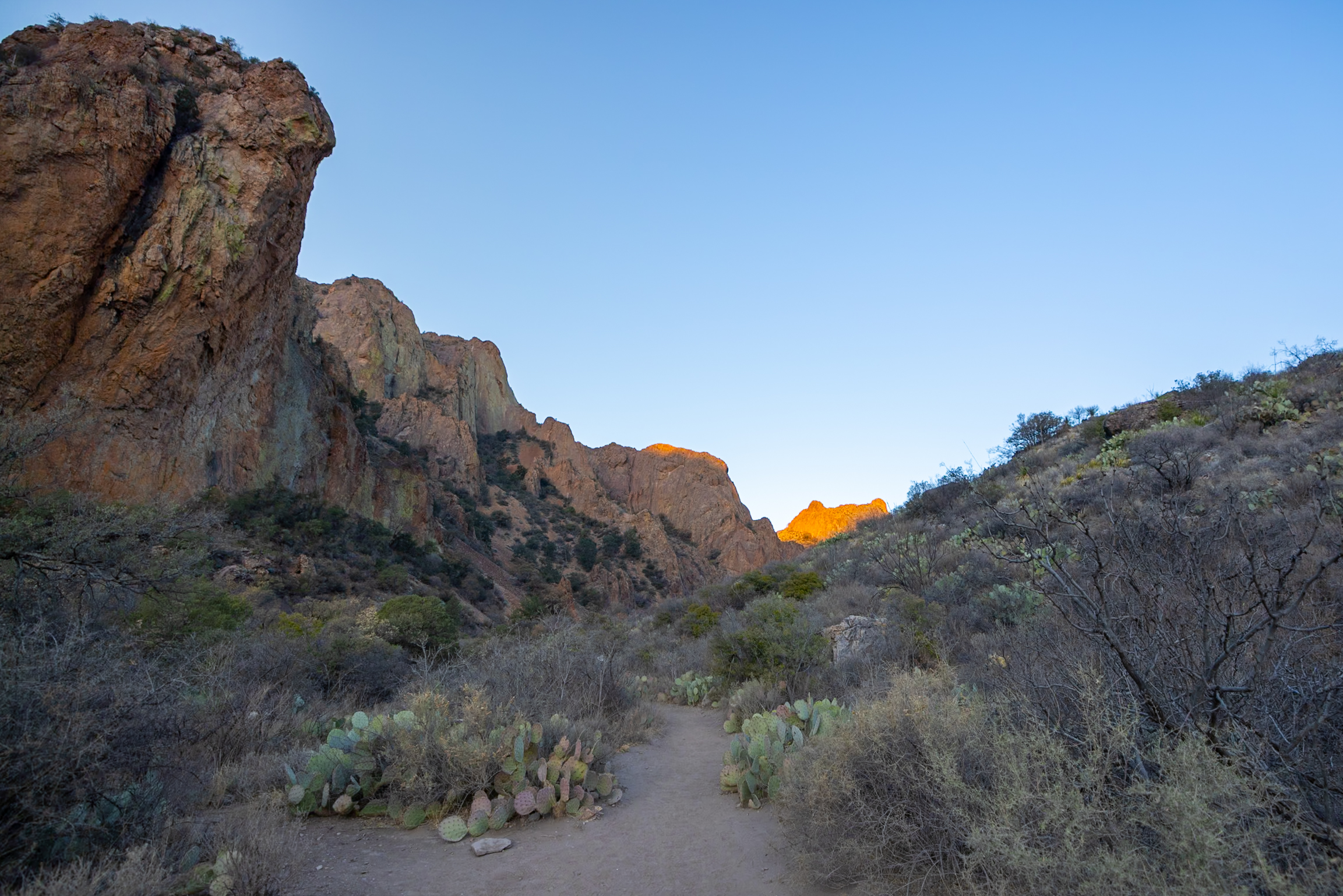
We hiked this trail at sunrise and highly recommend it—the early morning light casts a beautiful glow over the canyon walls, and the cooler temperatures make the climb back more manageable. The final viewpoint offers an incredible overlook of the western side of the park, and the smooth rock at the edge is a testament to how many hands have touched it over the years.
There are bathrooms at the trailhead, and parking is available near the Chisos Basin Campground. Just keep in mind that the way back is entirely uphill, so pace yourself and bring plenty of water. If you’re looking for a scenic, rewarding hike with a stunning photo op at the end, this one is a winner!
👁️ A shorter alternative is the Window View Trail, an 8-minute loop trail from Chisos Campground that gives you a great view from afar.
Distance: 5.53 mi from parking lot or 4.4 mi from campground (8.9 km)
Difficulty: Moderate
Estimated Time: 2.5 hours
Type: Out and back
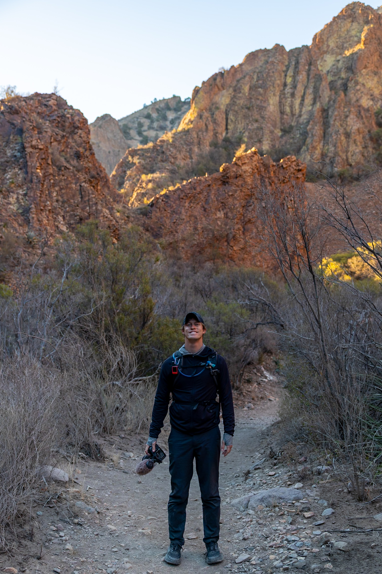
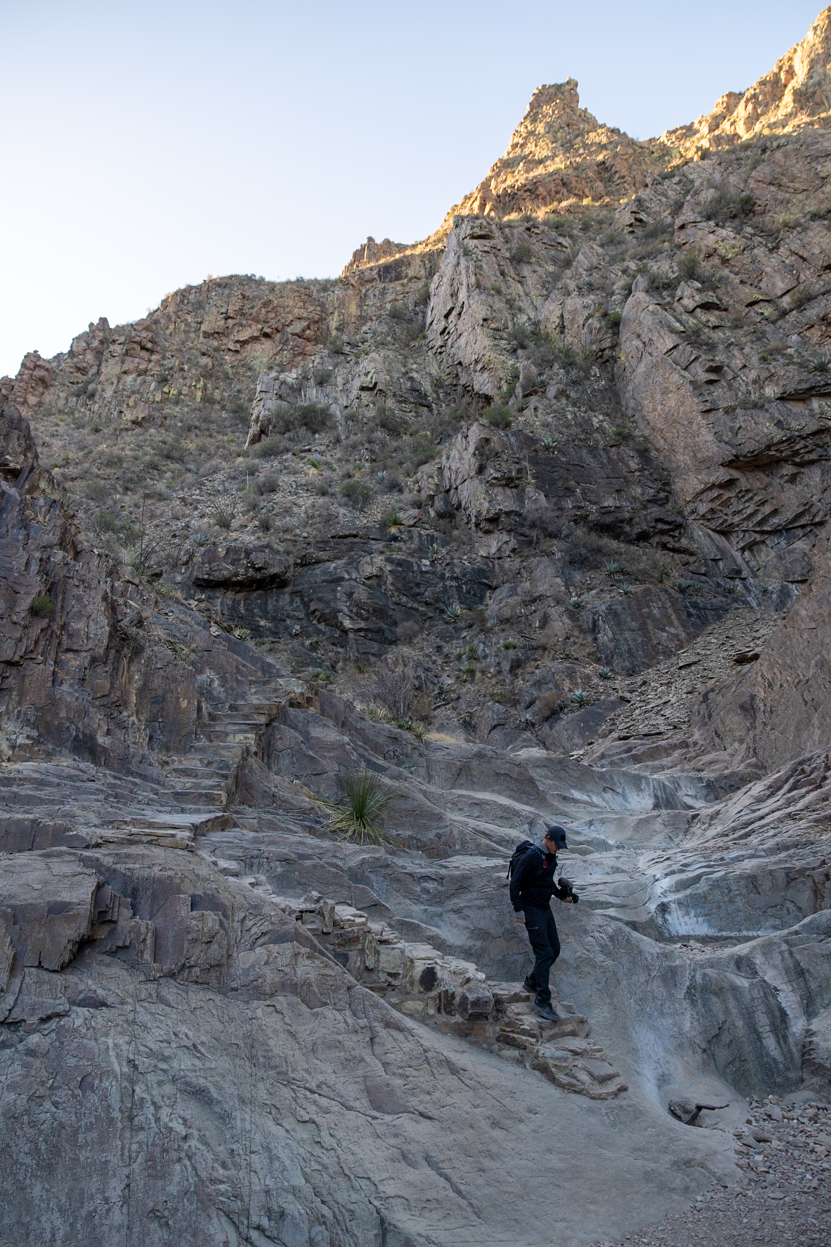
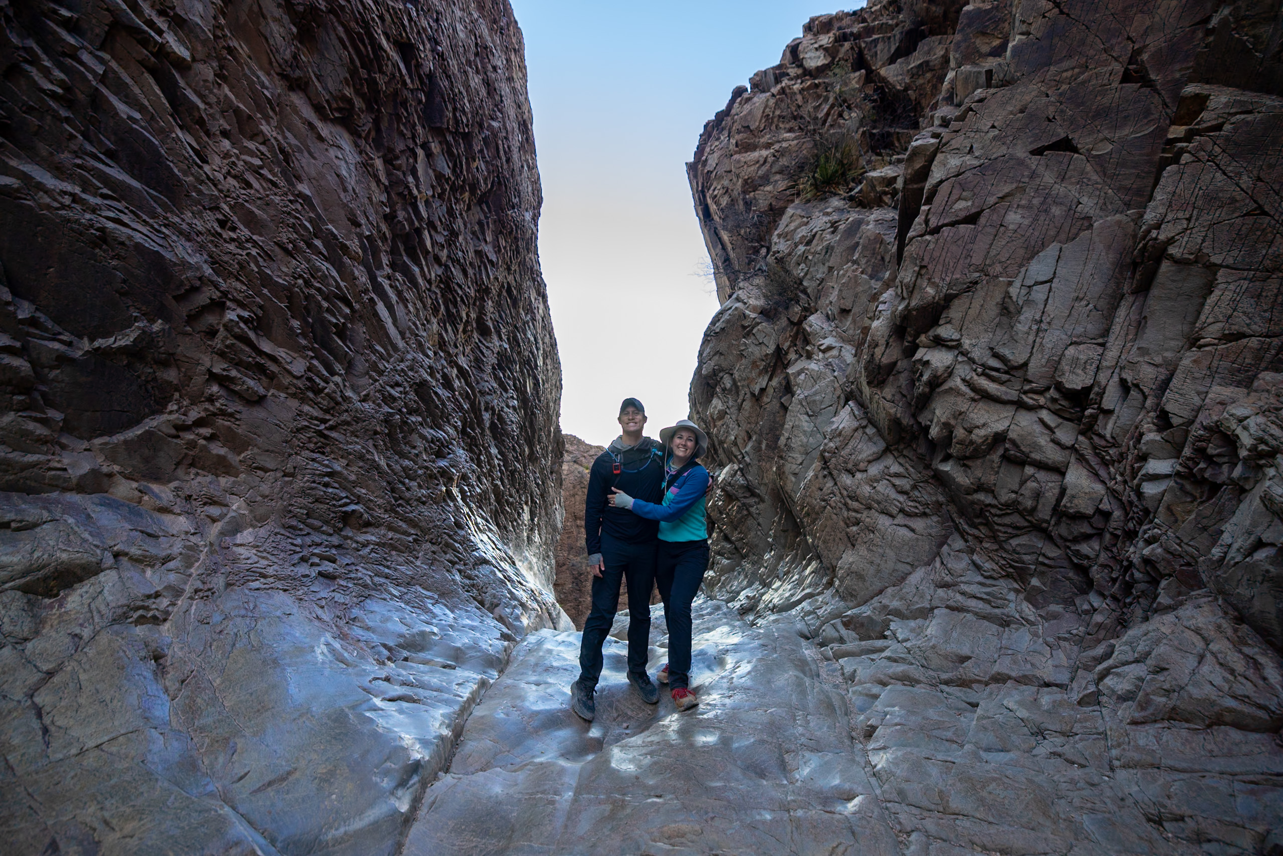
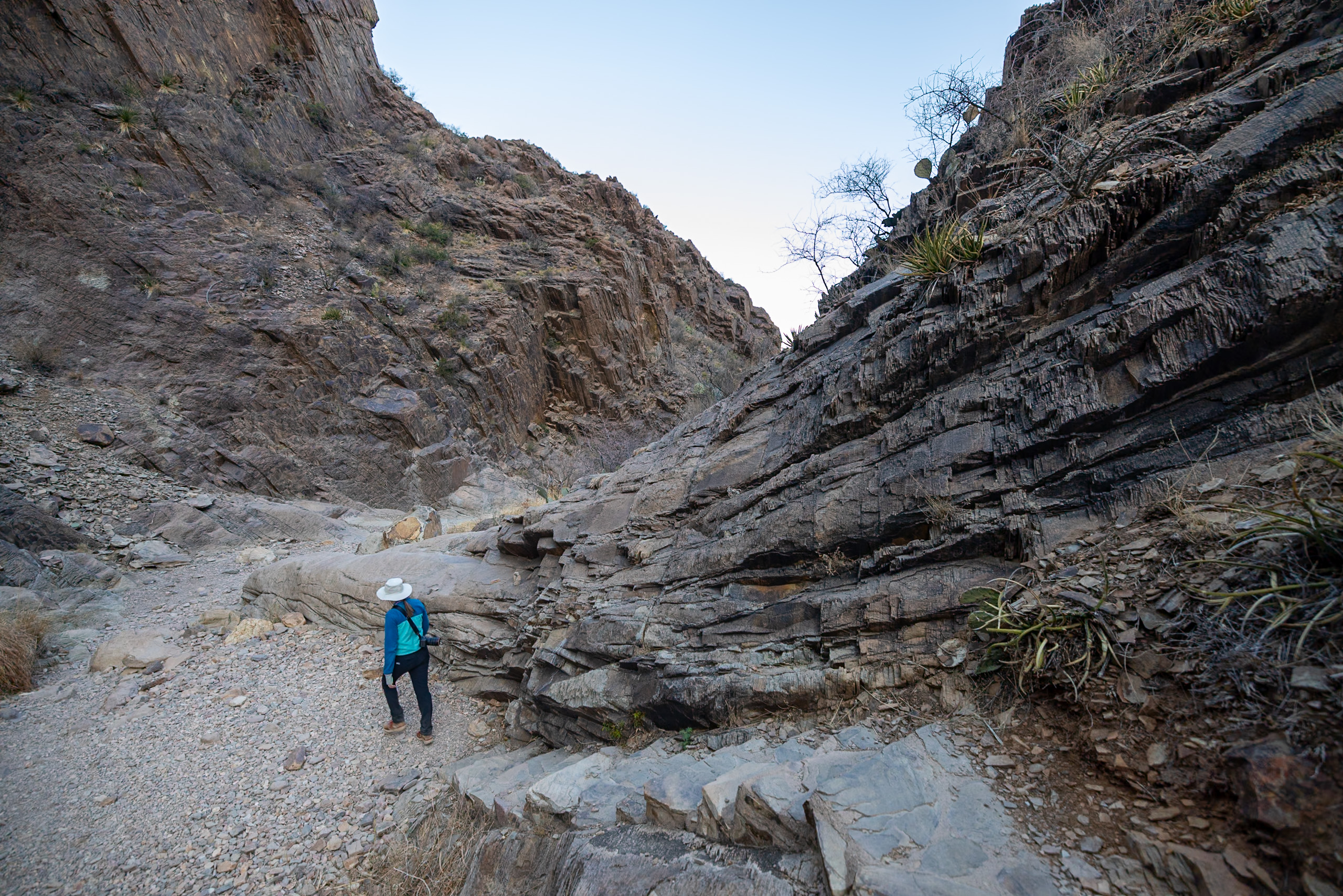
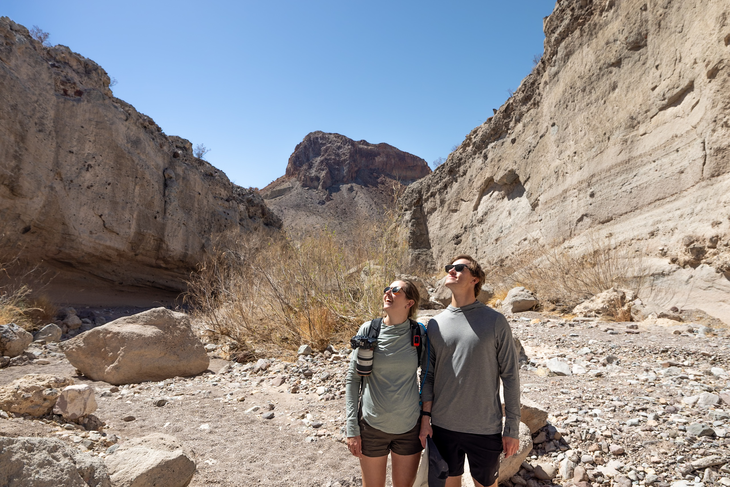
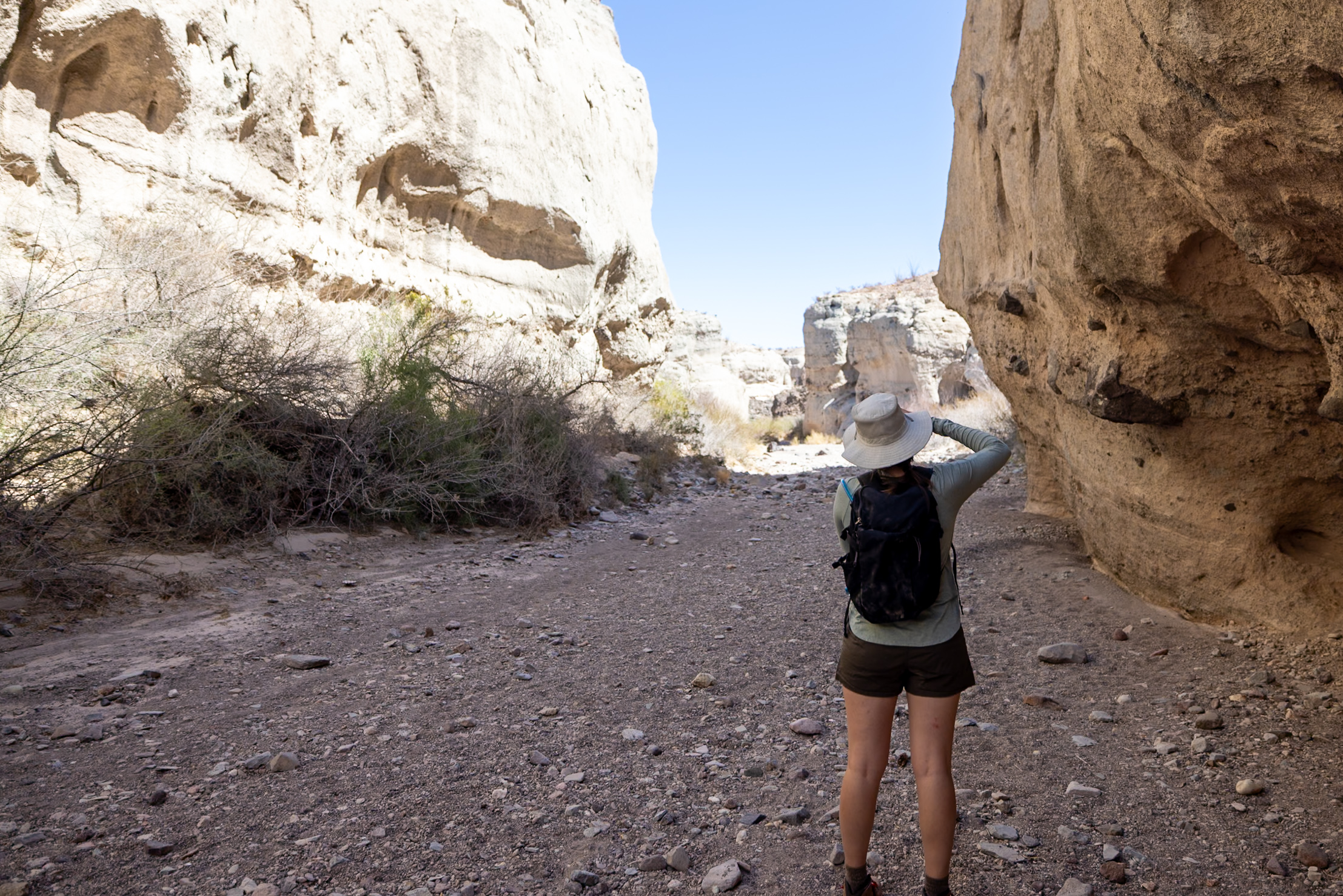
3. Santa Elena Canyon Trail
Santa Elena Canyon Trail is one of Big Bend’s most breathtaking and accessible hikes, offering a short but stunning journey into the towering canyon walls carved by the Rio Grande. This easy, 40-minute trail starts from the parking lot and leads to the riverbank, where you cross Terlingua Creek (which may be dry, depending on water levels). From there, the trail climbs gently up a few switchbacks before descending into the heart of the canyon, where the walls soar dramatically on either side.
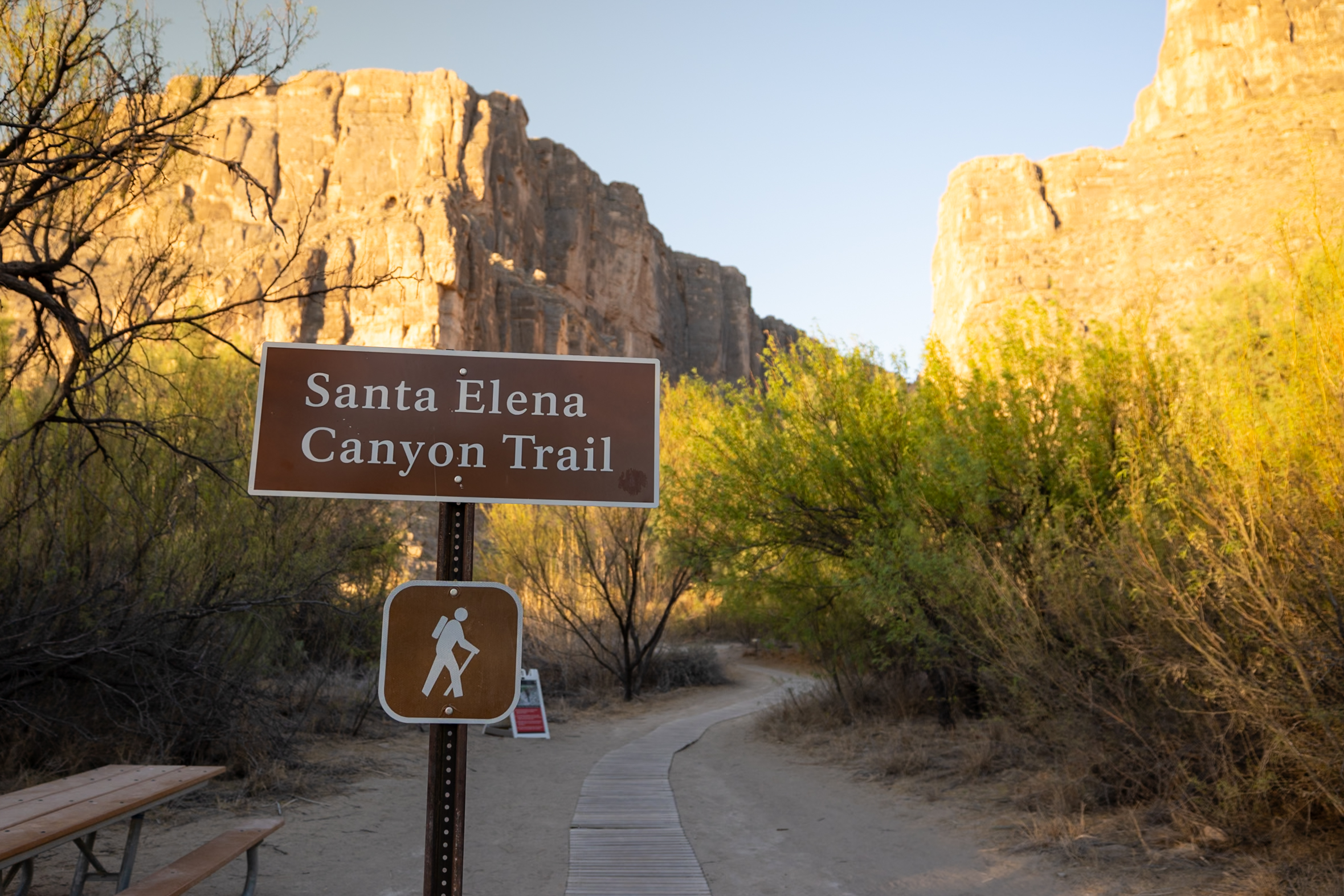
We hiked this trail at sunrise and had the canyon almost to ourselves, making for a peaceful and unforgettable experience. The early morning light illuminates the canyon walls, enhancing their golden hues and creating a beautiful contrast against the deep blue sky. Santa Elena Canyon runs 20 miles (32 km) on the west side of the park. Since water levels fluctuate, the exact length of the trail depends on how far you can walk along the Rio Grande’s edge, but no matter the conditions, the views are spectacular.
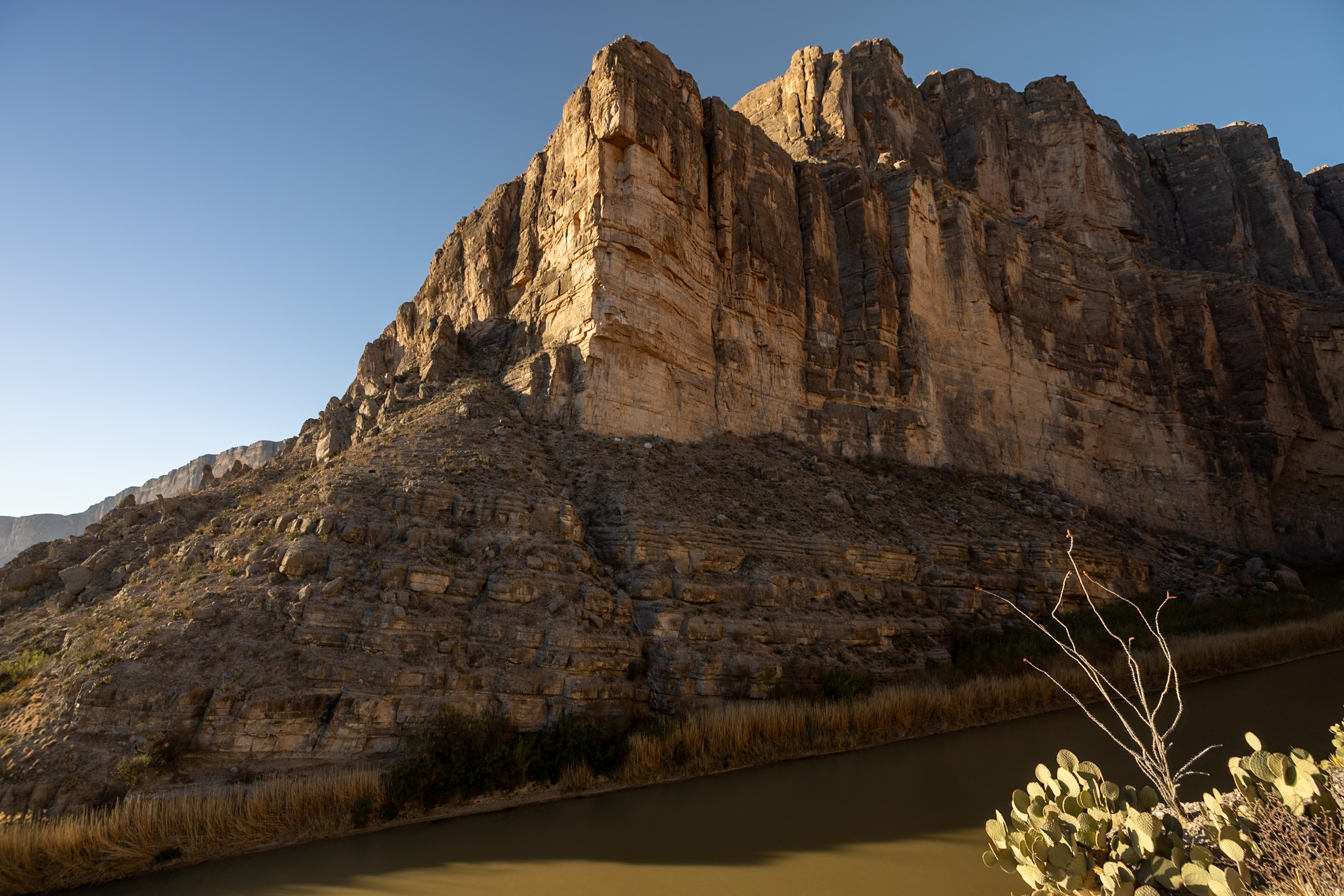
Parking is limited, with about 20 spots, and an NPS staff member was assisting with parking for smaller RVs (under 25 feet) when we visited. There are also bathrooms and trash receptacles at the trailhead. Overall, this is an easy, rewarding hike with some of the best views in Big Bend!
Distance: 1.62 mi (2.6 km)
Difficulty: Easy
Estimated Time: 40 minutes
Type: Out and back
📌 Pin this post
Pin this guide with the best hikes in Big Bend National Park to help plan your trip.

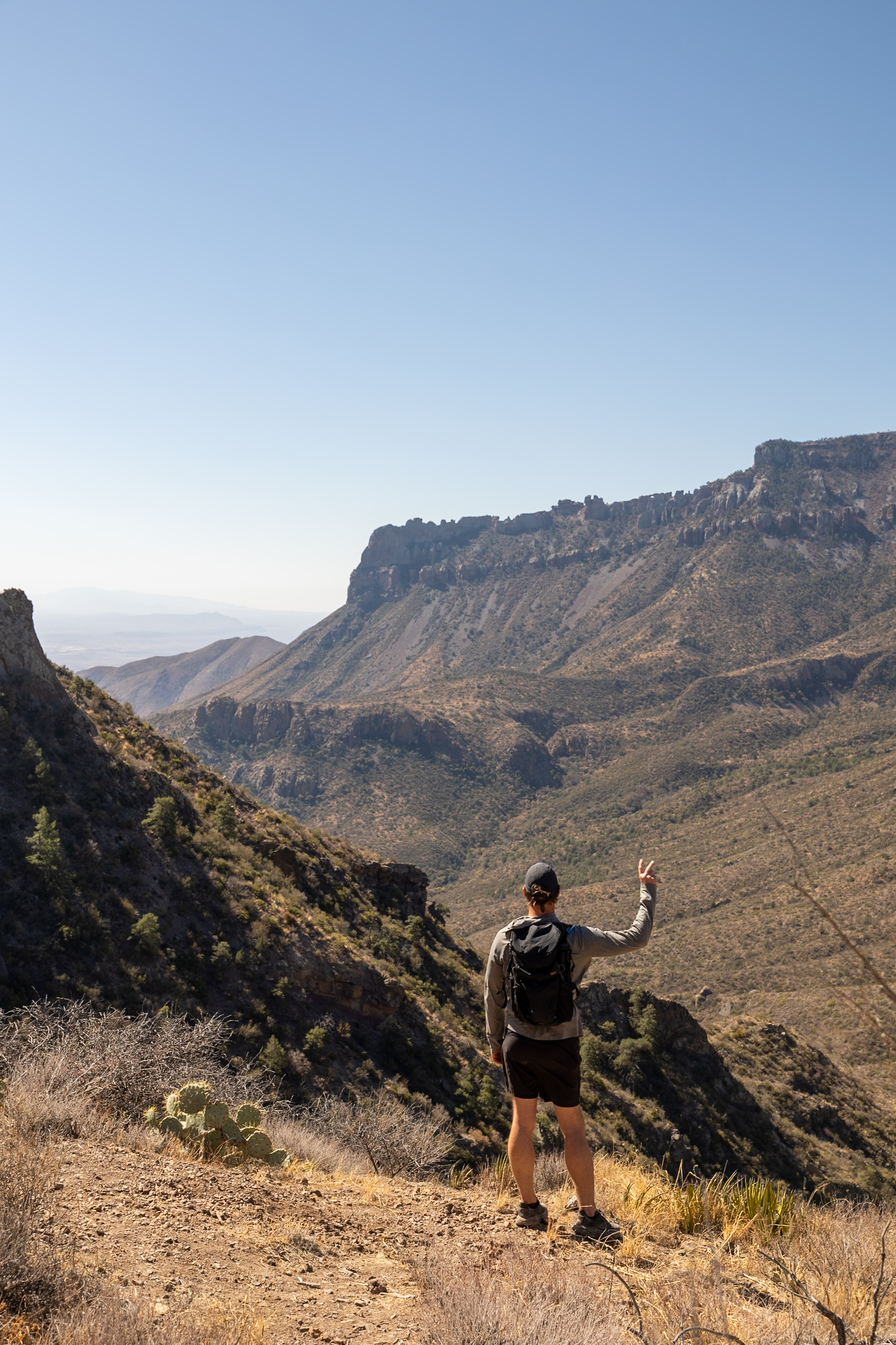
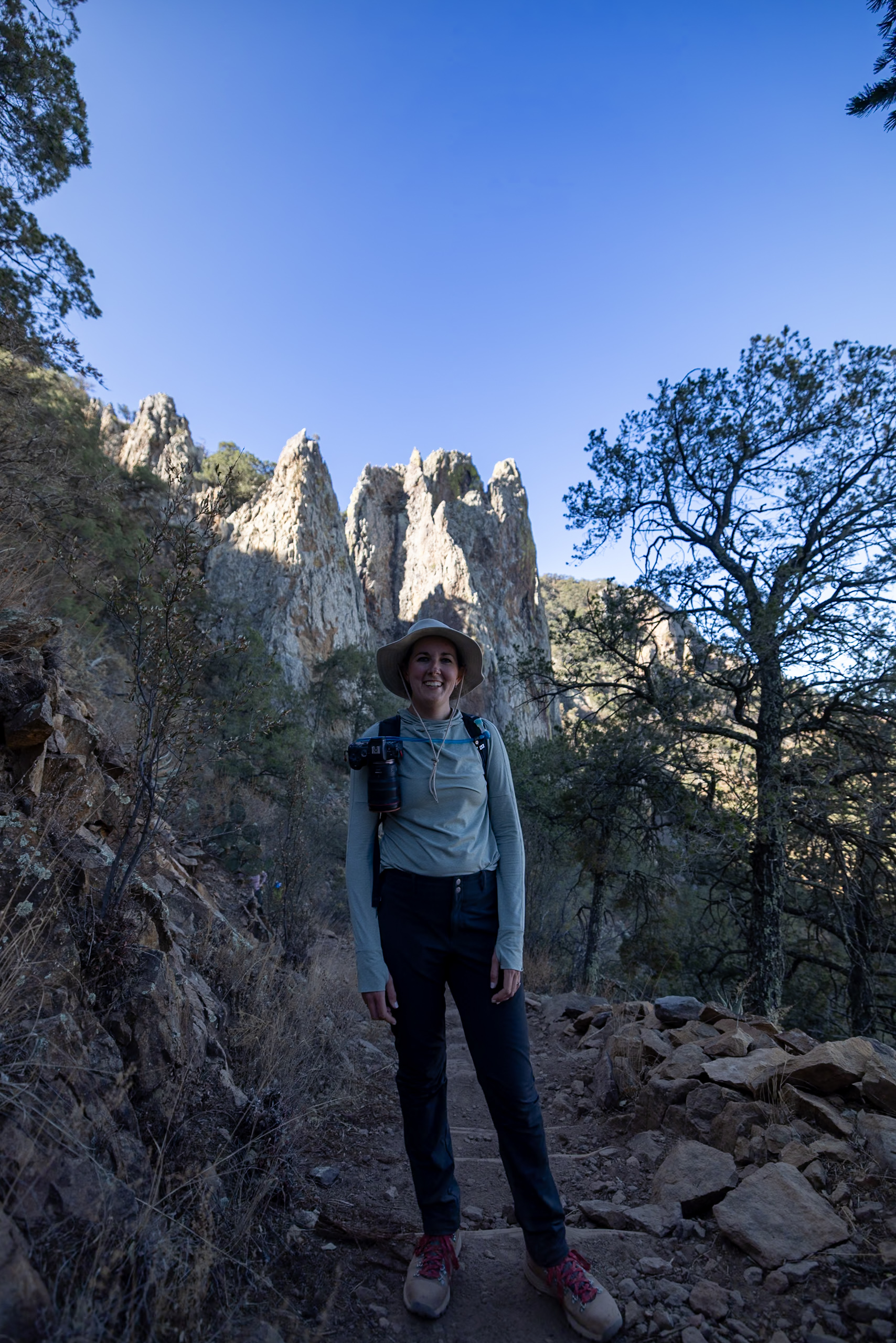
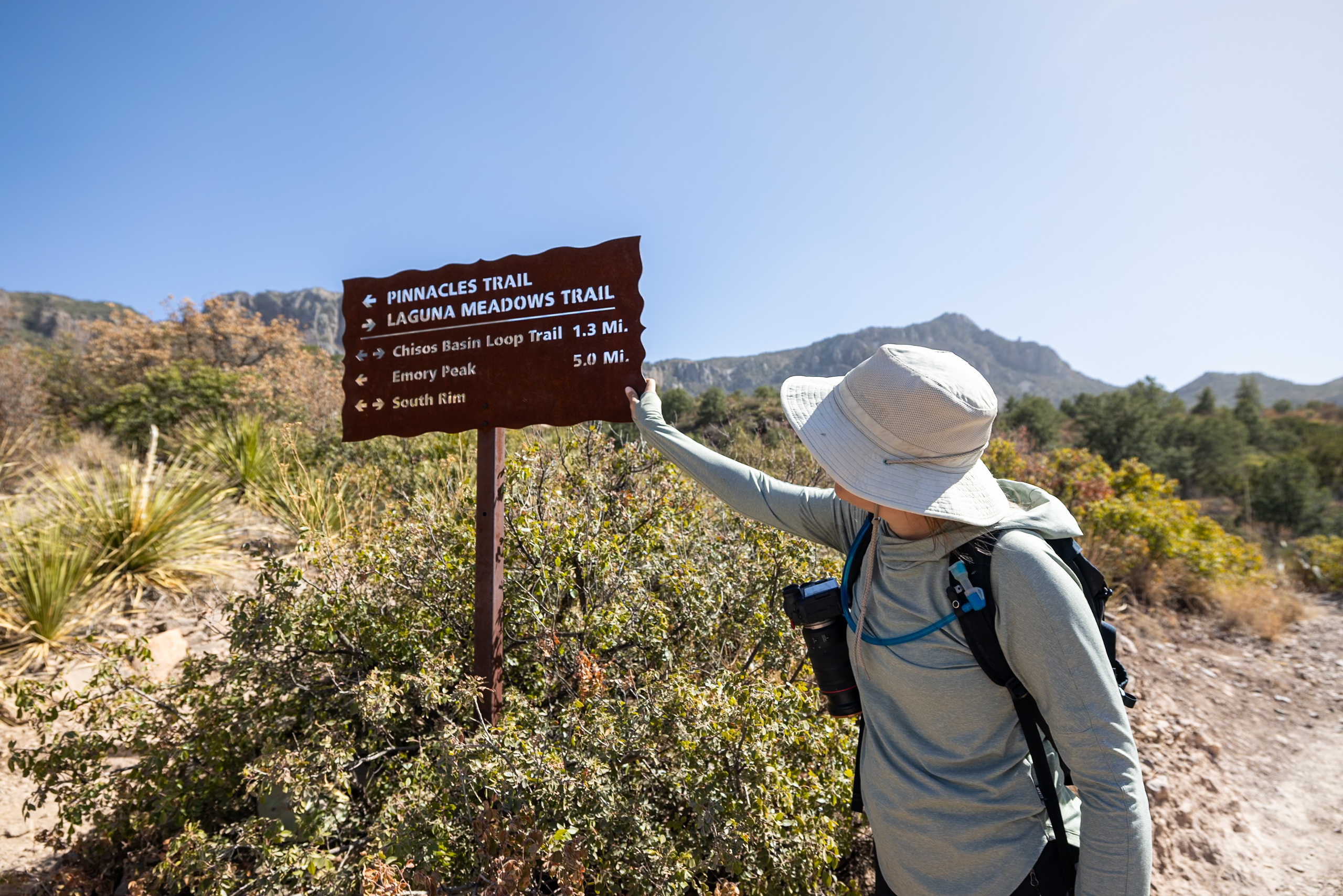
4. Emory Peak Trail
If you’re up for the challenge, Emory Peak Trail takes you to the highest point in Big Bend National Park at 7,825 feet, offering panoramic views of the Chisos Mountains and beyond. This strenuous hike is around 10 miles round-trip, with a steep final ascent that requires some rock scrambling.
The trail begins at the Chisos Basin Trailhead, following the Pinnacles Trail before branching off toward the peak. The first few miles involve a steady incline through scenic mountain terrain, but the final quarter-mile climb is the most challenging, requiring hands-and-feet scrambling up sheer rock. At the top, you’re rewarded with 360-degree views of the vast desert and rugged mountains.
Distance: 9.82 mi (15.8 km)
Difficulty: Hard
Estimated Time: 4-5 hours
Type: Out and back
5. Balanced Rock Trail
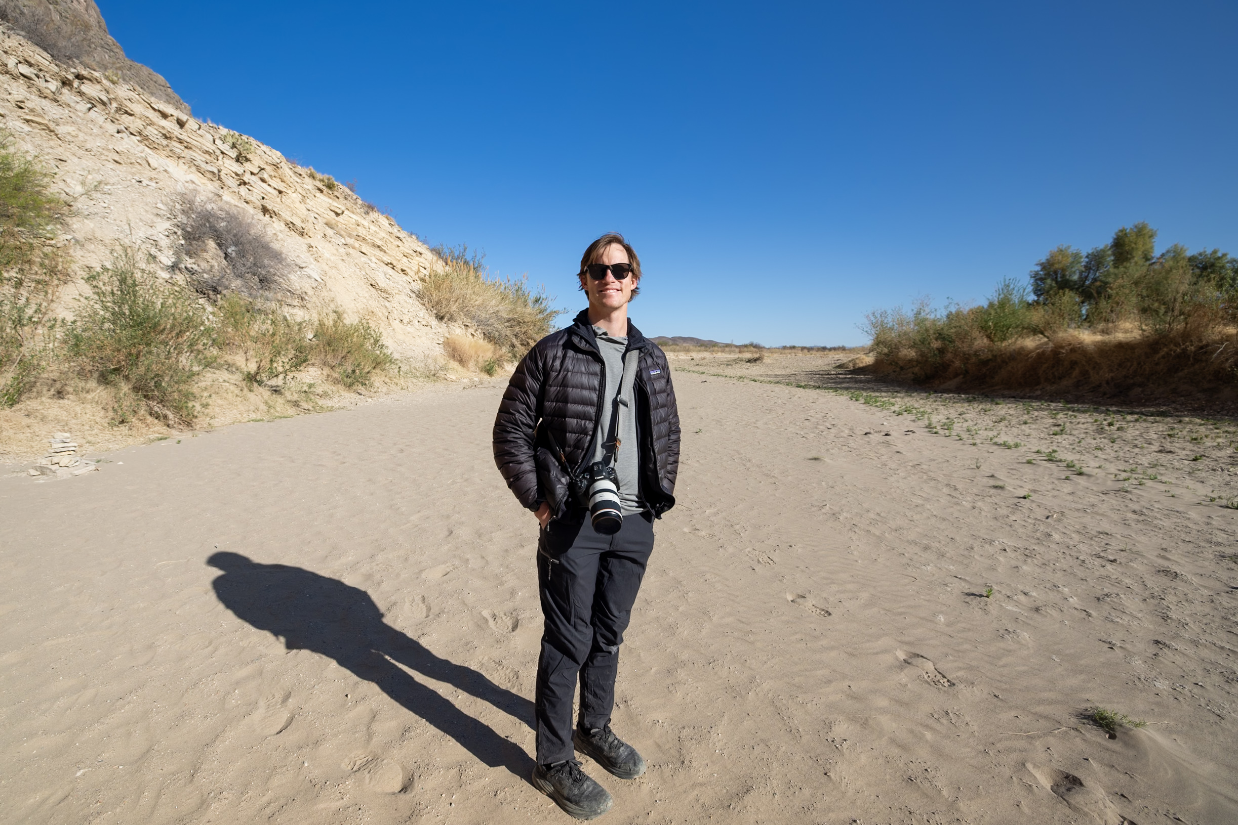
The Balanced Rock Trail is a fun, short hike that leads to one of Big Bend’s most unique rock formations—a massive boulder precariously balanced between two rock walls. This 2-mile round-trip trail is mostly easy but includes a short rock scramble at the end. The best time to hike is early in the morning or late in the afternoon to avoid the harsh midday sun, as much of the trail is exposed. This trail is located in the desert, so being prepared with ample water is critical.
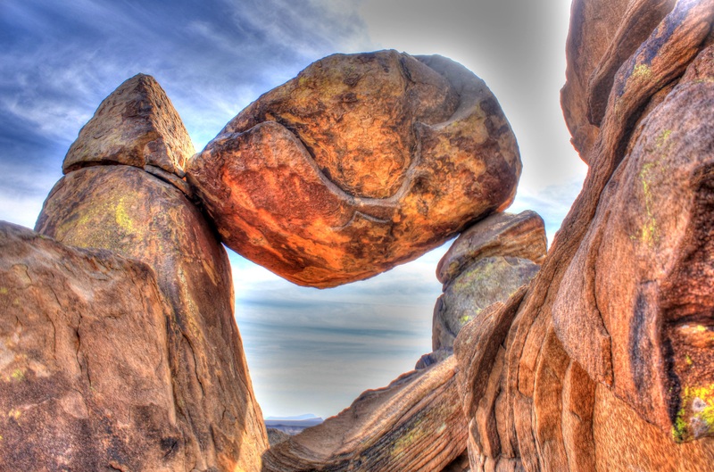
To reach the trailhead, you’ll need to drive down Grapevine Hills Road, a rough gravel road that can be challenging for low-clearance vehicles. The first part of the hike is a flat, sandy wash, surrounded by towering boulders and desert vegetation. The final stretch requires a short but steep rock scramble, leading to the Balanced Rock formation with panoramic views of the surrounding desert.
Distance: 1.93 mi (3.1 km)
Difficulty: Moderate
Estimated Time: 1 hour
Type: Out and back
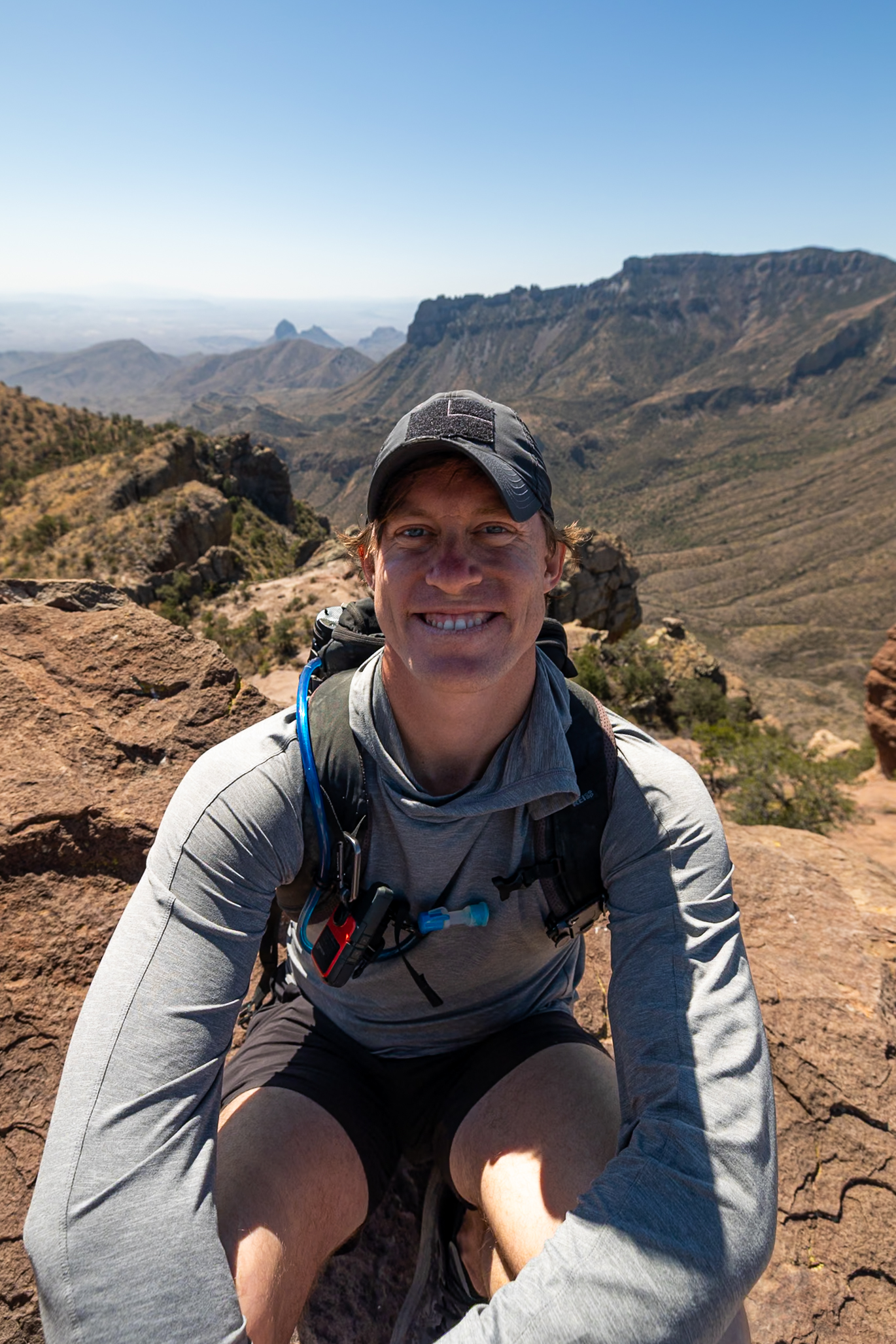
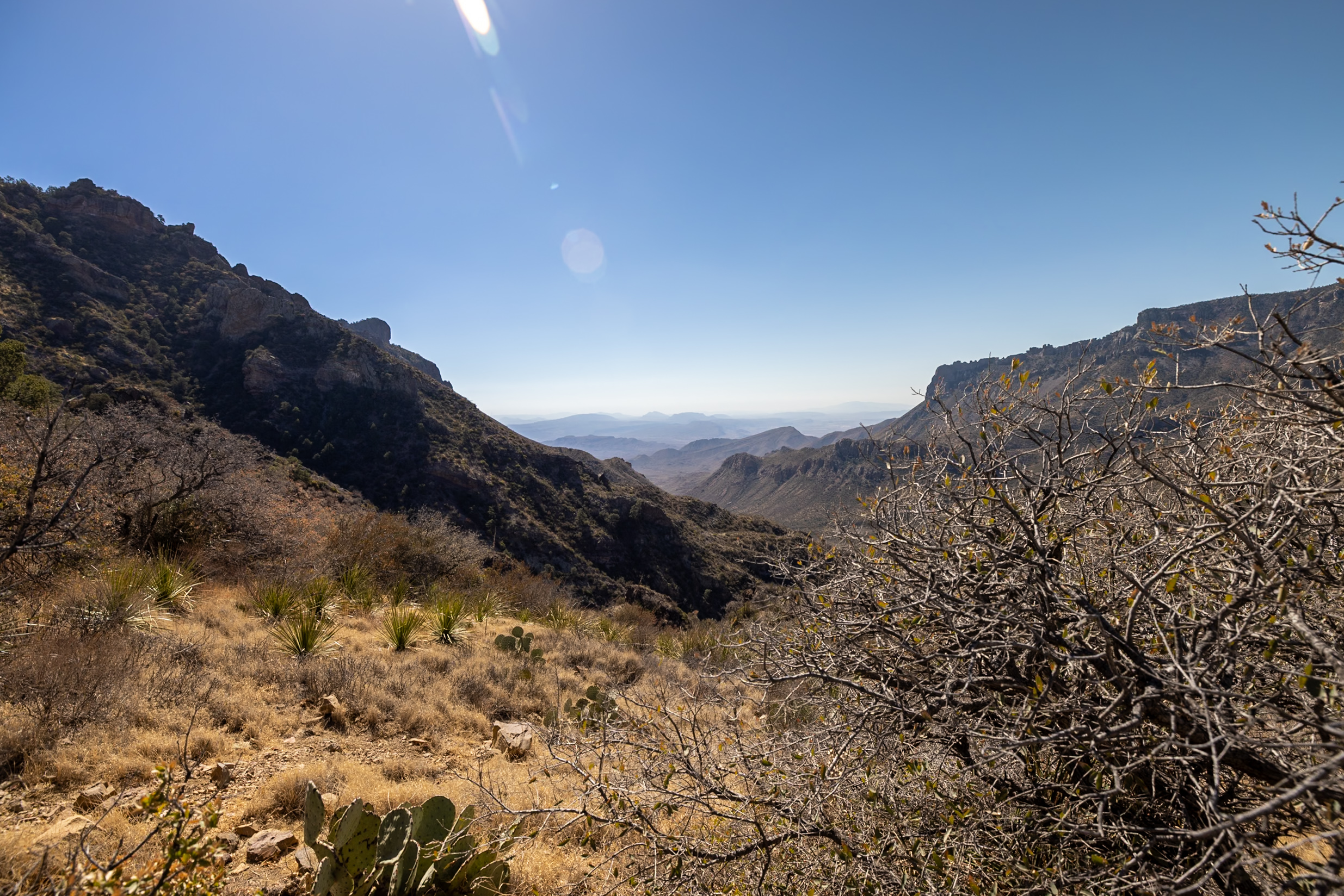
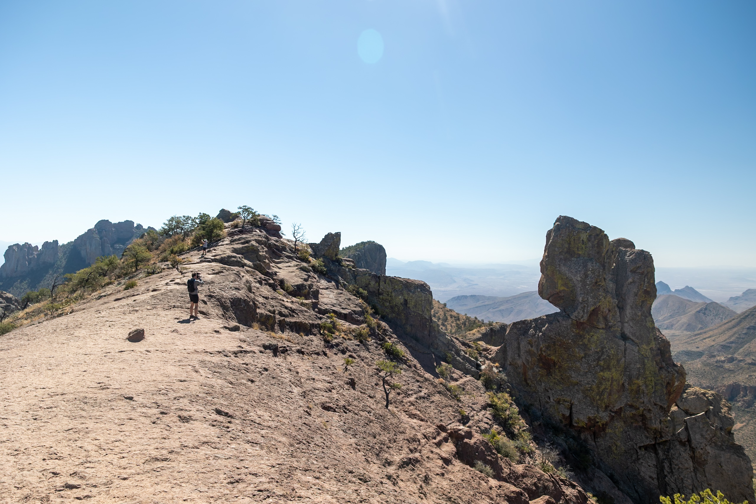
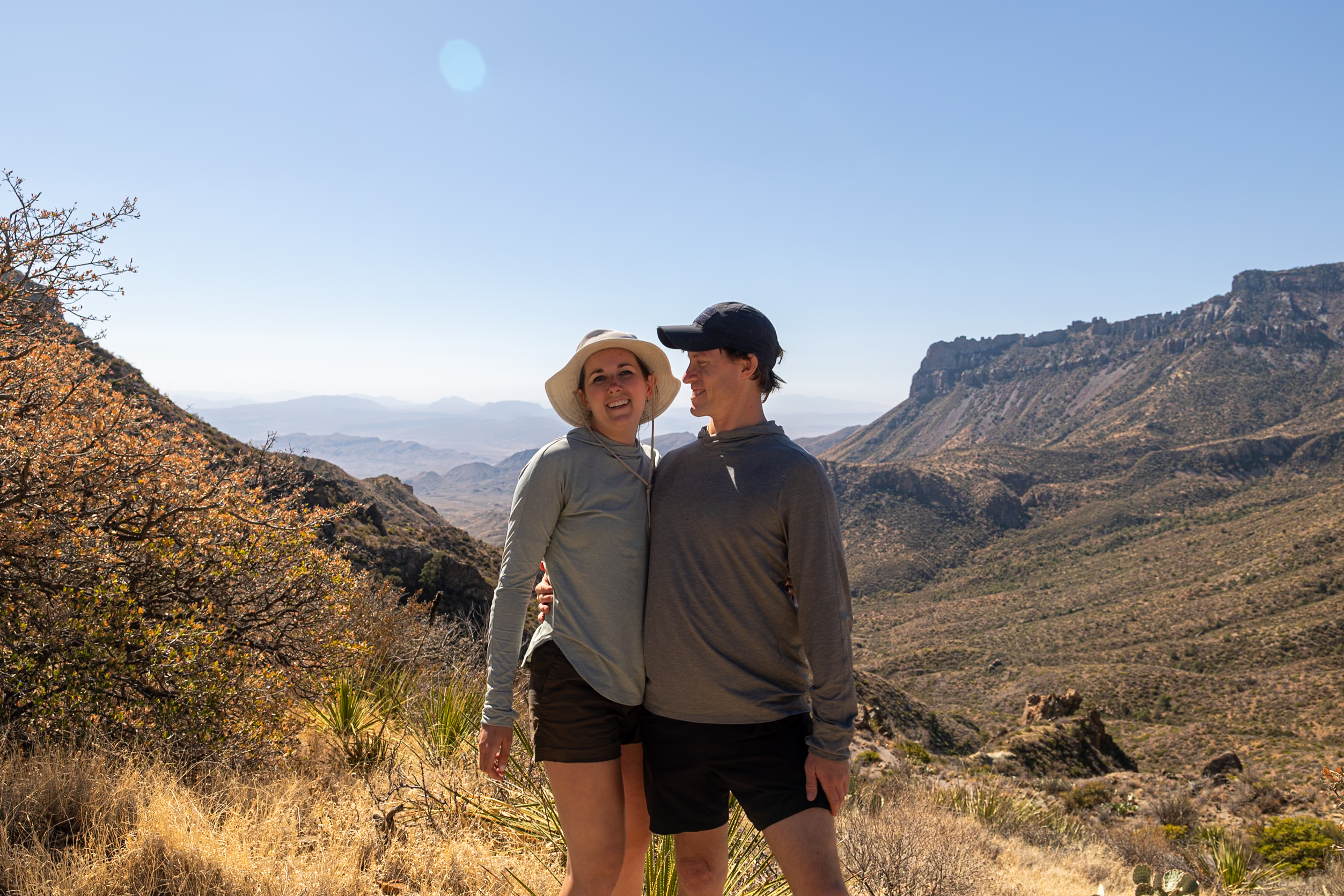
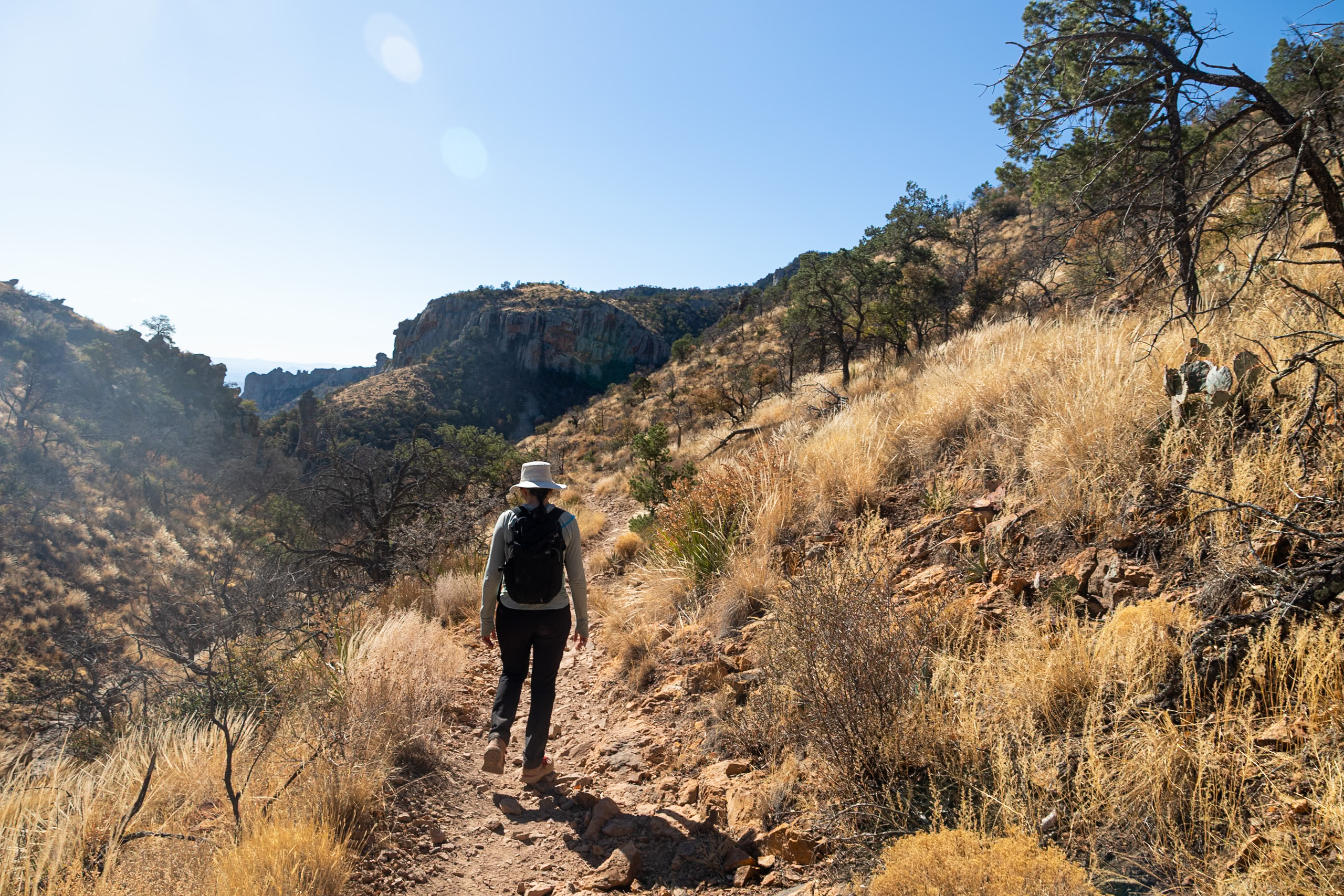
6. South Rim Trail
Of all the hikes in Big Bend, the South Rim Trail was hands-down our favorite. We hadn’t planned on hiking this trail, but after chatting with park rangers, they explained to us that the breathtaking views from the South Rim were a huge reason why Big Bend was designated a national park.
This challenging route takes you through diverse terrain, from steep switchbacks in the Chisos Basin to open grasslands, shaded springs, and finally, the dramatic cliffside views overlooking the vast desert below. It’s incredible!
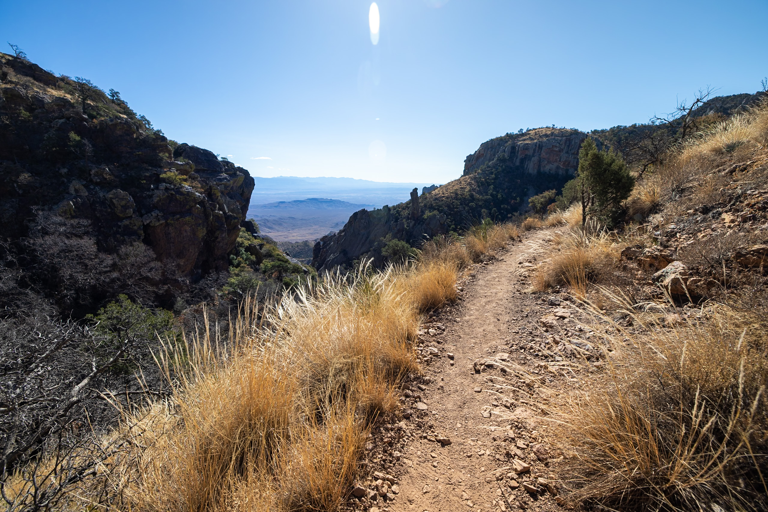
The trail can be accessed via the Laguna Meadow Trail or Pinnacles Trail—we started with Pinnacles and ended with Laguna Meadows, which we’d highly recommend since Pinnacles is steeper. While the hike is long, the incredible scenery and lack of heavy crowds made it well worth the effort. Along the way, we saw backpacking groups setting up for overnight trips, and if we return, we’d consider staying overnight to catch a sunrise from the rim.
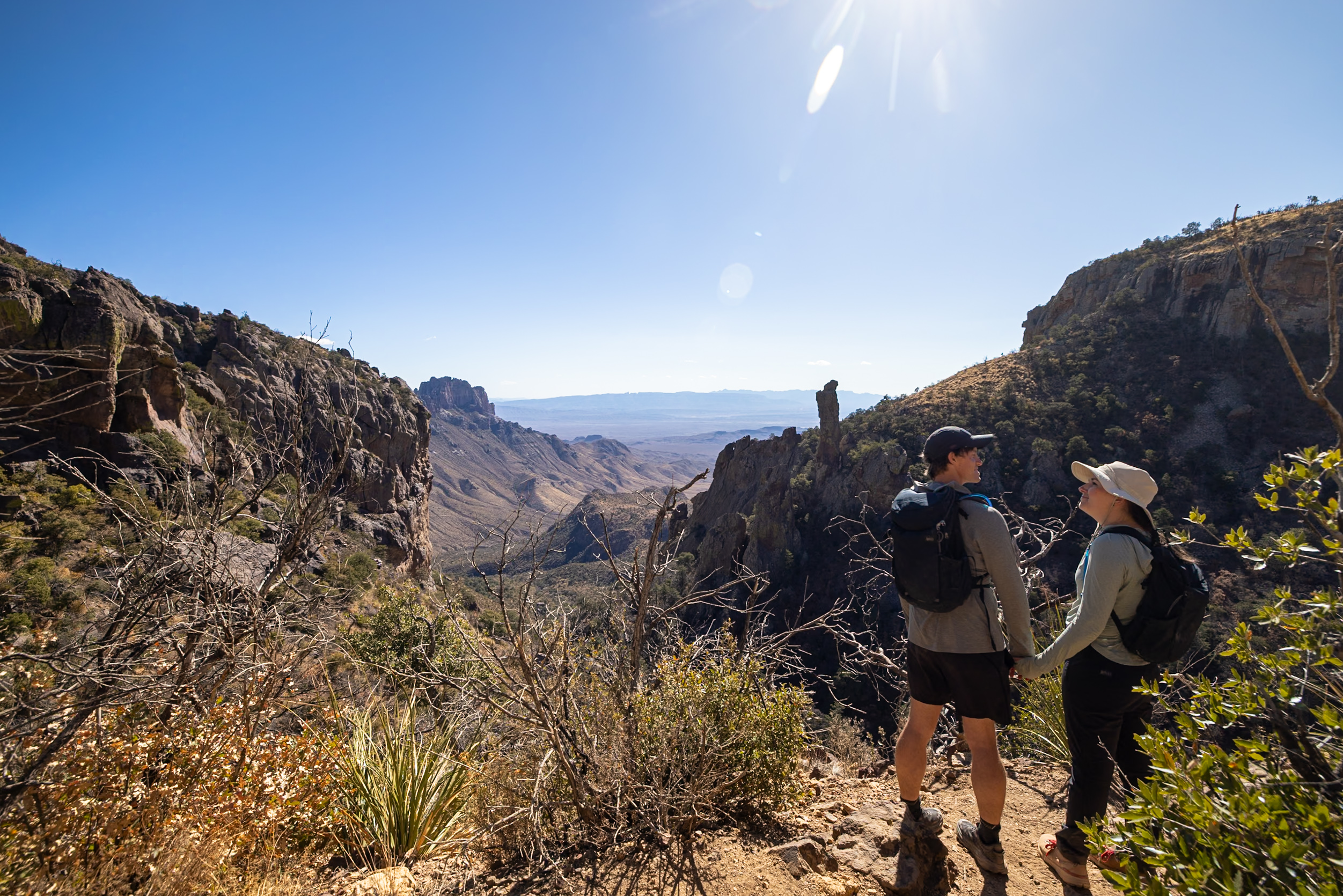
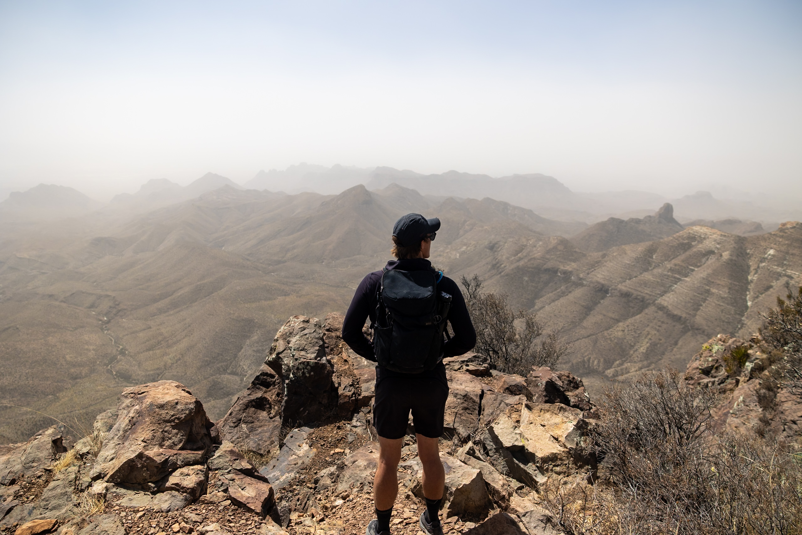
If you’re up for a full-day trek with some of the best views in Big Bend, the South Rim Trail is a must. Bring plenty of water, start early to beat the heat, and be prepared for changing weather as you climb higher into the mountains. The effort is intense, but the unforgettable panoramas make it one of the most rewarding hikes in Big Bend!
🥾 Read more about our experience on this trail—South Rim Trail at Big Bend National Park Hiking Guide!
Distance: 12.2 miles (19.6 km), although we recorded 14.4 miles
Difficulty: Hard
Estimated Time: 6-6.5 hours
Type: Loop
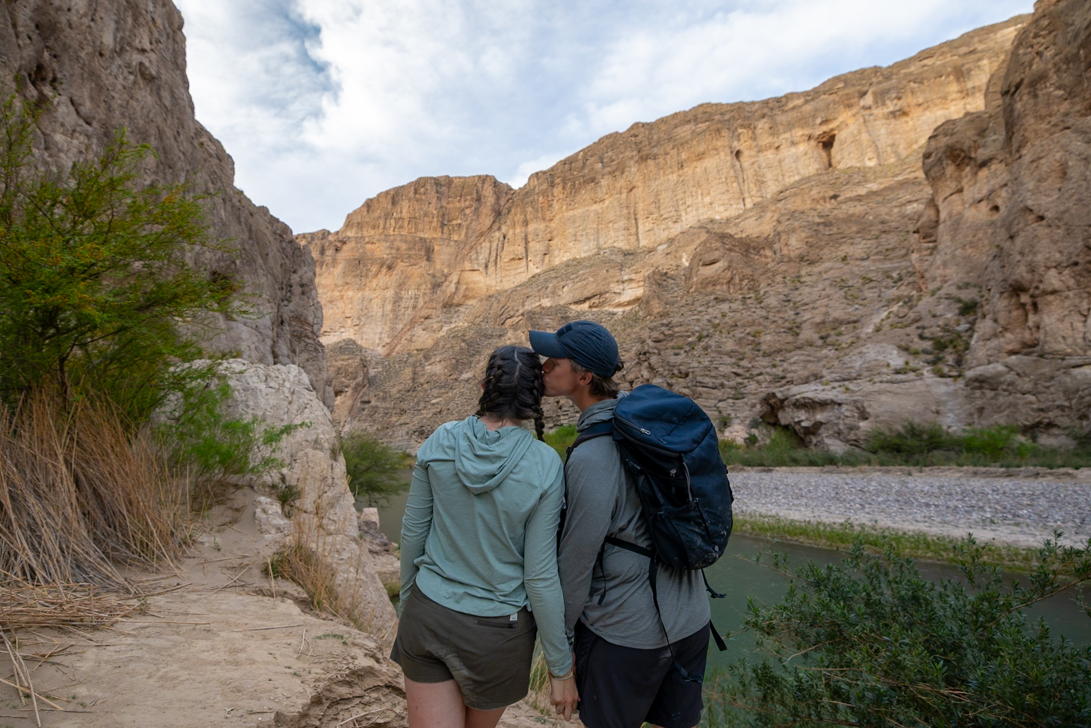
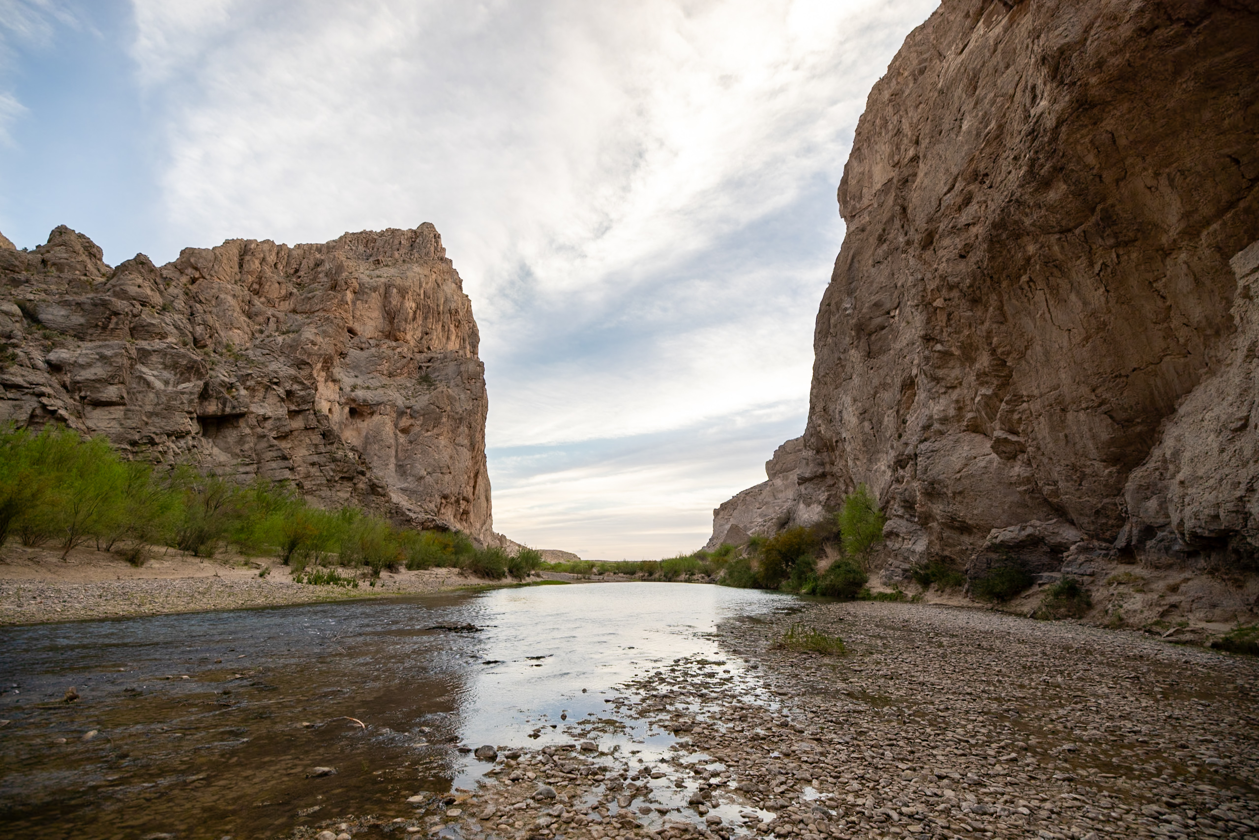
7. Boquillas Canyon Trail
The Boquillas Canyon Trail is a short but scenic hike that takes you along the Rio Grande and into one of Big Bend’s most stunning canyons. Boquillas Canyon runs 33 miles (53 km) on the east side of the park, close to the Boquillas, Mexico crossing.
The trail begins with a brief uphill climb before quickly descending toward the river, where you’ll walk alongside towering canyon walls. We hiked this trail just before sunset and loved watching the golden light play across the rock formations.
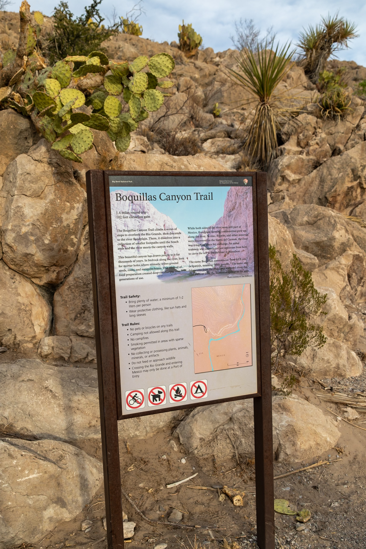
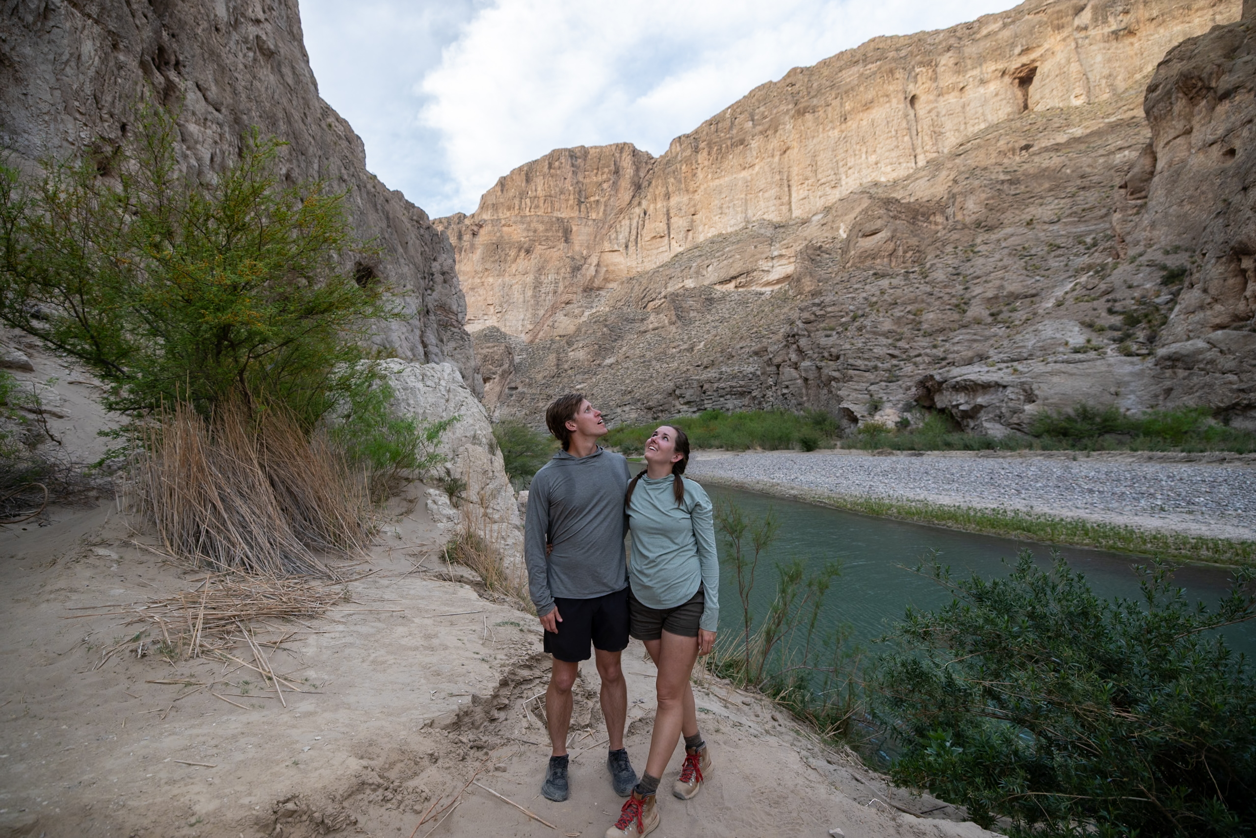
The steep canyon walls create a feeling of total immersion, and the sound of the Rio Grande flowing makes the hike even more peaceful. Though it’s only about 42 minutes round-trip, the beauty packed into this short hike makes it well worth the stop.
Parking is limited, especially for larger vehicles, so plan accordingly. We were able to park our 23′ long van, but it would have been challenging if there were more cars in the parking lot. There are also bathrooms and trash receptacles at the trailhead. If you’re looking for a quicker, less strenuous hike with incredible scenery, Boquillas Canyon is a perfect choice—especially at sunset!
Distance: 1.43 mi (2.3 km)
Difficulty: Moderate
Estimated Time: 45 minutes
Type: Out and back
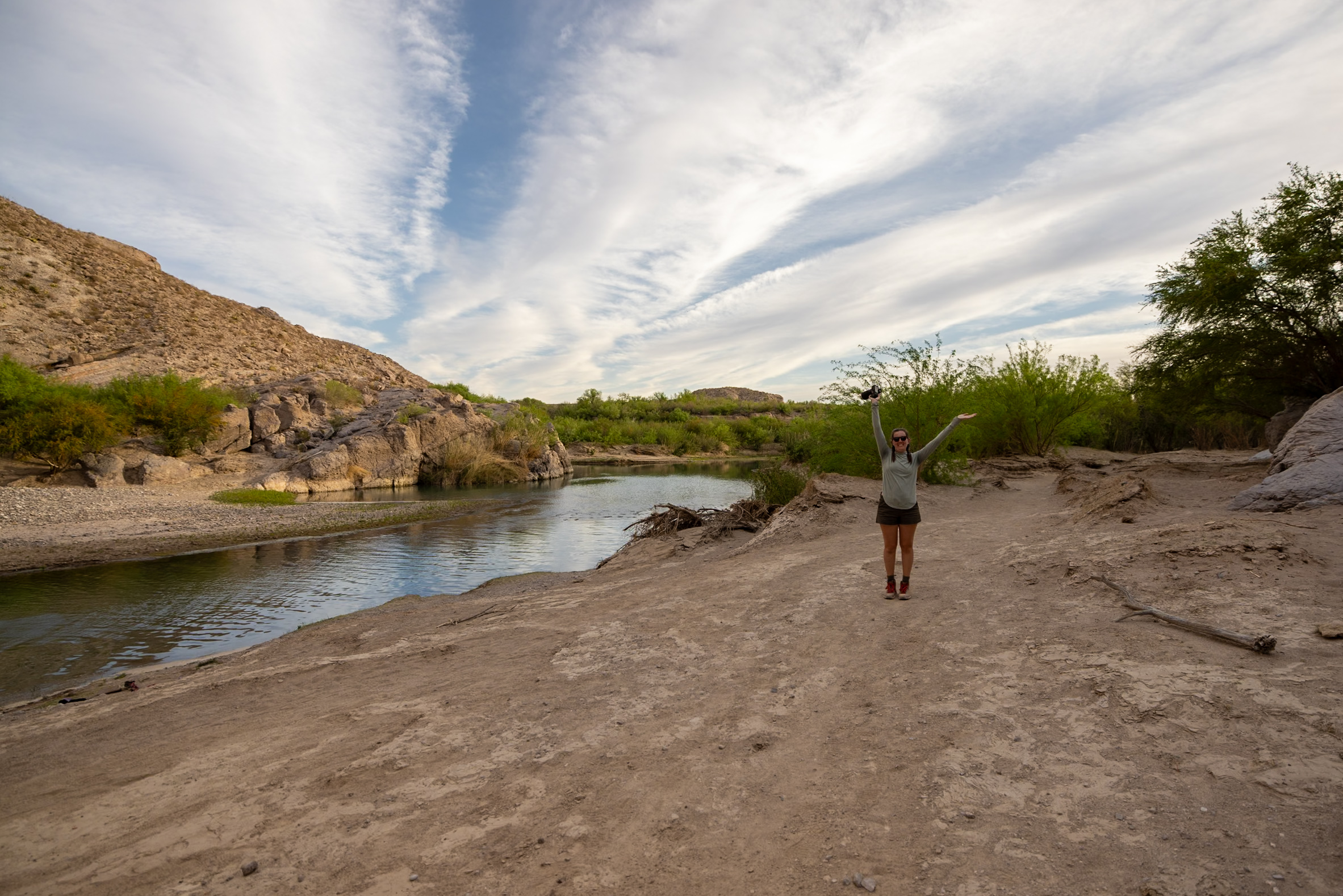
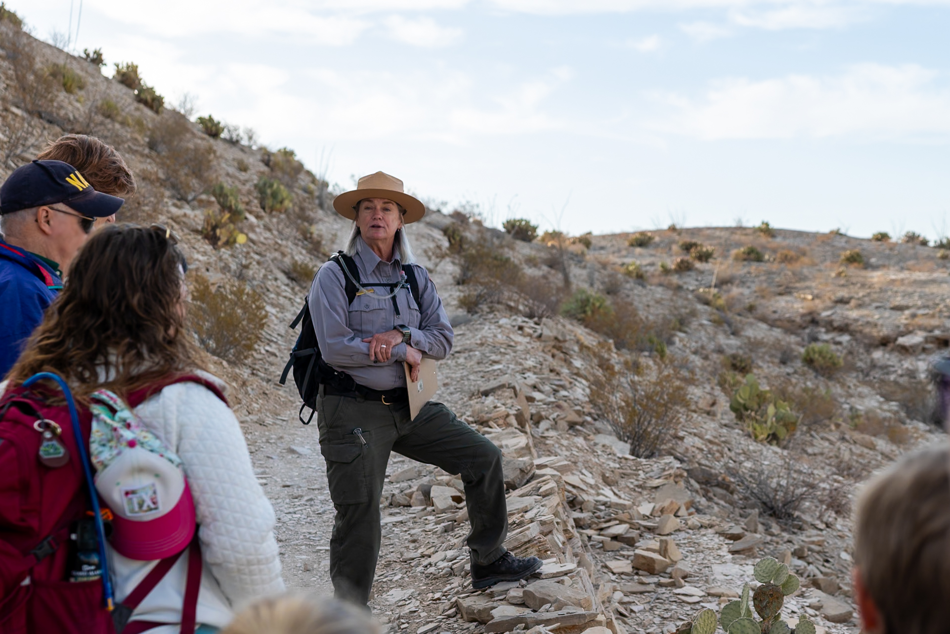
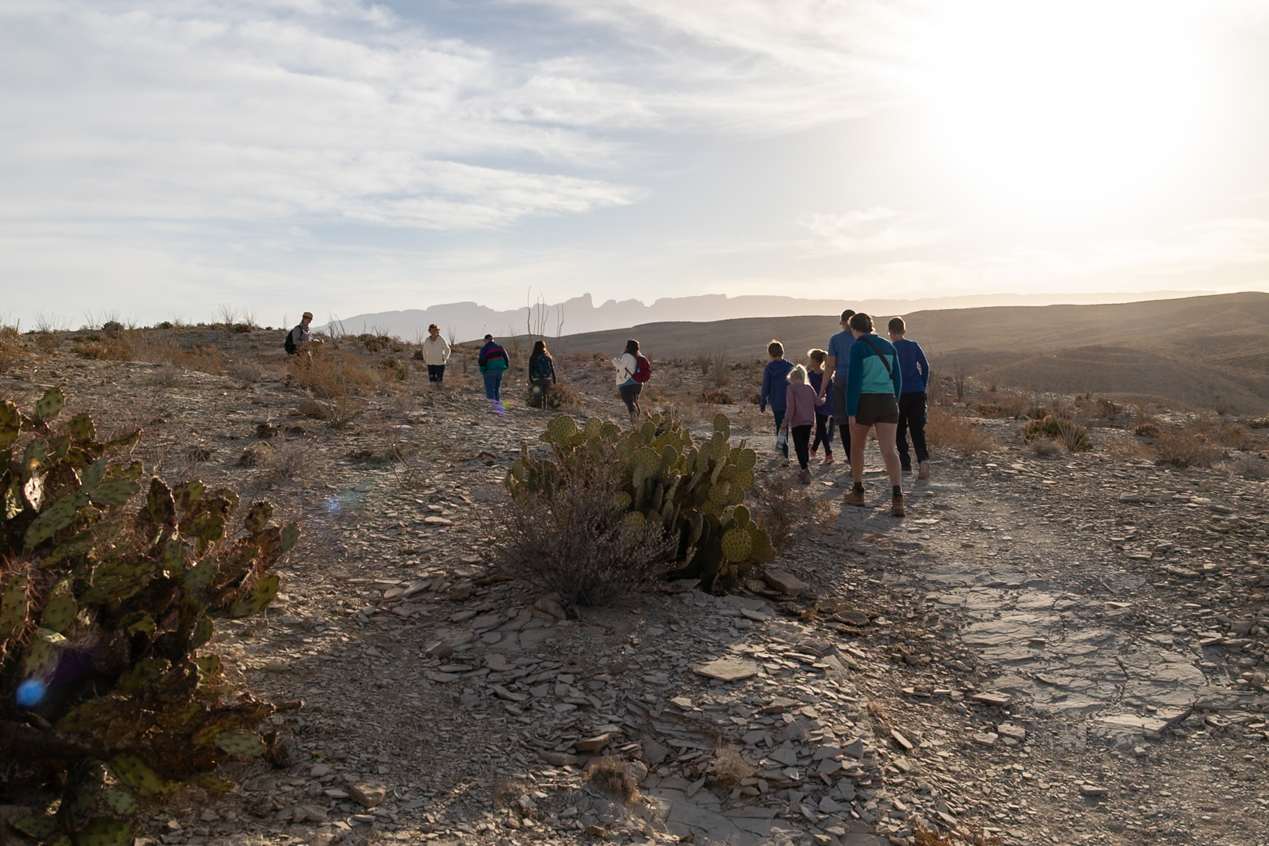
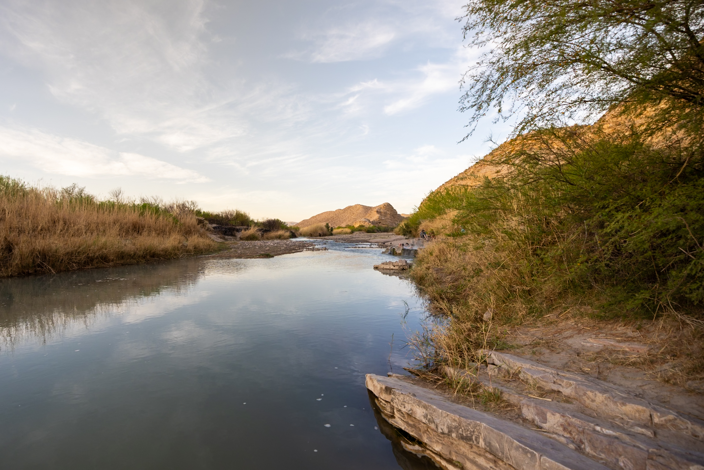
8. Hot Springs Trail
The Hot Springs Trail is a short, scenic hike leading to a natural hot spring along the Rio Grande. We visited the Hot Springs before sunrise and then joined a ranger-led tour for the hike and learned that this area was once used as a health resort by a man named J.O. Langford. The remains of the bathhouse, post office, and motel still stand today!
Getting there requires driving a narrow, winding dirt road with a steep drop-off—this was a bit nerve-wracking in the dark! There’s parking for larger vehicles halfway down, but we drove the full route – not something I would necessarily recommend for larger vehicles like ours. Once at the springs, we soaked in the warm water, surrounded by stunning river views. It was one of our favorite memories of Big Bend National Park.
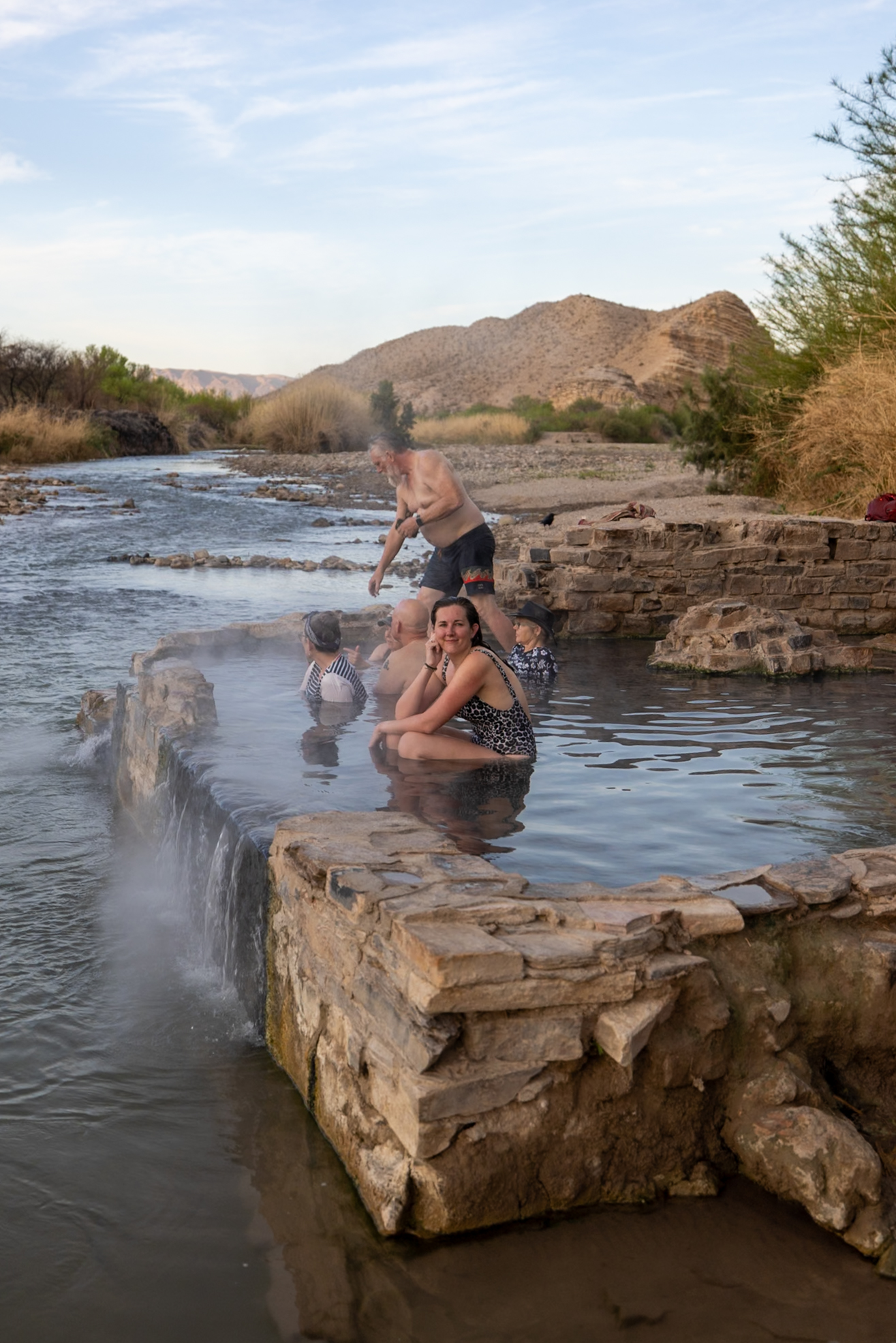
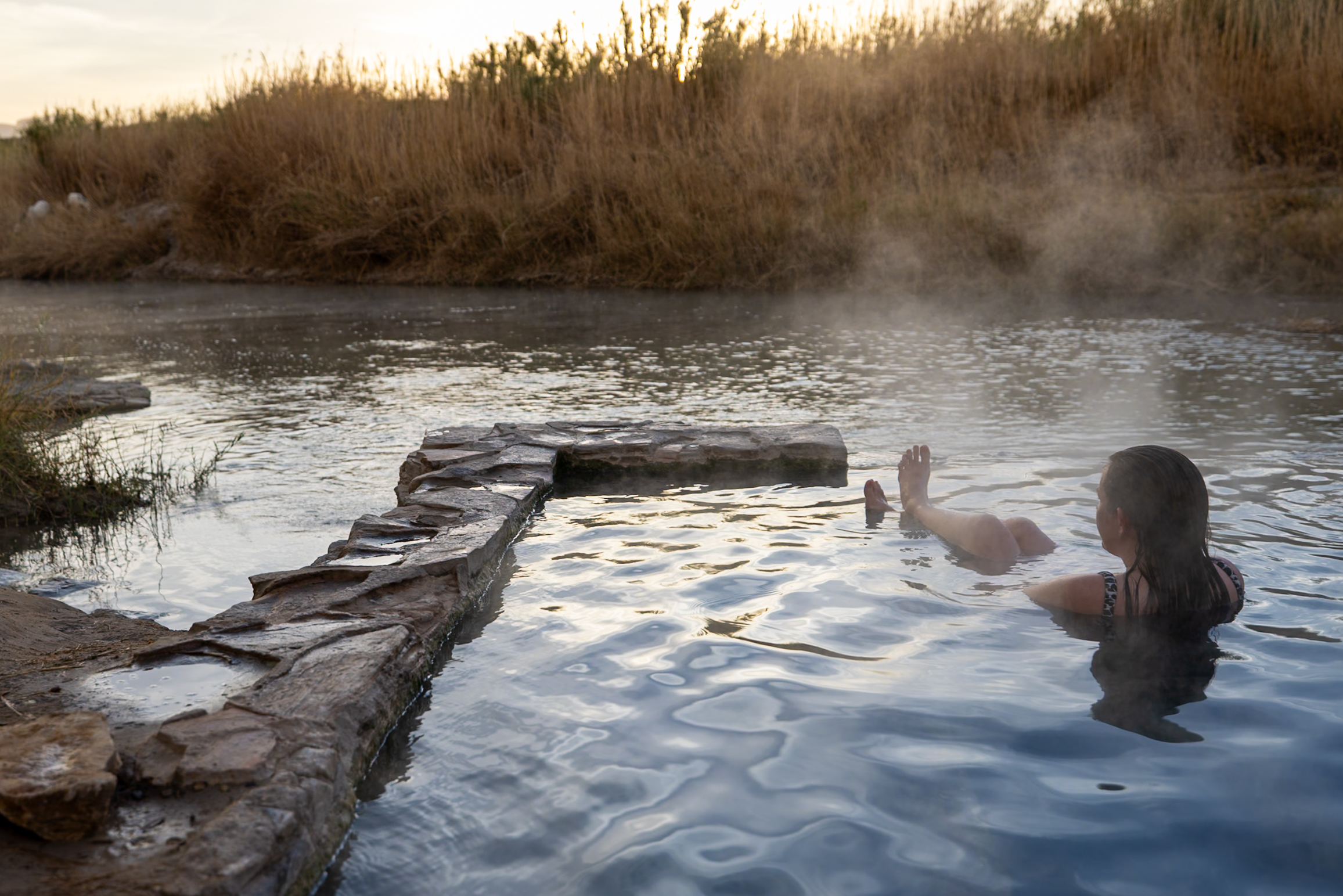
If you plan to take a dip, bring a bathing suit, towel, and water shoes. Bathrooms and trash bins are available if you need to change at the trailhead. The Park Ranger told us this fossilized water source won’t last forever, so experience it while you can!
Distance: 1.18 mi (1.9 km)
Difficulty: Easy
Estimated Time: 45 minutes
Type: Loop
9. Tuff Canyon Trail
The Tuff Canyon Trail is an easy hike that takes you down into a lesser-known canyon nestled below Ross Maxwell Scenic Drive. Though unassuming from the road, the trail offers stunning views of the surrounding mountains and canyon walls. We found it to be a relaxing, scenic stop while exploring the west side of the park.
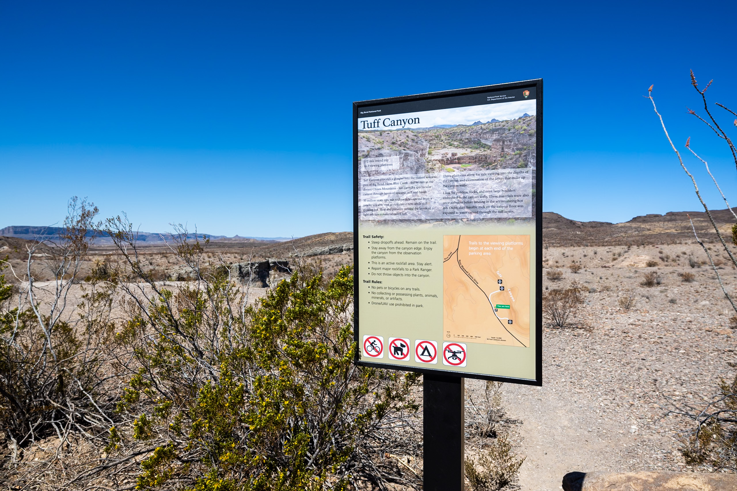
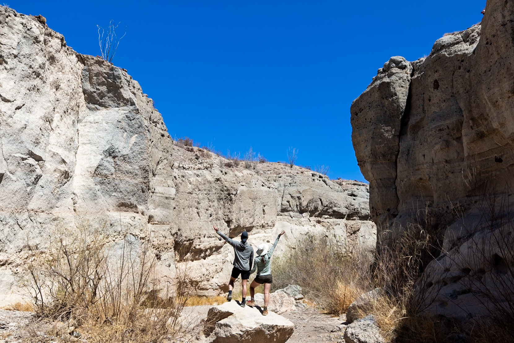
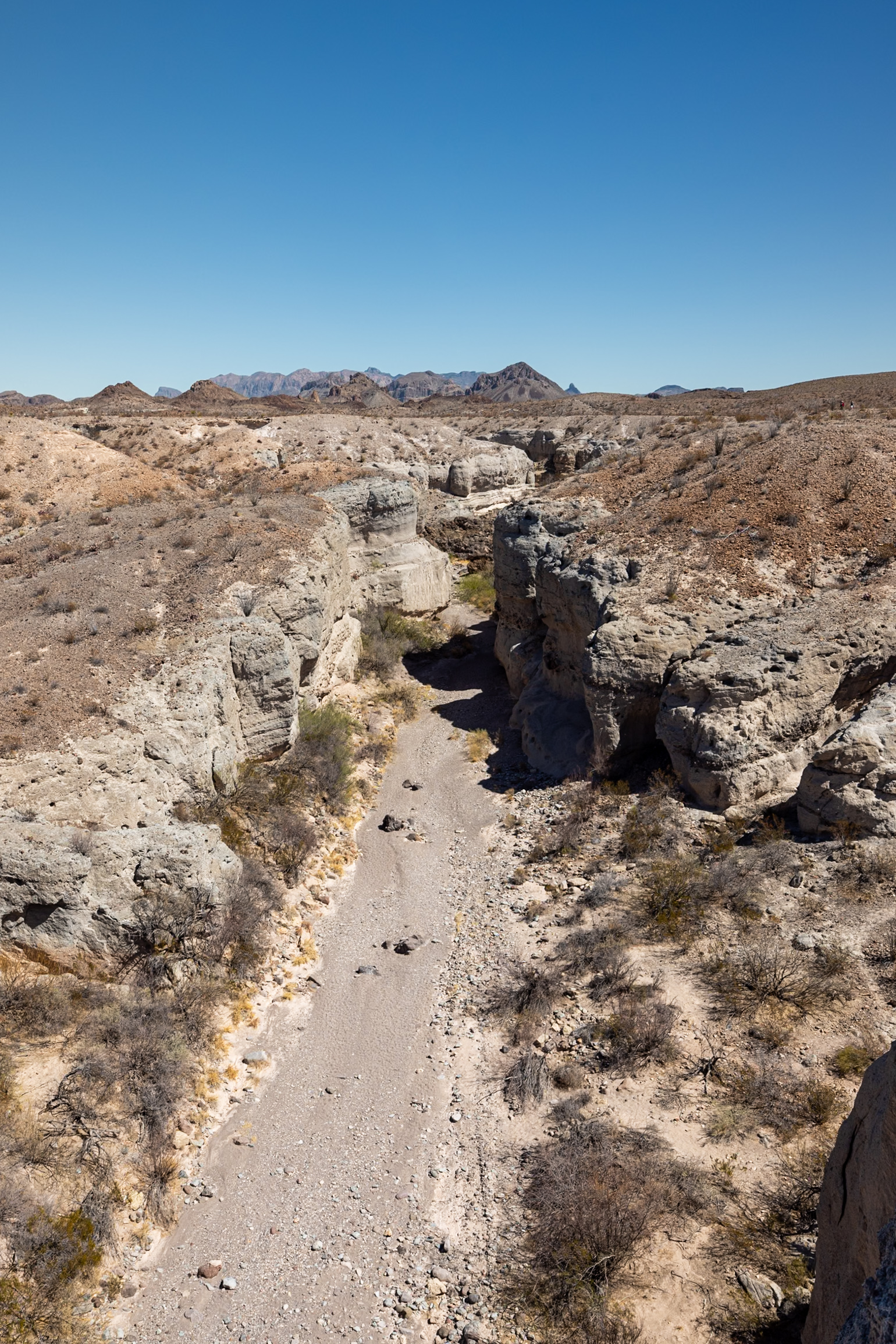
A short walk from the parking area leads to an overlook platform, perfect for those who want to take in the views without hiking. For those venturing in, the trail descends into the canyon, where you can explore the unique rock formations up close.
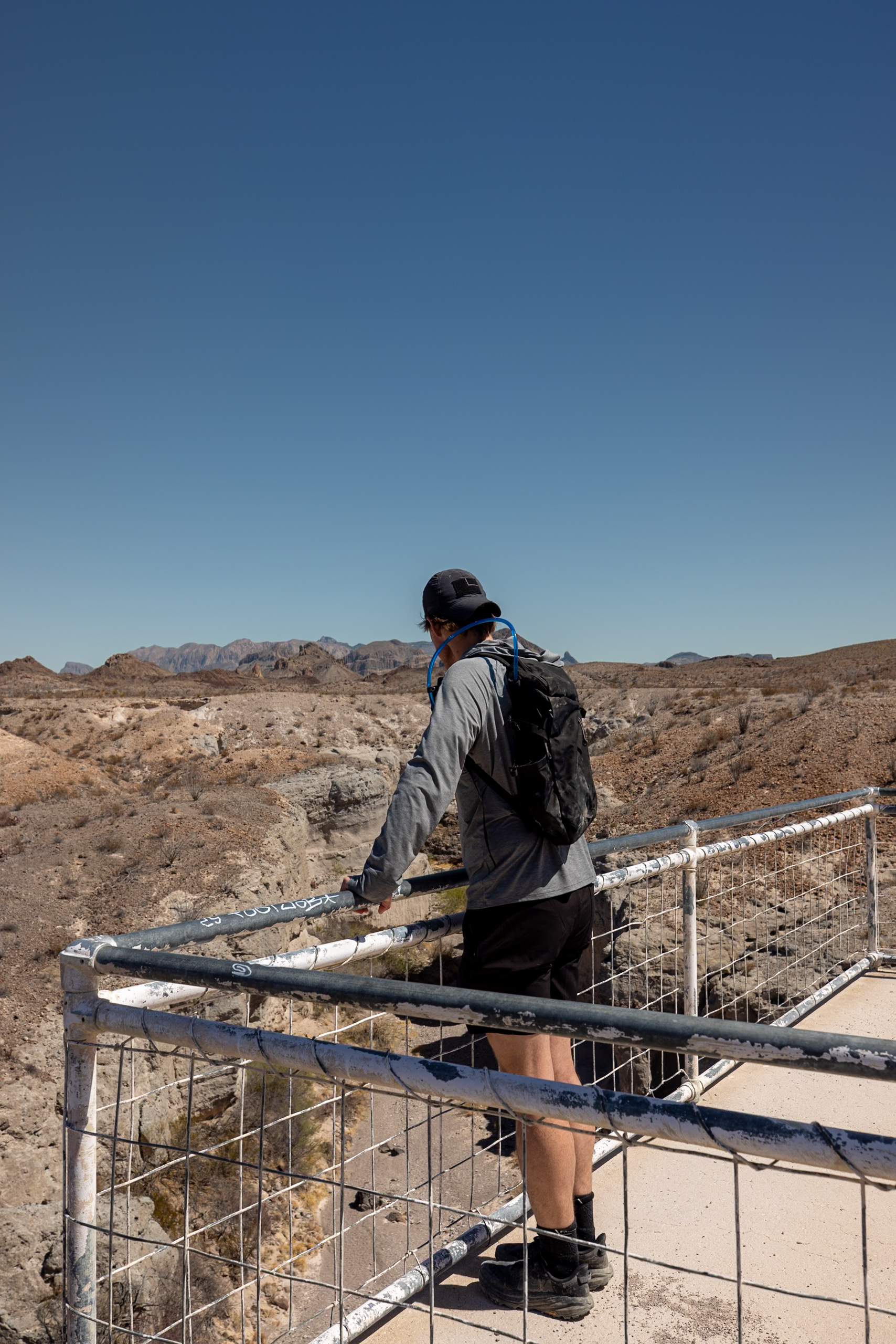
With its short distance and minimal elevation change once you make the initial descent into the canyon, this hike is great for all levels. It’s an easy way to experience Big Bend’s diverse landscapes without a major time commitment.
Distance: 1 mi (1.6 km)
Difficulty: Easy
Estimated Time: 25 minutes
Type: Out and back
With offline maps, wrong-turn alerts, and extra planning features, make the most of every outside adventure with AllTrails Plus. Get 7 days of AllTrails Plus for free!
🗺️ Map of the Best Hikes in Big Bend
Here we’ve pinned our top 9 hikes in Big Bend. We were able to mark the trailheads for some of them, but we always recommend using AllTrails to navigate the trails themselves. This map is designed to give you a sense of the areas each trail covers within the park.
How to use this map: We have saved the locations from this guide on this map. You can save this map to your Google Maps by pressing the star icon. In your Google Maps, click the menu icon and then Saved Maps, where this map will appear.
📅 Best Time of Year to Hike in Big Bend
The best time to hike in Big Bend is from November to April, when the weather is mild and perfect for outdoor activities. We visited in mid-March, and while we encountered some crowds and parking challenges at popular trailheads, the pleasant temperatures made up for it.
Summer in the park brings extreme heat, with temperatures often exceeding 100°F, and many campgrounds and visitor centers close from May 1 to October 31. For the most comfortable hiking experience, aim for the cooler months to avoid the sweltering summer conditions.
🎒 Big Bend Packing Essentials
From sun protection to comfortable hiking shoes, here’s a quick list of our top hiking essentials for Big Bend National Park. For a more extensive list, head over to What to Pack for Big Bend: Ultimate Packing Guide.
Hiking Essentials
Read next: Hiking Gear for Beginners!
Sun Protection
Safety Essentials

🎫 Consider investing in the America the Beautiful pass for $80 like we did if you’re planning on travelling to several parks within the year.
📰 Related Articles
- How to Camp in Big Bend National Park: Tent & RV Camping Guide
- Boquillas, Mexico: The Perfect Half-Day Trip from Big Bend
- What to Pack for Big Bend: Ultimate Packing Guide
- South Rim Trail at Big Bend National Park Hiking Guide
- The 5 Visitor Centers of Big Bend: What You Need to Know
- 17 Must-See Attractions in Big Bend National Park
- 3-Day Big Bend National Park Itinerary & Ultimate Guide
📺 Watch on YouTube
📌Pin this post!
Pin this guide with the best hikes in Big Bend National Park to help plan your trip!


Leave a Reply
You must be logged in to post a comment.