

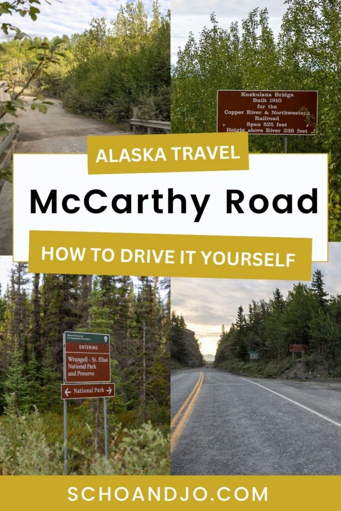
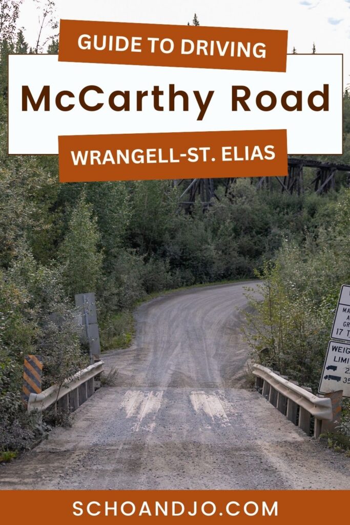
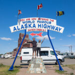
Interested in driving Alaska’s McCarthy Road into Wrangell–St. Elias National Park? As one of only two roads that can gain you access to Wrangell-St. Elias, driving it is one of the top things to do in the park. But as this road is renowned for its tumultuous lumps and bumps, it’s common to feel a bit wary.
Lucky for you, we drove it ourselves so you don’t have to guess what you’re getting into. Below, we break down everything you need to know to safely navigate McCarthy Road: how long it takes, what to bring, the best stops along the way, and more!
If you’re still feeling cautious by the end of this article, we’ve outlined a few alternatives to driving McCarthy Road that can still drop you off in McCarthy.
Note: We use affiliate links which provide us a little kickback each time you use one of our links and make a purchase, without any additional cost to you. We do not recommend products that we don’t already love or have heard great things about, so you can trust we’re only suggesting great products to you.
ℹ️ About McCarthy Road
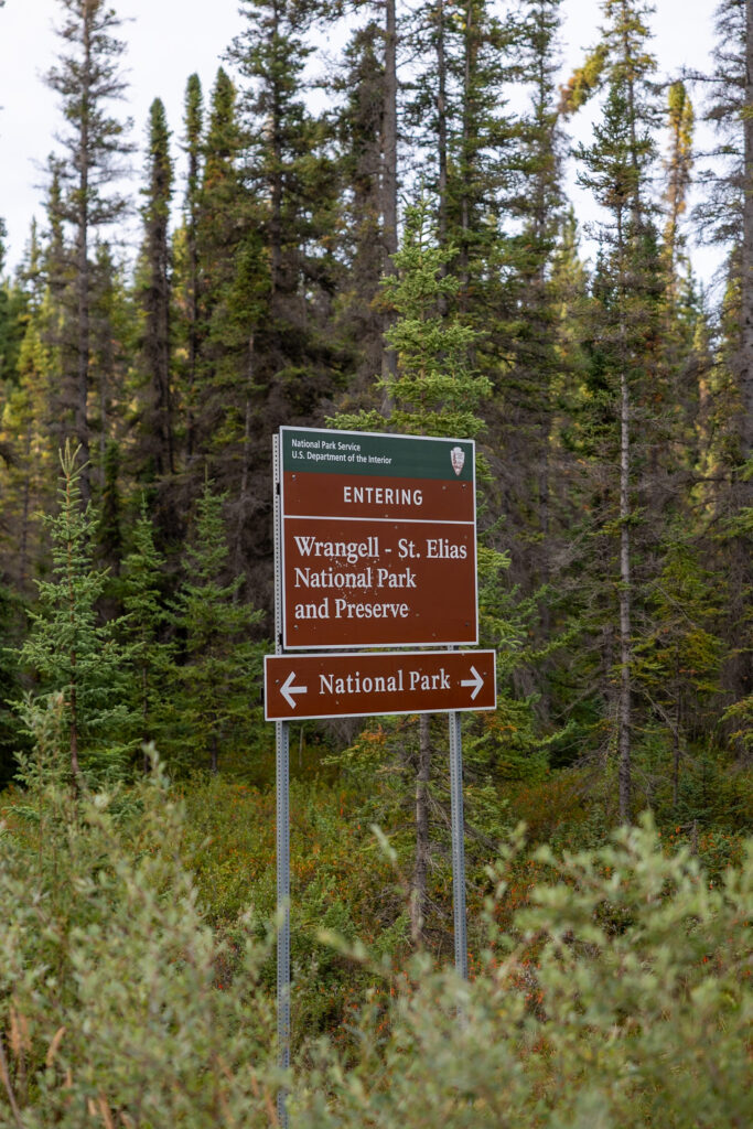
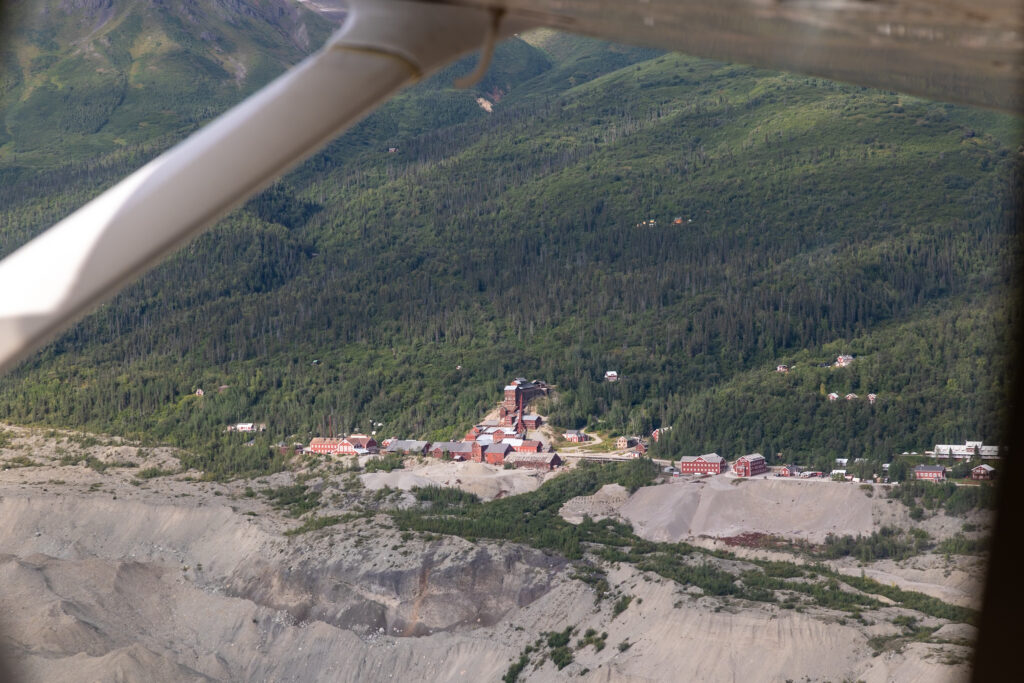
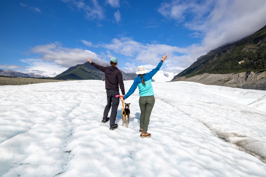
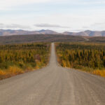
Driving McCarthy Road is one of the top things to do in Wrangell–St. Elias National Park. This 60-mile (96-km) gravel road connects the town of Chitina (pronounced Chit-Na) to a footbridge that brings you to McCarthy. Reaching McCarthy gives you access to some of the most popular things to do in all of Wrangell-St. Elias National Park, including visiting the Kennecott Mines National Historic Landmark or hiking the Root Glacier Trail.
Following the route of the old Northwestern Railway, this road was once used to haul copper ore from the Kennecott Mines. Along the way, there are tons of interesting sites, from historic bridges to calm lakes, that you can pull over and stretch your legs at.
We’ll be honest: we were a bit nervous about driving this road ourselves. It’s known to be quite rough, and rumor has it that there are still old railroad ties hidden beneath the gravel. That being said, we didn’t hit or see a single tie during our drive. While it was bumpier than pavement, the road’s conditions seem to have improved in recent years. Driving slowly made us feel even safer.
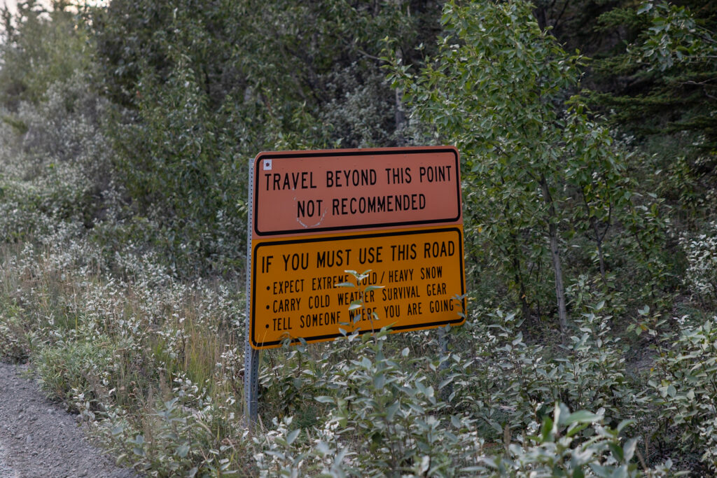
🌲 Be Mindful of Private Land: You’ll pass through Native and private lands several times throughout this drive (signs point out where you are). Ensure you follow the local rules for the area you’re in. For example, you may be asked for compensation if camping on Native Land but you can camp for free on public land.
🚗 How to Drive McCarthy Road: Step-by-Step
Below, we outlined step-by-step how to prepare for and then successfully drive McCarthy Road. From double-checking your vehicle to finding the beginning of the road to navigating the road itself, here’s everything you need to know!
1. Check Your Vehicle
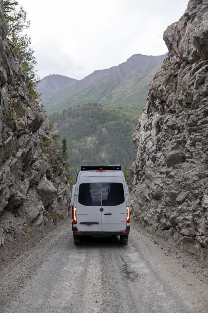
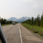
Despite its rough reputation, you don’t need a 4×4, or even AWD, to drive McCarthy Road. Most standard cars, trucks, vans, and Class B or C RVs do just fine as long as you take it slow and watch for potholes and washboards. Larger RVs and trailers are generally discouraged because of tight sections and uneven terrain, but people do manage it. We tackled the drive in our Sprinter van and had zero issues.
If you’re renting a car, inform your rental company about McCarthy Road before booking a vehicle. Some allow travel on unpaved roads, and others strictly prohibit it—better to double-check than risk a fee or violation.
2. Fill up on Gas & Download Maps
Fill up on gas either at Wrangell View Store in Chitina or beforehand in the towns of Glennallen, Kenny Lake, or Copper Center. Remember that there’s no gas once you’re on McCarthy Road, not even at the end of it. This means you’ll need enough gas to carry you there, and back—a total of roughly 120 miles (193 km)
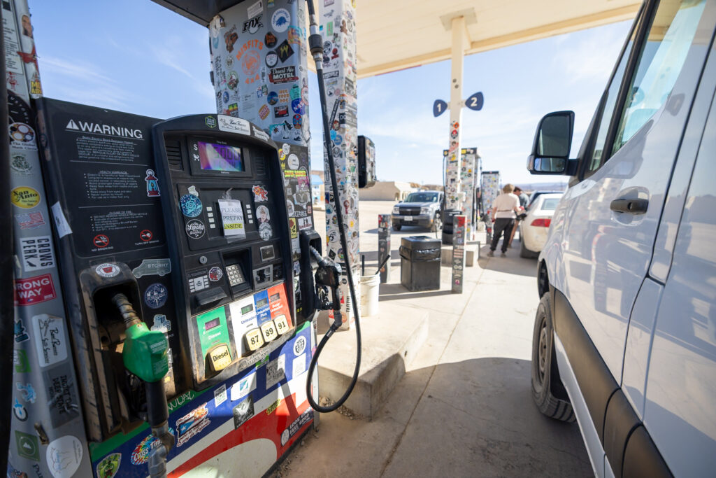
Also, keep in mind that there’s no cell service for most of the route. Because of this, we recommend downloading offline Google Maps before starting down McCarthy Road.
3. Drive to the Start of McCarthy Road (Chitina, Alaska)
To reach McCarthy Road, you’ll first need to reach the small town of Chitina. Most visitors drive from Anchorage. You can expect a full travel day to reach Chitina before even starting the road to McCarthy. Below, you’ll see the route from Anchorage to Glennallen, Glennallen to Chitina, and then Chitina to McCarthy.
- From Anchorage to Glennallen, you’ll drive east on AK-1, a well-paved road. There are occasional frost heaves, but otherwise, it’s an easy drive.
- At Glennallen, you’ll take a right to go south on the Richardson Highway. This highway is also paved and has some potholes and frost heaves. It’s still in relatively good condition.
- Take a left at the Edgerton Highway (AK-10). This scenic, paved 60-mile (96 km) route ends right at the Chitina Ranger Station. Although this road is paved, it is not well-kept and has potholes and frost heaves.
We drove from Anchorage to Chitina in one day and then drove Chitina to McCarthy on the McCarthy Road the following morning.
4. Stop at the Chitina Ranger Station
We highly recommend stopping at the Chitina Ranger Station before starting McCarthy Road. It’s open late May through late August, Wednesday–Monday from 9 AM to 5 PM, and the rangers there can update you on current road conditions, weather, wildlife activity, and any recent washouts or closures. You can also call them at (907) 823-2242.

5. Air Down Your Tires
While not absolutely necessary, airing down your tires can make for a smoother ride on McCarthy Road. We used this tire deflator before starting the drive, and this inflator to reinflate our tires when we completed the road. We recommend carrying a spare tire and a tire repair kit for good measure. During our time in Alaska, we often saw drivers with two spare tires. It’s a good idea to know how to change a tire before you head out, just in case.
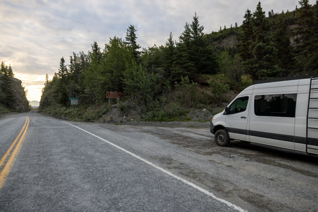
6. Start Driving McCarthy Road
Now you’re ready to start down McCarthy Road! The first stretch is fairly easy and allows you to settle into the rhythm of the drive while enjoying views of the surrounding forests and rivers.
📻 FREE Audio Tour! We highly recommend listening to this free NPS audio tour of McCarthy Road while you drive.
You’ll experience a mix of pot holes and frost heaves on the “paved” section (paved is a generous term) and a mix of washboards and pot holes on the gravel sections. Keep an eye out for wildlife, be wary of the road conditions, and remember to drive slowly (especially when there’s oncoming traffic)!
7. Make These Stops on McCarthy Road
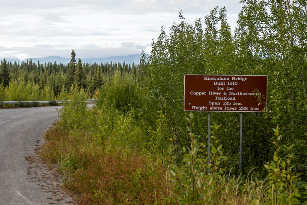
Below, we’ve listed the stops we recommend along McCarthy Road, with a bit of info on each. The most popular by far is the Kuskulana Bridge, which is located about 1/4 of the way down the road, at Mile 17. There are even more stops you can make on this road, but we’ve boiled it down to the top highlights.
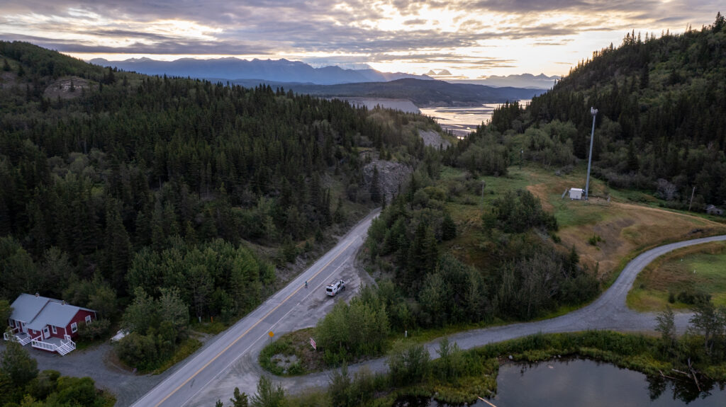
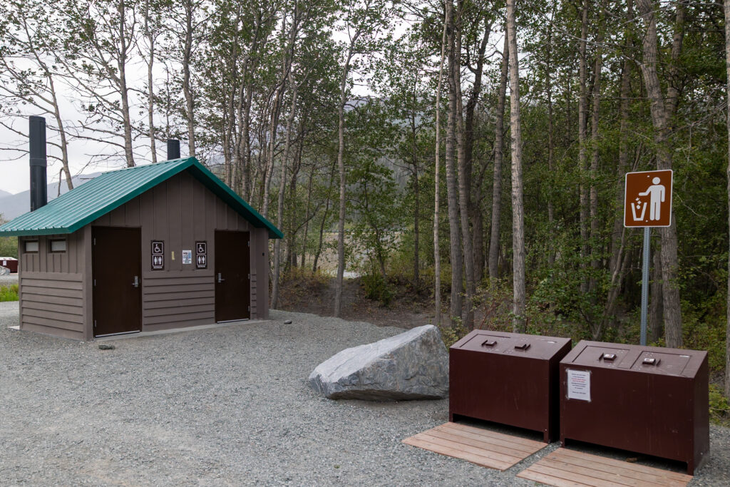
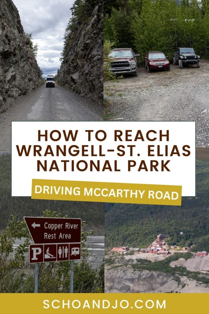
- State Wayside (Mile 0): This is where the pavement ends and the gravel begins. You’ll find informational boards and restrooms here. Just beyond, you’ll drive through the “railroad cut,” originally a tunnel for trains running through the area.
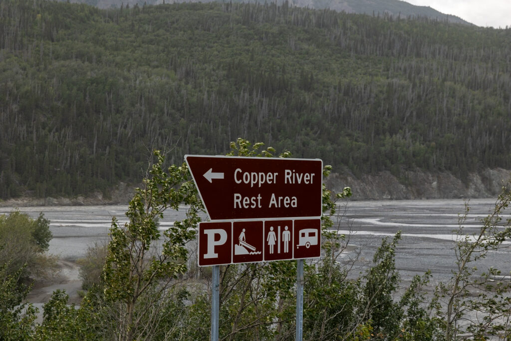
- Copper River Bridge (Mile 1.4): This bridge spans the Copper and Chitina Rivers. You can’t stop in the middle for photos, but there are several small pull-outs nearby. If you’re camping, Copper River Campground is on the right just after the bridge.
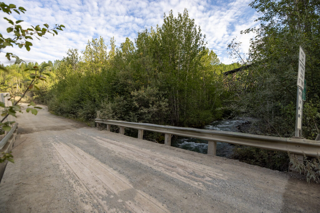
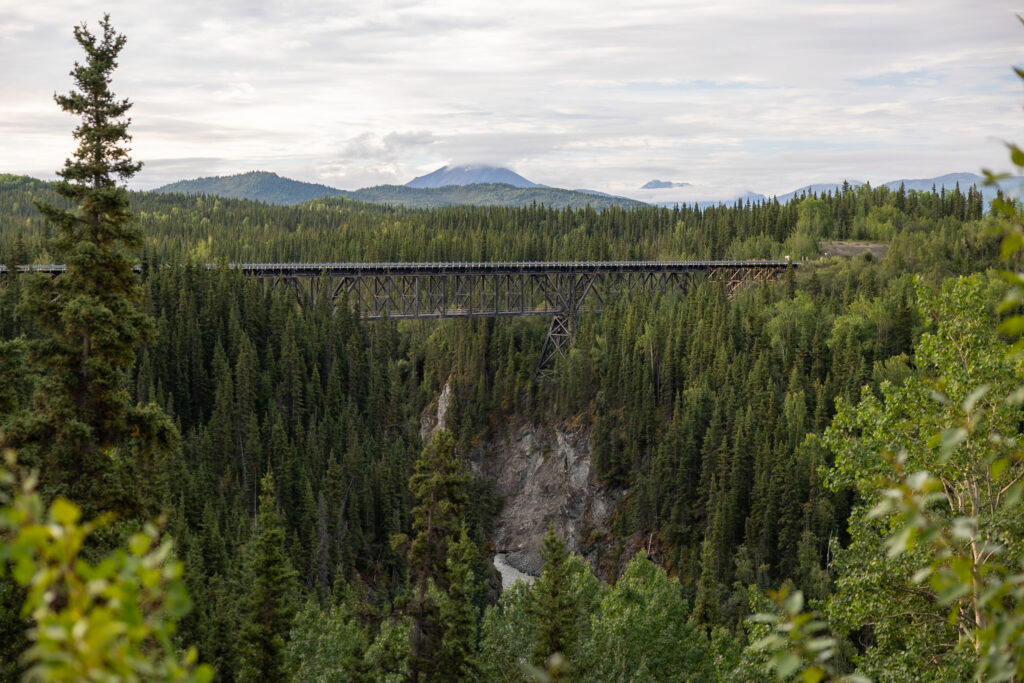
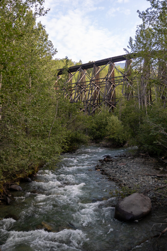
- Kuskulana River Canyon & Bridge (Mile 17): Suspended nearly 240 feet (73 m) above the river, this old railroad bridge dates back to 1910. Narrow and one lane only, it’s an unforgettable experience to drive across. You can take photos before or after the bridge, and there’s a rest area with toilets shortly beyond it.
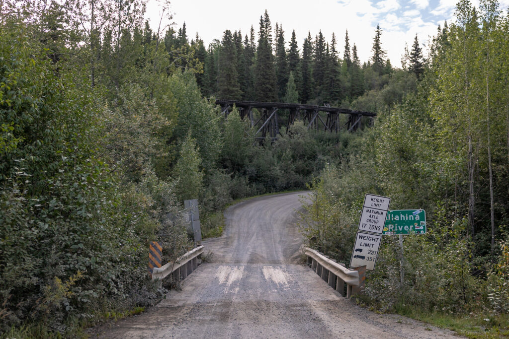
- Gilahina River & Gilahina Trestle Wayside (Mile 29): Built in just eight days during the winter of 1911, this 890-foot-long, 90-foot-high wooden trestle was a remarkable feat for its time. The wayside has restrooms and a short 0.5-mile trail to stretch your legs.
- Crystalline Hills Area (Mile 34.8): Keep an eye on the Crystalline Hills to the left of the road, where Dall sheep are commonly seen. Binoculars are highly recommended!
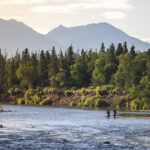
- Long Lake (Mile 45.5): A beautiful lunch stop if you started early in the morning. From September to April, about 18,000 sockeye salmon make their way up the Copper and Chitina Rivers to spawn here.
- End of McCarthy Road (Mile 60): Congrats! You made it to the end of McCarthy Road!
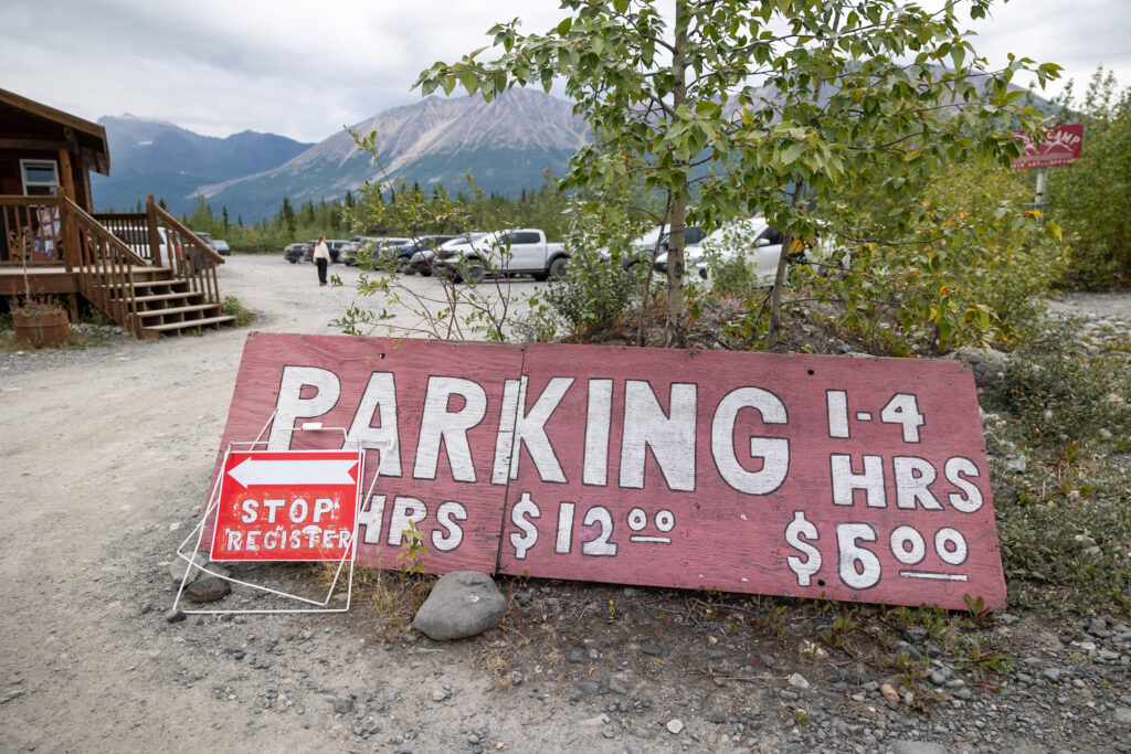
8. Park by Base Camp Kennicott
At the end of the road, park at the designated lot ($6 for 0-4 hours or $12 for a full day) and walk across the McCarthy Footbridge into the town of McCarthy. Carts are available to help carry your gear to the other side, where you can then take a shuttle into McCarthy and Kennecott!
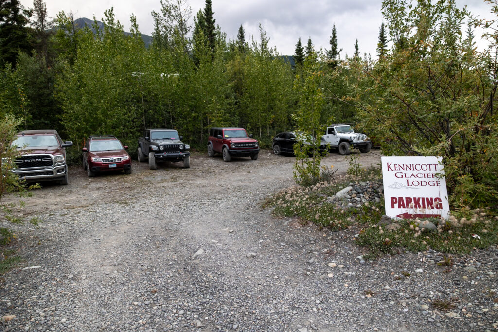
🏕️ Go Camping! Right by the footbridge is Base Camp Kennicott, the closest campground to McCarthy, fees are $35-45/night. We stayed just one night, but the views and location are unbeatable. Free pull-offs along McCarthy Road are also an option if you want to save.
❓FAQs: Driving McCarthy Road
How long does it take to drive McCarthy Road?
Although NPS recommends 2 hours, plan to take at least three hours one way. While the road is only 60 miles (96 km), rough gravel, potholes, and washboarded sections slow things down—and you’ll probably want time to pull over for photos and viewpoints.
2 hours would be enough only if you planned to not stop at all and kept up a steady pace. You’ll likely see locals driving this road at faster paces, so it’s definitely possible to get it done in 2 hours.
When is the best time to drive McCarthy Road?
The best time to drive McCarthy Road is during the summer months—late June through early September—when the road is most likely to be clear of ice or snow. This window aligns with the larger visitor season for Wrangell–St. Elias National Park, when trails, tours, and local businesses are fully operational and weather conditions are friendlier.
As far as the best time of day to drive McCarthy Road, we recommend driving during daylight. If your goal is to explore McCarthy and Kennecott in a single day, leave at first light to maximize your time in the park.
That being said, if you’re coming from farther away or have multiple days to spend, starting the drive after lunchtime works just fine as well. Personally, we recommend staying a minimum of one night in McCarthy since driving McCarthy Road is a lot. It’s a tough road to drive there and back in one day.
What other options are there besides driving?
The Kennicott shuttle can take you from Glennallen, Chitina, and other nearby towns into McCarthy for $119-169 round-trip, depending on where you leave from. Another option is to take a charter flight from Chitina with Wrangell Mountain Air for about $205 one-way, dropping you off right in downtown McCarthy. Taking a charter flight is also a way to experience part of the popular flightseeing tours of Wrangell-St. Elias National Park.

What is there to do in Wrangell-St. Elias?
The top things to do in this area of Wrangell-St. Elias include going on a tour of the Kennecott Mines, hiking the Root Glacier Trail, and taking a flightseeing tour of the park. If you’re hungry, stop at The Potato—we had an amazing meal here!
📰 Read More! For a full breakdown of everything there is to do in Wrangell-St. Elias National Park, check out our guide to 15 Things to Do in Wrangell–St. Elias: The Largest US National Park.
📰 Related Articles
- How to Choose an Unforgettable Flightseeing Tour of Wrangell-St. Elias
- The 9 Best Hikes in Wrangell-St. Elias National Park, Alaska
- How to Drive McCarthy Road to Wrangell-St. Elias: Step-by-Step
- How to See Wrangell-St. Elias National Park in 48 Hours
- 15 Things to Do in Wrangell-St. Elias: The Largest US National Park
- 11 Best Things to Do in McCarthy, Alaska: Ultimate Travel Guide
📺 Watch on YouTube
- Coming Soon!
🔍 Ready to Visit Wrangell-St. Elias National Park?
Pin this guide to driving McCarthy Road into Wrangell-St. Elias National Park to make planning your upcoming trip a breeze!

Leave a Reply
You must be logged in to post a comment.