

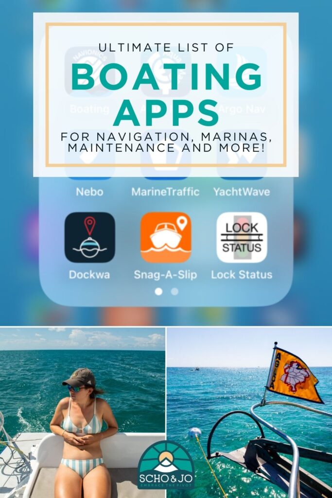
Although boating has been done for centuries without any fancy apps or technology we have today, we relied on many different apps aboard PIVOT. During our 6,000-mile boating journey around the United States and Canada, we consistently used several marine and boating apps on both our smartphones and tablets. We’ve compiled the apps we’ve personally used most frequently, from navigation assistance to boat locators and social networking for boaters.
By downloading these apps before you leave your dock, you’ll set yourself up for success by having the right tools (or apps) to enjoy a stress-free boating experience. In this comprehensive guide, we’ll explore some of the best boating apps available today and which ones we actually use. Whether planning a leisurely cruise or embarking on a nautical adventure like America’s Great Loop, these apps will surely enhance your boating experience.
Note: We use affiliate links which provide us a little kickback each time you use one of our links and make a purchase, without any additional cost to you. We do not recommend products that we don’t already love or have heard great things about, so you can trust we’re only suggesting great products to you.
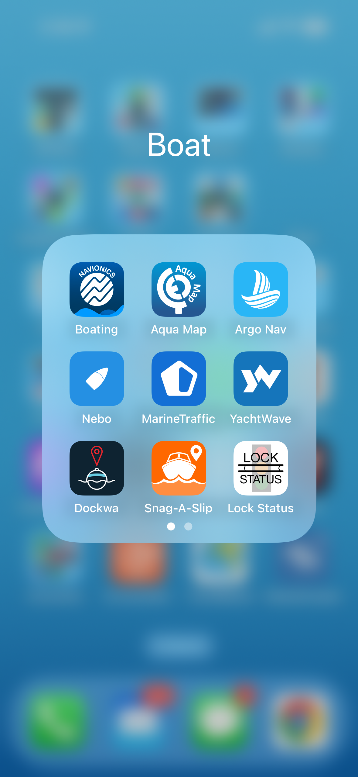
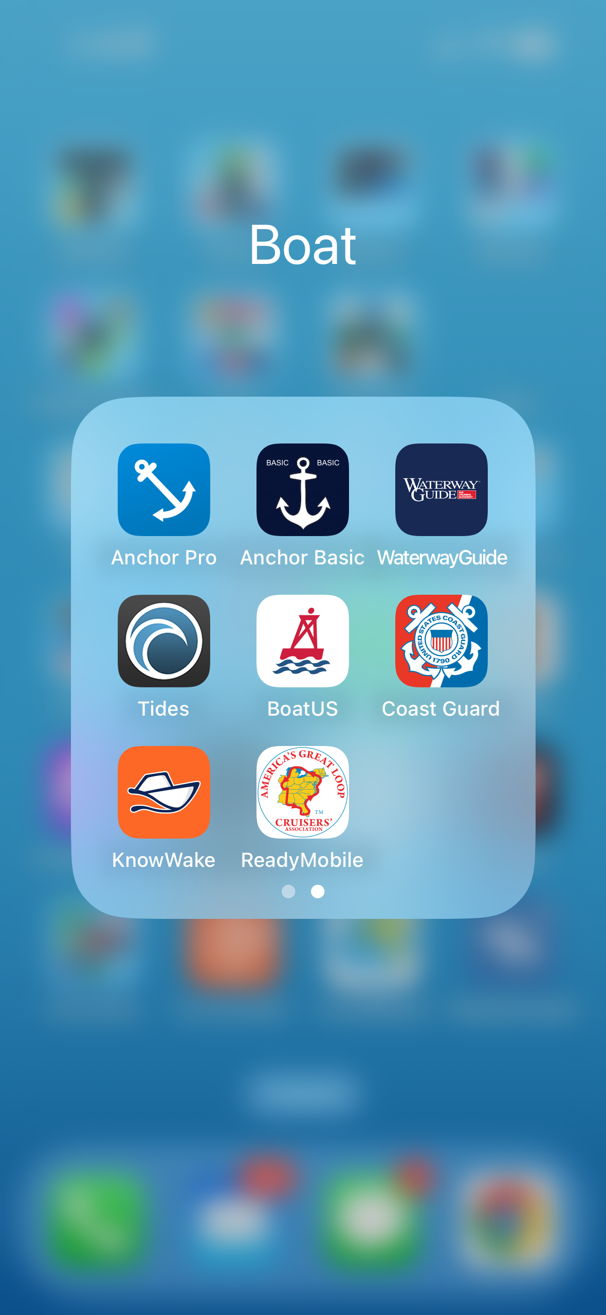
Marine Navigation Apps
We boated 10,000 miles and tried so many boating navigation apps. Here are some of the ones we tried and tips and tricks we learned with each one. Remember that no digital navigation chart software is perfect, and each one still requires the boater to be mindful and alert at the helm.
Navionics
Navionics is a top-rated navigation app that provides detailed charts and maps for boaters worldwide. Its strengths lie in its extensive coverage and user-friendly interface, making it easy to plan routes, mark waypoints, and navigate safely on the water. We love the ability to mark anchorages, customize relief shading to identify areas of shoaling easily, and its connection to Active Captain. Garmin owns Active Captain, an open-source software that collects reviews on anchorages, marinas, and other important boating information in one easy-to-use platform. Navionics was our most used app while living on a boat.
Price: the app requires an annual subscription, and the price depends on the extent of maps you want. For example, the navigation maps in the United States and Canada cost $49.99/year.
AquaMap
AquaMap is another popular boating navigation app that offers a wide range of features. In addition to detailed charts and maps, AquaMaps includes advanced navigation tools such as route planning, weather, tides, and AIS integration. We used AquaMaps primarily for two use cases:
- areas where we want the most recent USACOE surveys, like the southeast US Intracoastal waterway
- when we were boating at night, as Aquamaps has a great night mode.
We also downloaded Bob423’s Tracks, which overlaid onto AquaMaps and helped us navigate the chronic shoaling areas on the ICW. AquaMaps also has a built-in anchor alarm, and a connection to Active Captain, which we use frequently! Our friends have also told us that AquaMaps are superior in the Bahamas.
Price: The app requires an annual subscription, with pricing depending on the number of maps you want. For example, the navigation maps in the United States and Canada cost $14.99/year (Expert); $24.99/year (Master).
Ditch
Ditch is a new navigation app released in 2024. Ditch brings “Local Knowledge” to your navigation by using real AIS data combined with NOAA and USACE, all with their AI Smart Path technology. Waterways are constantly changing, and accurate, historical AIS information is a great way to ensure your tracks are currently navigable.
Price: The app requires an annual subscription for $29.99/year
Argo
Argo is another navigation app that compiles offline charts, weather, wind, tides, custom depth shading, charts, and routes into one seamless app. We love the custom depth shading, which allows us to identify areas of shoaling and log captain reports easily. Having personally met the founder of Argo, Jeff Foulk, we really like how the app blends marine navigation and social boating. We didn’t use Argo while boating, mainly because we didn’t learn about it until later! If you use Argo, let us know what you think in the comments!
Price: Free for their Basic Plan, Argo Premium is annual: $39.99/year, monthly: $6.99/month.

Read The Best Marine Weather Apps for Boating to see what marine weather apps we recommend and regularly use!
Tides
Tides is a handy app that provides accurate tide and current information for thousands of locations worldwide. We used Tides to plan our trips to optimize current, save fuel, safely navigate shallow waters, and avoid strong currents. While the app’s basic features are free, premium features such as extended tide forecasts and offline access require a subscription. Tides offers essential information for boaters in an easy-to-read format so we can easily plan our cruises with the tides. We often used Tides on the east coast to favor the current in our direction of travel, giving us an extra boost of speed.
🧠 Add Tides to your smart watch to know the tides at a glance!
Price: Free
Heading out on a trip? Don’t skip the insurance. After getting Zika in Colombia and breaking my wrist on the Maryland coast, I learned the hard way. Travel insurance is non-negotiable. SafetyWing’s Nomad Insurance Essential covers 175+ countries for illness, injury, delays, lost luggage, and trip interruptions, with flexible plans you can buy, cancel, or auto-extend at any time. Check it out here.
Sponsored by SafetyWing
Boating Apps for Community
One of the best parts of boating is the community. Hands down. These are a few apps that use apps to strengthen the boating community by allowing you to connect with other boaters, communicate with messaging, and ask for recommendations or suggestions.
Nebo
Nebo is a unique boating app that combines a captain’s log with social networking, allowing users to share their boating experiences with friends and fellow sailors. It was easily one of our favorite apps on the water because it allowed us to connect with other boaters, ask boaters for recommendations, and have a unique flag icon that helped us find other Loopers. We’re huge fans of Nebo for elevating our Great Loop experience, and we wouldn’t do the Great Loop without Nebo and the hardware device.
Price: The Nebo Starter Membership is free. The “Gold” option is $99.99/year or $12.49/month. The “Silver” option is $53.90/year or $6.49/month. The Nebo Link has a one-time cost of $199.
Sea People
Sea People is a new app developed by the crew from Sailing La Vagabonde. This app is designed to track your voyages without needing a hardware device; instead, it uses your phone’s internal GPS. It’s designed to make connecting with other boaters and staying in touch with the friends you make on the water easier. If you’ve tried Sea People in Beta, let us know what you think below!
Price: Free
Travel Boast
Although Travel Boast isn’t a “boating-specific travel app,” it is a fun way to document your travels by boat (or other means of travel) and share it with friends and family or on your social media accounts. The app allows you to customize your travels through an easy-to-use interface.
Price: Free with in-app purchases for upgraded features
Boating Apps for Maintenance
YachtWave
YachtWave is a comprehensive boating app that offers a wide range of features tailored specifically for yacht managers and boat owners. With a tagline Boat Ownership has Never Been Easier, YachtWave focuses on the daily and yearly maintenance obligations of boat ownership. After setting up your boat(s) and their engines, generators, and heavy equipment, you can add your spares and set up your boat maintenance tasks. The best part is that you can share this with other crew members if you are not personally maintaining your own boat. Since your maintenance is moving from your captain log into the YachtWave App, you can now easily share and search your information and pull it up whenever you need it.
Price: Free for personal use.
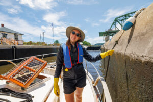
Boating Apps for Locking
Lock Status
Lock Status is a great app for finding information about upcoming locks. We found it a great resource when planning our travel itinerary for the following day, as it allowed us to see what was coming up and the last lock-through that occurred.
Price: Free
Read our post on How to Lock A Boat (Our Step-By-Step Process)
Boating Apps for Vessel Tracking
Marine Traffic
Marine Traffic is a must-have app for boaters seeking real-time vessel tracking and AIS data. With its extensive database of ship positions and comprehensive coverage of maritime traffic worldwide, Marine Traffic provides invaluable insights into vessel movements and navigation hazards. While the app’s basic features are available for free, premium features such as extended vessel details and route predictions require a subscription. Marine Traffic remains a valuable tool for boaters seeking to enhance their situational awareness of the water. We frequently used this app since we didn’t have AIS and wanted information on barge, tug, and ship traffic in the Chesapeake Bay, Great Lakes, and Midwest rivers. Whenever we experienced fog, we used Marine Traffic to give us extra data on boats near us.
⚠️ AIS data is sometimes delayed through Marine Traffic so keep that in mind
Price: Free with optional in-app purchases. For Access Plus 24 is $0.99, Starter Plan Annual is $9.99, and Nautical Charts Monthly is $6.99.
Boating Apps for Emergencies
Coast Guard
The US Coast Guard app is a great way to request a USCG Safety Check, review your safety equipment, check state-by-state safe boating information, file a float plan, and report hazards, pollution, or suspicious activity. We used this app to look up boating rules as we cruised, ensuring we followed the rules and obeyed the laws on the waters to the best of our knowledge.
Price: Free
Boating Apps for Towing
Boat US
The BoatUS app allows you to carry your BoatUS membership card easily, request a tow, add your insurance policy, and find out location information such as weather, tides, buoys, and discounts. We used the app to keep our BoatUS membership card handy as we thankfully did not need a tow.
Price: The app is free, but a Boat US yearly membership costs $215/year for unlimited towing with other cheaper membership options available.
We used BoatUS to have peace of mind while cruising, knowing help was only a radio call away. Sign up for BoatUS here!
Sea Tow
The Sea Tow app allows you to request a tow, carry a digital version of your Sea Tow membership card, and show your latitude and longitude.
Price: The app is free, but Sea Tow’s yearly membership is $249/year.
C-Tow
The C-Tow app is specifically for Canadian boaters or boaters who are boating in Canada and want towing assistance. The app allows you to request a tow, carry a digital version of your C-Tow membership card, pinpoint your GPS location, check current Environment Canada marine weather conditions, including weather alerts, see tide predictions for coastal areas, check your speed and heading, and locate nearby marinas, marine facilities, and fuel docks. Note that some Sea Tow and BoatUS memberships won’t cover you in Canada, so if you’re doing the Great Loop you may want to look into C-Tow!
Price: The app is free, but membership ranges between $145-250/year.
Boating Apps for Anchor Alarms
Having an anchor drag alarm is easily one of the best apps to have readily available if you’re planning on anchoring. We recommended downloading a few apps before leaving your home port and testing them one by one when you arrive at your anchorage to find the app you like best. If you don’t want another app, specifically for anchor alarms, try out Aquamaps if you already are using it for navigation.
Anchor! Drag Alarm
This simple anchor drag alarm is easy to use with various options depending upon your anchoring set up. It allows you to set a circle perimeter or an arch, has a dark screen mode for anchoring at night, and makes adjusting your alarm distance easy.
Price: one-time cost of $4.99
Anchor Pro
You can easily set your distance, see your past movements, and set your anchor alarm after anchoring. You can also be alerted on a secondary phone.
Price: Free with in-app purchases for $6.99
Anchor Basics
This anchor alarm app has many similar features to the previous apps and is free.
Price: $0.99
Check out our blog post on the Marine Weather Apps for boaters!
Boating Apps for Marinas
During our Great Loop, we found that many larger marinas worked with companies to make reserving a marina spot easier. As we planned our route and marina stays, we often reviewed these apps for availability and amenities. Here are the two most popular marina apps:
Snag-A-Slip
Snag-A-Slip is owned by Marina Life Company and is an easy way for boaters to book a marina or private boat slip. The app allows you to explore marinas from Canada to the Caribbean, book your slip or mooring ball with their easy-to-use app reservation system, and pay via card. It helps take the Google searches and phone tag with a marina out of the equation. Snag-A-Slip doesn’t charge booking fees and offers their service free of charge with a price match guarantee.
💡 Pro tip: Snag-A-Slip partners with Sea-Tow to give members an extra discount!
Price: Free
Dockwa
Dockwa is a convenient app that simplifies the process of finding and booking marina slips and moorings. With its extensive database of marinas and user-friendly interface, Dockwa makes it easy for boaters to search for available dockage, reserve slips in advance, and manage their reservations on the go, making marina bookings hassle-free. Pro tip: Dockwa partners with Boat US to give members an extra discount!
Price: Free
Use our Referral Code 450ZMS3 for a $15 discount on your Dockwa reservation!
In conclusion, there are many apps for boat navigation and boat apps in general. Whether you’re seeking navigation assistance, boating community, vessel tracking, marina bookings, or tide information, an app can help you navigate confidently. As a software engineer (Elliot) who loves to test the latest apps and software development, we thoroughly enjoyed using and experimenting with the wide array of boating apps. We hope this list of boat navigation apps and other boat apps gives you the resources you need to have an enjoyable time out on the water. If you have any favorites that we may have missed, let us know in the comments below!
Save for Later
Save this to Pinterest to read again later!


Leave a Reply
You must be logged in to post a comment.