

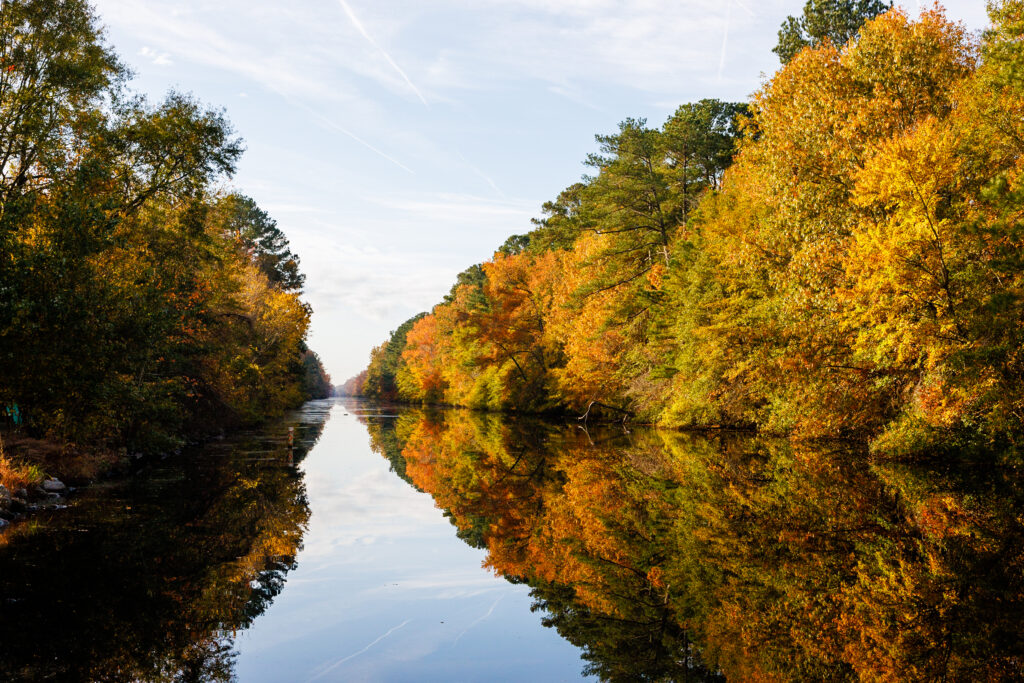
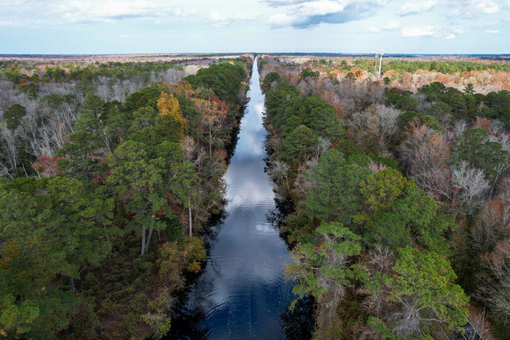
The Dismal Swamp Canal is the oldest operating man-made canal in the United States and connects the Chesapeake Bay with the Albemarle Sound through a 22-mile-long waterway. The Dismal Swamp Canal is one of two protected ICW routes boaters can take when transiting north or south. We cruised this waterway twice, once in the spring and another in the fall, during our trip around America’s Great Loop, and loved it both times. Many factors influence a captain’s decision-making process regarding whether the canal suits his or her boat.
In this post, we share a brief history of the Dismal Swamp Canal, how to get there, boater precautions, places to stay, things to do, and boater resources so you can have the most enjoyable trip through Virginia and North Carolina’s Dismal Swamp Canal.
Note: We use affiliate links which provide us a little kickback each time you use one of our links and make a purchase, without any additional cost to you. We do not recommend products that we don’t already love or have heard great things about, so you can trust we’re only suggesting great products to you.
About the Dismal Swamp Canal
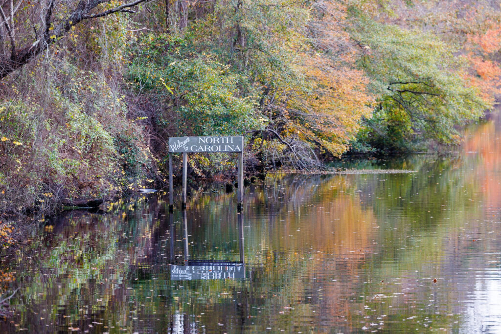
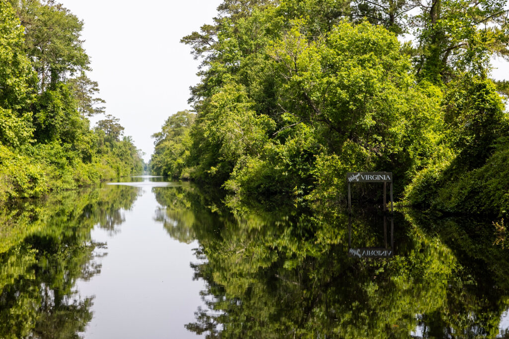
The Dismal Swamp Canal is a 22-mile waterway that connects the Pasquotank River in North Carolina with the Elizabeth River in Virginia. The Dismal Swamp Company was formed in 1793 to transform the swamp into valuable land for wealthy Virginians, and their most famous shareholder was none-other than George Washington.
The canal was dug by hand with enslaved labor and eventually connected the Chesapeake Bay in the north with the Albemarle Sound in the south. It took 12 years to complete and was open for use in 1805. It was an integral part of US history, including the Civil War, the Underground Railroad Network to Freedom, and Black History in the United States. The Canal is on the National Register of Historic Places as a Historic Landmark, noted as a National Historic Civil Engineering Landmark, and has received the National Underground Railroad Network to Freedom Designation.
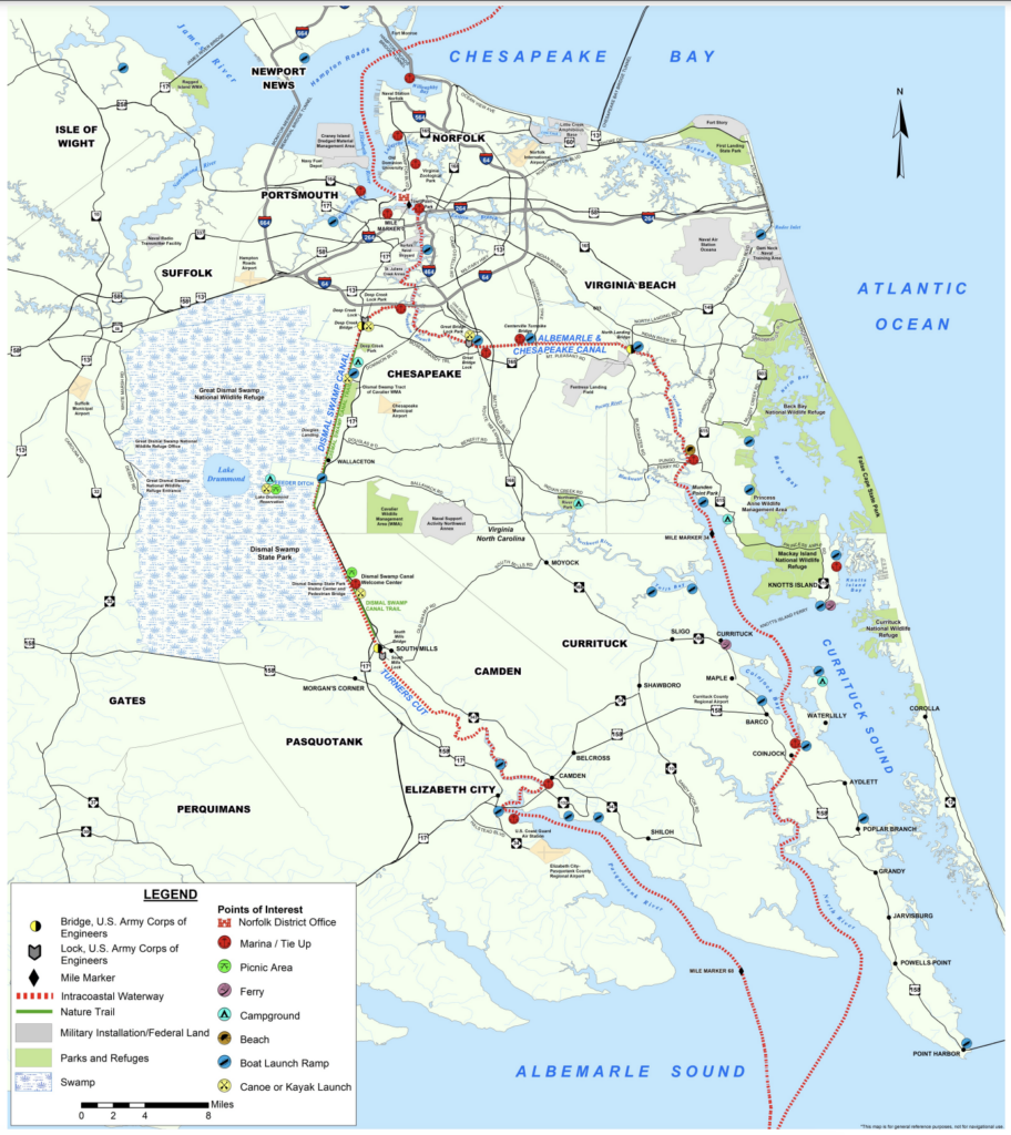
Dismal Swamp Canal Map
The Dismal Swamp Canal connects the Chesapeake Bay near Portsmouth and Norfolk, Virginia, to Elizabeth City in North Carolina. It runs along the Great Dismal Swamp National Wildlife Refuge.
The Great Dismal Swamp National Wildlife Refuge, adjacent to the west side of the canal, consists of 107,000 acres of forested wetlands surrounding Lake Drummond, a 3,100-acre natural lake located in the heart of the swamp. The Dismal Swamp Canal is the oldest operating man-made canal in the United States. The US Army Corps of Engineers manages the canal to keep it operable for boats.
Getting to the Dismal Swamp Canal by Boat
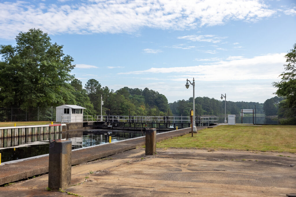
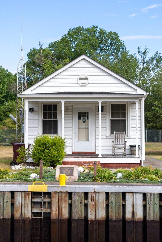
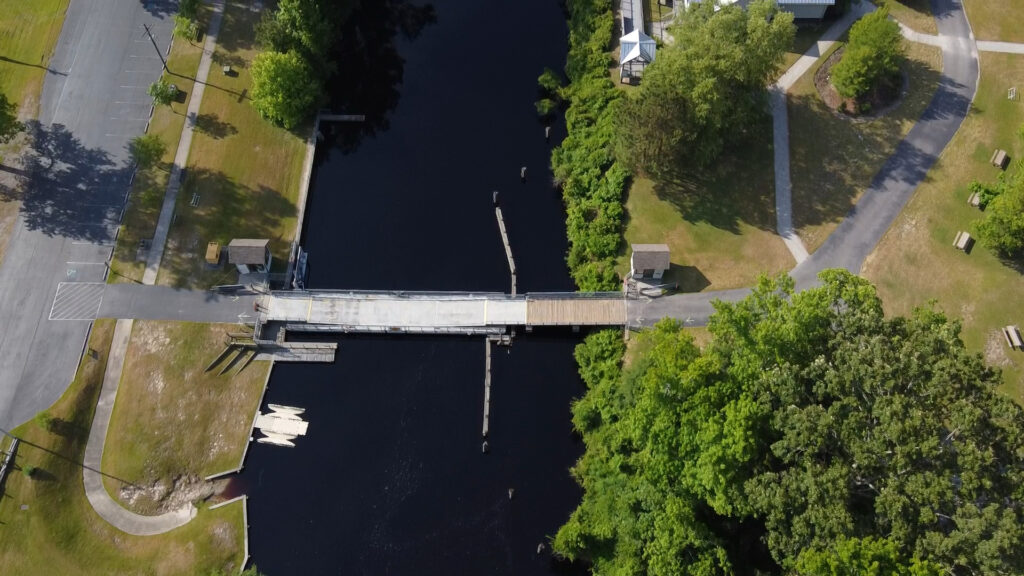
The Dismal Swamp Welcome Center is the only welcome center in the United States accessible by both car and boat. Getting to the Dismal Swamp by boat requires you to go through a lock; one north of the swamp is called Deep Creek Lock, and the second is South Mills Lock. Both locks open at 8:30 am, 11:00 am, 1:30 pm, and 3:30 pm seven days a week, 365 days a year, but can change with abnormal conditions. With each lock, there is also a bridge that requires opening. The lock operator will also open the bridge with the lock through. You can reach the Canal operators on the VHF radio or by phone.
- Deep Creek Lock – (757) 487-0831
- South Mills Lock – (252) 771-5906
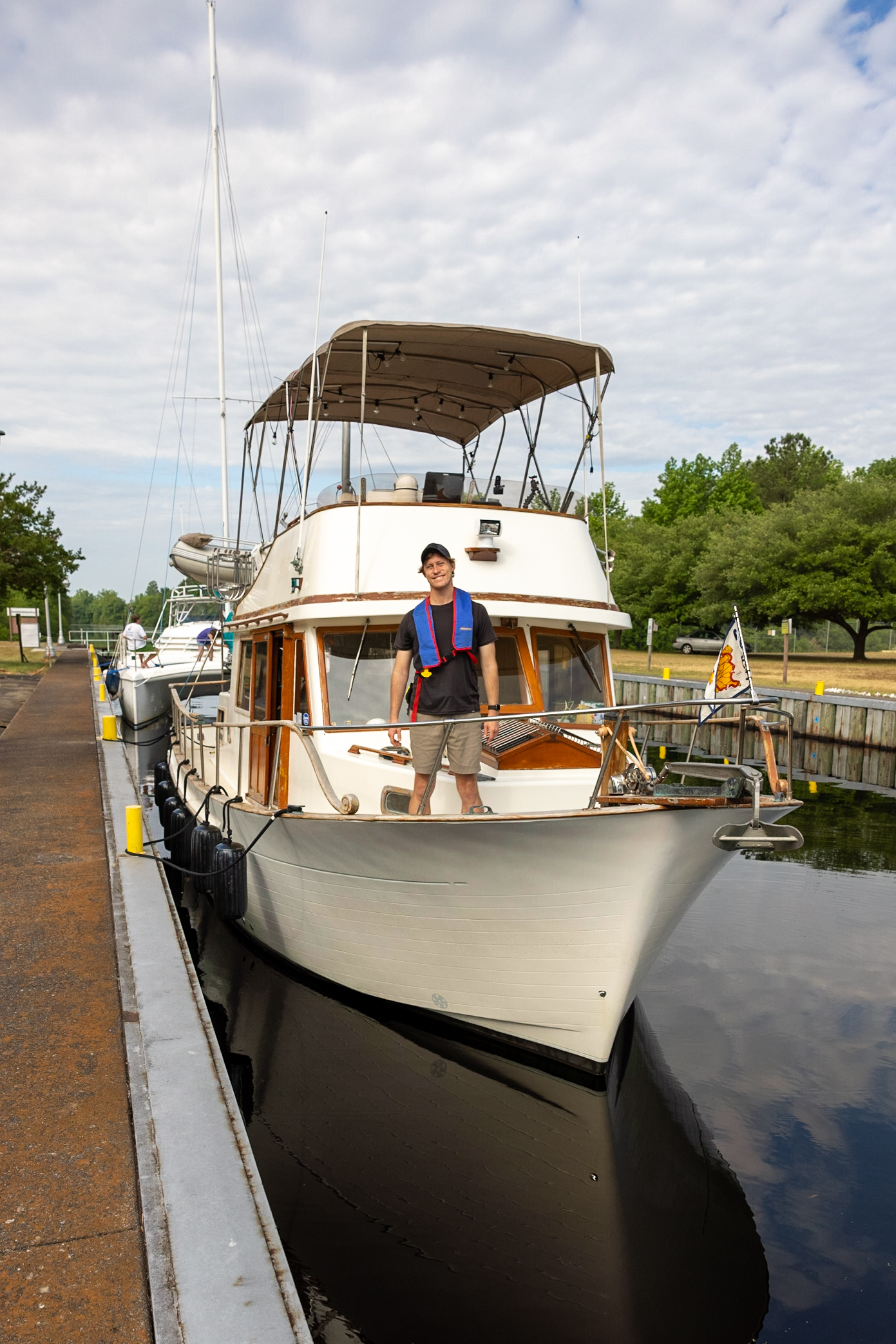
The Deep Creek Lock and South Mills Lock raise you about 8 feet to the Dismal Swamp Canal. The locks are relatively simple, and the lock operator will hand you a line for your bow and stern. The USACE requires all passengers to wear a life jacket during the locking process. You can watch us transit both locks on YouTube: South Mills Lock on YouTube and the Deep Creek Lock on YouTube.

New to locking a boat? Read our blog post, How to Lock a Boat! We include our locking gear, our step-by-step process, and a free checklist.
Dismal Swamp Canal vs. Virginia Cut
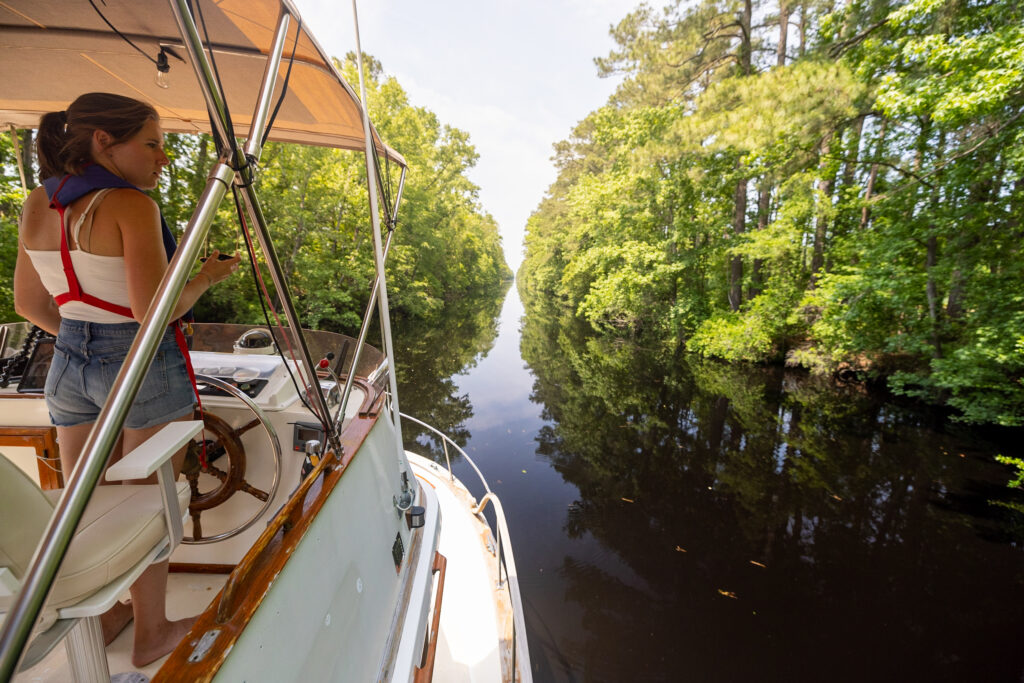
Boats have two options when traveling this area: the Dismal Swamp Canal to the west and the Virginia Cut route to the east. The alternative route for boaters is the 19 miles long, wider, and deeper Virginia Cut. The Virginia Cut is a popular route for boaters concerned about their boat’s depth or want to transit the area quickly. There is no current in the Dismal Swamp Canal, making it a reasonably easy waterway to navigate. We have taken the Dismal Swamp Canal and Virginia Cut route and prefer the Dismal Swamp Canal. We list each route’s pros and cons in our YouTube video.
Although both routes take boaters past Portsmouth, Virginia, the Dismal Swamp route takes boaters to Elizabeth City, North Carolina, whereas the Virginia Cut bypasses Elizabeth City and heads straight into the Albermarle Sound.
Dismal Swamp Canal Boating Tips
Boating through the canal has a few challenges; however, with these tips, you’ll have a fun and enjoyable experience!
Duckweed
Duckweed is a flowering aquatic plant in still or slow-moving water or wetlands. If the canal is full of this small green plant, it can be a nuisance for boaters if it clogs the sea straighter and doesn’t allow proper water flow into the engine for engine cooling. It’s important to keep an eye on your engine temperature meters; if they go above the normal range, it may mean you need to clear out your sea strainer.
Deadheads
Deadheads are dead trees that have fallen into the waterway and can be completely submerged or located just a few inches above the waterline. Going slowly through the canal is essential to look out for “deadheads.” Hitting a deadhead with your propeller has the potential of causing significant damage. Fortunately, they are generally not in the center of the channel. If you stay in the center, drive slowly, and give the boat ahead of you plenty of clearance to allow items to settle, you’ll be just fine!
Canal Depth and Width
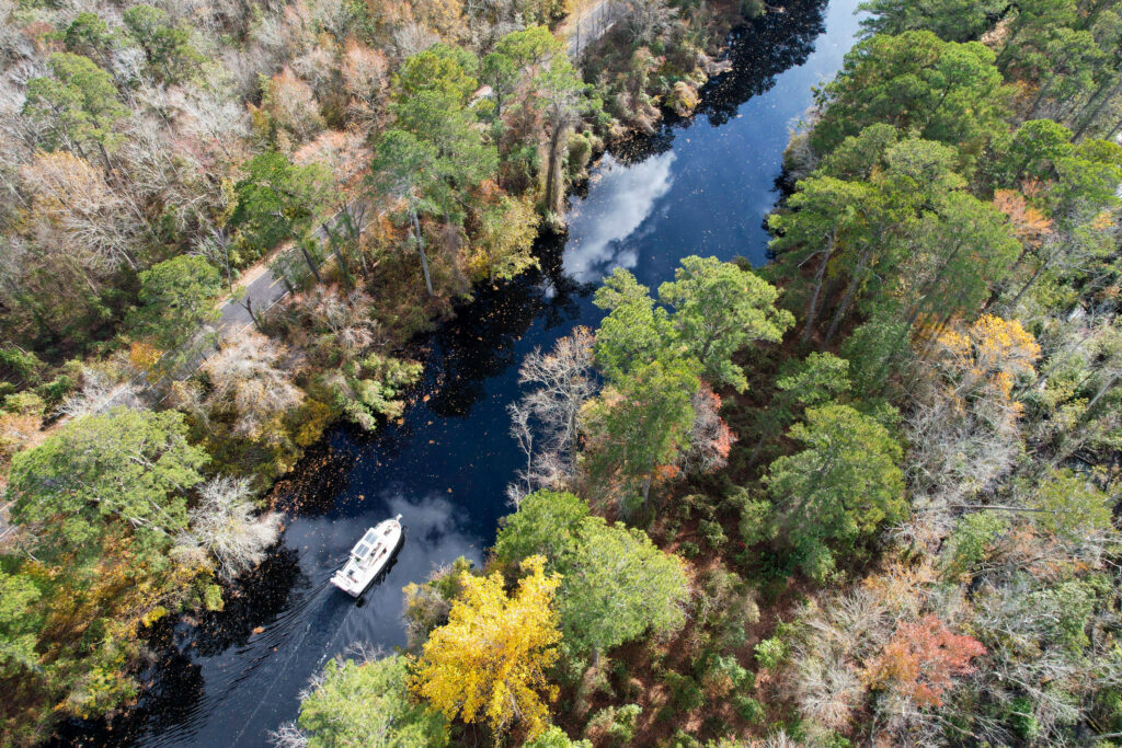
The canal is narrow at 25’ wide and 6’ deep in the center part of the canal. Passing other boats can be challenging due to the narrow conditions. We found going slower than slow and staying in the middle of the channel worked just fine. Since most boat traffic was transiting the same direction for the season, the boat traffic we saw going in the opposite direction as us (and other cruising boats) was small, local center console boats that didn’t have a large width.
Go Slow
The Dismal Swamp Canal is a no-wake zone. Go slow and enjoy the view. Boats who want to prioritize speed should consider taking the Virginia Cut route. The waterway is completely straight, with one turn about a third of the way southbound. Going slow will reduce your chances of damaging a prop from any deadhead or debris in the water.
Keep Your Distance
Maintaining distance between boats can help reduce the amount of debris a boat kicks up, reducing the chances of damaging a prop or propeller. When boats closely follow each other, the lead boat can unknowingly kick up things underwater and send them toward the boat behind it. Staying further away from other boats can help reduce this risk!
Stay in the Middle
Staying in the center of the canal can reduce the chances of a sailboat hitting branches with its mast. The middle of the channel also has the deepest depth, reducing the chances of things hitting your prop or propeller.
Communicate
Lastly, while in the lock, ask the lock master if any dredging or work is being done in the canal. They’re a great resource to inform you about what’s coming up. Also, the lock staff can inform boats with a wider beam if other wide-beamed traffic is coming.
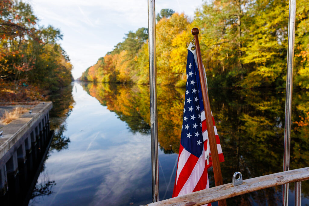
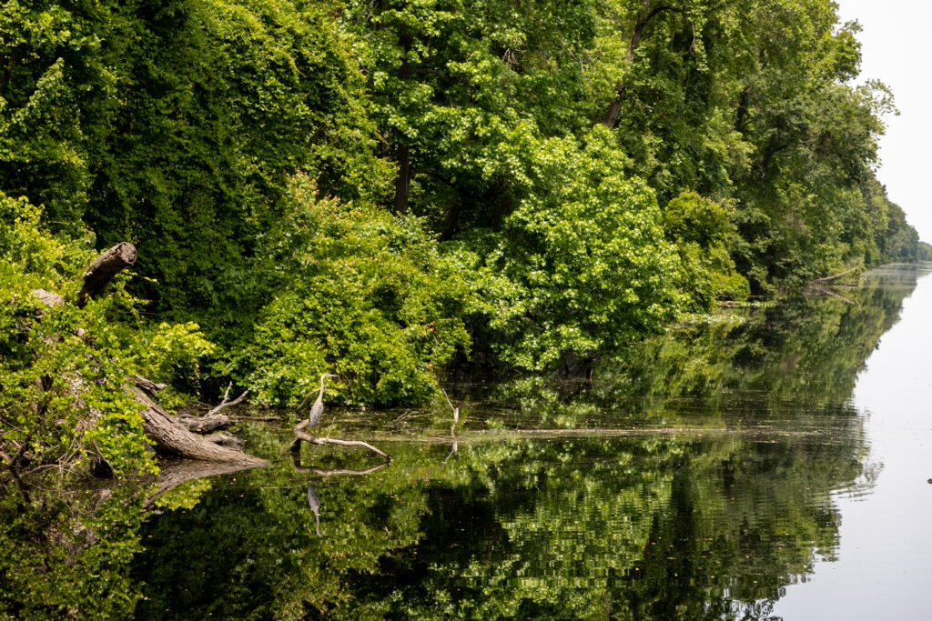
We have taken both the Dismal Swamp Canal and Virginia Cut route and prefer the Dismal Swamp Canal. The Dismal Swamp is a slower-paced route with less fast boat traffic. The trees mirrored onto the water are magical and something we hope you can enjoy yourself!
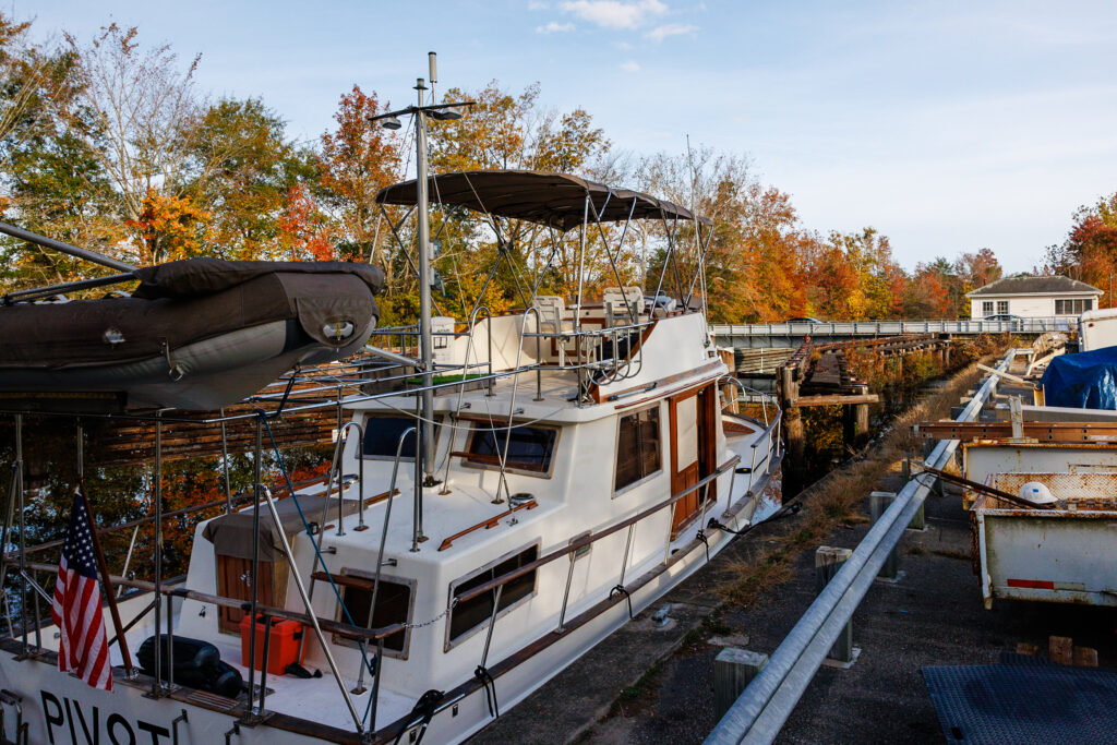
Dismal Swamp Canal Docks
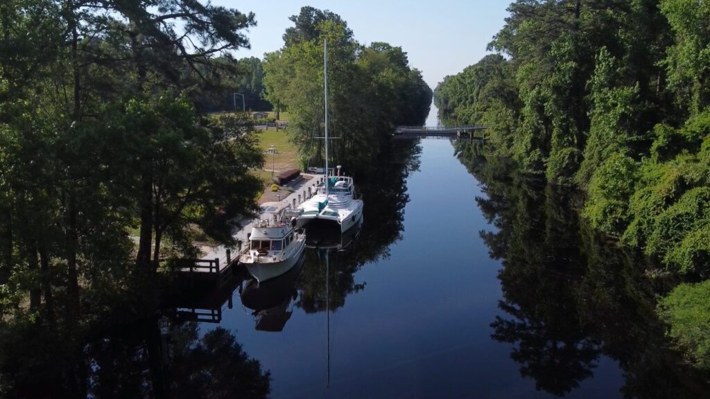
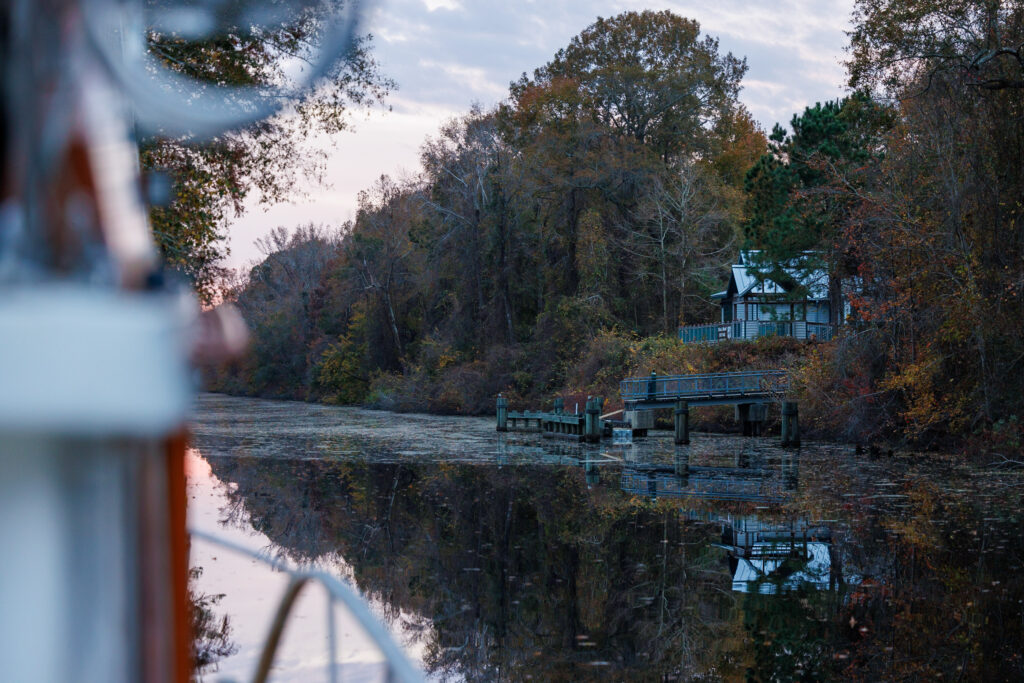
One of the reasons we love the Dismal Swamp Canal so much is that five free docking options are available throughout the canal from lock to lock. We love staying at free docks because it means we can easily take our dog to shore and can easily get off the boat to walk around and explore without the price of a marina. Here are all the free docks with links to Waterway Guide so you can easily find them in your navigation charts.
South Mills Bridge Free Wall is located just north of the South Mills Bridge, on the western bank. It’s a great option if you want to get the first lock through.
The Dismal Swamp Canal Welcome Center dock holds about 3-4 boats but can hold more boats with rafting. It’s not unusual to have to raft with other boats during the busy seasons (April-May and October-November) due to the large number of boats that pass through the canal. We’ve seen up to 9 boats rafted together on this dock.
The Douglas Road Free Dock is a great option for boaters who do not want to be social at the Dismal Swamp Welcome Center or want easy access to the Great Dismal Swamp Canal Trails for biking or hiking.
The Deep Creek Bulkhead is just south of the Deep Creek Bridge. We’ve comfortably stayed at this dock with another boat each time. There is a little bit of road noise, but it dies down around 10-11 pm and resumes around 7 am. This is the most convenient dock to re-provision from!
The last free dock is Elizabeth’s Dock located between Deep Creek Bridge and Deep Creek Lock. If you want less road noise and more quiet, this is a great option!
For more information, we recommend checking out the reviews on Waterway Guide.
Download the free Waterway Guide App to locate marinas, services, anchorages, free docks, navigation alerts, bridges, locks, and more!
When to Visit the Dismal Swamp
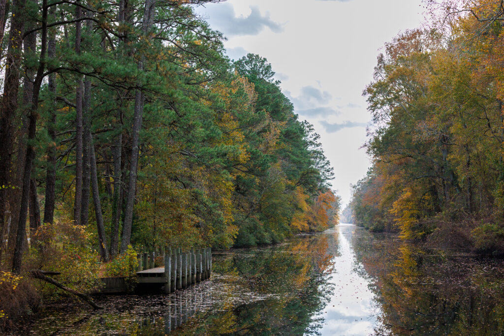
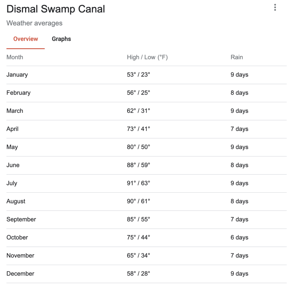
The Dismal Swamp is open year-round, but most boats transit through the Dismal Swamp Canal in the spring when heading northbound or in the fall when heading southbound. Since the canal is a bit more inland, and it’s a manmade canal, after all, it’s not super affected by heavy winds. This also means on hot days, there’s not a breeze to cool you down. Wearing the appropriate clothing will keep you comfortable on the water. The fall season is wonderful when timing it with the changing color of the leaves.

Check out our blog post on the Marine Weather Apps for boaters!
How much time do you need in the Dismal Swamp?
If you catch the early 8:30 Sam lock and arrive to the Dismal Swamp Welcome Center by mid-morning, you should have plenty of time to explore the Dismal Swamp State Park. If you come by the later 4:00 pm lock, you should explore the Dismal Swamp Welcome Center and State Park the following day. If you’re an outdoor enthusiast, we recommend spending one full day exploring the State Park and nearby trails to thoroughly enjoy what the area offers.
We took a slow approach and spent three days transiting the Dismal Swamp Canal and exploring the Dismal Swamp State Park.
Can you do the Dismal Swamp Canal in One Day?
Yes, you can travel through the Dismal Swamp in one day if you make the first lock at 8:30 am, pass by the Dismal Swamp Welcome Center, and hit the second lock by 1:30 pm. Although the canal is a no-wake zone, requiring boaters to travel slowly, the canal is a total of 22 miles. Boaters traveling an average speed of 5 knots can transit the canal in 4.4-5 hours. If you are on a tight schedule, it’s recommended to call the lock operators ahead of time to let them know you’re coming.
Things to do in the Dismal Swamp
The Dismal Swamp offers several ways to get off the boat and enjoy the surrounding area, from the Great Dismal Swamp Canal Trail to the Dismal Swamp State Park and kayaking on the Dismal Swamp Canal.
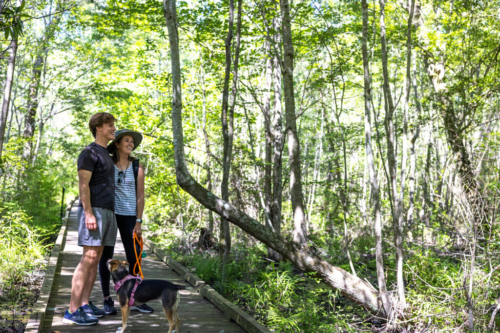
Great Dismal Swamp Canal Trail
The Great Dismal Swamp Canal Trail is great for biking and hiking! This 8.6-mile paved multi-use trail connects to Deep Creek Park and includes a boat, canoe, or kayak ramp, two restrooms, and picnic areas. There are two sections of the Dismal Swamp Canal trail. One is located in Virginia and is not accessible from the Dismal Swamp Welcome Center in North Carolina. The second is located in North Carolina and is 3 miles at the southern side of the Dismal Swamp Welcome Center, which is part of the East Coast Greenway. Check out the Dismal Swamp Welcome Center website for additional information on these trails.
With offline maps, wrong-turn alerts, and extra planning features, make the most of every outside adventure with AllTrails Plus. Get 7 days of AllTrails Plus for free!
Dismal Swamp State Park
The Dismal Swamp State Park is part of the North Carolina State Parks and is only accessible by the draw bridge at the parking lot from the Dismal Swamp Welcome Center. Dismal Swamp State Park is open daily during peak season, from 8 a.m. to 5:30 p.m., from March through October. There are additional hiking trails inside the park where you can hike on original logging trails. It’s a great spot for birdwatching, hiking and biking. Trails range from 0.5 mile loops to 5.4 mile one way giving you a wide range of options depending upon how much time you have. Trail Maps can be found inside the Dismal Swamp State Park. We enjoyed visiting the Dismal Swamp State Park and hiking their trails!
Kayaking
Another way to see the Dismal Swamp Canal is by kayak. It’s a great way to slow down and enjoy the water from a water-level perspective. Kayaks are available for rental at Dismal Swamp State Park, or you can bring your own. There is a kayak launch at the Park Entrance by the Draw Bridge. We saw many people kayaking the waterway and enjoying themselves.
Events in the Dismal Swamp
The first weekend in May is Paddle for the Boarder, a 7.5-mile kayak or canoe paddle down the Dismal Swamp Canal to the North Carolina/ Virginia border. It’s a great way to get out on the canal and experience its beauty. On the flip side, this is probably not the best weekend to plan your cruise through the canal!
Boater Resources
Wifi
There are no nearby spots for good Wi-Fi in the Dismal Swamp Canal. However, we did have pretty decent T-Mobile service.

Check out our blog post on Boat Internet!
Hardware + Marine Supplies
There’s an Advanced Auto Parts store within walking distance from the Deep Creek Bridge free dock.
Provisioning
A Food Lion grocery store is within walking distance of the Mooring Wall before the Deep Creek Bridge. We’ve re-provisioned here and found it super convenient!
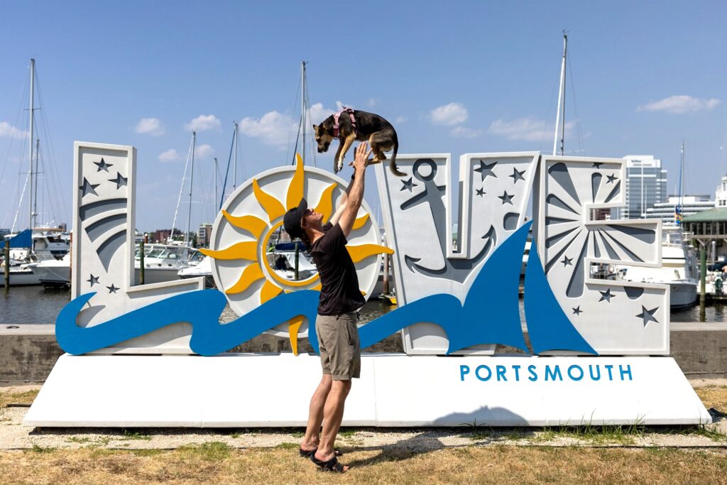
Heading northbound? Read our post Best Activities in Portsmouth, VA!

Heading southbound? Read our Elizabeth City Guide!
Related Articles
- Exploring Historic Portsmouth, VA: Ultimate Trip-Planning Guide
- Our Favorite Things to Do in Beaufort NC: Ultimate Travel Guide
- Our Guide to New Bern NC: Things to Do, See, and Eat in Bear Town!
- Oriental, NC: The Charming Town You’ll Visit and Won’t Want to Leave
- Elizabeth City, NC Travel Guide – The Harbor of Hospitality
Watch our time on the Dismal Swamp Canal on YouTube!
Save for Later
Save this to Pinterest to read again later!


Leave a Reply
You must be logged in to post a comment.