Your cart is currently empty!
Ultimate Guide to the Okeechobee Waterway
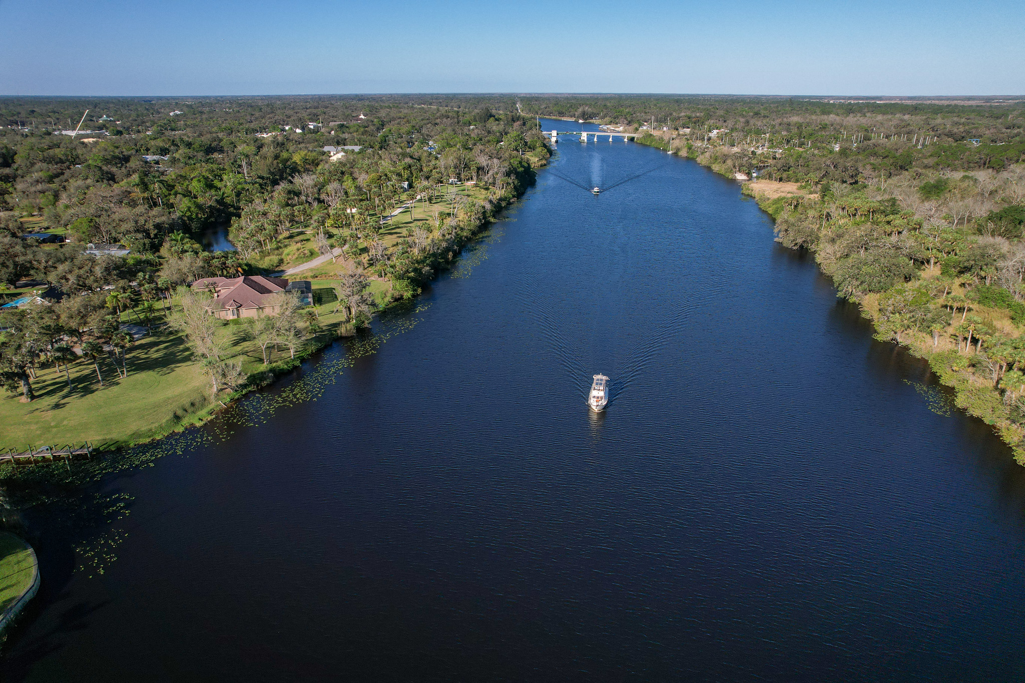
The Okeechobee Waterway connects the Gulf Coast of Florida to the Atlantic Coast, with Lake Okeechobee in the center. We cruised through the waterway during our 2022-23 passage of America’s Great Loop, and it was an incredible part of our journey on our boat, Pivot. In this blog, we share the ultimate guide to the Okeechobee Waterway and everything you need to know about planning your voyage!
Note: We use affiliate links which provide us a little kickback each time you use one of our links and make a purchase, without any additional cost to you. We do not recommend products that we don’t already love or have heard great things about, so you can trust we’re only suggesting great products to you.
What is the Okeechobee Waterway
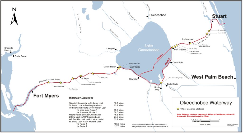
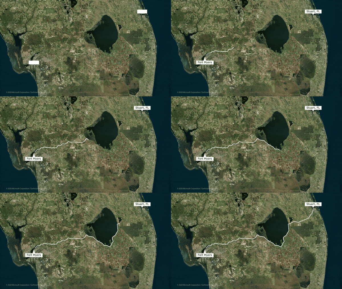
The Okeechobee Waterway is a 154-mile waterway through central Florida. The Westernmost section is the Caloosahatchee River and Fort Myers, and the Easternmost section is the St. Lucie Canal and Stuart. The Okeechobee Waterway is the official way to cross Florida on America’s Great Loop and also part of Smuggler’s Run or the Florida Loop.
History of the Okeechobee Waterway
The Okeechobee Waterway was finished in 1937, primarily providing a navigable east-west water route throughout the state. Now, it is mainly used by pleasure craft and to help maintain Florida floods as part of the Central and Southern Florida Flood Control Project.
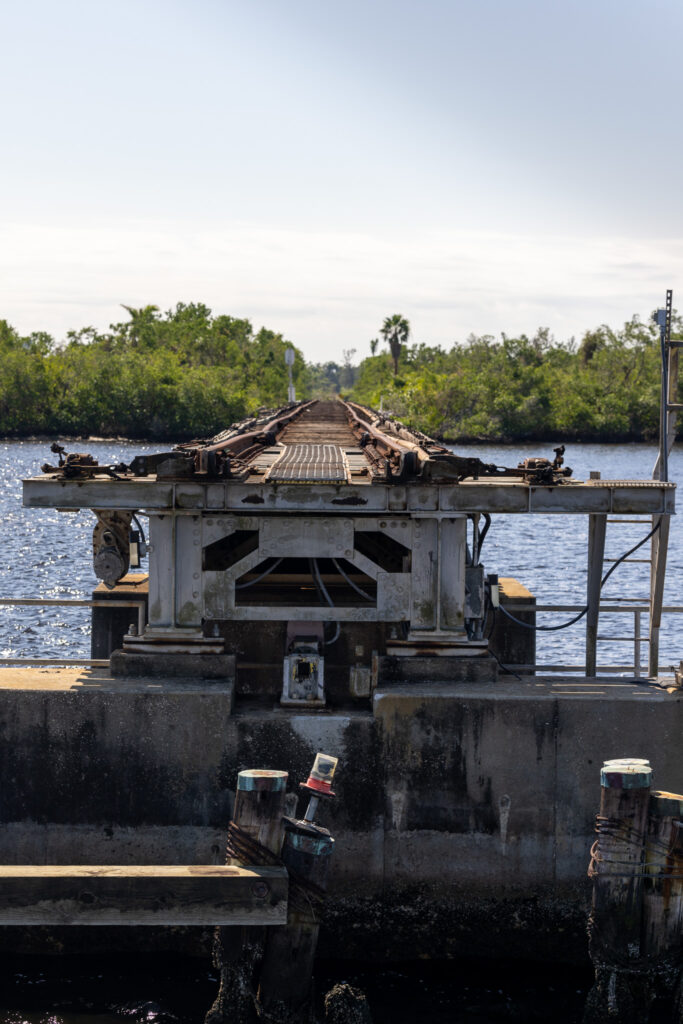
Facts about the Okeechobee Waterway
- The maximum vessel size is a 50 ft beam, 10 ft draft, 250 ft long, and a 49 ft air draft.
- The waterway length is 154 miles.
- There are 5 locks, 3 West of Lake Okeechobee and 2 East of Lake Okeechobee. There are multiple other locks off of Lake Okeechobee, not part of the waterway.
- Locks are open from 7 a.m. – 5 p.m. daily, with last lockage starting at 4:30 pm.
- The VHF channel for calling locks or bridges is 9.
- 6 million people every year travel to Lake Okeechobee, Florida.
- Lake Okeechobee is derived from the Seminole Indians and means “Big Water”.
- Lake Okeechobee is the second largest freshwater lake completely within the United States Borders.
Map of the Okeechobee Waterway
How to use this map: We have saved the locations from this guide on this map. You can save this map to your Google Maps by pressing the star icon. In your Google Maps, click the menu icon and then Saved Maps, where this map will appear.
Okeechobee Waterway Itinerary
With a 154-mile journey and the locks only available from 7 am to 5 pm, you cannot do the entire waterway in one day. A traditional passage will take 3-4 days, consisting of a Western section, the Lake, and an Eastern section. However, there are many exciting destinations on the route, and so many choose to break it up even further! We transited the Okeechobee Waterway in four days, and here is our breakdown of our West-to-East passage. If you are transiting East to West, then you can swap the order!
This map is not to be used for navigation or for the use of marine charts.
How to use this map: We have saved the locations from this guide on this map. You can save this map to your Google Maps by pressing the star icon. In your Google Maps, click the menu icon and then Saved Maps, where this map will appear.
Day one on the Okeechobee Waterway
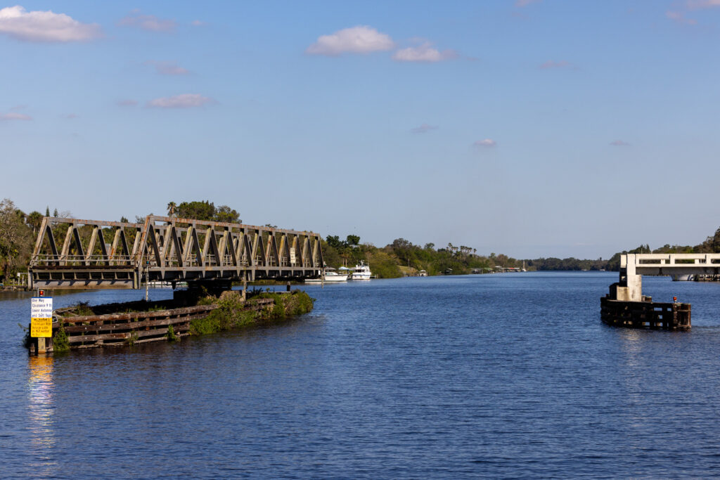
For your first day along the Okeechobee Waterway, you will leave the Gulf Intracoastal Waterway, cruise next to Fort Myers, and travel through unique infrastructure like a swing bridge and your first lock, the Franklin Lock. You’ll end up in the town of Labelle, Florida. Town docks in LaBelle have power for $30 / night and a max stay of 3 nights. You can use Dockwa to reserve your stay, and use our code 450ZMS3 for a $15 discount!
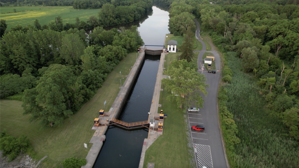
Check out our blog post How to Lock a Boat for our Step-by-Step Guide!
Use our Referral Code 450ZMS3 for a $15 discount on your Dockwa reservation!
Statistics
- 27.2 NM (31.3 statute miles)
- 1 Lock – Franklin Lock
- 1 Swing Bridge – Fort Denaud Swing Bridge
Our YouTube Video of the Trip
Day two on the Okeechobee Waterway
Day two on the Okeechobee Waterway gets you into Lake Okeechobee proper. You have two locks on the way, so you’ll need to plan your trip according to the lock schedules. It is very popular to break this leg into two, and instead of going into the Lake from LaBelle, you’ll stop in Moore Haven, just before the Lock into Lake Okeechobee. There is a marina here, and if you have poor weather on Lake Okeechobee, we’d recommend holding up here.
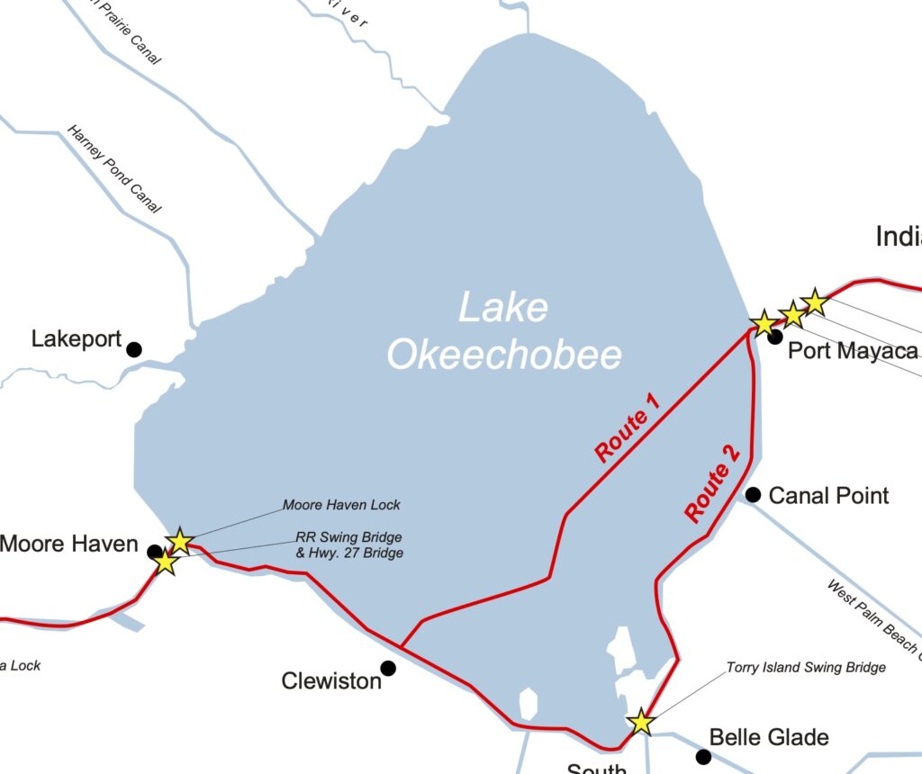
You especially do not want high winds and high North Easterly winds when doing this section of the Lake. This is because some of the Southern sections of the rim route are entirely exposed to the Lake.
Statistics
- 43.7 NM (50.3 statute miles)
- 2 Locks – Ortona Lock and the Julian Keen Jr. Lock (formerly Moore Haven Lock)
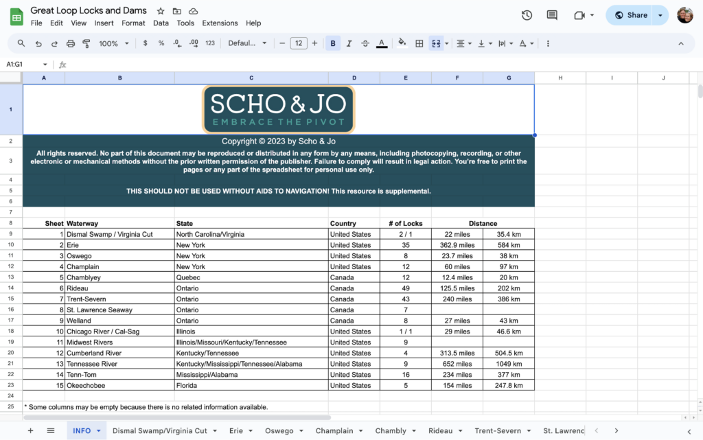
Check out our Great Loop Locks Spreadsheet!
Weather Concerns with the Two Routes Through Lake Okeechobee
To cross Lake Okeechobee, you have two options: the Rim Route (our route) and the Crossing. The rim route follows the Southern rim of Lake Okeechobee and is protected for the first 60% of the distance, only getting exposed to the lake at the end of the route. If you prefer to cross Lake Okeechobee, then you need to ensure you have good weather. As you’re traveling West to East (or East to West), you do not want strong North West or South East winds. With an unfavorable wind direction and speed, you will have swell on the beam, and it will be an uncomfortable crossing for a Motor Vessel.

Check out our blog post on the Marine Weather Apps for boaters!
Day three on the Okeechobee Waterway
Day three takes you out of Lake Okeechobee and almost through the entire waterway. In fact, you could transit through the St. Lucie Lock at the end of the day to finish the route in 3 days instead of 4. As mentioned above, ensure you have good weather on Lake Okeechobee for this day, as Port Mayaca Lock on the Eastern shore of Lake Okeechobee is completely exposed to the Lake. Also, if you are anchored here, a swing bridge forces you to leave after 7 am. This section also has the lowest non-movable bridge on the route, the Indiantown Bridge, with a maximum air draft of 49 feet. We ended this day at the Port St. Lucie Lock Marina and Campground. For only $30 per night, it is a great deal to refill water, clean your boat, and recharge your batteries before hitting more expensive Florida Marinas on the coast.
Statistics
- 42.1 NM (48.4 statute miles)
- 1 Lock – Port Mayaca Lock
- 1 Swing Bridge – Torry Island Bridge
Day four on the Okeechobee Waterway
The final day on the Okeechobee Waterway is a short day with only one lock. Start your day at the St. Lucie Lock and travel the remaining 15 nm to the Atlantic Intracoastal Waterway. Welcome to the East Coast!
🕰️ Plan an outgoing tide on the St. Lucie Canal for a speed boost to Stuart.
Statistics
- 7.4 NM (8.5 statute miles)
- 1 Lock – St. Lucie Lock
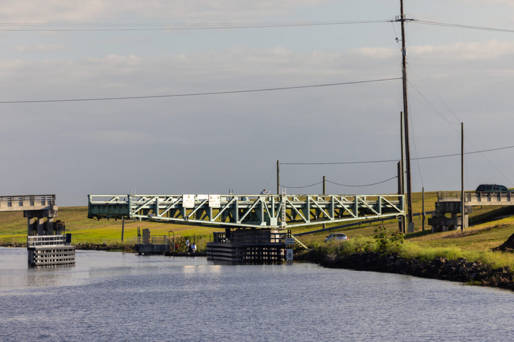
- 1 Swing Bridge – Old Roosevelt Bridge (you’ll also need the Britt Point Railway Bridge to open at the same time)
The Top Stops on the Okeechobee Waterway
Now that you have our itinerary to go off of, here are some incredible stops on the Okeechobee Waterway, some that we missed and some that we visited!
LaBelle, Florida
The first town that you cross Eastbound is LaBelle, Florida. You can walk around a small Florida town and see what the locals are up to. Don’t expect a city or many options for going out to eat, but you can tour one of the few cities on the route.
LaBelle Town Docks
Located right before the LaBelle Swing Bridge, their town docks are $30 / night with power. The perfect place to dock so you can stop and tour LaBelle.
Check the town docks out here.
LaBelle Attractions
Right across the LaBelle town docks is the Barron Public Library. We find Libraries amazing stops on the Loop because you get Air Conditioning with (typically) good internet speeds. It’s also nice to get off boat for a free excursion!
Across the street is Barron Park where you can enjoy a nice stroll along the water. This is also a great spot to land your dinghy if you decide to anchor in the river.
The best place to get a bite is to take a stroll over to Forrey Grill, and grab some local Italian food. The best place to grab a coffee is to stop by Bridge Street Coffee & Tea, located just a quarter mile from the docks!
If you need to grab a hotel for guests, the closest spot will be the Inn at LaBelle Yacht Club. It is located just across the river from the town docks OR you can decide to stay at the marina instead of the town docks! Be prepared to spend $4/foot at the marina though!
Moore Haven, Florida
The next town on the main waterway is Moore Haven, Florida, which is located just before Lake Okeechobee.
Docks in Moore Haven
You have three options for mooring in Moore Haven (did you see what I did there), two local marina and the town docks.
Moore Haven Marina won’t be accessible to most boats as the basin is extremely shallow, so most Loopers will tie up at either the Moore Haven City Docks or River House Marina. I don’t see much difference between the two options, as they are both $1.00 a foot, besides security possibly.
Moore Haven Attractions
If you stay at the town docks, right across is the City Park and the Glades County Public Library.
The best place to grab a bite to eat is Haven Fresh. They have fantastic tacos, and you can also pick up some local groceries at their small store!
If you are meeting friends or family and need a hotel, there aren’t many options. We recommend checking out VRBO as there are a few riverfront cottages!
Clewiston, Florida
Clewiston might be a surprise to be on this list because while it is on the main Okeechobee Waterway route, you don’t actually ever cruise into Clewiston. You must go off the Rim Route and into the Clewiston Lock to enter the town.
Roland Martin Marina
If you don’t want to anchor on the Lake, or need to wait out extended bad weather, Roland Martin Marina is a great option. Roland Martin Marina is a great stop for fishing, has a hotel if you want to go off boat, and is famous for their Gator Tail at the Tiki Bar.
Check Roland Martin out here.
Clewiston Restaurants
We’re a sucker for local eats and Clewiston has plenty to choose from! Punto Rojo, a Colombian spot, is within walking distance of Roland Martin. If you want to catch an Uber or bring out those e-bikes, you can go to Jalapeños for some Mexican cuisine!
Clewiston Attractions
If you want to learn more about the local Native Americans, you can head over to the Big Cypress Reservation and learn about the culture and history of the Seminole Tribe of Florida.
Anchoring on Lake Okeechobee
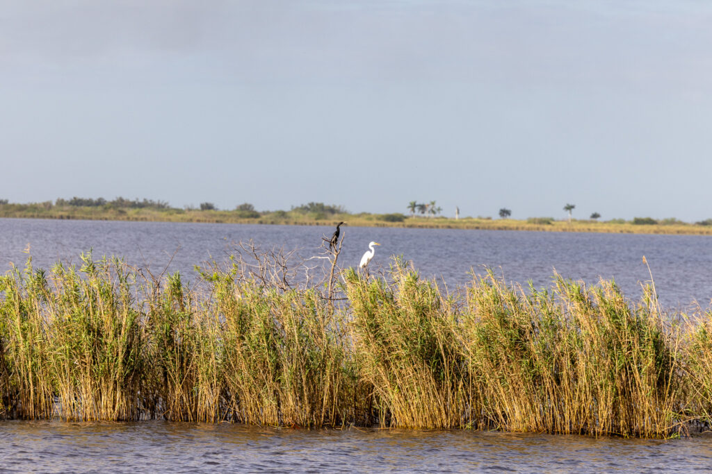
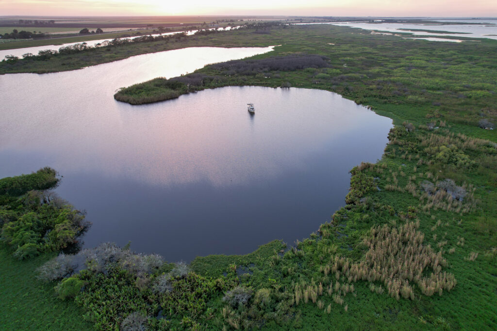
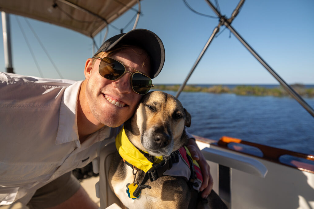
One of our favorite anchorages on our entire 6,000-mile trip around the Eastern portion of the US was on Lake Okeechobee. It was protected and secluded, and the wildlife was incredible. We spotted four gators our one night alongside trees of Cormorants and White herons. There was also this boat dock across the anchorage, allowing easy dog access. 10/10 would recommend!
Check out our full list of Great Loop Anchorages and Free Docks!
Lake Okeechobee Scenic Trail
Stop along the side of Lake Okeechobee and hike part of the Lake Okeechobee Scenic Trail. A 109-mile hiking trail with campgrounds along the way, the scenic trail is a way to get in tune with the local wildlife and flora. Read more information here.
Indiantown Marina
Indiantown Marina is a spot of character on the waterway. With decent prices and a boat yard where you can perform your own work, many boaters stop here for an extended period. Our friends Andy and Gwen replaced their engine here a few years ago and raved about the best tacos in the region at a local taco truck!
Check Indiantown Marina out here.
St. Lucie Lock Marina and Campground
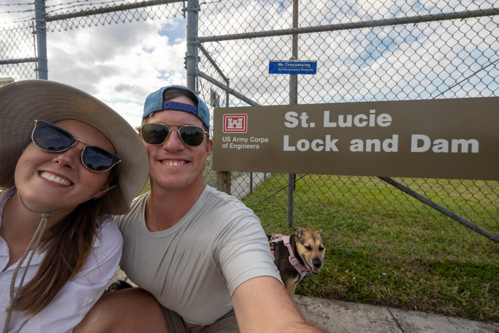
We stopped at the St. Lucie Lock Marina and Campground and would highly recommend it. Not only is it a good deal, at $30 / night, but you can walk and check out the St. Lucie Lock. It is special to be able to explore these engineering marvels. You can watch other boats lock through and even chat with a lock tender.
Check the marina out here.
Stuart, Florida
The final (or first) city of the Okeechobee Waterway is the largest, Stuart, Florida. In fact, many boaters will stay in Stuart after heading to the Bahamas due to the number of marinas and the large mooring field. Stuart, also known as the Sailfish capital of the world, could be its own blog post, so we’ll just highlight some popular options!
Moorings in Stuart
There are many marinas in Stuart, but the most popular (and the one we recommend) is the Sunset Bay Marina and Mooring Field. It’s right next to historic downtown, and the marina is very active, so you can meet other boaters. However, if you’re cheap like us, you may prefer anchoring. We loved the anchorage just outside the Stuart City Dock. Its not super protected, so you may get a little rocky and rolly, but you have tons of room and a dinghy dock practically downtown! We’ve stayed here for about a week at one time.
Stuart Restaurants
We had a lovely, nice night out at the Spritz City Bistro. It’s a way to celebrate finishing the Okeechobee Waterway! You can’t go wrong with any place downtown, so walk around and try whatever excites you.
Provisioning for the Okeechobee Waterway
There are a few great spots to re-provision along the Okeechobee Waterway. It’s best to reprovision at either end of the waterway in Stuart or Fort Meyers. In Stuart, there’s a Publix Supermarket within walking distance of this dinghy landing spot in Shepard Park (reviews say docking is only permitted for 4 hours in a 24-hour period). Fort Meyers has a Publix Supermarket within walking distance from the City of Fort Meyers Boat Ramp.
Final thoughts about the Okeechobee Waterway
We thoroughly enjoyed cruising the Okeechobee Waterway. From the amazing wildlife to the historic locks, you get to see a different part of Florida than coastal cruising. Much of the trip reminded us of our journey down the St. Johns River, which we also highly recommend. Let us know if you cruised down the Okeechobee Waterway and your favorite and least favorite parts!
Save for Later
Save this to Pinterest to read again later!
The ups, downs, and everything in between, we share it all. If you like what you see, there are lots of ways to show your support and say thanks! The easiest way to support our work is by commenting on this post, liking and sharing our content on Facebook, and pinning our content on Pinterest. It’s a small way to say thank you that goes a long way!
by
Tags:

